Sergipe

State · Northeast

Sergipe

Sergipe is the smallest state in Brazil. From Aracaju you can reach beaches, colonial towns and the Cânion do Xingó in the sertão in a few hours.

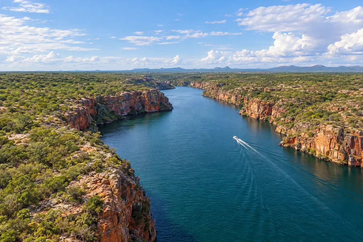
In the photo: Cânion de Xingó, Canindé de São Francisco (SE)

Illustrative images. The pictures in this guide are illustrations based on the real place, not photographs, and may differ from it.

Get it on Google Play

The state

Get to know Sergipe

Aracaju was planned in 1855 to replace São Cristóvão as the capital and grew in straight streets down to the banks of the Rio Sergipe. The Orla de Atalaia concentrates leisure activities, with lakes, sports courts, a bike path and the Passarela do Caranguejo, where bars serve the cooked crustacean, the casquinha and the caldinho. In the center, the Thales Ferraz and Antônio Franco markets sell Irish lace, embroidery, cashew nuts and manioc flour, and the Museu da Gente Sergipana presents the state's culture in interactive rooms.

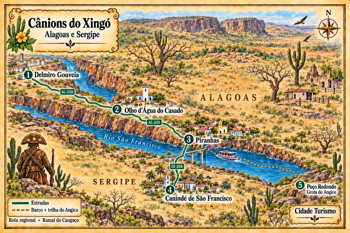
Day trips depart the capital in several directions. To the south, the Orla Pôr do Sol, in Mosqueiro, sits beside the Rio Vaza-Barris, from where boats go to the Croa do Goré and the Ilha dos Namorados. About 25 kilometers away, São Cristóvão has the Praça São Francisco, a world heritage site, and the queijadas sold in the historic center; Laranjeiras preserves churches and engenhos from the sugarcane cycle. In the sertão, Canindé de São Francisco gives access to the Cânion do Xingó on the Rio São Francisco, visited by catamaran. To the north, the mouth of the São Francisco marks the border with Alagoas.

June is forró month. Forró Caju takes over downtown Aracaju, and Estância is known for the fireworks from the barco de fogo and the busca-pés. On the table, besides caranguejo, you'll find moqueca de peixe, carne de sol, cuscuz and tapioca.


Routes

Routes through Sergipe

When to go

In Aracaju and on the coast, rains are concentrated from April to July; the rest of the year is sunny, with a constant breeze. In the sertão of Xingó it rains little year-round, and the heat is strong in the second half of the year. June features Forró Caju and the interior's June festivals, a period of high demand for accommodation. Summer is high season along the waterfront.

How to get there

Aracaju International Airport – Santa Maria is in the southern zone of the capital, near the Orla de Atalaia. BR-101 crosses the state and links Aracaju to Maceió and Salvador, and the Linha Verde along the Bahian coast is another option from Salvador. BR-235 leads inland. Bridges connect the capital to Barra dos Coqueiros over the Rio Sergipe and to the southern coast over the Vaza-Barris. To reach Xingó, the route continues along state highways to Canindé de São Francisco.

Your questions

Frequently asked questions about Sergipe

Is it possible to visit the Cânion do Xingó in one day from Aracaju?

Yes, but it's a long day. It's about 200 kilometres to Canindé de São Francisco, and the catamaran tour through the canyon takes several hours. Agencies offer the itinerary with an early departure and a return at night. Those who prefer to take it easy can stay overnight in Canindé or in Piranhas on the Alagoas side.

How many days should I plan for Aracaju?

With three or four days it's possible to see the waterfront, the city center and the markets, take a trip to the Croa do Goré and spend a day in São Cristóvão and Laranjeiras. Add an extra day for Xingó.

When is Forró Caju?

It takes place in June, on the days of São João, in downtown Aracaju, with open-air stages and quadrilhas. The program is announced by the city hall weeks beforehand.

How do you get to the Croa do Goré?

Boats depart from the Orla Pôr do Sol in Mosqueiro, the southern area of Aracaju. The Croa is a sandbank that appears at low tide, with a floating bar. Check the tide table before you go.

Acre Alagoas Amapá Amazonas Bahia Ceará Distrito Federal Espírito Santo Goiás Maranhão Mato Grosso Mato Grosso do Sul Minas Gerais Pará Paraíba Paraná Pernambuco Piauí Rio de Janeiro Rio Grande do Norte Rio Grande do Sul Rondônia Roraima Santa Catarina São Paulo Sergipe Tocantins
Tap a state to see its cities, destinations and routes.

Mapa: @svg-maps/brazil, CC BY 4.0

Beyond the guide