
Route · AL,SE
Cânions do Xingó
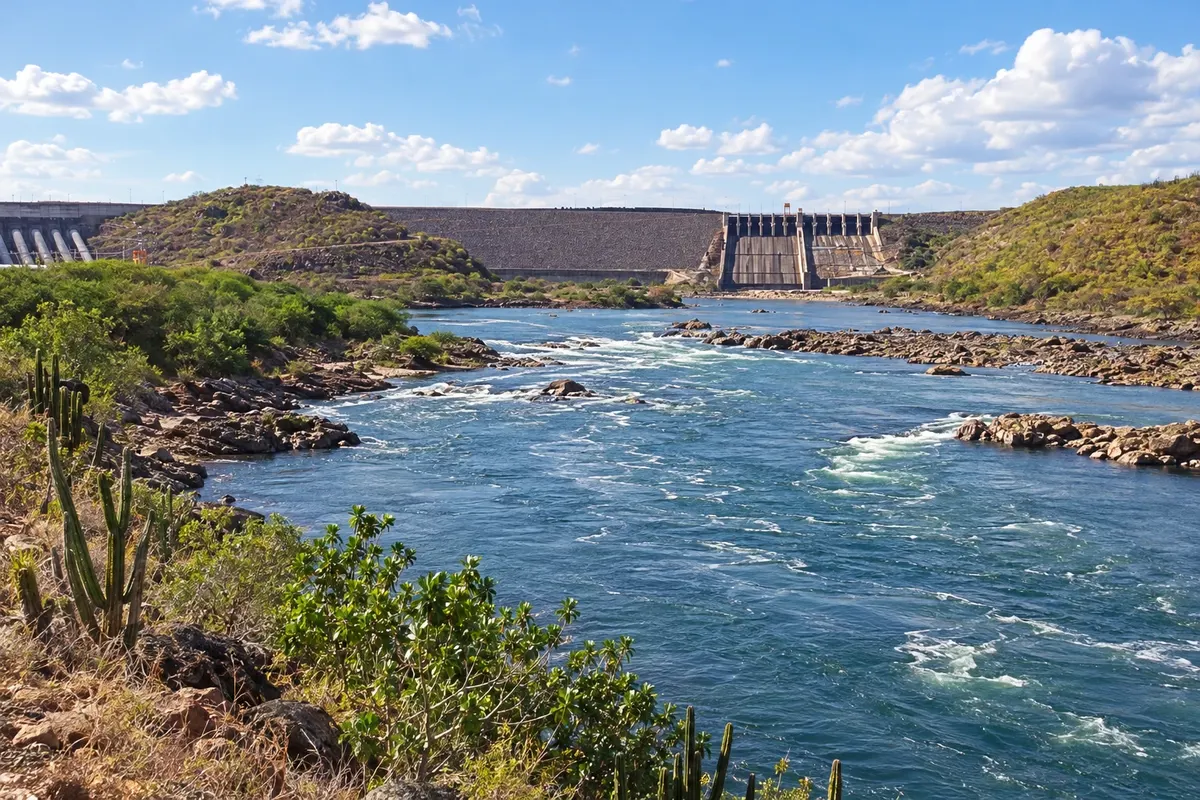
Between the banks of Alagoas and Sergipe, the São Francisco links the landscape of the Xingó reservoir, the history of Piranhas and the boat-and-trail route to the Grota do Angico.
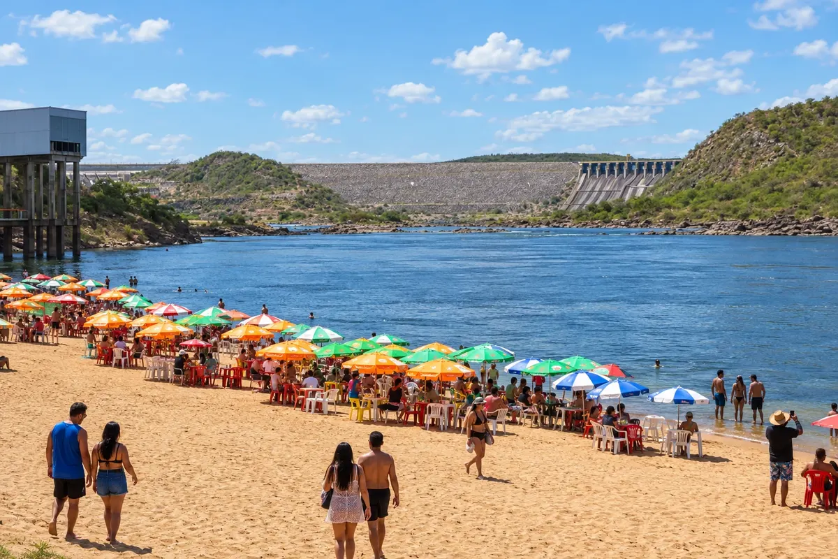
In the photo: Rio São Francisco next to the Usina de Xingó, between Alagoas and Sergipe.
Illustrative images. The pictures in this guide are illustrations based on the real place, not photographs, and may differ from it.

The route
What the Cânions do Xingó are
The itinerary brings together two tourist routes of the São Francisco backlands. The Cânions do Xingó tour runs along the reservoir's waters between rocky cliffs. The Rota do Cangaço departs from Piranhas and combines navigation with a walk to the Grota do Angico, in Poço Redondo, where Lampião, Maria Bonita and other members of the group died in 1938. Embarkation points, visitation rules and the participation of guides must be arranged with those responsible for the tour.
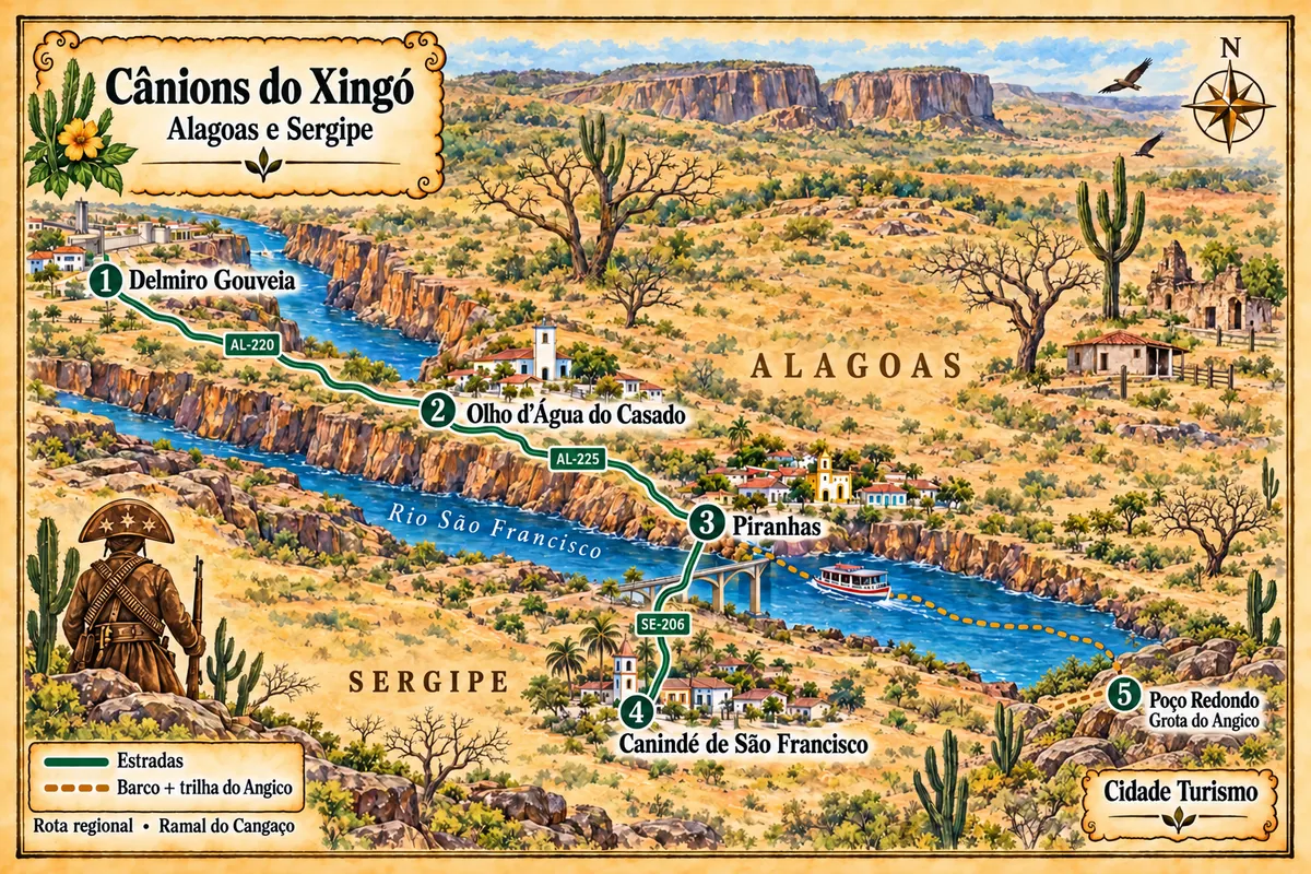
On the Alagoas bank, Delmiro Gouveia adds the industrial memory of the former Pedra. Olho d'Água do Casado has access points to the river and archaeological sites. Piranhas preserves a protected historic ensemble and the village of Entremontes. On the other side of the bridge, Canindé de São Francisco brings together the waterfront and the Museu de Arqueologia de Xingó. The Angico branch is not a road continuation from Canindé: it returns to the Piranhas embarkation and ends in the rural area of Poço Redondo.
The map
5 cities along the way
Mapa: @svg-maps/brazil, CC BY 4.0
The journey
City by city
Distances and times are approximate: check before you set off.
-
 1 · AL
Delmiro Gouveia
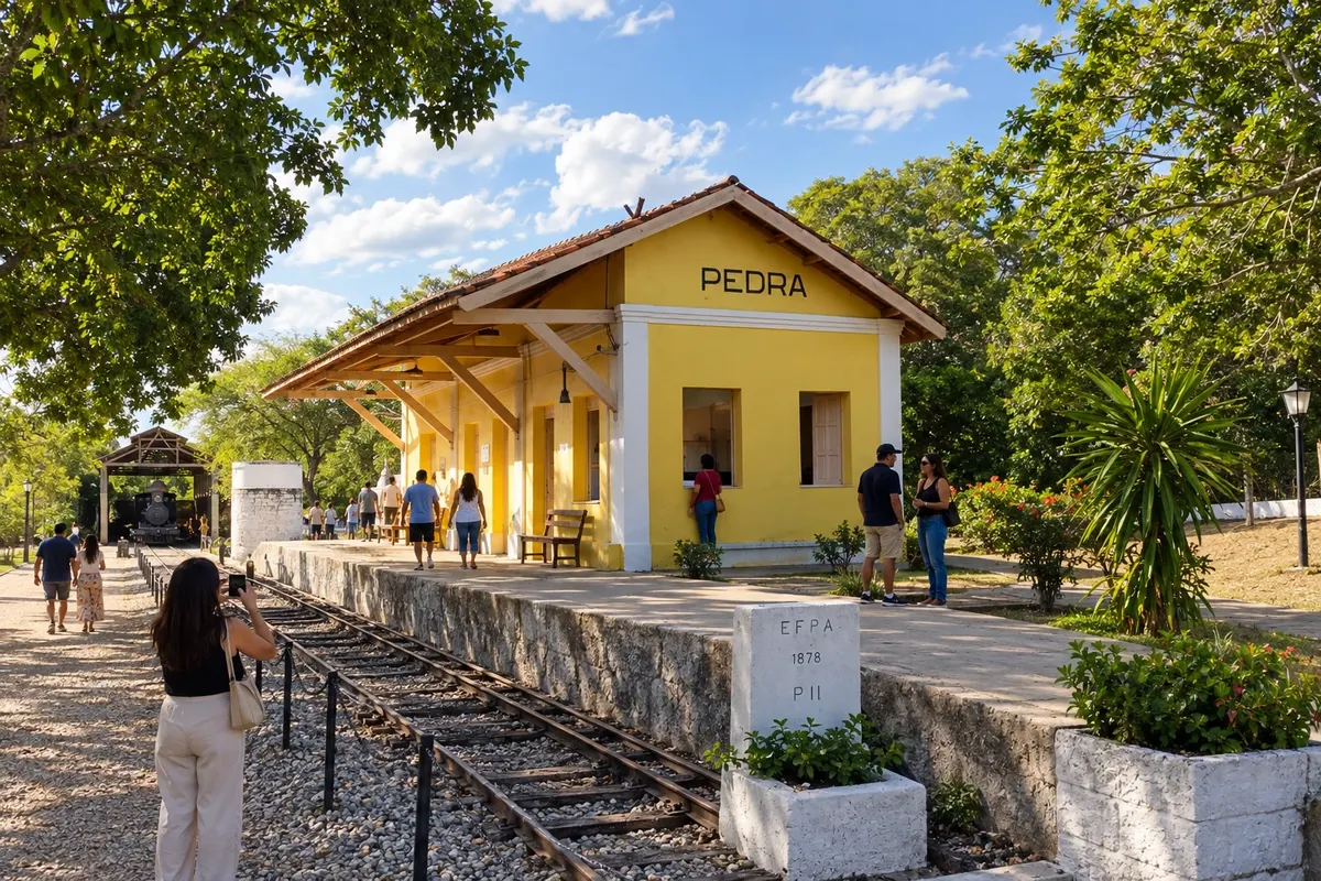
Delmiro Gouveia was born around the former Pedra and gained importance with the textile industry established on the banks of the São Francisco. The memory of that transformation appears in the old railway station and in spaces dedicated to the businessman who gives the municipality its name. Via the AL-220, the city is part of the land access to the canyons region.
→ Olho d'Água do Casado Road via the AL-220, between Delmiro Gouveia and Olho d'Água do Casado. Accesses to the embarkation on the São Francisco bank are additional local transfers.
-
 2 · AL
Olho d'Água do Casado
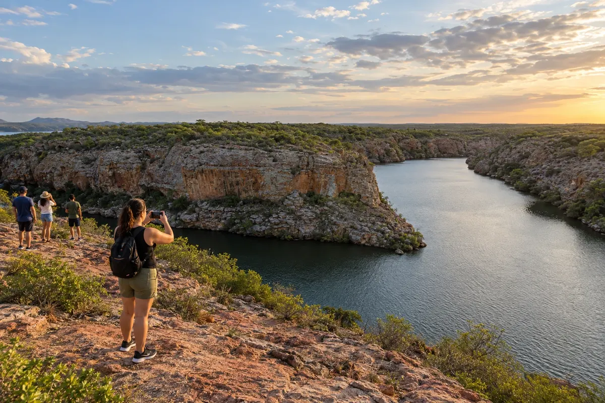
Olho d'Água do Casado occupies the Alagoas bank of the São Francisco between Delmiro Gouveia and Piranhas. Praia da Dulce is one of the access points to the reservoir, while the Nova Esperança archaeological complex records the ancient occupation of the sertão. Embarkation points are located outside the town and need to be identified before traveling.
→ Piranhas Road connection via the AL-225 to Piranhas, followed by access to the historic center on the riverbank.
-
 3 · AL
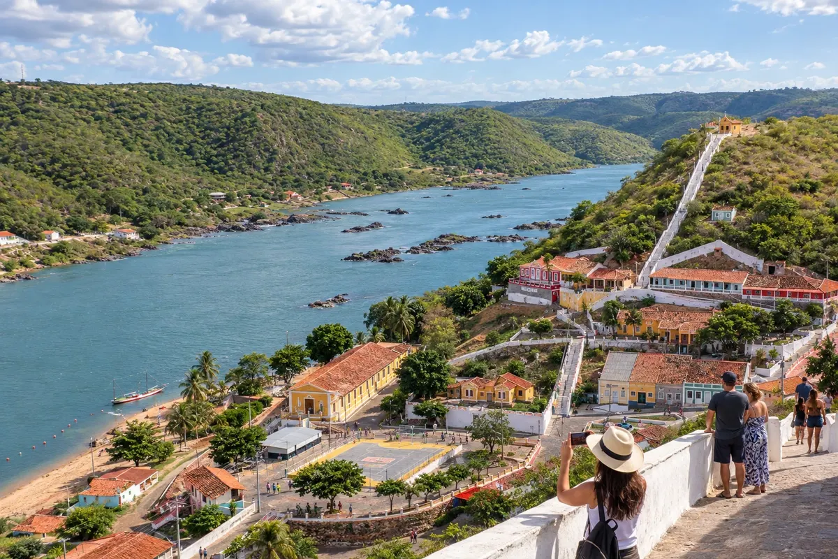
Piranhas
Piranhas has a protected historic ensemble beside the São Francisco. The old station houses the Museu do Sertão, and Entremontes preserves riverside architecture and a tradition of embroidery. In addition to cultural visits, the town is the starting point for the boat trip and trail to the Angico on the Sergipe bank.
→ Canindé de São Francisco Road crossing via the Xingó bridge, between the Alagoas and Sergipe banks, and connection to the SE-206 on the access to Canindé.
-
 4 · SE
Canindé de São Francisco
Canindé de São Francisco is on the Sergipe side of the Xingó reservoir. The Museu de Arqueologia de Xingó brings together remains of ancient populations from the region, and the waterfront brings the town closer to the river. Its access points for navigation tours should be arranged with the person responsible for embarkation.
-
 5 · SE
Poço Redondo
Poço Redondo holds the Grota do Angico, where Lampião, Maria Bonita and other cangaceiros died in 1938. The site is within a caatinga conservation unit in the rural area near the São Francisco. The tour from Piranhas arrives by boat and continues on foot; the municipal seat is not the disembarkation point.
How many days
Allow three to five days for the regional set, choosing the Xingó and Angico excursions on different days. Required time varies with arrival transfers, cultural visits and the contracted river tour.
Best time to go
From March to July it usually rains more than from September to December. June and July tend to be less hot; from October to March the heat is usually more oppressive on walks through the historic town and on the Angico trail. In the canyons, the tour is on the reservoir: navigation conditions also depend on wind and dam operation. From December to February, the high season usually increases demand for embarkations.
The seasons shown are the most usual ones; nature doesn't always follow the calendar.
How to travel it
Use the AL-220 and AL-225 for land connections on the Alagoas bank. The Xingó bridge connects Piranhas to the accesses to Canindé via the SE-206. Navigation through the canyons and the trip to the Angico have their own embarkation points. Confirm with the operator where each activity starts, the transport to the dock and the rules of the conservation unit.
Who it's for
For those looking for river landscape, sertão history and urban heritage, and who intend to combine road, boat and walking routes. The Angico tour requires assessing the trail conditions and each participant's needs before booking.
Your questions
Frequently asked questions about the Cânions do Xingó
Is the canyons tour the same as the Rota do Cangaço?
They are different activities. The first tours the Xingó reservoir between rock formations; the second combines boat and trail to the Grota do Angico. Check the itinerary you book before reserving.
Where does the tour to the Angico depart from?
There is a boat departure from Piranhas, followed by disembarkation and a walk on the Sergipe side. The operator should inform the dock, access rules and whether the trail is accompanied.
Is it possible to make all the connections by car?
The towns are connected by road, but the described tours include navigation. Driving to Poço Redondo is not equivalent to taking the Cangaço river route.
How to plan a visit to the Museu de Arqueologia de Xingó?
Allow time for the exhibition and check the visiting guidelines before going. The cultural visit is separate from the reservoir tour.
What to check before the Angico trail?
Confirm authorization and local rules, the group's guidance and the suitability of the hike for the participants. Bring water and sun protection.