

 Antarctica
 Argentina
 Bolivia
 Chile
 Colombia
 Ecuador
 Guyana
 French Guiana
 Falkland Islands (Malvinas)
 Paraguay
 Peru
 Suriname
 Uruguay
 Venezuela
 Germany
 Austria
 Belgium
 Croatia
 Denmark
 Slovakia
 Slovenia
 Spain
 Finland
 France
 Greece
 the Netherlands
 Hungary
 Ireland
 Iceland
 Italy
 Luxembourg
 Norway
 Poland
 Portugal
 the United Kingdom
 the Czech Republic
 Sweden
 Switzerland
 Turkey
 Bermuda
 Canada
 the United States
 Greenland
 Mexico
 Saint Pierre and Miquelon
 the Dominican Republic
 Japan
 South Africa
 Egypt
 Australia
 Fiji
 New Zealand
 Papua New Guinea
State · North
Roraima
Almost entirely north of the Equator, Roraima stretches from the lavrado savanna to the border highlands and Monte Roraima, with Boa Vista roughly halfway along the way.
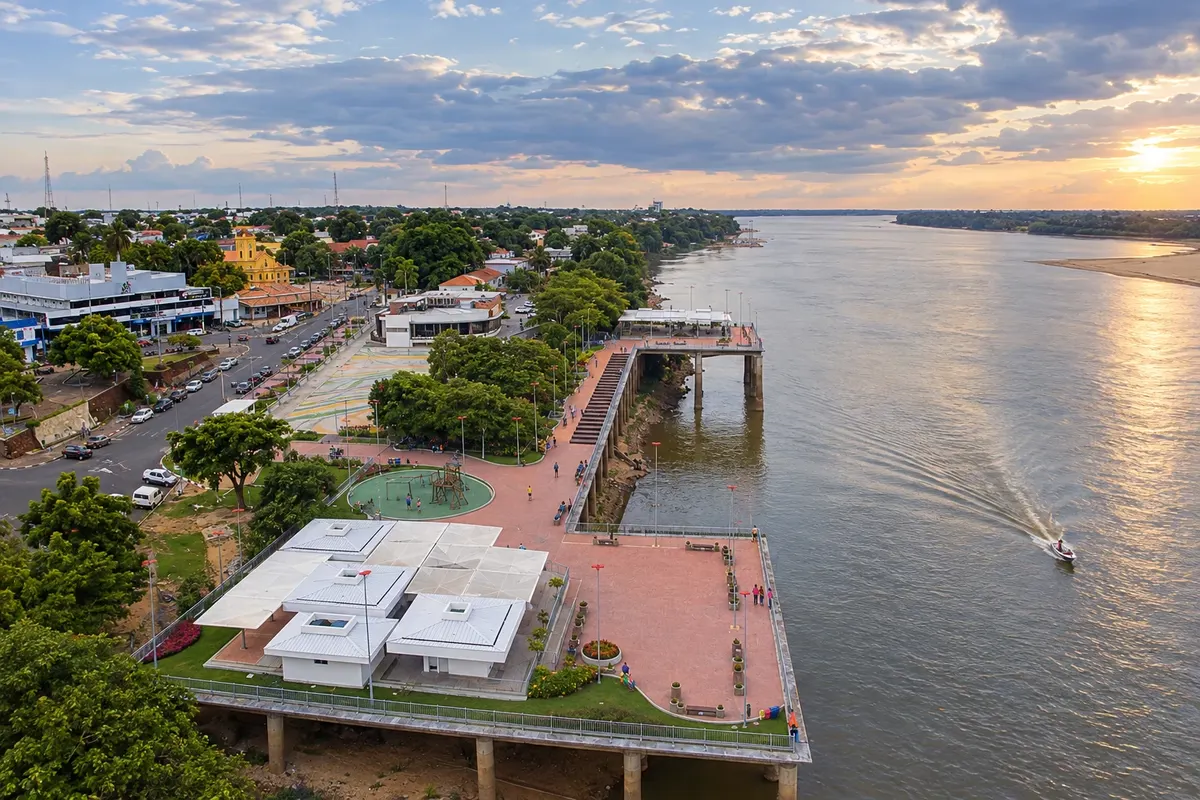
In the photo: Orla Taumanan and Rio Branco, Boa Vista (RR)
Illustrative images. The pictures in this guide are illustrations based on the real place, not photographs, and may differ from it.


The state
Get to know Roraima
Roraima is the northernmost state of Brazil and borders Venezuela and Guyana. Most of the territory lies in the Northern Hemisphere, so the rains fall in the middle of the year, unlike the rest of the country. Peoples such as the Macuxi, Wapichana, Taurepang and Yanomami live across much of the state, and many visited areas are on indigenous lands, where entry follows the communities' rules.
Boa Vista, the capital, was planned like a fan from the banks of the Rio Branco: avenues radiate out from the Centro Cívico. Parque do Rio Branco, the waterfront and Praça das Águas concentrate activity at night. In the dry season the river forms sandy beaches and the wind attracts kitesurfers.
To the north, the lavrado — Roraima's savanna — with open fields, buriti palm groves and lakes extends up to the highlands. In Amajari, the Serra do Tepequém has a plateau over a thousand meters, waterfalls and villages bearing traces of past garimpo. In Normandia, Lago Caracaranã, ringed by beaches, lies within the Terra Indígena Raposa Serra do Sol and visits are organized by the community. Uiramutã, also on indigenous land, brings together highlands and waterfalls at the northern extreme.
Monte Roraima, a flat‑topped tepui on the triple border, draws long‑distance hikers. The most used ascent starts on the Venezuelan side: from Pacaraima you cross the border to Santa Elena de Uairén and continue to the village of Paraitepui, where the trail begins, always with a licensed guide.
The cuisine has a strong indigenous base. Damurida, a fish or meat broth with plenty of chili, and paçoca made from pounded dried meat mixed with farinha, served with banana, are cultural heritage of Boa Vista. In June the Boa Vista Junina fills the city with quadrilhas and corn‑based foods.
When to go
The dry season runs from October to March, with clear skies, low rivers and beaches on the Rio Branco. From May to August there is heavy rain, especially in June and July; dirt roads to Uiramutã and Normandia become difficult and the waterfalls swell. For Monte Roraima, the dry season makes the trails less muddy, although the summit can have rain and fog in any month. The Boa Vista Junina takes place in June.
How to get there
Boa Vista’s international airport – Atlas Brasil Cantanhede – is in the capital. The BR-174 reaches Boa Vista from Manaus and continues to Pacaraima on the border with Venezuela; on the stretch through the Terra Indígena Waimiri-Atroari traffic is halted at night. The BR-401 leads to Bonfim, where a bridge over the Rio Tacutu crosses into Lethem, Guyana, and continues to Normandia. For Monte Roraima, the trip follows BR-174 to Pacaraima and continues on the Venezuelan side.
Your questions
Frequently asked questions about Roraima
What documents to bring to climb Monte Roraima?
The most commonly used ascent goes through Venezuela, so bring a valid passport and the yellow fever vaccination certificate. Entry rules and the border situation change frequently: confirm everything shortly before your trip with the company that will run the trek.
How many days does the Monte Roraima trek take?
Generally six to eight days, round trip, starting from the village of Paraitepui, with nights in camp and at least one full day on the summit. Hire a company with licensed guides and porters.
Can I go to Lago Caracaranã on my own?
Yes, by car, about 190 kilometers from Boa Vista. The indigenous community organizes the visit and has rules: no loud music, no glass bottles or cups, and no fires on the beach, and all trash must be taken back by the visitor.
When does the Rio Branco form beaches in Boa Vista?
In the dry season, between October and March. In those months the waterfront beaches become wide and the wind favors kitesurfing. In the high water season, from May to August, most of them disappear.
Does Roraima have a different time zone than Brasília?
Yes, one hour behind year‑round, the same time zone as Manaus.
What to bring for the Serra do Tepequém?
A light jacket, because nights on the plateau are cooler than in Boa Vista, plus insect repellent, sunscreen and hiking footwear for the waterfalls.
Mapa: @svg-maps/brazil, CC BY 4.0
Beyond the guide


