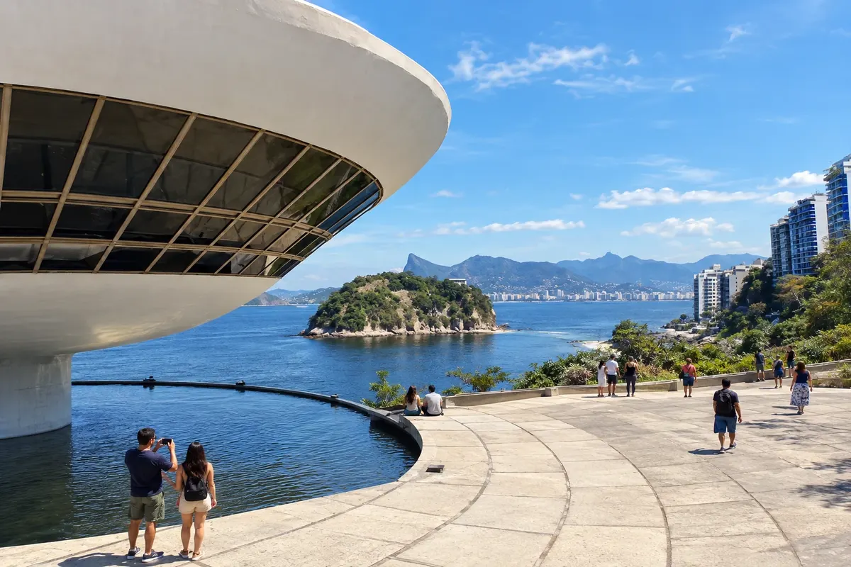
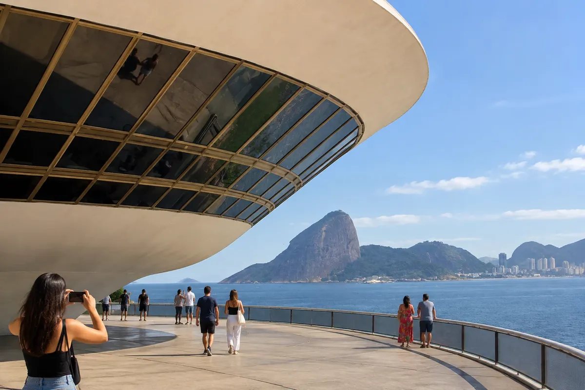
MAC and Boa Viagem waterfront
From Boa Viagem Viewpoint on foot, after bus, taxi or rideshare 2 to 3 hours Morning or late afternoon easy
The Museum of Contemporary Art is the image of Niterói. Oscar Niemeyer designed the building for the Boa Viagem Viewpoint, a stone promontory that juts out over the bay: a white disc supported on a narrow base, over a reflecting pool, which many people compare to a flower or a spaceship. It opened in 1996 and gave rise to the Niemeyer Path.
The visit begins from the outside. The courtyard is open every day and, on its own, already justifies the trip: from there you can see the entire bay, Sugarloaf Mountain and Corcovado on the other side, and Niterói’s beaches. The red-floored concrete ramp curves up to the galleries.
Inside, a continuous band of windows runs around the circular hall, and the landscape shares attention with the artworks. The museum houses the João Sattamini Collection, one of the most important collections of Brazilian contemporary art, and stages temporary exhibitions that change throughout the year. The galleries are open Tuesday through Sunday.
In front of the museum is Ilha da Boa Viagem, listed as national heritage, which receives visitors on weekends. The waterfront continues on foot in both directions, toward Ingá and Icaraí.
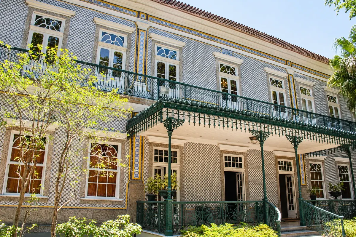
If you want to extend the program, you’ll find three museums a few blocks away, in Ingá and São Domingos: Solar do Jambeiro, a 19th-century townhouse covered in Portuguese tiles; the Museu do Ingá, in a neoclassical palace dedicated to the political and artistic history of the state of Rio de Janeiro; and the Janete Costa Museum of Brazilian Popular Art, housed in a late 19th-century mansion.
Stops: Museum of Contemporary Art of Niterói, Boa Viagem Viewpoint, Ilha da Boa Viagem, Boa Viagem Beach, Solar do Jambeiro, Museu do Ingá, Janete Costa Museum of Popular Art.
Includes: The courtyard and viewpoint are freely accessible. Entry to the galleries is charged separately, with half-price tickets for students, teachers and people over 60; on Wednesdays no admission is charged, and cyclists also do not pay. Check the current fee table.
Tip: Go late afternoon to watch the sun set over the bay, but arrive with time to spare: the ticket office and the ramp close half an hour before the galleries. The island and the other museums have their own opening days; confirm before you go. From the Centro, bus line 47B serves the museum.
Best time: All year; from May to September the sky is usually clearer for seeing Rio on the other side of the bay.
R$ 20 · per person, full ticket for the MAC galleries · official price
Caminho Niemeyer and São Pedro Fish Market, on foot from the ferries
From Ferry terminal, Praça Arariboia, Centro on foot, with a guided visit 2 to 3 hours morning easy
This is the walk for those arriving by ferry: everything is in the Centro, near the Praça Arariboia terminal, on flat ground.
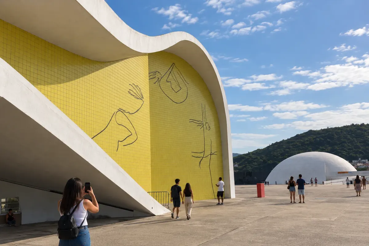
Following the waterfront you reach the Caminho Niemeyer plaza, an open area by the bay where the architect grouped three white, curved buildings. The Teatro Popular has a wavy roof, a façade with designs by Niemeyer himself and a reversible stage that serves the 460-seat indoor audience or opens to the plaza for outdoor performances. The Roberto Silveira Memorial is a concrete dome that seems to rise from the ground and houses a memory center for the state’s history and literature. The Oscar Niemeyer Foundation occupies a spiral dome over a reflecting pool, with a ramp leading to the exhibition hall; inside, the echo is part of the visit.
The Tourist Information Center, to the right of the main entrance, organizes free guided visits that depart hourly, every day. The guides tell the story of the project and lead the group through the three works. From the plaza, Rio de Janeiro appears across the water.
The complex continues along the waterfront with other works by the architect, such as Praça Juscelino Kubitschek, the São Domingos cinema center, the MAC and the Charitas ferry terminal, but those sections require bus, bicycle or car.
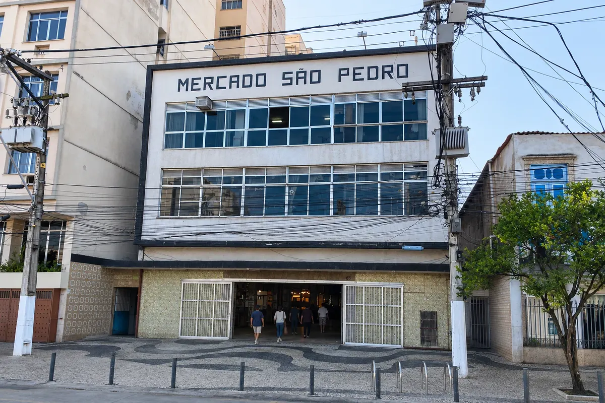
Finish at the São Pedro Fish Market, in Ponta d’Areia, also on foot. On the ground floor dozens of stalls sell fish, shrimp, squid and shellfish on ice; on the upper floor simple restaurants prepare what is bought below or serve ready-made dishes.
Stops: Praça Arariboia, Caminho Niemeyer, Teatro Popular Oscar Niemeyer, Memorial Roberto Silveira, Fundação Oscar Niemeyer, São Pedro Fish Market.
Includes: There is no entrance fee for the Caminho Niemeyer, and the guided visit is also free. At the market you pay for the fish and for preparation at the restaurant; check each vendor’s current price list.
Tip: Go in the morning, when the market has the best selection, and leave lunch for the upper floor; on weekends tables fill early. Check at the Tourist Information Center the days the plaza opens and the time of the next guided visit. There is little shade: bring a hat.
Best time: All year; on dry days, from May to September, the view of Rio is usually clearer.
Parque da Cidade: the viewpoints of Morro da Viração
From São Francisco neighborhood car, taxi, ride-hailing app or van 1 hour 30 minutes to 2 hours late afternoon or morning easy
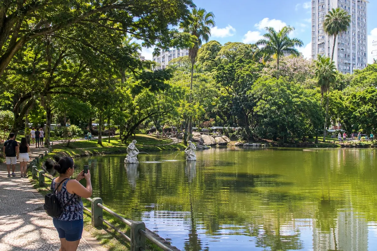
Parque da Cidade sits atop Morro da Viração, at 270 meters elevation, between the bay neighborhoods and the Oceanic Region. It is a municipal environmental protection area with forest, lawns and two viewpoints, and it offers the most complete view of Niterói.
You reach it via Estrada da Viração from the São Francisco neighborhood. The road is narrow and winding, and therefore there is no bus line: access is by car, taxi, rideshare or van.
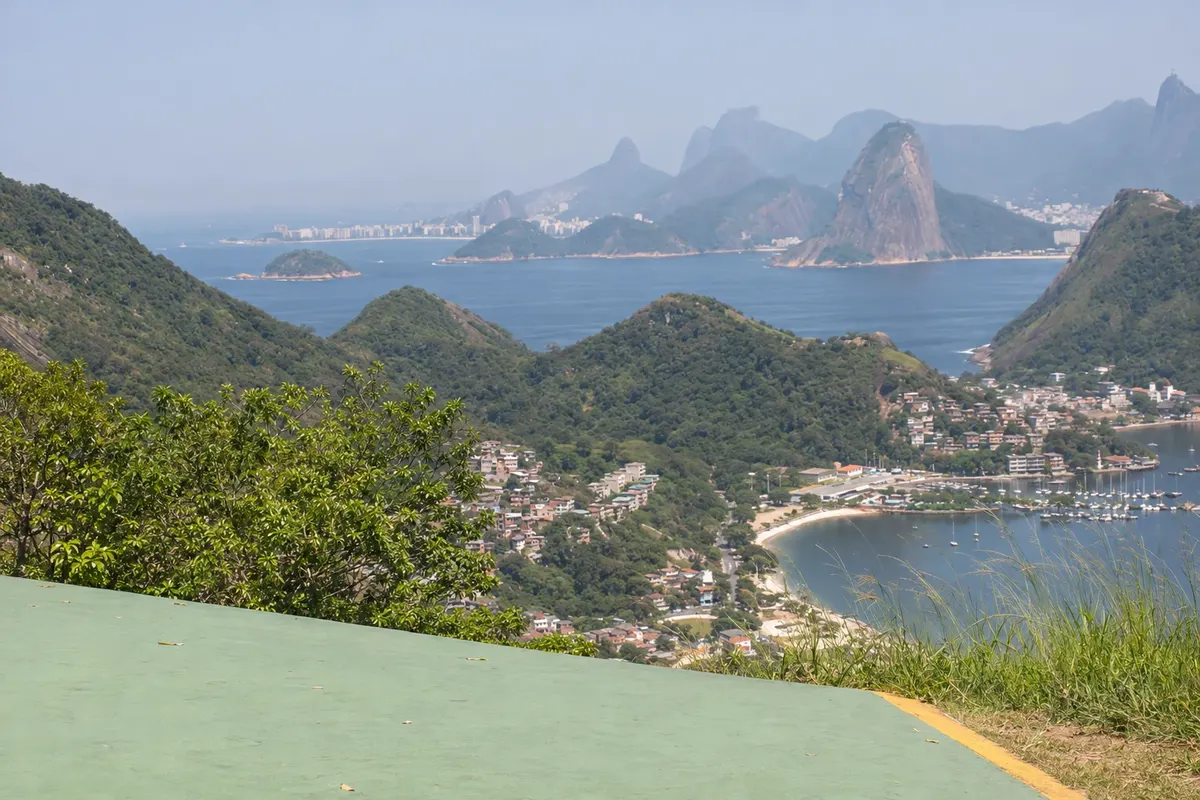
The first viewpoint faces the open sea: the Piratininga and Itaipu lagoons, the ocean beaches and the Serra da Tiririca in the background. The second faces the bay: the coves of São Francisco, Charitas, Jurujuba and Icaraí, the Rio–Niterói Bridge and, across the water, Sugarloaf Mountain, Corcovado and the mountains of Rio de Janeiro. On a clear day, it is one of the widest views of Guanabara Bay.
Both viewpoints are also free-flight ramps. With favorable wind, hang-gliders and paragliders launch from there and land on the beaches below; instructors offer tandem flights to those who want to try, hired in advance or on site.
The park is open Tuesday through Sunday and does not charge admission. Late afternoon, when the sun lowers on the Rio de Janeiro side, is the most sought-after time; mornings are less crowded.
Stops: Parque da Cidade, Morro da Viração, Free-flight ramps.
Includes: There is no park entrance fee. Tandem hang-gliding or paragliding flights are paid separately and arranged with the instructor.
Tip: Arrange with the driver to wait or to come back: there is not always a car available uphill. Bring a light jacket because it can be windy, and avoid days with low clouds that obscure the view. The park is closed on Mondays.
Best time: From May to September, when the sky is clearer. In summer, prefer the morning, before late-afternoon rain showers.
Fortaleza de Santa Cruz da Barra and Jurujuba
From João Goulart Terminal, in the Centro, or Charitas waterfront municipal bus, taxi or car; guided visit on foot 3 to 4 hours, including travel time Morning or early afternoon easy, with stairs and uneven flooring
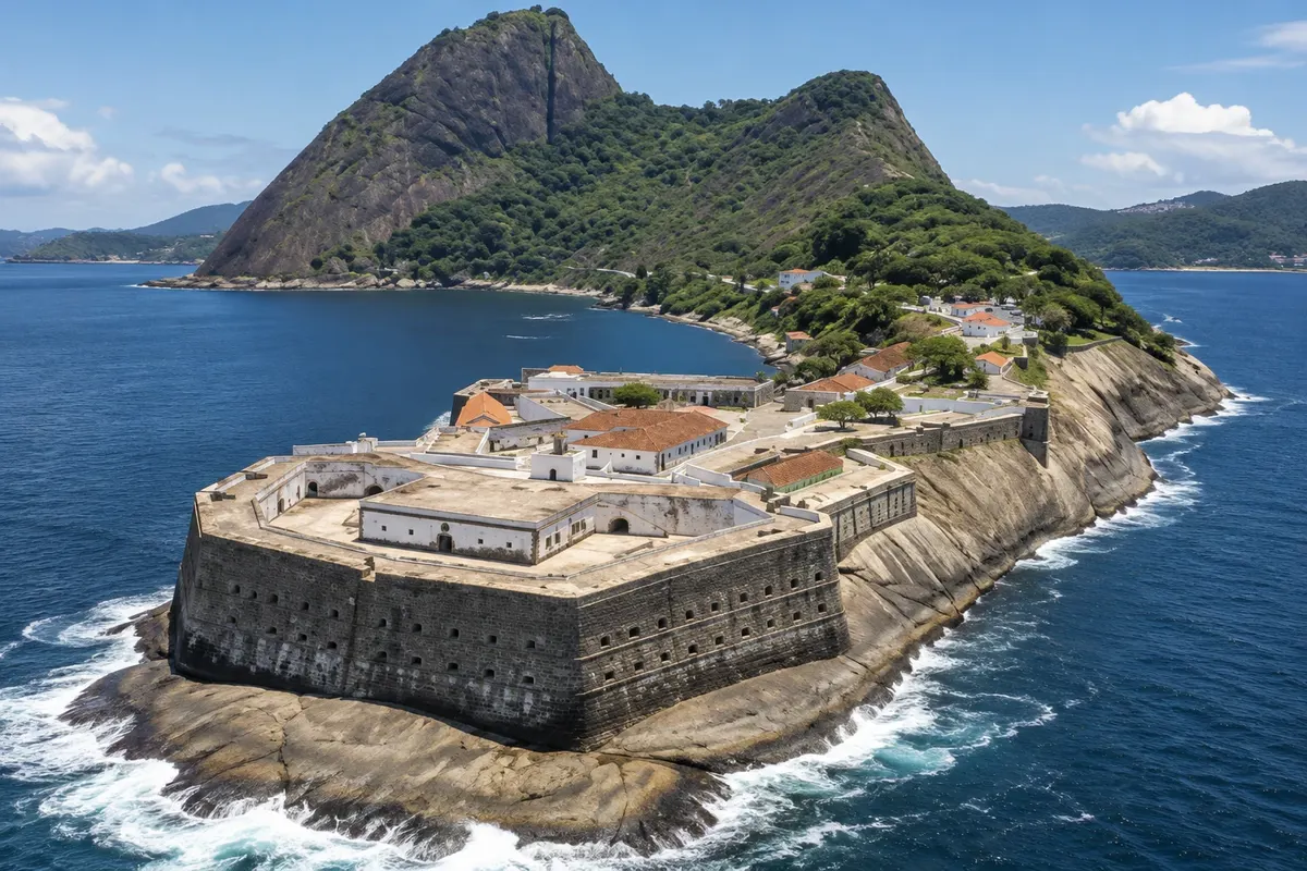
The Fortaleza de Santa Cruz da Barra sits on the rocky point that closes the entrance to Guanabara Bay on the Niterói side, directly opposite Sugarloaf Mountain. It was the first defense erected around the bay from the 16th century, and for centuries it exchanged fire with the forts on the other shore to protect the port of Rio de Janeiro. It remains under Army administration and is listed as national heritage.
Visits are guided by the garrison's military personnel, in groups that depart every hour, Tuesday through Sunday. The route passes along hand-cut and laid stone walls, through courtyards and batteries with 45 cannons from the 18th and 19th centuries aimed at the bar, through galleries and old cells carved into the rock, and the Chapel of Santa Bárbara, from 1612, which houses an 18th-century statue of the saint. From the viewpoints you can see, very close up, the passage of all ships entering and leaving the bay, with Urca and Sugarloaf Mountain in the background.
The approach is part of the experience. The road skirts the Jurujuba cove, a former fishing village with boats at anchor and a row of seafood restaurants along the waterfront.
The fortress is the main piece of a fortification complex that the city presents as the largest in the country in continuous area, including the forts of Pico, São Luiz, Barão do Rio Branco and Imbuhy. The other forts have their own, more limited visiting arrangements: check before you go.
Stops: Fortaleza de Santa Cruz da Barra, Chapel of Santa Bárbara, Jurujuba.
Includes: The fort’s ticket includes the guided visit. Small children and those over 60 do not pay, and students have half-price admission. Transport and meals are each visitor’s responsibility; check the current price list.
Tip: Arrive before the last departure of the day, which takes place in the mid-afternoon. By bus, use line 33, which leaves from Terminal João Goulart and has few departures: check the return trip. Bring ID, water and closed shoes, and have lunch in Jurujuba before or after.
Best time: All year; clear-sky days enhance the view of Sugarloaf. Avoid rainy days, when the rocks become slippery.
R$ 10 · per person, adult ticket with guided tour · official price
Itacoatiara: beach and Costão trail
From Itacoatiara Beach, Região Oceânica bus, car, or rideshare; hiking trail on foot half a day to a full day; trail about 1 hour 30 minutes Morning and afternoon moderate on the trail, with rocky uphill sections
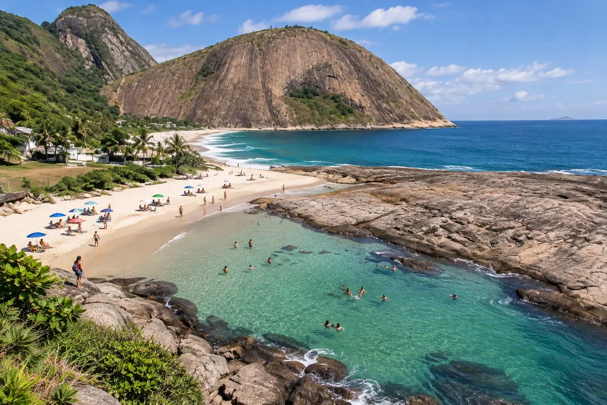
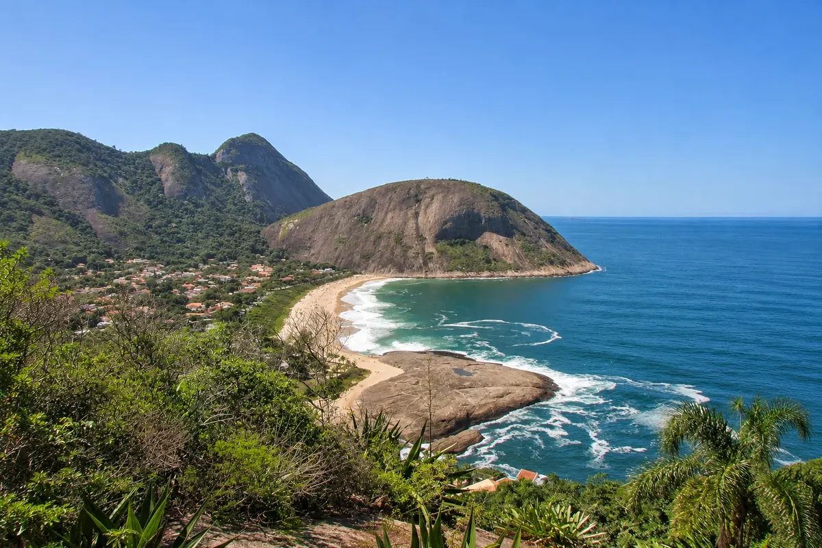
Itacoatiara is Niterói's best-known beach: roughly 700 meters of light sand between two rocky hills, with Atlantic Forest descending to the sea. The name comes from Tupi and means scratched rock. It lies at the end of the Região Oceânica, about a half-hour drive from the Centro.
The sea is open, with clear water and strong waves, so the beach is a traditional surf spot; in winter it hosts big-wave competitions. It is not safe for every swimmer: enter only on calm days and stay near others. On the right-hand side is Prainha, a protected cove with usually still water where families with children go.
On the left side is the reception post of the Parque Estadual da Serra da Tiririca, where the Costão trail begins. Visitors register their name and hike on their own. The first stretch, about 15 minutes, is a steep climb through the forest to a fork with signs; from there you continue on bare rock, steeply uphill, for another 15 minutes to the summit. In some spots you need to use your hands.
From the top you can see the beach right below, the lagoons and the other ocean beaches and, on clear days, the mountains of Rio de Janeiro, from Pedra da Gávea to Sugarloaf Mountain. From the same fork other park trails depart, such as the Enseada do Bananal trail.
The park is open every day and limits the number of people on the trail. In rain, the rock becomes slippery and the climb is not recommended.
Stops: Itacoatiara Beach, Prainha de Itacoatiara, Costão de Itacoatiara, Parque Estadual da Serra da Tiririca.
Includes: The beach and the trail are freely accessible, with no admission fee. Parking, chair rentals and purchases at the kiosks are paid separately.
Tip: Do the trail early, before the strong sun, wearing shoes with good grip and carrying water, and save the beach for afterwards. Do not climb when the rock is wet. By bus, get off at the Itacoatiara entrance and walk to the sand; by car, arrive early on weekends because parking is limited.
Best time: April to September for the trail, with less rain and heat. December to March for the beach, with warmer water and more activity.
Oceanic Region: Piratininga, Camboinhas and Itaipu
From Centro or Charitas, through the tunnel to the Oceanic Region Transoceanic corridor bus, car, or rideshare Full day Morning and afternoon easy
Behind the hills that surround the bay, Niterói has another city: the Oceanic Region, with low neighborhoods, two lagoons and five open-ocean beaches. It’s reached by the tunnel that links Charitas to the Cafubá neighborhood, which is also used by an exclusive bus corridor.
The first beach is Piratininga, long and wide, with a surf zone and a more sheltered corner, the Prainha, and views of the islands Pai, Mãe and Menina. Between Piratininga and Camboinhas lies Praia do Sossego, a small undeveloped cove reached by a short trail.
Camboinhas has wide sand, generally calmer water and kiosks along the shore; it’s the choice for those who want to spend the day with chairs, a beach umbrella and snacks. The neighborhood occupies the strip of land between the ocean and Lagoa de Itaipu.
The Itaipu Canal, which connects the lagoon to the sea, separates Camboinhas from Praia de Itaipu. There the cove is sheltered, the water is calm and the fishing community remains active, with boats on the sand and fish restaurants. Next to the beach are the Church of São Sebastião de Itaipu, from the early 18th century, and the Itaipu Archaeology Museum, housed in the ruins of an 18th-century religious retreat. The collection brings together pieces from the sambaquis and the region’s dunes, left by peoples who lived on the coast thousands of years ago.
Further on is Itacoatiara, which deserves a day by itself. On the return, the lagoons of Piratininga and Itaipu appear between the neighborhoods, with the Serra da Tiririca in the background.
Stops: Piratininga Beach, Praia do Sossego, Camboinhas Beach, Itaipu Beach, Itaipu Archaeology Museum, Lagoa de Itaipu, Lagoa de Piratininga.
Includes: Access to the beaches is free. Parking, chair rentals and purchases are paid separately. The museum has specific opening days: check before you go.
Tip: Pick one or two beaches a day: they’re next to each other, but traffic between neighborhoods is slow on sunny weekends. Itaipu and Prainha de Piratininga are suitable for children; for surf, the open stretch at Piratininga. Have fish for lunch in Itaipu.
Best time: From December to March the sea is warmer; from April to November there are fewer people. Cold fronts, more common from May to August, stir the sea.


 Antarctica
 Argentina
 Bolivia
 Chile
 Colombia
 Ecuador
 Guyana
 French Guiana
 Falkland Islands (Malvinas)
 Paraguay
 Peru
 Suriname
 Uruguay
 Venezuela
 Germany
 Austria
 Belgium
 Croatia
 Denmark
 Slovakia
 Slovenia
 Spain
 Finland
 France
 Greece
 the Netherlands
 Hungary
 Ireland
 Iceland
 Italy
 Luxembourg
 Norway
 Poland
 Portugal
 the United Kingdom
 the Czech Republic
 Sweden
 Switzerland
 Turkey
 Bermuda
 Canada
 the United States
 Greenland
 Mexico
 Saint Pierre and Miquelon
 the Dominican Republic
 Japan
 South Africa
 Egypt
 Australia
 Fiji
 New Zealand
 Papua New Guinea