Teresópolis

Rio de Janeiro · Brazil

Teresópolis

In the destination Rio de Janeiro Mountain Region (Serra Verde Imperial).

Illustrative images. The pictures in this guide are illustrations based on the real place, not photographs, and may differ from it.

Get it on Google Play Send your photos

The city

What to expect from Teresópolis.

Teresópolis sits beside the mountains of the Serra dos Órgãos and is a base for exploring the Atlantic Forest. A stay combines nature walks with outings through its neighborhoods and mountain flavors.

Teresópolis sits high in the Serra dos Órgãos, in the state of Rio de Janeiro, about 94 km from the capital. The center is nearly 900 meters above sea level, and the city is named in honor of Empress Teresa Cristina, wife of Dom Pedro II. Settlement began in 1818, when Englishman George March established a farm on the banks of the Paquequer River and began hosting travelers. The village separated from Magé in 1891, and the railroad, inaugurated in 1908, brought summer visitors from Rio.

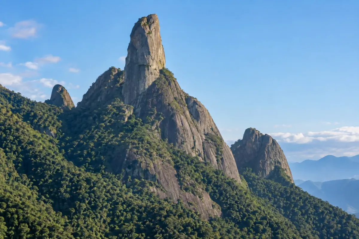
What draws people here are the mountains. The city is the main headquarters of Serra dos Órgãos National Park, created in 1939, and from there depart walks of half an hour as well as the climb to Pedra do Sino, the highest point of the range. Dedo de Deus, a granite peak of 1,692 meters that appears on the municipal flag, can be seen from Mirante do Soberbo, right on arrival. Mozart Catão, one of the first two Brazilians to reach the summit of Everest, was from here, and the climbing tradition explains the city’s title as the mountaineering capital. Two other parks complete the map: Três Picos State Park and Montanhas de Teresópolis Municipal Natural Park, where Pedra da Tartaruga is located.

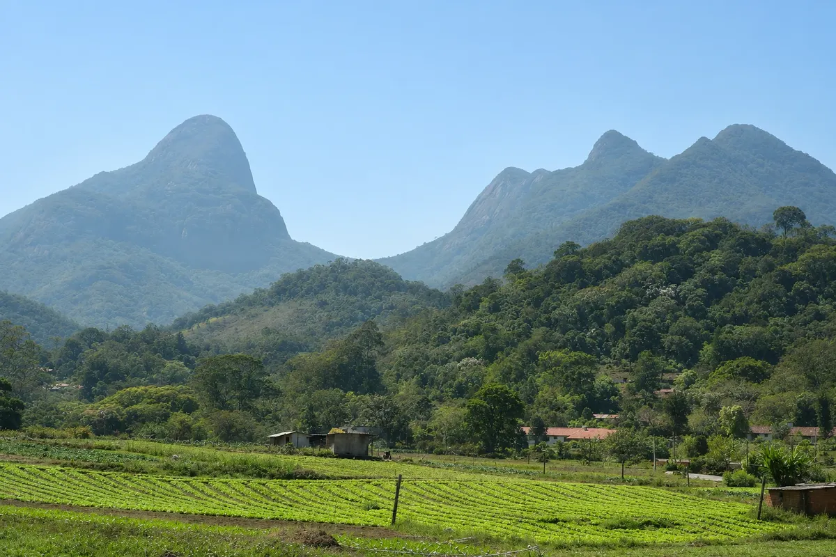
The city is divided into two parts used differently by visitors. The Alto, near the BR-116 entrance, houses the Feirinha do Alto, Fonte Judith, the national park entrance and many of the restaurants; next door, in Carlos Guinle neighborhood, are Lago Comary, the Brazilian national soccer team training center and the Municipal Nursery. The Várzea, a few kilometers on, is the commercial center, with the bus station, Matriz de Santa Teresa, Casa da Memória and Palacete Granado. Beyond the urban area, the road to Nova Friburgo (RJ-130, the Terê-Fri) crosses the municipality’s vegetable belt, with farms open to visitors, vineyards, cheesemakers and Vale dos Frades.

The climate is mountainous. From May to September it rains little, the sky is usually clear and nights are cold, with average lows around 14 °C in July and August; it is mountaineering season. From November to March it is warmer, with highs near 28 °C, and it rains a lot, almost always in afternoon showers: the park’s swimming holes become more inviting, but fog often closes the viewpoints. April and October are transition months.

On a first visit, Mirante do Soberbo, the lower part of the national park with the Suspended Trail and, if it’s a Saturday, Sunday or holiday, the Feirinha do Alto fit into a day. With two or three days you can add Lago Comary, a viewpoint hike, Pedra da Tartaruga and the rural Terê-Fri road. A practical note: the national park is closed on Mondays, and the feirinha only opens on weekends and holidays.

Share: WhatsApp

Where to stay

58 places to stay in Teresópolis.

Where to eat

26 places to eat in Teresópolis.

Teresópolis highlights and titles

National park
Beer route

The local experience

What to see in Teresópolis

market

Feirinha do Alto

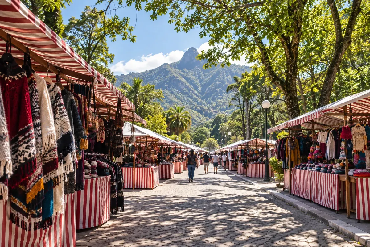
Started around 1973 on Praça Higino da Silveira, in the Alto neighborhood, it brings together hundreds of vendors on weekends and holidays. Products include clothing from small manufacturers, wood and bamboo crafts, sweets and regional food.

Discover Feirinha do Alto

lookout

Colina dos Mirantes

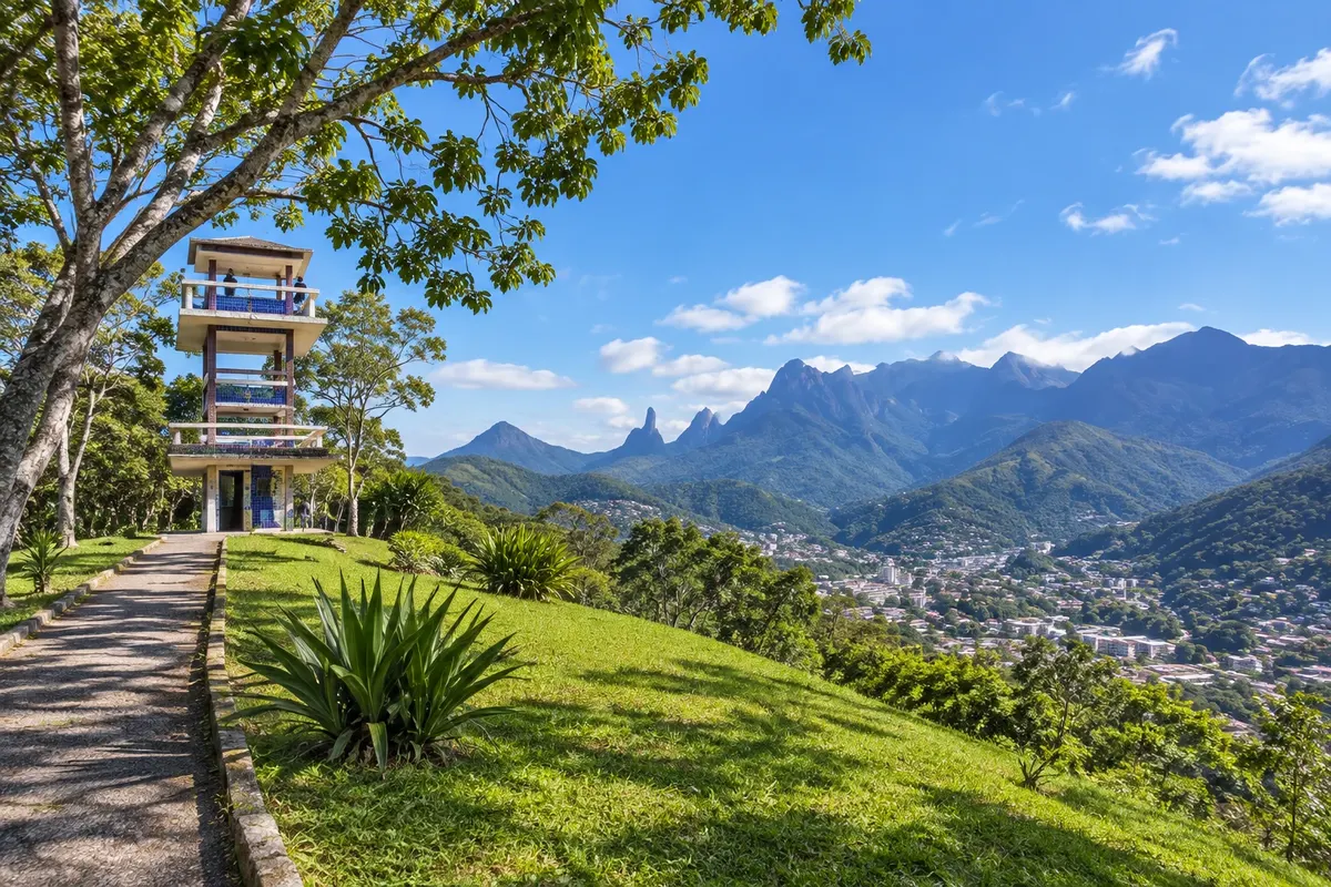
In the Fazendinha neighborhood, it offers an aerial view of the urban area surrounded by the mountains of the Serra dos Órgãos, the Parque dos Três Picos and the municipal park. The site has a paragliding launch ramp.

Discover Colina dos Mirantes

See 2 more places in Teresópolis
mountain and trail

Woman of Stone

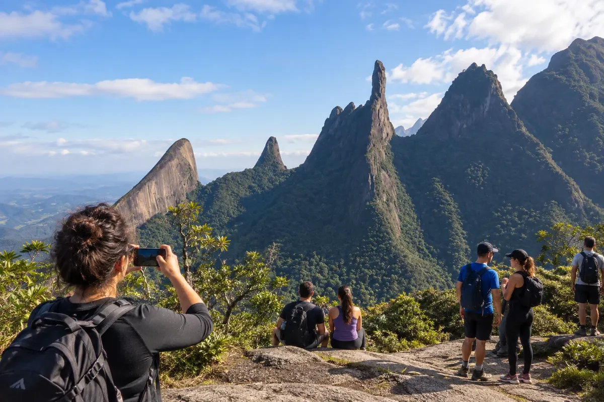
A group of granite peaks in the Três Picos State Park whose profile resembles a reclining woman, visible from the Teresópolis–Friburgo road. The trail to the Seio, the most sought-after point, is steep, has technical sections and takes a full day.

Discover Woman of Stone

To choose before you go

Tours in Teresópolis

Where each tour starts, how long it takes, how it is done, what is included and the price range.

Serra dos Órgãos National Park: Suspended Trail, pools and natural swimming hole

From Teresópolis headquarters gate, Avenida Rotariana, Soberbo on foot; by car via Estrada da Barragem while parking spots are available 3 to 4 hours morning or afternoon easy

The lower sector of the Teresópolis headquarters is the park’s simplest outing and is suitable for all ages. Just after the gate are the Visitor Center, with a scale model of the trails, panels about the fauna and flora and mountaineer Mozart Catão’s belongings, and the natural swimming hole fed by the Paquequer River, the most popular bathing area. Nearby are the Poço do Castelo, reached by a short staircase, the Poço Dois Irmãos and the Bosque Santa Helena, a flat, shaded spot with stone tables and benches designed in the 1940s. From the gate the Estrada da Barragem climbs — a cobblestone road about 3 km long, with signs every 500 meters, viewpoints, outdoor showers and small cascades. It can be done on foot in about two hours round trip, or by car. It ends at Praça da Barragem, where water from the Beija-Flor River is captured for the city; swimming is not allowed there. The Suspended Trail starts at the square: a 1.3 km wooden boardwalk with handrails, built over an early 20th-century aqueduct, rising up to eight meters above the ground at canopy level. It is wheelchair accessible on the way in; because the exit is by stairs, wheelchair users return the same way. One of the staircases descends to Poço Ceci and Peri, named after characters from O Guarani, José de Alencar’s novel set on the banks of the Paquequer. The park is open Tuesday through Sunday and on holidays, and closed on Mondays. Each visitor must present photo ID and CPF, or a passport. There is a daily vehicle limit, on a first-come, first-served basis. Pets, glass, campfires, barbecues and sound equipment are not permitted.

Stops: Serra dos Órgãos National Park, Visitor Center, Natural pool, Poço do Castelo, Poço Dois Irmãos, Santa Helena Grove, Barragem Road, Suspended Trail, Poço Ceci e Peri, Barragem Square.

Includes: Access to the Visitor Center, bathing areas and the short trails. Check at the gate whether an entrance fee and parking fee are charged on the day of your visit.

Tip: Arrive early on weekends and holidays because of the vehicle limit. The water is cold year-round. With overcast weather at the headwaters or heavy rain, stay out of the pools: the river level rises quickly.

Best time: November to March for swimming, in the morning; May to September for hiking in dry weather.

Park lookouts: Cartão Postal, Mozart Catão and 360 trails

From Estrada da Barragem, Teresópolis headquarters of Serra dos Órgãos National Park on foot 2 to 3 hours morning moderate

Three short trails from the Teresópolis park headquarters lead to lookouts and can be done separately or joined into a circuit. All start from Estrada da Barragem and have dirt paths with roots, stones and steps. The Cartão Postal Trail is 1.2 km and takes about two hours round-trip. It crosses forest with large trees, including a jequitibá, and ends at a lookout facing the Serra dos Órgãos range, offering a view of Dedo de Deus from inside the forest. The Mozart Catão Trail is 800 meters and about one and a half hours round-trip. It crosses small streams and climbs the slope to the Mirante Alexandre Oliveira, from where you can see the town and, beyond it, the mountains of the Três Picos State Park. The names honor two mountaineers from Teresópolis who died on Aconcagua in 1998. The 360 Trail connects the two along the ridge. The circuit is 2.6 km and takes around two and a half hours; with detours to the three lookouts it reaches 4 km and three hours. The highlight is Mirante Borandá, which on clear days shows the Serra dos Órgãos on one side and the city of Rio de Janeiro in the distance. There is no need to book or hire a guide for these trails. Bicycles are not allowed. Park entry rules apply: photo ID and CPF, or passport; the gate is closed on Mondays.

Stops: Postcard Trail, Mozart Catão Trail, Alexandre Oliveira Viewpoint, 360 Trail, Borandá Viewpoint, Dedo de Deus.

Includes: Access to the three trails. Check at the gate whether an entrance fee is charged on the day of your visit.

Tip: Go in the morning: fog tends to rise and cover the lookouts in the afternoon, especially from November to March. Bring water and closed shoes with non-slip soles.

Best time: May to September, when skies are usually clearer.

Pedra do Sino: the ascent to the highest point of the Serra dos Órgãos

From Barragem Square, Teresópolis headquarters of Serra dos Órgãos National Park on foot, with a backpack 5 to 6 hours ascent only (about 11 km) a full day or two days strenuous

Pedra do Sino, at about 2,263 meters, is the highest point of the Serra dos Órgãos. The trail is a classic of Brazilian mountaineering: roughly 11 km of continuous ascent from the upper part of the Teresópolis headquarters, just over one thousand meters in altitude, taking five to six hours of walking for those who are fit. The first section runs inside the forest, partly over old paving, and passes two waterfalls that serve as stopping points. Above 2,000 meters the forest gives way to highland fields. From the summit, on clear days, the view reaches Guanabara Bay, the city of Rio de Janeiro and part of the Paraíba Valley. To go and return on the same day no appointment is required. Visitors fill out the Risk and Rules Acknowledgement Form beforehand and present it at the Visitor Center within the entry window, which is early in the morning. Access to the high part has a daily limit of people, and the park’s guidance is to begin descending in the early afternoon. To sleep on the mountain, in a camping area near Abrigo 4, it is mandatory to request scheduling from ICMBio. There is no trash collection up there: everything that goes up must come back down. Pedra do Sino is also the last section of the Petrópolis–Teresópolis crossing, about 30 km, which is usually done in three days starting from Bonfim, in Petrópolis. From the same gate other mountain trails depart, such as Agulhinha do Beija-Flor, which is shorter, and the trails to Morro da Cruz and Papudo. A guide is not mandatory, but the park maintains a list of accredited guides. Fog can rise suddenly and the temperature drops quickly, even in summer.

Stops: Pedra do Sino, Abrigo 4, Véu da Noiva Waterfall, Barragem Square, Serra dos Órgãos National Park.

Includes: Trail access. Overnight stays depend on scheduling with ICMBio; a guide, if hired, is paid separately.

Tip: Bring a flashlight, warm layer, rain jacket, food and water for the first section. Confirm the entry window and trail conditions with the park the day before. If you lack mountain experience, go with a licensed guide.

Best time: From May to September, in the dry, cool season when the sky at the summit is usually clearer.

Mirante do Soberbo, Dedo de Deus and Pedra do Elefante

From Soberbo, at the entrance to Teresópolis on BR-116 car, taxi or rideshare; the trail is on foot 30 minutes at the lookout; about 2 hours with the trail morning easy; moderate with the trail

The Mirante do Soberbo sits high on the climb of the mountain along BR-116, at the point where the road reaches Teresópolis. It is the city’s best-known view: Dedo de Deus, at 1,692 meters, and the neighboring peaks of the same massif — Escalavrado, Dedo de Nossa Senhora and Cabeça de Peixe. On clear days you can also see the Baixada Fluminense and Guanabara Bay. Dedo de Deus is the symbol of Brazilian mountaineering and appears on the municipal flag, with the Latin motto meaning “under the Finger of God.” Next to the lookout are the statue of Empress Teresa Cristina, who gave the city its name, a city-run tourist information booth open every day, and a craft shop selling goods by local producers. The entrance gate of Serra dos Órgãos National Park and Piscina Sloper, a river bathing area beside an old railway bridge, are a few minutes away on Avenida Rotariana. Those who want more can climb Pedra do Elefante. The trail starts beside BR-116, near the lookout, is 800 meters long and is a steep, steady ascent with some sections where you’ll use your hands. The summit, at 1,180 meters, shows the Serra dos Órgãos, Guanabara Bay, the city entrance and Lago Comary. The area belongs to the Três Picos State Park. Climbing Dedo de Deus is another story: it’s only possible via rock-climbing routes, requiring technique, equipment and the national park’s rules.

Stops: Mirante do Soberbo, Dedo de Deus, Statue of Empress Teresa Cristina, Pedra do Elefante, Guanabara Bay.

Includes: Self-guided stop; there is no entrance fee for the lookout.

Tip: Stop by the lookout early: that’s when the mountain usually is clear. If fog rolls in, try again on your way back. On the Pedra do Elefante trail, avoid rainy days because wet rock is slippery.

Best time: May to September, when skies are clearer; in summer, the mornings.

Alto on foot: Alto Market, Feirarte and surroundings

From Higino da Silveira Square, Alto neighborhood on foot 3 to 4 hours morning or afternoon easy

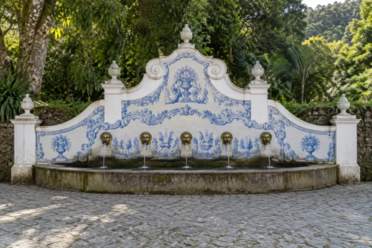
Alto is Teresópolis’s most visited neighborhood and is explored on foot. The heart of everything is the Alto Market, Feirarte, in Higino da Silveira Square. It started in 1973, when artisans began displaying their goods in the square, was formalized by the city in 1977 and is listed as the municipality’s historical and cultural heritage. There are more than 500 stalls, divided into sections: clothes and knitwear from small manufacturers, winter coats, leather, knitting, home décor, costume jewelry and woodcrafts. The food court sells regional dishes, homemade sweets, cheeses and smoked products, and there is a playground for children. The market operates on Saturdays, Sundays and national holidays, during daytime hours. A few minutes’ walk up Dona Olga de Oliveira Street is the Judith Fountain. The spring has existed since 1920 and took its current form in 1967: a colonial-style structure covered with Portuguese tile panels by ceramist Jorge Colaço, with five water spouts in the shape of fauns. The name recalls the girl Judith, daughter of a former landowner, who according to tradition was healed by its water. On Avenida Oliveira Botelho, the neighborhood’s main street, is the Santo Antônio do Paquequer Parish, founded in 1855, the city’s oldest religious institution. In June the saint’s festival, with a novena, procession and stalls, fills the surrounding streets; June 13 is a municipal holiday. On the same avenue stands the former Higino hotel-casino, a 1930s half-timbered building listed by the municipality, which today hosts shows and events. To finish, the Adolpho Bloch House of Culture, in the neighboring Fátima neighborhood, has exhibition galleries, a theater and a glass façade facing the Serra dos Órgãos.

Stops: Alto Market, Feirarte, Higino da Silveira Square, Judith Fountain, Santo Antônio do Paquequer Parish, Avenida Oliveira Botelho, Adolpho Bloch House of Culture.

Includes: Self-guided outing. No admission is charged for the market, the Judith Fountain or the House of Culture; purchases and meals are extra.

Tip: On weekends in June and July Alto fills up and parking becomes difficult: arrive near the market opening or go by taxi. From Monday to Friday the square is empty; on those days the neighborhood is worth visiting for the Judith Fountain and the restaurants.

Best time: All year, on Saturdays, Sundays and public holidays; from May to August the market displays winter collections.

Comary Lake, Granja Comary and Municipal Nursery

From Carlos Guinle neighborhood car, taxi or ride-hailing to the entrance; on foot at the lake and the hortomarket 2 to 3 hours morning or afternoon easy

Comary Lake is an artificial lake of about 106,000 square meters, created in 1930 by entrepreneur Carlos Guinle when he parceled out the former Fazenda Comary. The water surface is a municipal heritage site and has the Serra dos Órgãos in the background, with Dedo de Deus. It lies inside a residential condominium: visitors enter on foot during the day and leave their car on the streets outside. On the lake’s shore is Granja Comary, the training center of the Brazilian Football Confederation, opened in 1987. This is where the Brazilian national team assembles and trains before tournaments and friendlies. The facilities are closed to the public; what you can see is the entrance gate and the set of fields from outside. For many people, a photo at the gate of the “team’s house” already justifies the walk. A few minutes away, in the same neighborhood, the Carlos Guinle Municipal Nursery is the plant nursery that produces the plants for the city’s squares and also a recreational park. It has a walking track, short trails, a sensory garden with aromatic and medicinal plants, a picnic area, a playground and a dog area. The Municipal Butterfly House operates inside it, a conservatory where you walk among free butterflies and observe their life stages, from egg to chrysalis, with guided visits. The nursery is open Tuesday through Sunday and on holidays, and there is a tourist information booth that operates Friday through Sunday.

Stops: Comary Lake, Granja Comary, CBF Training Center, Carlos Guinle Municipal Nursery, Municipal Butterfly House.

Includes: Self-guided. There is no entrance fee for the lake, the municipal nursery, or the butterfly house.

Tip: On days when the national team trains, access to the lake may change: check before you go. The hortomarket is a good plan for visitors with small children.

Best time: All year; from May to September, on clear days, Dedo de Deus appears behind the lake more often.


See 4 more tours

Várzea: Matriz of Santa Teresa, Casa da Memória and Palacete Granado

From Baltazar da Silveira Square, Várzea on foot 2 to 3 hours morning or afternoon easy

Várzea is Teresópolis’s commercial center and preserves the built part of the city’s history. It’s also the outing for a rainy afternoon. Start at the Church of Santa Teresa (Matriz), on Baltazar da Silveira Square. Replacing a chapel from 1855, the current temple was built beginning in 1925 and opened in 1940 in a neo-Gothic style, with a central tower, rose window and twelve Czech stained-glass windows that depict biblical scenes. The church is open every day. In October, the feast of Saint Teresa of Ávila, the city’s patron saint, fills the square. On the same square is the Arthur Dalmasso Memory House, the municipal museum. The mansion was built in the 1920s by a former mayor in an eclectic style, with French glass and metalwork, hydraulic tiles and Portuguese azulejos. It was a gymnasium, hotel and library before becoming a museum. It displays old photographs, documents, maps, coins and objects of notable residents, and is open every day except Christmas and New Year’s Day. Also in Várzea, on Avenida Feliciano Sodré, the Teresa Cristina Palace, the “Pink Palace,” is the city hall: a neocolonial building begun in 1928 that also houses the Municipal Theater, an art gallery and a bust of the empress sculpted by Rodolfo Bernardelli. It is open for visits on weekdays. Finish at Palacete Granado on Avenida Delfim Moreira. The 1913 house was the summer residence of José Antônio Coxito Granado, founder of Drogaria Granado, who kept a small estate there with flowers, fruit and medicinal plants. Restored, it is now the Sesc Teresópolis headquarters, with exhibitions, theater and a bistro. Closed on Mondays.

Stops: Church of Santa Teresa (Matriz), Baltazar da Silveira Square, Arthur Dalmasso Memory House, Teresa Cristina Palace, Palacete Granado, Sesc Teresópolis.

Includes: Self-guided visit. There is no fee to enter the Matriz, the Casa da Memória, or the access to Palacete Granado; Sesc performances require separate tickets.

Tip: Avoid entering the Matriz during Mass times. Várzea is a few kilometers from Alto: go by city bus, taxi, or app ride.

Best time: All year; it’s the plan for rainy afternoons from November to March.

Montanhas de Teresópolis Municipal Natural Park: Pedra da Tartaruga and Santa Rita

From Pedra da Tartaruga Sector, Granja Florestal car, taxi or ride-hailing app to the entrance; trails on foot half a day in each sector morning easy to moderate

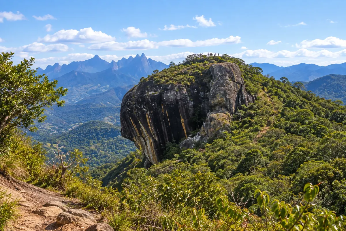
The Montanhas de Teresópolis Municipal Natural Park was created in 2009 to protect 5,335 hectares of Atlantic Forest and the granite formations that stone extraction threatened. It has two visitor sectors with separate accesses. The Pedra da Tartaruga Sector is in Granja Florestal, close to the urban area. The trail to the rock’s summit is 650 meters, easy to moderate, and reaches 1,180 meters in altitude, with views of the mountains in the national park and the Três Picos State Park; many people climb to see the sunrise. The Vidocq Casas Trail, 1,250 meters, passes over small footbridges and along a roughly 40-meter boardwalk attached to the rock face and ends at the Mirante da Tartaruga, which explains the rock’s name. The sector is a climbing school, with routes and rappels up to 35 meters, and the neighboring Pedra do Camelo has a via ferrata to the summit, only for those with the technique and equipment. There is a camping area, first-come, first-served. The Santa Rita headquarters is in the rural zone, accessible from BR-116 and the Santa Rita Road. It’s the quieter side of the park and a well-known birdwatching spot. There you’ll find the visitor center, a lake, a vegetation maze, a playground and three trails: the Jacu Trail, a circular 890-meter path with an observation tower at canopy level; the Tangará Trail, 1,100 meters, with a 22-meter suspension bridge; and the Pedra Alpina Trail, 2 km, which climbs to 1,315 meters and reveals Pedra de Santa Rita, the Três Picos and the Mulher de Pedra. The park is open Tuesday through Sunday and on Mondays that are public holidays. Campfires, barbecues, amplified sound, alcoholic beverages, glass and pets are not allowed. Climbing activities and camping require signing a risk-awareness form.

Stops: Montanhas de Teresópolis Municipal Natural Park, Pedra da Tartaruga, Mirante da Tartaruga, Vidocq Casas Trail, Pedra do Camelo, Santa Rita Headquarters, Jacu Trail, Tangará Trail, Pedra Alpina.

Includes: Access to the sectors, trails and the camping area; no entry fee is charged. A climbing guide or instructor, if hired, is paid separately.

Tip: Entrance to the Pedra da Tartaruga Sector closes before late afternoon: confirm the exact cutoff with the park if you plan to camp. Bring water, because there are no shops inside the sectors. To watch birds at Santa Rita, arrive at opening time.

Best time: May to September for the summits; year-round for Santa Rita’s short trails in the morning.

Terê-Fri: farms, vineyards, Mulher de Pedra and Vale dos Frades

From Teresópolis downtown, via RJ-130 car full day morning and afternoon easy; mountain trails only with a guide

The RJ-130, the Teresópolis–Friburgo road, crosses the municipality’s third district, an area of farms and vegetable crops. The first 25 km from the town make for a day of rural sightseeing, with the mountains of the Três Picos State Park always in view. Right at the start, the locality of Prata dos Aredes gathers organic producers and mushroom growers. Around km 12, in Vargem Grande, appears Mulher de Pedra, a group of mountains whose silhouette resembles a reclining woman; it can be seen from several points along the road. The climb to the summit, at 2,040 meters, is short, very steep and requires a guide. At km 15, in Venda Nova, the Museu Sobrado José Francisco Lippi occupies the main house of a late 19th-century farm. Local residents themselves receive visitors, dressed in period clothing, and tell the village’s history among furniture, dishes, documents and tools stored in the cellars. It is open on Saturday and Sunday afternoons and on holidays; during the week only by appointment. In the same area there is a goat cheese dairy with a small farm, farms that serve coffee and rural lunch cooked on a wood stove, strawberry picking in a pick-and-pay system and, further on, two wineries with visits and tastings. Almost everything operates from Thursday to Sunday or by appointment. Around km 20, in Vieira, an unpaved road enters Vale dos Frades, inside an environmental protection area. Cachoeira dos Frades, with a ten-meter drop and a pool for swimming, is about 4 to 5 km from the entrance; the valley continues for a few more kilometers to Fazenda Itatyba, from where the Caixa de Fósforos trail and the crossing to Vale dos Deuses depart, already at the foot of the Três Picos. In Bonsucesso, the Torres de Bonsucesso form a granite wall more than half a kilometer long, sought after by climbers.

Stops: Teresópolis–Friburgo Road (RJ-130), Venda Nova, Museu Sobrado José Francisco Lippi, Mulher de Pedra, Vale de Bonsucesso, Torres de Bonsucesso, Vale dos Frades, Cachoeira dos Frades.

Includes: Self-guided outing. Visits to farms and wineries, meals and tastings are paid separately; some attractions in Vale dos Frades are on private property.

Tip: Plan the itinerary before you leave and schedule visits: many farms only open by reservation. The Vale dos Frades road is unpaved and can become bad after rain. Fill the car’s tank in town.

Best time: All year for the road and the table; from May to September for the trails; from November to March for the waterfall swim, in the morning.

Três Picos State Park in Teresópolis: Vale da Revolta and Jacarandá

From Núcleo Vale da Revolta, BR-116 car, taxi or ride-hailing app to the complex; trails on foot half day morning easy to moderate

Três Picos State Park, created in 2002 and managed by Inea, is the largest state park in Rio de Janeiro and covers parts of Teresópolis, Nova Friburgo, Cachoeiras de Macacu, Guapimirim and Silva Jardim. The group of peaks that gives it its name lies in Nova Friburgo, but two visitor centers are in Teresópolis, with short, quiet trails. Núcleo Vale da Revolta is beside BR-116 and is the most structured: visitor center, park rangers who advise on the trails, a seedling nursery and a flat picnic area with tables and benches in the shade by the streams. The Caminho das Águas, 250 meters long, is flat and follows a creek. From it departs the Caminho das Centenárias, 924 meters long, which passes by fig trees, jequitibás, jacarandás and other large trees, some estimated to be more than 300 years old. Núcleo Jacarandá is in the Meudon neighborhood. Near the entrance, an easy path leads to Prainha and Cachoeira das Pedras, a small waterfall with a pool for swimming. For views, the Pico do Urubu trail climbs to 1,318 meters in just over 2 km, with a detour to Mirante Boa Vista; from the top you can see the Serra dos Órgãos surrounding the area. A 4.5 km crossing links the two nuclei passing the same peak. Another 4.5 km route, open to bicycles, descends from Jacarandá to Prata dos Aredes, an area of organic producers. The visitor centers are open every day during daytime hours.

Stops: Três Picos State Park, Núcleo Vale da Revolta, Caminho das Centenárias, Caminho das Águas, Núcleo Jacarandá, Pico do Urubu, Mirante Boa Vista, Prainha and Cachoeira das Pedras.

Includes: Access to the trailheads and trails; no entrance fee charged.

Tip: First stop by the Vale da Revolta visitor center to learn trail conditions. For through-hikes, arrange return transport in advance, because the trail end is far from the start.

Best time: May to September for the viewpoints; November to March for swimming at Cachoeira das Pedras, in the morning.

Day by day

1, 2 and 3-day itinerary in Teresópolis

Suggestions to plan the trip. Change the order of the days according to the weather and tour availability.

1 days · Teresópolis in 1 day: Soberbo, national park, and Alto

For those coming from Rio to spend the day or passing through the mountains · Based in Bairro do Alto
  1. Day 1 · Viewpoint, Suspended Trail and Feirinha do Alto

    Stop at Mirante do Soberbo as soon as you arrive, while the mountain is clear, to see Dedo de Deus. Go to the headquarters of Parque Nacional da Serra dos Órgãos, a few minutes away. Take Estrada da Barragem, do the Suspended Trail and descend to Poço Ceci and Peri. If you have energy left, the Mozart Catão Trail leads to the viewpoint over the city in about an hour and a half round trip. Remember the park is closed on Mondays. Have lunch in Alto. In the afternoon, stroll through Feirinha do Alto, which opens on Saturdays, Sundays and holidays, and climb to Fonte Judith. On weekdays, trade the market for Lago Comary and the Municipal Horto, with its butterflyhouse. Those returning to Rio the same day should descend the mountain before dusk if there is fog.

2 days · Teresópolis in 2 days: mountain, lake, and the town
For weekend and first visit · Based in Bairro do Alto
  1. Day 1 · Soberbo and the national park trails

    Start at Mirante do Soberbo and enter the national park early. In the morning, do the viewpoint circuit: Cartão Postal Trail, 360 Trail with Mirante Borandá and descend via Mozart Catão, in about three hours. After a snack, descend to the lower area: Suspended Trail, Poço Ceci and Peri and, if it’s hot, the natural pool. Late afternoon, Feirinha do Alto and Fonte Judith. At night, the Alto restaurants are a short walk away; the town is part of the state’s beer route and has breweries with their own bars.

  2. Day 2 · Lago Comary, Várzea and Pedra da Tartaruga

    In the morning, go to the Pedra da Tartaruga sector of the municipal park. The climb to the summit is short, and the Vidocq Casas Trail, with the boardwalk along the cliff, leads to the Tartaruga Viewpoint. Return through the Carlos Guinle neighborhood to walk at Lago Comary, see the Granja Comary gate and stop by the Municipal Nursery. After lunch, descend to Várzea: Santa Teresa Mother Church, Arthur Dalmasso Memory House and Palacete Granado. On rainy days, reverse the order and leave the trail for when the weather clears.

3 days · Teresópolis in 3 days, with the Terê-Fri rural road
For for those who want nature at a relaxed pace and are traveling by car · Based in Bairro do Alto or a pousada on RJ-130
  1. Day 1 · National park end to end

    Soberbo viewpoint on arrival and then the national park. In the morning do the Cartão Postal, 360 and Mozart Catão circuits and, in the afternoon, the Suspended Trail, the pools and the Santa Helena Wood. Those who are fit and experienced can swap this day for Pedra do Sino as a round trip: in that case, enter the park gate right at opening, with the risks waiver signed, and reserve the whole day. Late afternoon in Alto, with Judith Fountain and, from Saturday to Sunday, the little market.

  2. Day 2 · Terê-Fri: Venda Nova, vineyards and Vale dos Frades

    Leave early on RJ-130. Stop to see Mulher de Pedra in Vargem Grande and continue to Venda Nova. If it’s Saturday, Sunday or a holiday, fit the Sobrado José Francisco Lippi Museum in the afternoon; in the morning, visit a cheesery or a farm with pick-and-pay, arranged in advance. Have lunch at one of the rural restaurants on the road or at one of the wineries, with a reservation. In the afternoon, enter Vale dos Frades to Cachoeira dos Frades. With good weather, drive to the end of the road to see Três Picos and Caixa de Fósforos from a distance. Return to town before dark.

  3. Day 3 · Pedra da Tartaruga, Lago Comary and Várzea

    Morning at Núcleo Pedra da Tartaruga, with the summit and the Mirante da Tartaruga. If you prefer flat walking and birdwatching, choose Sede Santa Rita or Núcleo Vale da Revolta, in the Parque Estadual dos Três Picos. On the way back, Lago Comary, Granja Comary and the Municipal Horto. After lunch, Várzea: Matriz de Santa Teresa, Casa da Memória and Palacete Granado. If the sky is clear, finish at Colina dos Mirantes, in the Fazendinha neighborhood, where you can see the urban area surrounded by mountains.

Best time to go

When to go: Teresópolis month by month

The seasons shown are the most usual ones; nature doesn't always follow the calendar.

January High rain

Rainiest month, together with December · Summer school break

Mountain warmth and lots of water: lows around 21 °C, highs around 28 °C and over 300 mm of rain, in heavy bursts, almost always in the afternoon. Do trails and visit viewpoints in the morning and leave Várzea and Palacete Granado for after lunch. The natural pool and the pools in the national park get crowded; stay out of the water during heavy rain or if the headwaters look stormy. It's school vacation month in Brazil.

February High rain

Carnival, in February or March · Summer rain

It stays hot and rainy, with lows near 21 °C and highs near 29 °C, the highest of the year. Carnival, in February or March depending on the year, increases activity: book ahead. Outside the holiday the town is calm during the week. River bathing works in sunny mornings; fog often closes Soberbo in the afternoon.

March High rain

End of summer · Rains still frequent

It still rains a lot, with a volume similar to February, and highs near 27 °C. In the second half of the month showers usually ease and nights cool. It’s a low-activity month outside late Carnival and Holy Week. Long trails remain prone to mud and fog.

April Some rain

Holy Week, in March or April · Start of the dry season

Transition month: rainfall falls to less than half of March’s, highs around 25 °C and lows around 18 °C. Holy Week fills the city. The wells still have good volume and the sky begins to clear at the viewpoints. The Feirinha do Alto starts receiving winter clothes.

May Low rain

Start of the mountaineering season

The dry season settles in, with clear days, highs around 23 °C and lows around 16 °C. It’s the start of the mountaineering season, which runs until September: a good time for Pedra do Sino, the traverse starting from Petrópolis and the park’s summits. Well water is already cold. Moderate activity outside holidays.

June Low rain

Feast of Saint Anthony, with municipal holiday on the 13th · Cold and clear skies

One of the driest months, with average lows near 15 °C and much colder predawn hours in the upper neighborhoods. In Alto, the Feast of Saint Anthony includes a trezena, procession and stalls; June 13 is a city holiday. Weekends fill the little market and the restaurants. Dedo de Deus often appears whole from Soberbo.

July Low rain

City anniversary, on July 6 · July school holidays · Winter festival

Coldest, driest month: average lows near 14 °C, highs near 23 °C and nights when temperatures drop significantly. The city celebrates its emancipation on the 6th. School holidays fill the high town, and winter brings cultural events and, on a date to be confirmed, the mountain chocolate festival. Nights at the top of Pedra do Sino are very cold.

August Low rain

Dry winter · Clear skies at lookouts

Still dry and cool, with lows near 14 °C and less traffic than in July. This is the month when lookouts and long trails tend to be most rewarding: Pedra do Sino, Trilha 360, Pedra da Tartaruga, Pedra do Elefante. Bring warm clothing for evenings and summits.

September Low rain

End of mountaineering season · Spring

Temperatures rise a little, with highs near 25 °C, and rain returns slowly, about double that of August. There are still many stable days for hiking. Outside the September 7 holiday the city is quiet. The rural producers’ fair usually happens between September and October, date to be confirmed.

October Some rain

Feast of Saint Teresa of Ávila, patron saint

Late-afternoon showers become common again and the forest turns greener; highs near 26 °C. In Várzea, the patronal festival fills the Matriz and Praça Baltazar da Silveira. The October 12 holiday brings visitors from Rio. Do the trails in the morning.

November High rain

Start of the rainy season · November holidays

Rain increases significantly and stormy afternoons become frequent, with lows around 19 °C. Pools and waterfalls gain volume, and trails become slippery. Holidays in the month bring more activity to the highlands. Check the forecast before any long hike and follow the guidance of the gatehouses.

December High rain

Illuminated Christmas · Rainiest month, with January

Tied with January as the rainiest month, with over 300 mm and highs near 27 °C. The town puts up the Illuminated Christmas decorations and program, and activity increases in the last week of the year. River bathing works in sunny mornings. On days of heavy rain parks may close trails.

Plan the journey

How to get there: Teresópolis

By plane: via Rio de Janeiro airports

Teresópolis has no airport with commercial flights nor train service: it is reachable only by road. The aerial gateway is Rio de Janeiro.

Rio de Janeiro/Galeão International Airport (Tom Jobim) handles international and domestic flights and is the closest to the mountains: from there you can reach BR‑116 via Linha Vermelha without crossing the city. Santos Dumont Airport, in downtown Rio, concentrates flights to São Paulo and other capitals.

From either airport, go by rental car, taxi, ride‑hailing app or prebooked transfer. To travel by bus, you must first get to Rodoviária Novo Rio and board there.

Before buying an airline ticket, confirm the route and connections with the carrier.

By bus: from Rodoviária Novo Rio and other cities

From Rio de Janeiro, Viação Teresópolis runs the direct line from Rodoviária Novo Rio, with departures throughout the day, generally hourly. The trip takes about two hours, depending on traffic leaving Rio and in the mountains. The same company has departures from Castelo, in downtown Rio, and from Barra da Tijuca.

Arrival is at Teresópolis bus station, in Várzea. From there, city buses, taxis and apps take you up to Alto, where the market and the national park entrance are located.

There are intercity lines to Petrópolis, Nova Friburgo, Guapimirim and Magé, and also to Cabo Frio and Rio das Ostras on the coast. Other companies link the city to Juiz de Fora and destinations in Minas Gerais and São Paulo.

Buy in advance for holidays and for the June and July weekend periods, and check the day’s schedules with the company.

By car: via BR‑116

From Rio de Janeiro it is about 94 km via Linha Vermelha and BR‑116, the Santos Dumont Highway, in about one and a half hours without traffic. The stretch has tolls: check the current rates. The mountain ascent is on a winding road and passes the park’s Guapimirim headquarters; at the top, near the city entrance, is Mirante do Soberbo.

From Petrópolis the connection is via BR‑495, a narrow winding mountain road that leaves Itaipava and is about 35 km. From Nova Friburgo, take RJ‑130, the Terê‑Fri, in about 76 km, without tolls.

Those coming from Minas Gerais arrive via BR‑116 in the opposite direction through Além Paraíba, or via BR‑040 to Itaipava and then BR‑495. The city hall indicates 150 km from Juiz de Fora, 434 km from Belo Horizonte and 550 km from São Paulo.

In heavy rain or fog, drive slowly and use headlights. In Alto, on weekends with the market, on‑street spaces disappear: prefer accommodation with a garage.

With a local guide, leader or agency

If you don’t want to drive there are two options. Local receptive tour agencies organize trips with transport to the national park, lookouts and rural sites, and the city council keeps a list of accredited agencies and tour guides. For mountain trails, the Serra dos Órgãos National Park publishes a list of licensed visitor leaders authorized to work in the unit.

A guide makes a difference on Pedra do Sino, the Petrópolis–Teresópolis crossing, Mulher de Pedra and the Torres de Bonsucesso, where orientation is difficult or terrain is exposed. Rock climbing, rappelling and via ferrata only with an instructor and proper equipment.

Agree beforehand on price, duration, group size and what’s included, and confirm the professional is registered.

How to get around Teresópolis

Up in Alto, walk: the Feirinha do Alto, Fonte Judith, Avenida Oliveira Botelho and the restaurants are close to each other. The entrance to the national park and the Mirante do Soberbo are a few minutes by car or taxi.

Várzea, with the bus station, the Matriz and the Casa da Memória, is a few kilometers from Alto. City buses connect the two neighborhoods; on Sundays, municipal urban lines do not charge a fare. Taxis and ride‑hailing apps work well in the central area.

Lago Comary, the Horto Municipal and Pedra da Tartaruga are reachable by taxi or app. For Sede Santa Rita, the cores of Parque Estadual dos Três Picos, Terê‑Fri and Vale dos Frades, a car is almost indispensable: the sites are spread out and part of the route is unpaved.

The city hall has tourist information booths at Soberbo every day; at Horto Municipal from Friday to Sunday; at the Feirinha do Alto on market days; and in a shopping center in Várzea.

Get your questions answered

Frequently asked questions about Teresópolis

How many days to stay in Teresópolis?

One day is enough for Mirante do Soberbo, the lower part of the national park and the Alto. With two days you can add a viewpoint trail, Lago Comary, the Várzea and Pedra da Tartaruga. Three days allow adding the rural Terê-Fri road, with Vale dos Frades, or reserving a full day for Pedra do Sino.

What is the best time to go to Teresópolis?

From May to September there is little rain, the sky tends to be clear and nights are cold: it’s the season for viewpoints, long trails and winter activity in the Alto. From November to March it’s warmer and rains a lot, with afternoon downpours; it’s suitable for river swims in the morning, but fog often closes the views. April and October are transition months, with fewer people.

Can you go to and return from Rio in the same day?

Yes. It’s about 94 km and an hour and a half by car each way, or around two hours by bus from Rodoviária Novo Rio. In one day you can do Mirante do Soberbo, the Suspended Trail and the park’s pools and, on weekends and holidays, the Feirinha do Alto. Long trails and the rural area require an overnight stay.

Which days does the Feirinha do Alto operate?

On Saturdays, Sundays and national holidays, during the day, at Praça Higino da Silveira, in the Alto neighborhood. From Monday to Friday the square is without stalls. If you’re traveling during the week and want to visit the market, plan to arrive on Friday or depart on Sunday afternoon.

Is the Serra dos Órgãos National Park open every day?

No. The park operates Tuesday through Sunday and on national and state holidays, and closes on Mondays for maintenance; when Monday is a holiday or the eve of a holiday, it opens. There is a daily limit on cars, on a first-come basis, so it’s worth arriving early on weekends.

Do you need to pay or show documents to enter the national park?

Identification is mandatory: each visitor must identify at the gate with CPF and a photo ID, or with a passport. Regarding the entrance fee, the park has had periods without charging entrance, parking or camping fees: check the current situation on ICMBio channels or at the gate. Pets, glass, open fires, barbecues and sound equipment are not allowed.

Do you need a guide or reservation to climb Pedra do Sino?

A guide is not mandatory, but is recommended for those without mountain experience; the park maintains a list of accredited guides. To go and return the same day no reservation is required: just present the prefilled risk awareness form at the Visitor Center within the early-morning entry window. To spend the night on the mountain, booking with ICMBio is mandatory. There is a daily limit of people on the trail.

Can you climb Dedo de Deus?

Only by climbing. There is no hiking trail to the summit: access is via rock-climbing routes that require technique, equipment and compliance with national park rules, preferably with a climbing guide. For most visitors, Dedo de Deus is to be seen from Mirante do Soberbo, the Trilha Cartão Postal or Lago Comary.

Can you visit Granja Comary, where the Brazilian national team trains?

Not inside: the training center facilities are closed to the public. Visitors can enter the condominium on foot during the day, walk around Lago Comary and get as far as the training center’s guardhouse. Cars stay on the streets outside. During team training camps access rules may change.

Where can you bathe in rivers and waterfalls in Teresópolis?

The easiest place is the national park headquarters, with the natural pool, Poço do Castelo, Poço Dois Irmãos and Poço Ceci e Peri, all near the gate or Barragem Road. Next to the park entrance is Piscina Sloper. In the rural area, Cachoeira dos Frades, in Vale dos Frades, has a ten-meter drop and a pool. The water is cold year-round; do not enter during heavy rain.

Can you get around Teresópolis without a car?

The main part, yes. The bus from Rio arrives at the bus station in Várzea, and city buses, taxis and apps take you to Alto, the national park gate and Lago Comary. Inside the park, everything is done on foot. A car is useful for Terê-Fri, Vale dos Frades, Sede Santa Rita and the rural sites.

Where is best to stay in Teresópolis?

In Alto, if you want the market and restaurants within walking distance and to be close to the national park. In Várzea, if you arrive by bus and prefer to be near shops and the bus station. Along BR-116 and the road to Nova Friburgo there are country hotels and farm inns, recommended for those with a car seeking peace and quiet.

What to do in Teresópolis when it rains?

Head to Várzea: Matriz de Santa Teresa, Casa da Memória Arthur Dalmasso and Palacete Granado, Sesc’s headquarters, with exhibitions and theater. In Alto, Feirinha do Alto has a food court, and Casa de Cultura Adolpho Bloch hosts shows. The Municipal Horto’s butterfly house and breweries with on-site bars complete the plan. Leave viewpoints and trails for the next morning.

Is it very cold in Teresópolis?

By Rio de Janeiro standards, yes. From June to August the average lows are around 14 °C and there are much colder nights, especially in the high neighborhoods and rural areas; daytime highs are around 23 °C. In summer highs reach about 28 °C, but evenings call for a light jacket. At the top of Pedra do Sino the cold is intense year-round.

How do you get from Teresópolis to Petrópolis and Nova Friburgo?

To Petrópolis, by car via the BR-495, a mountain road that reaches Itaipava in about 35 km; there is also an intercity bus. To Nova Friburgo, via the RJ-130, the Terê–Fri road, about 76 km, with a bus line that takes close to two hours. Both roads have many curves: avoid driving them at night or in fog.

Is it worth going to Teresópolis with children?

Yes. The Suspended Trail is flat and has handrails, the natural pool in the national park has lifeguards, and the Municipal Horticulture has a playground and a butterfly house. At Sede Santa Rita there is a vegetation maze and short trails, and along the Terê–Fri some farms offer strawberry picking and a small petting farm. The Feirinha do Alto has a playground and fair-style food.

Traveler, share your experiences through photos Up to 5 photos of each place you visited.

Brazilian routes

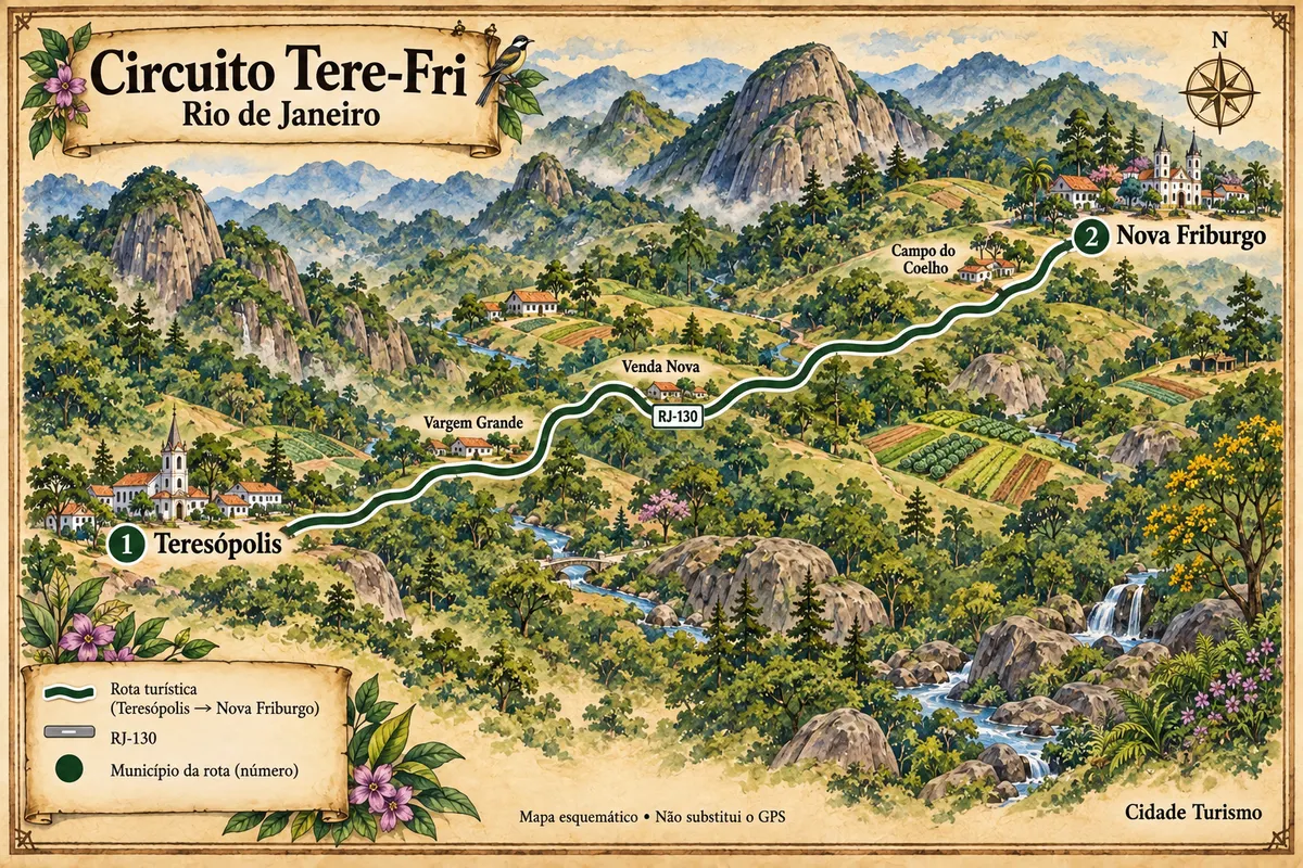
Teresópolis is part of the Tere-Fri Circuit

Teresópolis and Nova Friburgo connected by the RJ-130, passing through agricultural valleys, Atlantic Forest and mountains of the Mountain Region.

Illustrative map, not to scale. Tap a city to open its page.
Illustrated map of Tere-Fri Circuit
Explore the Tere-Fri Circuit
See the destination Rio de Janeiro Mountain Region (Serra Verde Imperial) Find another city

Beyond the guide