From Bombas to Lagoinha on foot: Passarela do Ribeiro, Bombinhas Beach, and Prainha
From Bombas Beach Promenade on foot; part of the route can also be done by bicycle 2 to 3 hours, not counting stops for swimming morning or late afternoon easy, on boardwalks and deck
This walk links the city’s two busiest beaches and ends at the snorkeling coves near the town center, always following the shoreline.
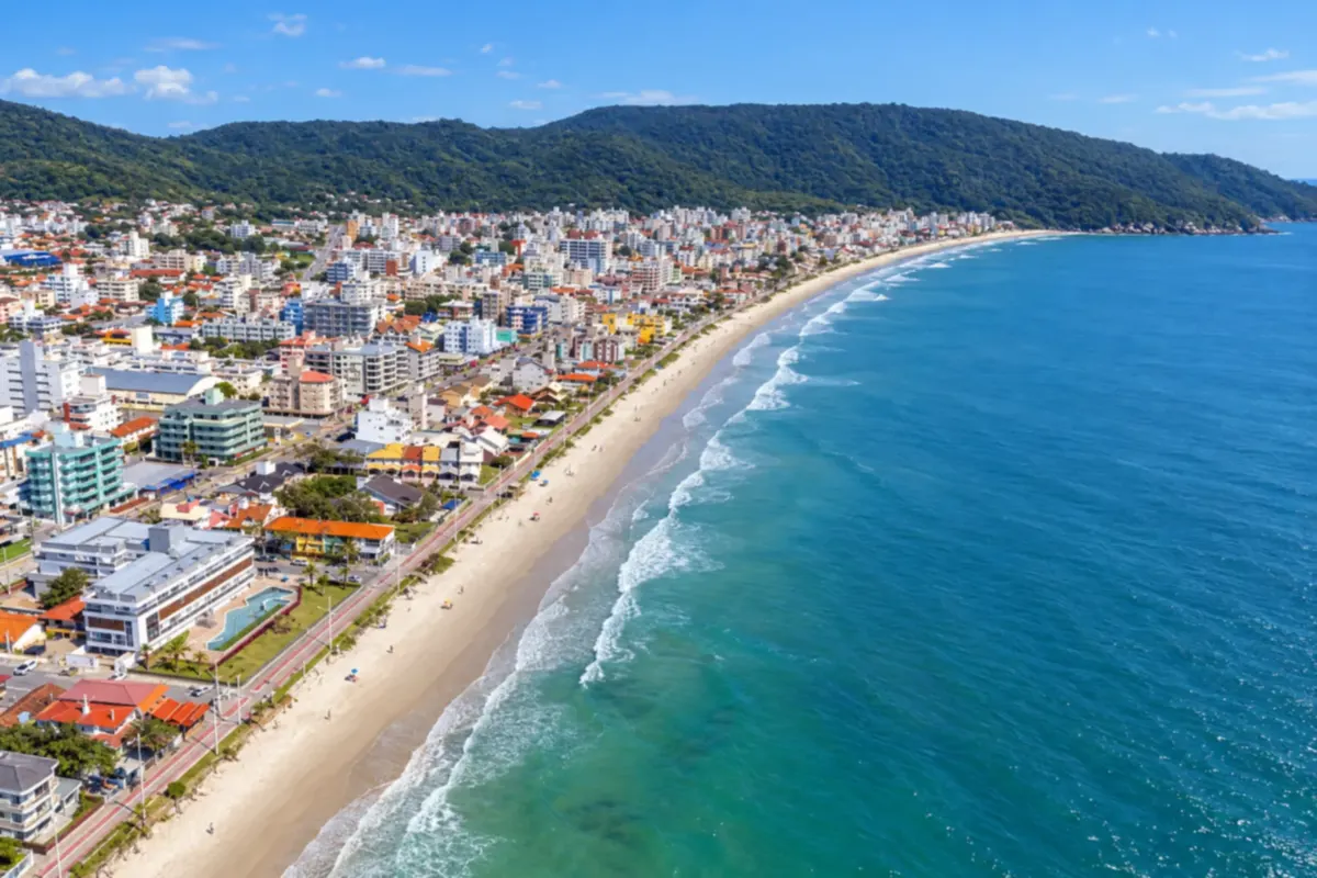
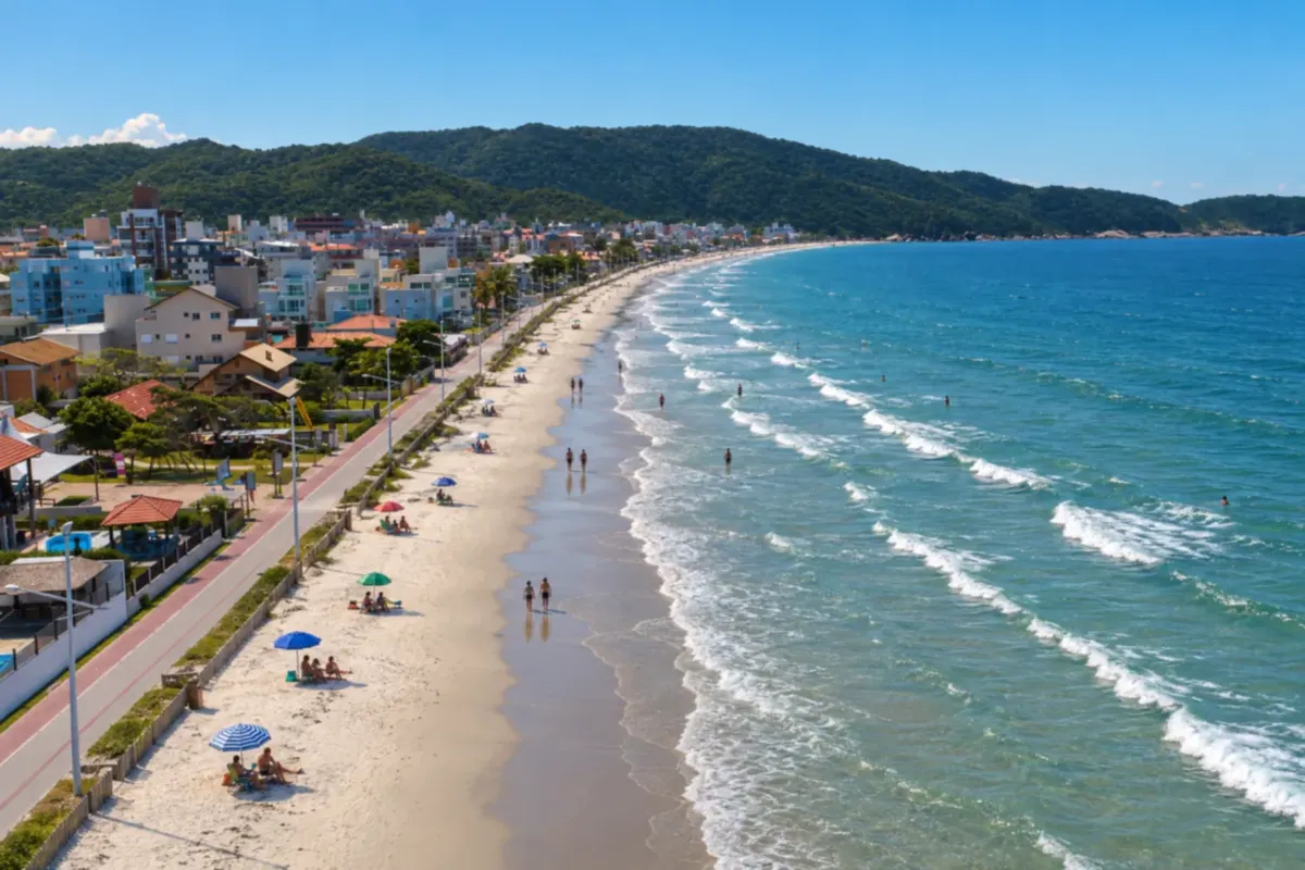
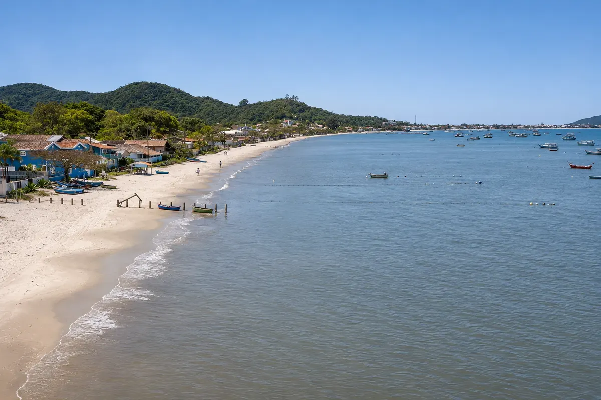
Start at Bombas, the first beach you see when arriving. It’s about 2 km of sand accompanied by a marked and lit promenade for walking and cycling. The sea is usually calm, with waves sometimes forming at the left corner. Along the beach are the small huts that store the single-outrigger canoes used in mullet fishing.
At the end of the promenade the Passarela do Ribeiro begins, an approximately 800-meter boardwalk that skirts the coastal forest, passes the small Praia do Ribeiro and replaced the old trail between the two neighborhoods. It has benches, lighting and an open view of the cove.
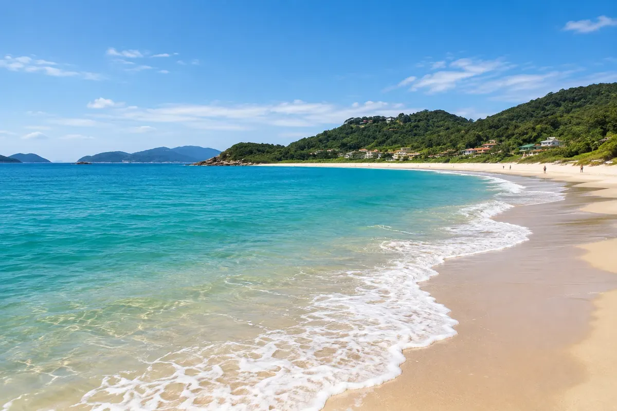
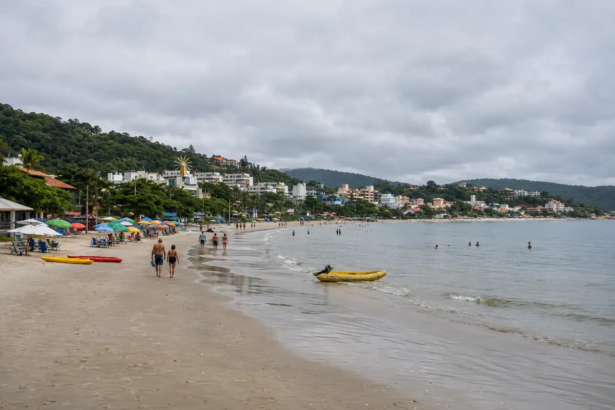
The boardwalk ends at Bombinhas Beach, which gives the town its name. There are 1,227 meters of white sand, made of quartz crystals, which crackle underfoot; this is the most common explanation for the beach’s name. The water is calm and clear, and the beach is a favorite of families with children.
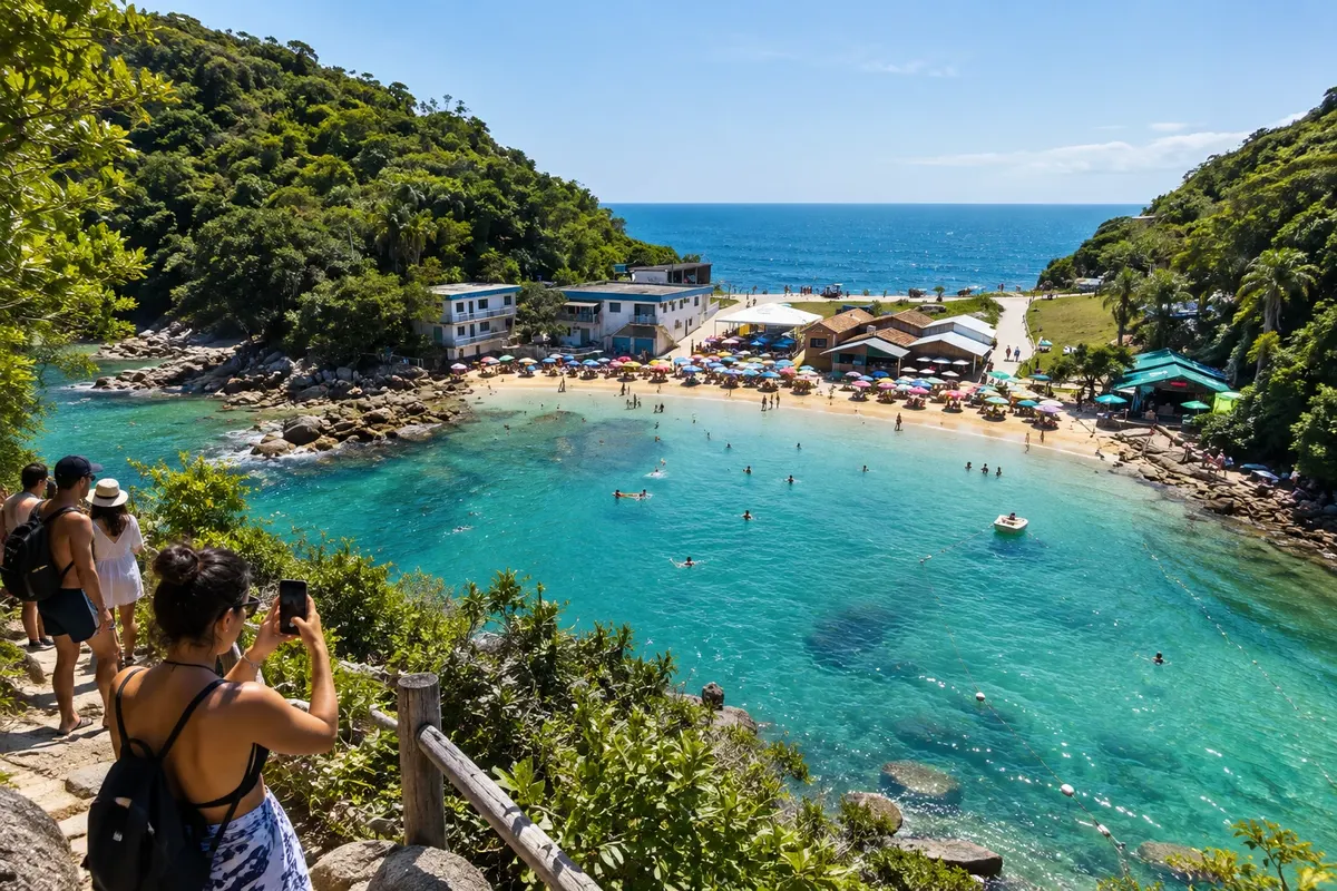
At the right corner, another deck leads to Prainha, only 60 meters long, where the pier for tour boats and diving schools is located. Next to the pier is a lithic workshop, evidence of prehistoric settlement in the region. Following are Embrulho and Lagoinha, with shallow waters and natural rock pools where fish and turtles often appear.
Stops: Bombas Beach, Passarela do Ribeiro, Praia do Ribeiro, Bombinhas Beach, Prainha, Bombinhas Pier, Praia do Embrulho, Praia da Lagoinha.
Includes: Self-guided stroll. In summer there are kiosks and rentals for chairs, kayaks, and boards on the beaches, paid separately.
Tip: Bring a mask and snorkel for Lagoinha and do not feed fish or turtles. From the Prainha pier you can see turtles. In summer, go early: Bombinhas Beach is one of the most popular.
Best time: November to April for sea bathing. The walk is suitable year-round.
Snorkeling at Praia da Sepultura and Retiro dos Padres
From End of Avenida das Garoupas, town center on foot, after arriving by car, bicycle or on foot from the town center half day morning easy
Sepultura is Bombinhas’ most popular cove for those who want to see fish without getting on a boat. It is at the end of Avenida das Garoupas, and the last stretch is a trail of about 200 meters. The water has no waves and is so still it resembles a natural pool; colorful fish swim among the rocks, just a few meters from the sand.
You can float with a life vest, free-dive with mask and snorkel, and scuba dive with tanks accompanied by one of the local operators. On the sea floor is Bio Vida III, a submerged sculpture by artist Pita Camargo, the first piece of an underwater gallery planned for the site.
The name comes from a legend: in the 19th century, the body of an enslaved man, killed in a fight, was said to have been buried there.
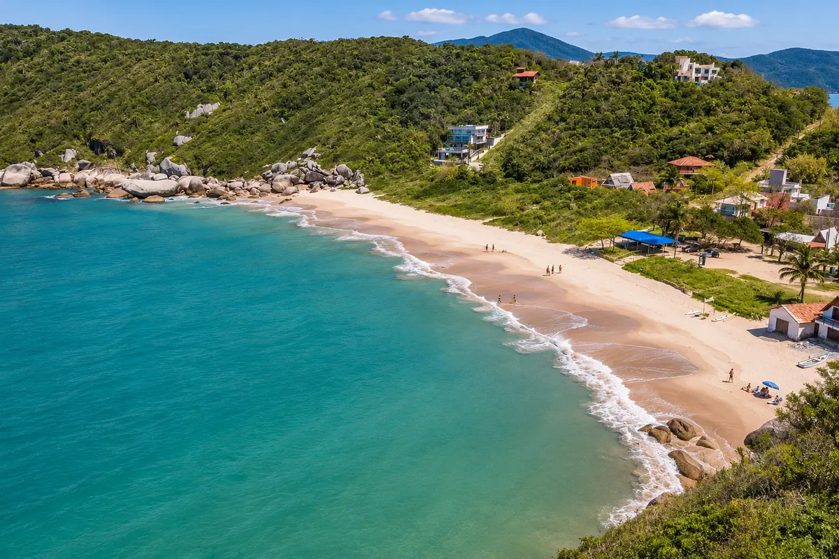
At the end of the same avenue is Retiro dos Padres, also called Praia dos Ingleses because it sheltered a damaged English ship in the 19th century. In 1967 it was bought by Catholic priests, who built a retreat house there, and the name stuck. It has about 260 meters of sand between hills and rocks, with clear and slightly rougher water used for diving and surfing. From the right-hand corner two trails depart: an easy one to the tip of the beach, and a more demanding one to Praia de Quatro Ilhas.
Stops: Praia da Sepultura, Praia do Retiro dos Padres, Submerged sculpture Bio Vida III.
Includes: Self-guided visit. Rental of mask, snorkel and life vest, when available, and scuba diving with an operator are paid separately.
Tip: In high season the cove gets very crowded: arrive early in the morning. Outside of summer the beach is almost empty. Do not step on rocks covered with marine life and do not feed the fish.
Best time: From December to March the water is warmer. On calm autumn and spring mornings the beach is quieter.
Quatro Ilhas and Mariscal: the open-sea beaches
From Bombinhas Center car, bicycle or municipal bus; on foot along the beaches a full day, or half a day at each beach morning and afternoon easy
On the other side of the hill, the peninsula faces the ocean, with waves and wider stretches of sand.
Quatro Ilhas is a little over 1 km long and has two different points. At the left corner the water is calm, used for snorkeling and stand up paddle, and that is where the restaurants and kiosks are located. At the right corner the surfers’ waves break in, and that stretch is preserved, with an easy circular trail on boardwalks over the dunes. The name comes from the islands visible from the sand: Galé, Deserta and Arvoredo, which belong to the Arvoredo Marine Biological Reserve, and Macuco, the one closest to the coast. At Praça Mirante das Ilhas there is a playground and a viewpoint. Longtime residents call the place Praia de Fora.
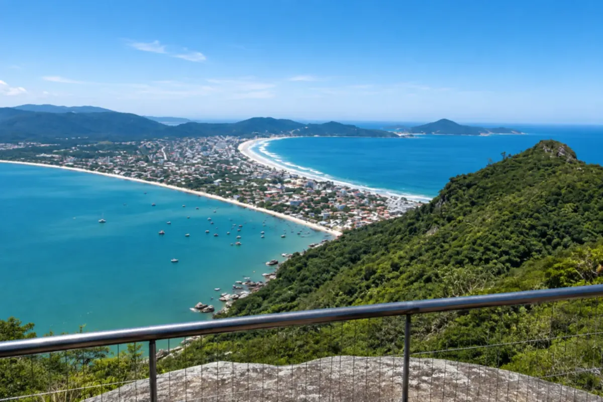
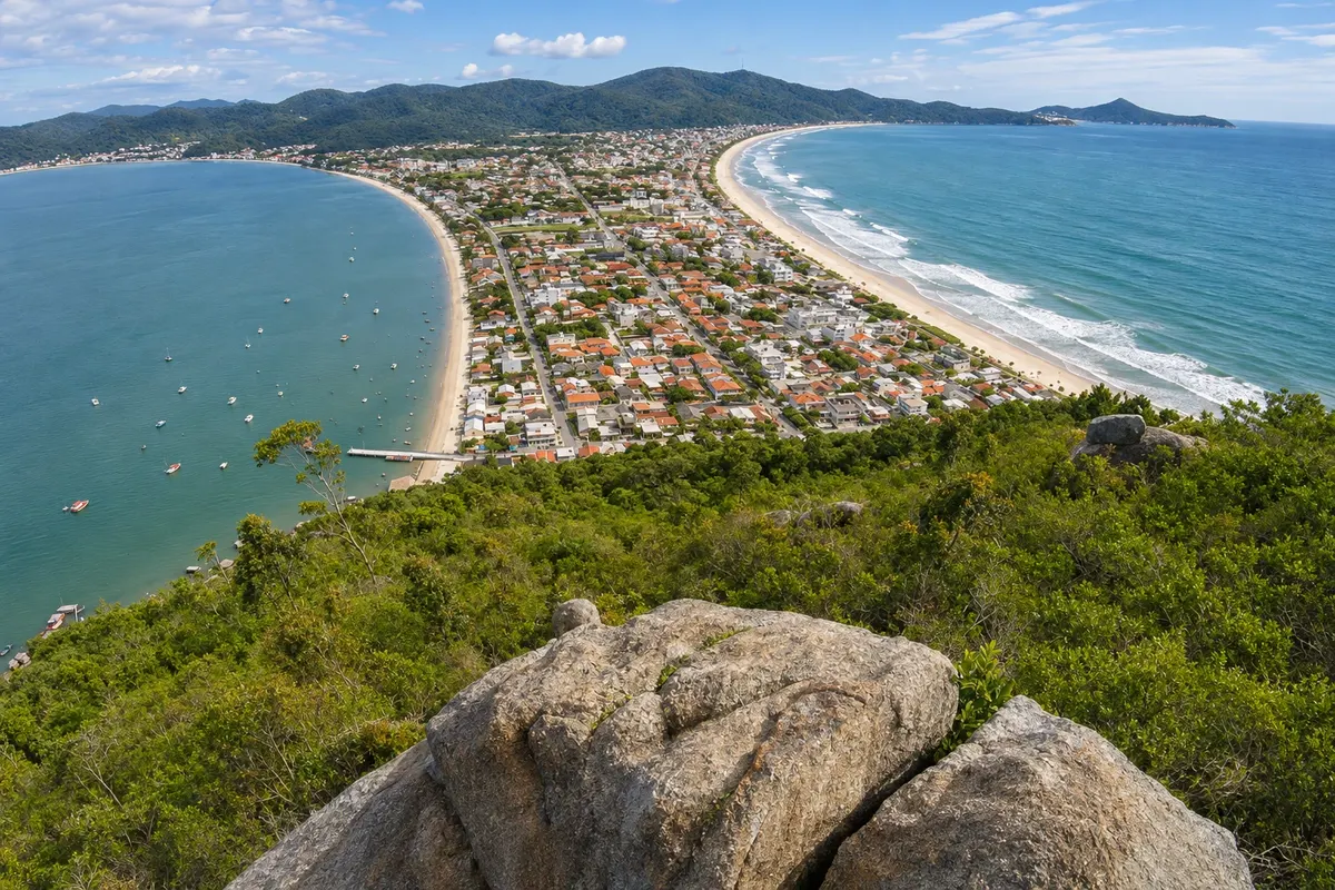
The road that descends from the Center to Mariscal has pullouts with viewpoints from which you can see the whole sand strip down to Canto Grande. It’s worth stopping.
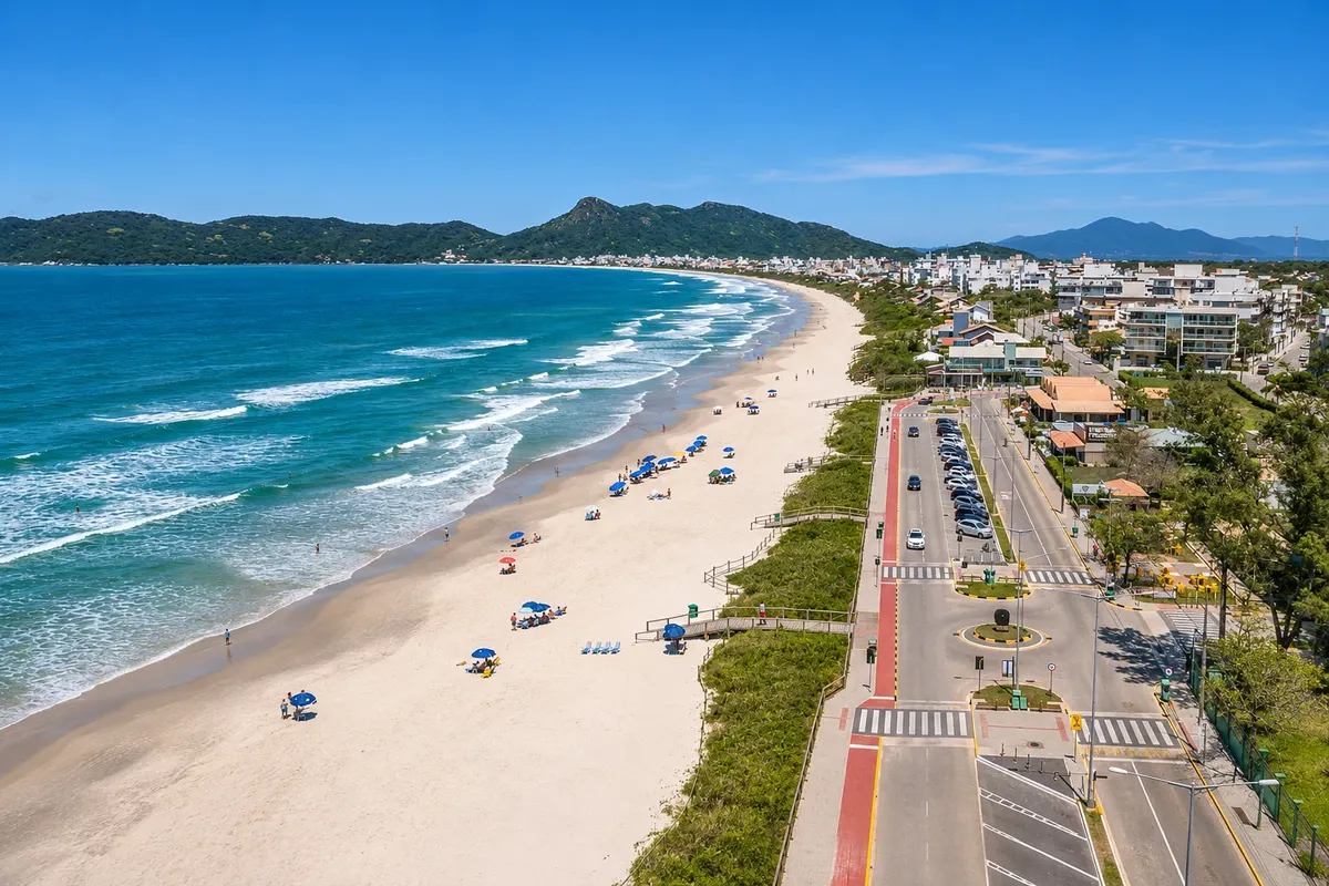
Mariscal is the beach for those who want space. Together with Canto Grande, on the open-sea side, it forms a continuous stretch of more than 4 km of white, fine sand, bordered by preserved restinga. The medium-sized waves attract surfers. The name recalls the shellfish on the headlands. Avenida Água Marinha, which runs along the beach, has a bike lane, a plaza and parking, and the neighborhood brings together bars, restaurants and inns.
Sections of Quatro Ilhas and Mariscal have received the Blue Flag, an international beach management certification, with lifeguards, public restrooms and access for people with reduced mobility during the season.
Stops: Quatro Ilhas Beach, Praça Mirante das Ilhas, Mariscal viewpoints, Mariscal Beach, Canto Grande Beach, Mar de Fora.
Includes: Self-guided outing. Surf lessons, board rentals and chair rentals are paid separately.
Tip: With children, stay at the left corner of Quatro Ilhas or near the lifeguard stations at Mariscal and obey the sea signage. From May to July, during the mackerel (tainha) fishing season, surfing is restricted at several beaches: check before entering the water.
Best time: December to March for beach activities. From May to July the mackerel fishing rules apply.
Morro do Macaco trail, Conceição Beach and sunset at Canto Grande
From Jequitibá Street arch, Canto Grande on foot about 1h30 of trail, round trip; half a day with the beaches afternoon moderate, with steep sections
Morro do Macaco closes the peninsula to the south and is one of Bombinhas’ most visited natural viewpoints. It is inside a municipal natural park created to protect the hill and Ilha do Macuco.
The trail begins at the Jequitibá Street arch, near the Canto Grande pier on the bay side. It’s about 2.4 km round trip, taking roughly 1h30, with steep sections and erosion points that require attention. The summit reaches 191 meters in altitude, and there is no fee to climb. From the top you can see the peninsula’s layout: the beaches of Canto Grande, Mariscal and Quatro Ilhas on one side, Zimbros and Morrinhos on the other, the Zimbros coastline and, offshore, the islands of the Arvoredo Reserve. The hill is also used for free flight and paragliding.
On the descent, two beaches are a few steps away. Canto Grande Beach, on the side called Mar de Dentro, is a sheltered cove with calm water, full of fishing boats and surrounded by hills; it’s one of the city’s most popular spots to watch the sunset. On the ocean side, separated from Mar de Fora by a point of land known as Ilhota, Conceição Beach is 453 meters long, sheltered from the wind and has natural tide pools on the right headland, reached by sea with guidance from lifeguards.
The park is open daily from early morning until late afternoon. No motorized vehicles or domestic animals are allowed, and camping or making fires is prohibited.
Stops: Municipal Natural Park Morro do Macaco, Morro do Macaco, Canto Grande Beach, Mar de Dentro, Canto Grande Pier, Conceição Beach.
Includes: Access to the trail and to the hilltop is free. Local guide, if hired, is paid separately.
Tip: Wear closed shoes, bring water and avoid the hottest hours of the day. Do not climb in the rain or soon after heavy rain: the ground becomes slippery. If you don’t know the route, go with a local guide. For sunset, plan the descent while there is still daylight.
Best time: All year, on dry days. From April to November temperatures are lower and the climb is more comfortable.
Mirante Eco 360°, Charles Darwin Museum and Praia da Tainha
From Praia da Tainha Road, Canto Grande car by dirt road, or a 4x4 tour with an agency; short walking trail 3 to 4 hours morning or afternoon easy to moderate
The far south of the peninsula is one of the most hilly and green areas of Bombinhas. The road to Praia da Tainha climbs a dirt track through the Atlantic Forest, and along the way is the Mirante Eco 360°.
At the base of the viewpoint is the Charles Darwin Natural History Museum, with exhibitions about the evolution of life: pieces from regional shipwrecks, skeletons and artifacts from sambaqui peoples, shells, rocks, minerals, meteorites, a room about whales and dolphins and a laboratory with aquariums. There are also two small sea-facing overlooks there.
To reach the top you need to walk about 15 minutes on a trail. At 218 m altitude, the view gives a full panorama over the beaches on both sides of the peninsula and the islands. The site also offers climbing, rappelling and zip-lining. Access to the top is paid and depends on weather: the viewpoint does not operate in rain or strong wind.
The road ends at Praia da Tainha, a stretch of about 200 meters of fine sand between rocks and forest, lightly used. The name comes from it being a good spot for artisanal mullet fishing. A section of the beach has received the Blue Flag. If you prefer to walk, you can take the Trilha da Tainha, which starts at the Jequitibá Street gate in Canto Grande: about 5.1 km round trip, 3 to 5 hours, easy to moderate.
Local agencies run this route in 4x4 vehicles, with stops at other viewpoints on the peninsula.
Stops: Mirante Eco 360°, Charles Darwin Natural History Museum, Praia da Tainha, Morro do Macaco Municipal Natural Park.
Includes: Self-guided or with an agency. Admission to the Mirante Eco 360°, the zip line and other activities are paid separately: check the current price list.
Tip: Before you go, check the viewpoint’s social media to see if it’s open that day. The final stretch of dirt road is better suited to driven vehicles. Bring closed shoes and swimwear for Praia da Tainha.
Best time: All year round, on clear, low-wind days. In summer, Praia da Tainha is an alternative to the crowded beaches.
Boat dive: Arvoredo Island, Macuco Island and the peninsula’s rocky shores
From Bombinhas pier, at Prainha dive operator boat; snorkel or scuba with instructor about 3 hours (snorkel) to 6–7 hours (Arvoredo) morning or full day easy; independent divers require certification
Bombinhas is known as the Capital of Ecological Diving, and most schools and operators are based downtown, with departures from the Prainha pier. There are three types of programs, and it’s useful to know the difference before booking.
The simplest is a schooner or speedboat trip with guided snorkeling along the peninsula’s rocky shores, such as Baía da Sepultura. It’s suitable for families and for people who have never used a mask.
The second is a baptism dive: a scuba dive for people without a course, with the instructor beside you at all times. It can take place on the rocky shores, at Macuco Island or at Arvoredo, depending on wind and sea conditions.
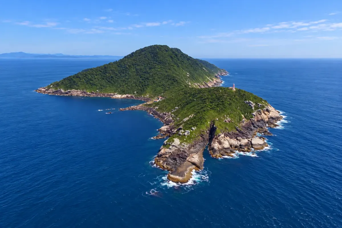
The third is autonomous diving for certified divers; Arvoredo Island hosts one of the best-known dive sites in southern Brazil. The island is part of the Arvoredo Marine Biological Reserve, created in 1990, covering about 17,600 hectares. Only authorized research and environmental education activities are allowed inside the reserve; landing on the islands is prohibited. Recreational diving takes place only at the southern tip of Arvoredo Island, near the Navy lighthouse, an area outside the reserve limits.
Closer to the coast, Macuco Island, also called Ilha do Amendoim for its shape, belongs to the Morro do Macaco park. It has calm waters and the wreck of the ship Orion, which sank in 1915 while en route to Itajaí and lies just a few meters deep.
Water visibility and temperature vary considerably throughout the year, and departures depend on sea conditions.
Stops: Arvoredo Marine Biological Reserve, Arvoredo Island, Macuco Island, Orion wreck, Praia da Sepultura.
Includes: Generally boat, equipment and instructor are included; some operators include a snack on board. Photos, courses and extra item rentals are paid separately: check the price list.
Tip: Ask the operator the exact dive location, because not every trip sold as Arvoredo reaches the island when the sea doesn’t allow it. If you get seasick prepare accordingly: the crossing to Arvoredo is in open sea. Minimum age varies by program.
Best time: From December to March the water is warmer and there are more departures. In spring visibility is usually good. In winter the water is cold and departures depend more on the forecast.


 Antarctica
 Argentina
 Bolivia
 Chile
 Colombia
 Ecuador
 Guyana
 French Guiana
 Falkland Islands (Malvinas)
 Paraguay
 Peru
 Suriname
 Uruguay
 Venezuela
 Germany
 Austria
 Belgium
 Croatia
 Denmark
 Slovakia
 Slovenia
 Spain
 Finland
 France
 Greece
 the Netherlands
 Hungary
 Ireland
 Iceland
 Italy
 Luxembourg
 Norway
 Poland
 Portugal
 the United Kingdom
 the Czech Republic
 Sweden
 Switzerland
 Turkey
 Bermuda
 Canada
 the United States
 Greenland
 Mexico
 Saint Pierre and Miquelon
 the Dominican Republic
 Japan
 South Africa
 Egypt
 Australia
 Fiji
 New Zealand
 Papua New Guinea