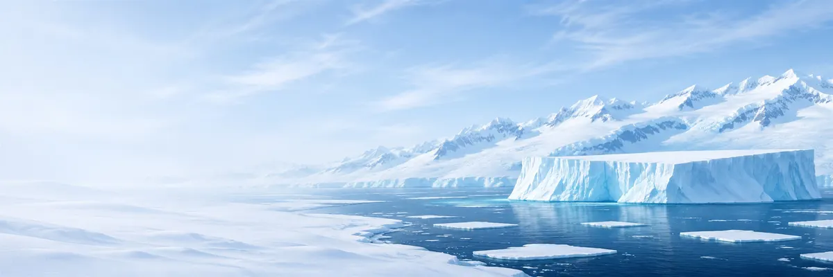
Illustrative images. The pictures in this guide are illustrations based on the real place, not photographs, and may differ from it.

Antarctica

Antarctica’s ice

How the largest mass of ice on Earth forms and moves, what it holds from the climate of 1 million years ago, and why the surrounding sea freezes and thaws every year.

Share: WhatsApp

The ice sheet

The Antarctic ice sheet is the largest mass of ice on Earth. It begins as snow: in places that almost never melt, each layer that falls is covered by the next and, under the weight, turns into ice. On the plateau, this process takes centuries or millennia.

The ice does not stay still. Under its own weight it flows slowly from the centre, where it is thickest, toward the coast. Inland it moves a few metres per year; in ice streams and glaciers near the sea it can exceed 1 kilometre per year.

There are two joined ice sheets: the East Antarctic Ice Sheet, the larger and older one, formed about 34 million years ago, and the West Antarctic Ice Sheet, smaller and in large part grounded on bedrock below sea level. The Peninsula has its own glaciers that descend from the mountains.

Thickness and volume

To know the size of the ice, scientists measure thickness with radar from aircraft and from vehicles on the snow, and use satellites that measure surface height. The Bedmap3 mapping project, coordinated by the British Antarctic Survey and published in 2025, compiled measurements from more than six decades.

According to Bedmap3, the ice sheet contains about 27.17 million km³ of ice. The average thickness is 1,948 metres including floating ice shelves, and 2,148 metres over land only. The thickest point measured, at 4,757 metres, lies in an unnamed valley of Wilkes Land.

The weight of so much ice depresses the continent’s bedrock and even changes the shape of the planet: Antarctica pulls a little of the ocean’s water toward itself by gravity, an effect that satellites also measure.

Ice and sea level

If the entire ice sheet melted, global mean sea level would rise by about 58 metres, according to Bedmap3. Most of that water is in East Antarctica. The West Antarctic Ice Sheet alone would equal more than 3 metres.

Ice that already floats, on the shelves, changes sea level very little when it melts, like an ice cube in a glass. What matters is ice grounded on land that flows into the ocean. Still, the shelves matter: they hold back the glaciers behind them.

Antarctica has been losing ice for decades, especially in West Antarctica and the Peninsula. The loss figures, measured by satellite, and what they mean for sea level are in Antarctica and Earth’s climate.

Ice shelves

Ice shelves are parts of the ice sheet that extend over the sea and float while remaining attached to the continent. They border about half of Antarctica’s coastline. Their fronts typically form a cliff 15 to 50 metres above the water, with hundreds of metres submerged.

The largest is the Ross Ice Shelf, at about 473,000 km², an area comparable to France. The second is Ronne–Filchner in the Weddell Sea, at about 422,000 km². Together they make up roughly two thirds of the total area of all ice shelves.

On the Peninsula, the Larsen Ice Shelf has lost entire sections. Larsen A disintegrated in 1995. Larsen B lost about 3,250 km² in just over a month, between January and March 2002, after warm summers that filled the surface with meltwater lakes. In 2017, Larsen C released iceberg A68, at about 5,800 km².

After Larsen B broke up, the glaciers it had restrained began flowing several times faster to the sea. That was proof that the shelves act like a plug for the continent’s ice.

The Thwaites and Pine Island glaciers

In the Amundsen Sea of West Antarctica are two of the glaciers losing the most ice in the world: Thwaites and Pine Island. Thwaites is the widest glacier on Earth, with about 120 kilometres of front, and drains an area the size of Great Britain.

Thwaites contains enough ice to raise sea level by about 65 centimetres. Its loss accounts for roughly 4% of the annual global sea level rise, according to the international collaboration that has been studying it since 2018.

The problem is underneath: slightly warmer ocean water, coming from depth, flows beneath the glacier and melts the ice at its base where it rests on bedrock. In 2025 that collaboration concluded that a rapid collapse in coming decades is less likely than once feared, but that retreat is expected to continue and accelerate through this century and the next.

Icebergs

Icebergs are pieces that break off from glaciers and shelves. Antarctic icebergs are often tabular: flat on top, with straight walls, sometimes tens or hundreds of kilometres long. About nine tenths of their volume lies under the water.

Large ones receive names from the U.S. National Ice Center: a letter for the quadrant of the continent where they originated, A to D, and a number. A23a, for example, broke from the Filchner Shelf in 1986, spent more than 30 years grounded on the Weddell Sea floor and returned to drift after 2020.

Carried by currents, icebergs travel north and gradually break up, sometimes after years. As they melt, they release iron and other nutrients that feed marine life.

Lakes beneath the ice

Beneath the ice sheet there is liquid water. Heat rising from Earth’s interior, the pressure of the ice and the insulating effect of the ice layer keep the base melted in many places. A 2022 survey counted 675 subglacial lakes under Antarctica.

The largest is Lake Vostok, beneath the Russian station of the same name, about 12,500 km² and covered by nearly 4 kilometers of ice. In 2012 a Russian drilling reached the water surface after decades of coring.

Many lakes are connected by rivers under the ice and fill and drain over time. In 2013 a U.S. team drilled into Lake Whillans in West Antarctica and found microbes living in the dark, without sunlight, as described in Life in Antarctica.

Ice cores and past climate

Each layer of snow that turns to ice traps air bubbles from the time it fell. By drilling the ice sheet, scientists extract cylinders of ice, called cores, and read temperature, dust and atmospheric gases from thousands of years ago.

The core from the European EPICA project, at Dome C, drilled up to 2004, covered 800,000 years and showed that carbon dioxide and temperature rose and fell together across the glacial cycles. In January 2025, the Beyond EPICA project reached bedrock at 2,800 meters at Little Dome C, near the Concordia station, recovering ice at least 1.2 million years old.

This older ice spans the period when the pacing of glacial cycles changed, shifting from roughly 41,000 years to about 100,000 years, between 1.2 million and 900,000 years ago. Understanding that change is one of the research goals.

Sea ice and the annual cycle

Unlike the ice sheet, sea ice is frozen seawater. It forms in autumn and winter around the continent and melts almost entirely in summer. It is typically about 1 meter thick, far less than land ice.

It is one of the planet’s largest seasonal changes. Sea ice reaches its maximum in September or October, about 18.7 million km² on average from 1981 to 2010, and its minimum in February or March, about 2.8 million km². According to NSIDC, in 2025 the maximum was 17.81 million km² and the minimum was 1.98 million km².

Until 2015, Antarctic sea-ice extent varied year to year, with a slight increase and a record maximum in 2014. Since 2016 it has been almost always below the average, with record lows in 2023. Sea ice matters for life: it is where emperor penguins raise their chicks and where algae grow that feed krill.

Frequently asked questions

How much ice is there in Antarctica?

About 27 million km³, according to the Bedmap3 mapping of 2025. It is the largest ice mass on Earth.

How thick is Antarctica’s ice?

On average about 1.9 kilometers including floating ice shelves, and 2.1 kilometers over land only. The thickest measured point is 4,757 meters.

How much would sea level rise if Antarctica’s ice melted?

About 58 meters if the entire ice sheet melted. This would not occur over a few centuries; the concern is partial loss, especially in West Antarctica.

What is an ice shelf?

It is the part of the ice sheet that extends over the sea and floats while remaining attached to the continent. The largest is the Ross Ice Shelf, about 473,000 km².

What happened to the Larsen B ice shelf?

It disintegrated between January and March 2002, losing about 3,250 km² in just over a month, after warm summers that filled the surface with meltwater lakes.

Why is the Thwaites Glacier called the Doomsday Glacier?

Because it holds ice equivalent to about 65 centimeters of global sea-level rise and is losing ice rapidly, melted from below by ocean water. The nickname comes from the press; scientists prefer to speak of risk and retreat rate.

How do icebergs get their names?

Large Antarctic icebergs receive a letter, A through D, corresponding to the quadrant of the continent where they originated, and a number assigned by the U.S. National Ice Center.

What is Lake Vostok?

The largest of the 675 known lakes under Antarctica’s ice, about 12,500 km², covered by nearly 4 kilometers of ice.

What is the oldest ice ever recovered from Antarctica?

From the Beyond EPICA project, drilled to bedrock in January 2025 at Little Dome C, with ice at least 1.2 million years old.

What is the difference between sea ice and the ice sheet?

Sea ice is frozen seawater, about 1 meter thick, that forms in winter and melts in summer. The ice sheet is accumulated snow-turned-ice over land, kilometers thick.

Is Antarctic sea ice decreasing?

Since 2016 extent has been almost always below the 1981–2010 average, with record lows in 2023, according to NSIDC. Before that, it varied year to year, with a slight increase up to a record maximum in 2014.