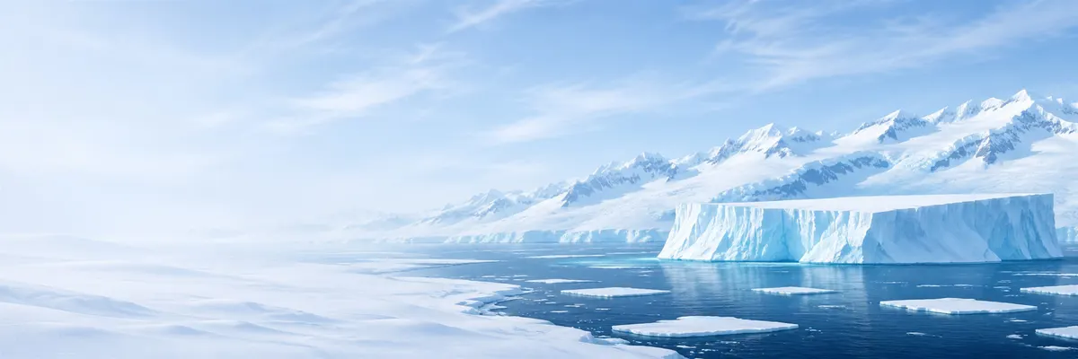
Illustrative images. The pictures in this guide are illustrations based on the real place, not photographs, and may differ from it.

Antarctica

Geography of Antarctica

The two halves of the continent, the mountains that separate them, the Peninsula that points toward South America, the seas, the islands, the two southern poles and the ocean that circles everything.

Share: WhatsApp

East and West Antarctica

Antarctica has two very different parts. East Antarctica, facing the Indian Ocean and mostly in the Eastern Hemisphere, covers about two thirds of the continent. It is a vast ice plateau, with much of it above 2,000 meters and summits, called domes, above 3,000 and even 4,000 meters.

Beneath the ice of East Antarctica lies an old, stable bedrock, much of it above sea level. There are the Gamburtsev Mountains, a mountain range the size of the Alps entirely buried by ice, discovered by radar and seismic surveys in the 1950s.

West Antarctica, facing the Pacific, is smaller, lower and made of crustal blocks and islands joined by ice. Much of its bedrock lies below sea level, which makes the ice sheet in this region more sensitive to ocean warming, as discussed in The Ice of Antarctica.

The Transantarctic Mountains

The Transantarctic Mountains cross the continent for about 3,500 kilometers, from Cape Adare near the Ross Sea to Coats Land near the Weddell Sea. They are among the world’s longest mountain ranges and mark the boundary between East and West Antarctica.

The range rose in the last 65 million years with the opening of a major rift in the crust on the western side. Its highest point is Mount Kirkpatrick, at 4,528 meters. Through valleys between the peaks, enormous glaciers such as the Beardmore and the Byrd carry ice from the eastern plateau down to the Ross Ice Shelf.

In several places the bedrock is exposed. On those slopes geologists find layers with fossils of forests and animals from when Antarctica was farther from the pole and had a temperate climate, more than 200 million years ago.

Mount Vinson and the volcanoes

The highest point in Antarctica is Mount Vinson, in the Vinson Massif of the Sentinel Range in the Ellsworth Mountains, in West Antarctica. A GPS measurement in 2004 set its height at 4,892 meters; older estimates exceeded 5,100 meters.

The massif was only sighted in 1958 and first climbed in 1966. As the highest point on a continent, it is part of the Seven Summits list sought by mountaineers.

Antarctica also has volcanoes. Mount Erebus, on Ross Island, at 3,794 meters, is the world’s southernmost active volcano and has a lava lake inside its crater. Deception Island, in the South Shetlands, is the rim of a volcanic caldera flooded by the sea and erupted in 1967, 1969 and 1970.

The Antarctic Peninsula

The Antarctic Peninsula is an arm of mountains about 1,300 kilometers long that extends from West Antarctica toward South America. It is the part of the continent that reaches farthest north, well beyond the Antarctic Circle.

Geologically, the Peninsula continues the Andes: the two ranges connect beneath the sea by the Scotia submarine arc. For that reason the rocks of the Peninsula resemble those of Patagonia and Tierra del Fuego.

Because it lies farther north and is surrounded by ocean, the Peninsula has the mildest climate on the continent, more stretches of ice-free rock and most of the land life. It is also where most research stations are and where almost all tourism arrives.

The Ross, Weddell and Bellingshausen seas

Two great embayments indent the continent. The Ross Sea, south of New Zealand, ends at the Ross Ice Shelf, the largest ice shelf in the world. The Weddell Sea, south of the Atlantic, ends at the Ronne and Filchner ice shelves. Both are named after 19th-century British navigators James Clark Ross and James Weddell.

The Weddell Sea is known for thick sea ice that circulates clockwise within it. It was that ice that trapped and crushed Ernest Shackleton’s ship Endurance in 1915, a story told in History and Exploration.

West of the Peninsula lie the Bellingshausen Sea and, beyond it, the Amundsen Sea, into which the Thwaites and Pine Island glaciers drain. Other coastal seas skirt East Antarctica, such as the Davis and Dumont d'Urville seas.

The islands

The South Shetlands form an archipelago about 100 kilometers from the Peninsula, separated from it by the Bransfield Strait. The largest island, King George, hosts stations from several countries, including Brazil’s Comandante Ferraz at Admiralty Bay.

Farther east, the South Orkneys lie on the edge of the Weddell Sea. On Laurie Island is the Argentine station Orcadas, opened in 1904 and the oldest continuously operating station in Antarctica. On Signy Island a British station recorded in 1982 the highest temperature south of 60° S: 19.8 °C.

Along the coast are other ice-covered islands, such as Ross Island, home to McMurdo and New Zealand’s Scott base, and Alexander Island, the largest island in Antarctica, connected to the Peninsula by the George VI Ice Shelf. South Georgia and the South Sandwich Islands lie north of 60° S and are not within the area of the Antarctic Treaty.

The geographic and the magnetic South Poles

The geographic South Pole is the point where the Earth's axis of rotation crosses the surface, at 90° south latitude. It sits on the plateau at 2,835 meters elevation, atop a layer of ice about 2,700 meters thick. There all directions point north and all time zones converge.

The plateau ice moves about 10 meters per year. For that reason, the American Amundsen-Scott Station recalculates the pole’s position every year and, on January 1, moves the marker. The marker is drawn by the team that wintered at the station the previous year.

The magnetic South Pole, which is where the south end of a compass needle points, is a different point and shifts over time. According to the 2025 World Magnetic Model, it lies at sea off Adélie Land, near 64° S and 135° E, about 2,900 kilometers from the geographic pole, and moves roughly 9 kilometers per year.

The Southern Ocean and the Circumpolar Current

The Southern Ocean is the sea that surrounds Antarctica. The International Hydrographic Organization proposed a 60° south latitude boundary in 2000, the same as the Antarctic Treaty; many scientists prefer to use the Antarctic Convergence, the zone where colder southern water meets warmer northern water, between about 50° and 60° S.

The Antarctic Circumpolar Current runs in it — the only current that circles the globe completely, from west to east, driven by the westerly winds. It is the largest ocean current on Earth: a measurement in the Drake Passage between 2007 and 2011 calculated 173 million cubic meters of water per second, roughly 30% above the classic estimate.

The current acts as a barrier that isolates the frigid waters around the continent and helps keep Antarctica cold. It also links the Atlantic, Indian and Pacific Oceans, transporting heat, nutrients and carbon dioxide among them — a role discussed in Antarctica and Earth’s climate.

The Drake Passage, about 800 kilometers between Cape Horn and the South Shetlands, is the narrowest section of the current. There winds and waves are often strong, and a ship crossing usually takes two days.

The land beneath the ice

Without the ice, Antarctica would be different. The Bedmap3 mapping, published in 2025 with more than 82 million measurements, reveals mountains, deep valleys, plains and basins below sea level hidden beneath the ice sheet.

The deepest point of exposed land on the planet lies beneath the Denman Glacier in East Antarctica: a valley whose bedrock reaches about 3,500 meters below sea level, according to the BedMachine mapping from 2019.

If the ice disappeared, the rock would slowly rebound, relieved of the weight, and part of West Antarctica would become an archipelago. That weight currently depresses the crust by hundreds of meters.

Frequently asked questions

What are the parts of Antarctica?

East Antarctica, larger and higher; West Antarctica, smaller and with much bedrock below sea level; and the Antarctic Peninsula, which extends from the western part toward South America.

What separates East Antarctica from West Antarctica?

The Transantarctic Mountains, a mountain range of about 3,500 kilometers between the Ross Sea and the Weddell Sea.

How high is Mount Vinson?

4,892 meters, according to a GPS survey conducted in 2004. It is Antarctica’s highest point.

Is there an active volcano in Antarctica?

Yes. The best-known is Erebus, on Ross Island, at 3,794 meters with a lava lake in its crater. Deception Island, in the South Shetlands, is also an active volcano.

What is the distance between Antarctica and South America?

About 1,000 kilometers between Cape Horn and the tip of the Antarctic Peninsula. The Drake Passage, between Cape Horn and the South Shetlands, is about 800 kilometers across.

Is the magnetic South Pole the same as the geographic South Pole?

No. The geographic pole is the fixed point of the Earth's axis on the plateau. The magnetic pole lies at sea off Adélie Land, roughly 2,900 kilometers away, and moves a few kilometers each year.

Why does the South Pole marker change location?

Because the ice it sits on moves about 10 meters per year. Every January 1, the Amundsen-Scott Station team places a new marker at the exact pole point.

What is the Southern Ocean?

It is the ocean that surrounds Antarctica. The most commonly used boundary is 60° south latitude; many scientists use the Antarctic Convergence, where cold southern water meets warmer northern water.

What is the Antarctic Circumpolar Current?

It is the largest ocean current on Earth and the only one that fully encircles the planet, flowing from west to east around Antarctica.

Which islands are part of Antarctica?

Major ones include the South Shetlands, with King George Island, the South Orkneys, Ross Island and Alexander Island. South Georgia lies north of 60° S, outside the Treaty area.

What is the deepest place on Earth that is land?

A valley beneath the Denman Glacier in East Antarctica, where the bedrock reaches about 3,500 meters below sea level, covered by ice.