Guarda do Embaú: the village, the crossing of the Rio da Madre and the beach
From Guarda do Embaú village on foot and by canoe 4 to 7 hours morning and afternoon easy
The visit to Guarda begins in the village: a few sand streets with pousadas, restaurants, small shops and surf schools. You can leave your car on one of the streets or in a parking lot, and from there everything is done on foot.
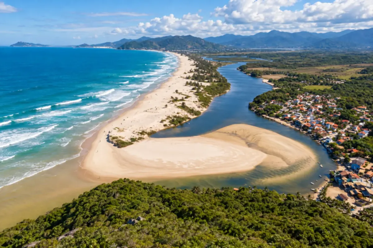
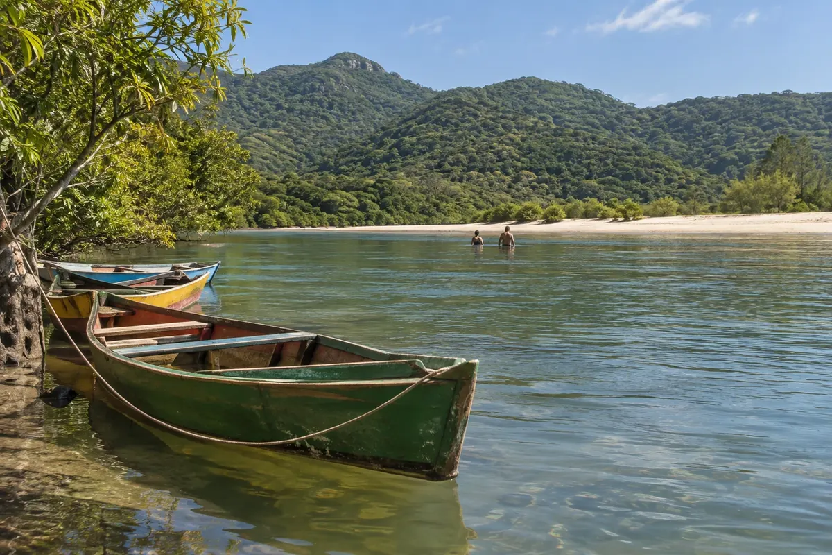
At the end of the village is the Rio da Madre, dark and clean, which runs parallel to the sea. The beach is on the other side, about 100 meters away. The village ferrymen make the canoe crossings, paid per crossing, and depart when a canoe fills; at low tide many people cross on foot, and surfers often swim across. The current can be strong: people without water experience should go by canoe.
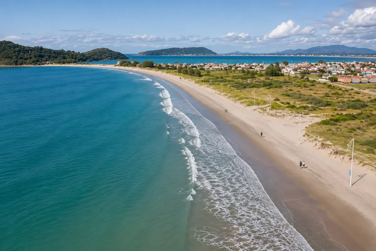
On the other side opens an extensive, undeveloped open-sea beach, with dunes and restinga in the background. The waves are the reason for the World Surf Reserve title granted by the organization Save The Waves. The sea has currents, and on big-wave days swimming is not recommended. For children and for those who prefer still water, the shallow river margin is the best spot. By municipal demarcation, the sand strip beyond the river already belongs to Paulo Lopes; in practice, it is the village’s beach.
Following the trail that runs along the river for about 600 meters from the village, you reach Praia da Barra at the mouth, where the fresh water mixes with the sea.
In summer there are lifeguards and some beach kiosks; outside the season the beach is almost empty.
Stops: Guarda do Embaú village, Rio da Madre, Praia da Guarda do Embaú, Praia da Barra.
Includes: The canoe crossing is paid per person and per crossing, directly to the ferryman. Parking, surf lessons, board rentals and food/drink are paid separately. Check prices in the village.
Tip: Bring cash for the canoe and only what you need for the beach. Ask the lifeguards where to enter the sea. In summer, arrive early: spots near the river fill up before noon.
Best time: December to March for sea and river swimming; in November and April the village is quieter. Waves break year-round.
Pedra do Urubu and Prainha Trail
From Bank of the Rio da Madre, at the end of the village of Guarda do Embaú on foot, on your own 2 to 3 hours including the Prainha; about 1 hour for the viewpoint alone morning moderate, with a short but steep climb
Pedra do Urubu is Guarda’s viewpoint. The trail leaves from the riverbank at the end of the village and climbs through shaded forest. It’s short, about 500 meters, but the ascent is constant: allow 20 to 30 minutes to reach the top, a little over 100 meters above sea level.
From the top you can see the whole layout of the place: the Rio da Madre winding to its mouth, the sand spit, the beach stretching south and, on the other side, part of Pinheira.
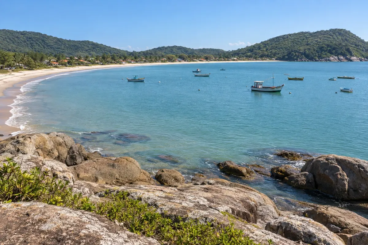
The same trail continues, crosses the hill and descends across a dune to the Prainha, about 1 km past the fork. It’s a roughly 200-meter crescent-shaped beach, undeveloped, set between rock headlands, popular for swimming and surfing. From the rocks you can reach the small Praia Solita.
The return can be made by another route along the coast: about 1.6 km skirting the sea, between rocks and grassy stretches, back to the village. With the viewpoint, the ascent via the hill and the return along the headland, the circuit totals close to 3.2 km.
There are no shops at the Prainha.
Stops: Pedra do Urubu, Prainha, Praia Solita, Costão da Guarda do Embaú.
Includes: There is no charge to do the trail. Bring any food and drinks you’ll need and carry your trash out.
Tip: Wear sneakers, not flip-flops: there are roots and slippery stretches after rain. Early morning has fewer people at the viewpoint and gentler sun. On the headland section, keep away from the edge when the sea is rough.
Best time: Year-round on dry days. In winter, clear skies after cold fronts offer good visibility; in summer, start early because of the heat.
Pinheira: Praia de Baixo, Praia de Cima and the Praia do Maço trail
From Praia da Pinheira on foot; car to the tip of Praia de Cima from 4 to 6 hours all day easy; short trails with a gentle climb
Pinheira is Palhoça’s bathing beach. The cove is shell-shaped, with calm sea and a wide sand strip, good for walking and for children.
The larger section, Praia de Baixo, concentrates bars, restaurants, markets and inns. At the corner of the beach, a path of about 600 meters over rocks and grassy areas leads to Praia de Cima, separated by a small headland. Praia de Cima is shorter, with even calmer water and native vegetation around; it’s common to see kayaks and stand up paddle boards.
From the tip of Praia de Cima leaves the region’s easiest trail. Shortly after the start it splits. The right fork crosses the hill, half up and half down, and in about 500 meters reaches Praia do Maço, a sand strip of a few dozen meters between rocks, in Vale da Utopia. The left fork goes to Ponta das Andorinhas, along the headlands and grassy coastal fields. Doing both, the walk is about 1.9 km round trip.
The trail doesn’t require a guide and is used by families. At Praia do Maço the sea breaks on the rocks; the calm swimming is at Praia de Cima.
Between May and July, Praia de Cima is one of the points for artisanal mullet fishing.
Stops: Praia de Baixo, Praia de Cima, Praia do Maço, Ponta das Andorinhas, Vale da Utopia.
Includes: Beaches and trails have free access. Parking, kayak and board rentals, and purchases are paid separately.
Tip: For the trail, park at the tip of Praia de Cima and bring water and closed shoes. In high season, the streets near the beach get crowded: arrive early. Mornings without wind are the most pleasant for swimming.
Best time: December to March for sea bathing. For walking, dry days in April, May, September and October.
Crossing the Vale da Utopia, from Pinheira to Guarda do Embaú
From Ponta da Praia de Cima, in Pinheira on foot; return by bus, taxi or a car left at the start 3 to 4 hours, one way morning moderate, with ascents and descents
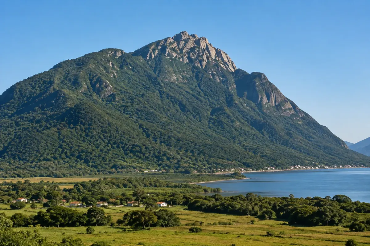
The Vale da Utopia is the stretch of hills, fields and rocky headlands that separates Pinheira from Guarda do Embaú, inside the Serra do Tabuleiro State Park. Crossing it on foot is the most complete hike on the Palhoça coast: it links the municipality’s two best-known beaches without using a road.
Leaving from the tip of Praia de Cima, the trail crosses the hill down to Praia do Maço and continues along the hilltops, with the open sea on one side. There is more than one route, and the distance varies depending on the chosen path: from 2.5 km to 4 km one way. The route alternates climbs and descents over open ground, with almost no shade, offering views of the headlands and the deserted beaches below.
After the last hill you reach the Prainha, a good place to rest and swim when the sea conditions allow. From there the hill trail climbs to near Pedra do Urubu, where you can see the mouth of the Rio da Madre, and then descends to the village of Guarda.
The crossing can be done in the opposite direction. Those who don’t want the full route can go from Praia de Cima to a viewpoint over Prainha and return, about 2.5 km round trip.
Camping in the valley is prohibited.
Stops: Praia de Cima, Praia do Maço, Vale da Utopia, Prainha, Pedra do Urubu, Guarda do Embaú.
Includes: There is no fee to cross. If you prefer, you can hire a local guide for an extra charge.
Tip: Bring at least 1.5 liters of water per person, a hat and sunscreen: there is no water source or commerce on the way. Arrange your return beforehand, because the route ends a few kilometers from where it began. With strong south wind or rain, postpone to another day.
Best time: From April to November, with milder temperatures. In summer, leave early in the morning.
Sonho Beach and Ponta do Papagaio
From Sonho Beach on foot 3 to 5 hours morning or afternoon easy; final stretch over rocks
Sonho Beach is the most residential of the southern beaches of Palhoça: about 2.5 km of sand, summer houses and, between them and the sea, a wide strip of dunes and native vegetation. Facing the south bay and the tip of Santa Catarina Island, it usually has small waves and clear water. The south wind can stir the sea on some days.
Walking toward the right corner you reach Ponta do Papagaio, a preserved wooded peninsula that separates Sonho Beach from Pinheira. A narrow strip of sand leads to the point and forms a small beach on each side, both very calm. About 100 meters offshore is Papagaio Island.
From the point a short trail of around 500 meters runs among large rocks and leads to the tip of the peninsula. This stretch requires care with your feet and some effort. From the end you can see Araçatuba Island, with its fortress, and, in the distance, Naufragados Beach at the southern tip of Santa Catarina Island.
It’s an outing for a day with calm seas, at walking-and-swimming pace, which pairs well with an afternoon in Pinheira, on the other side of the peninsula.
Stops: Sonho Beach, Ponta do Papagaio, Papagaio Island, Araçatuba Island.
Includes: The beach and the trail are free to access. Commercial offerings are small and operate mainly in the summer season.
Tip: Bring water, sunscreen and footwear that can get wet to walk on the rocks. Outside the high season, have lunch in Pinheira, where there are more open options.
Best time: December to March for swimming. Outside the season, the beach is nearly empty.
Enseada de Brito cove: church, square and Azorean heritage
From Praça da Enseada de Brito on foot 1 to 2 hours morning or late afternoon easy
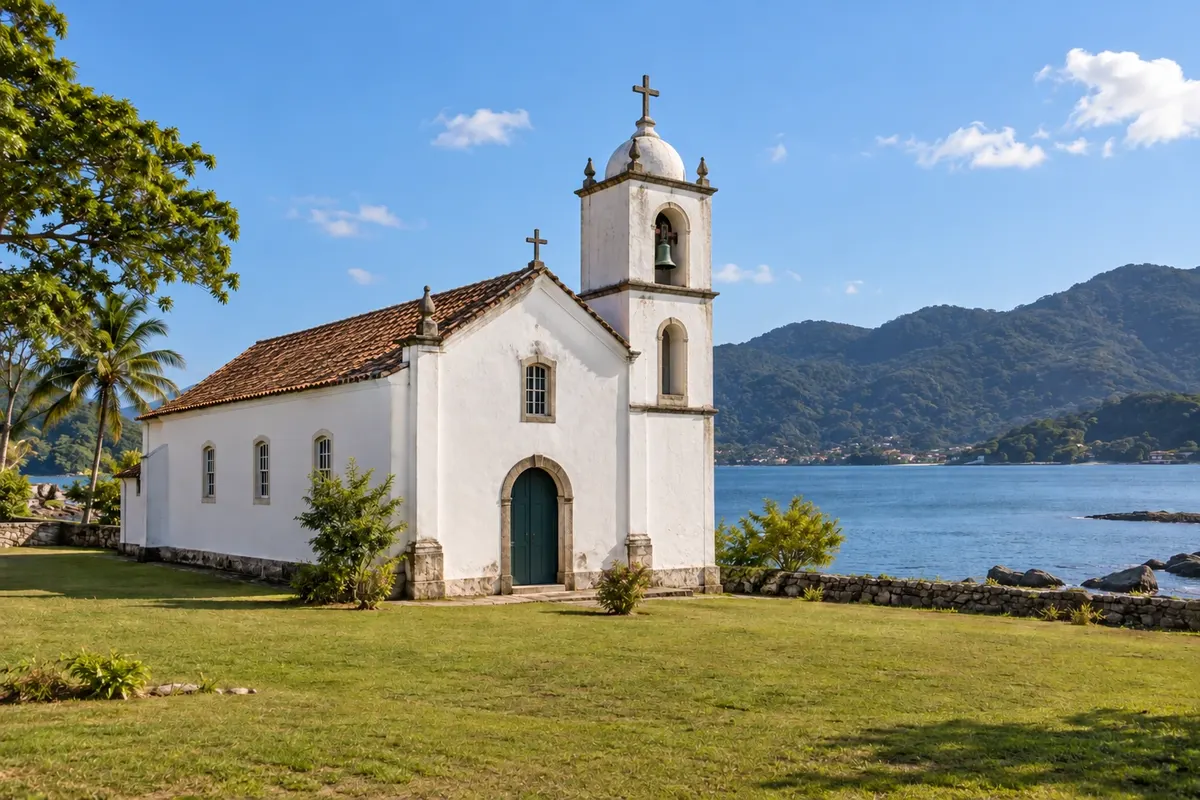
Enseada de Brito is a fishing village on the bay, on the road between downtown Palhoça and the southern beaches. It is the municipality’s historical stop and one of the first places on the Santa Catarina coast where families from the Azores settled.
The name recalls Domingos de Brito Peixoto, who settled in the cove in the 17th century before moving on to Laguna. The parish of Nossa Senhora do Rosário was created in 1750, making it one of the oldest parishes in Santa Catarina.
The village center is the Church of Nossa Senhora do Rosário, listed by the state in 1998. It faces a large square that opens to the sea and has a three-stage tower where the bell is located. Inside are images of Nossa Senhora do Rosário, São Francisco de Assis and São Domingos. Around it, the old houses and narrow streets preserve the features of Azorean colonization.
The Casa da Cultura Açoriana operates in the village, displaying local crafts such as bobbin lace and ceramics.
The walk is almost entirely flat: the church, the square, the façades and the waterfront. It fits well as a stop on the way to or from the beaches, or on a windy, overcast day.
Stops: Church of Nossa Senhora do Rosário, Praça da Enseada de Brito, Casa da Cultura Açoriana.
Includes: There is no fee to visit the square or the church. Check with the Casa da Cultura Açoriana for opening days.
Tip: Outside mass times and service hours, the church may be closed: check with the parish if you want to see the interior. The late-afternoon light flatters the square and the bay.
Best time: Year-round, on dry days.


 Antarctica
 Argentina
 Bolivia
 Chile
 Colombia
 Ecuador
 Guyana
 French Guiana
 Falkland Islands (Malvinas)
 Paraguay
 Peru
 Suriname
 Uruguay
 Venezuela
 Germany
 Austria
 Belgium
 Croatia
 Denmark
 Slovakia
 Slovenia
 Spain
 Finland
 France
 Greece
 the Netherlands
 Hungary
 Ireland
 Iceland
 Italy
 Luxembourg
 Norway
 Poland
 Portugal
 the United Kingdom
 the Czech Republic
 Sweden
 Switzerland
 Turkey
 Bermuda
 Canada
 the United States
 Greenland
 Mexico
 Saint Pierre and Miquelon
 the Dominican Republic
 Japan
 South Africa
 Egypt
 Australia
 Fiji
 New Zealand
 Papua New Guinea