1 city

 Search
 Brazil
 Antarctica
 Argentina
 Bolivia
 Chile
 Colombia
 Ecuador
 Guyana
 French Guiana
 Falkland Islands (Malvinas)
 Paraguay
 Peru
 Suriname
 Uruguay
 Venezuela
 Germany
 Austria
 Belgium
 Croatia
 Denmark
 Slovakia
 Slovenia
 Spain
 Finland
 France
 Greece
 the Netherlands
 Hungary
 Ireland
 Iceland
 Italy
 Luxembourg
 Norway
 Poland
 Portugal
 the United Kingdom
 the Czech Republic
 Sweden
 Switzerland
 Turkey
 Bermuda
 Canada
 the United StatesGreenland
 Mexico
 the Dominican RepublicTurkey
 South Africa
 Egypt
 Australia
 Fiji
 New Zealand
 Papua New Guinea
Municipality · South Greenland
Qaqortoq, the Nordic and Inuit farms of Kujataa, the church of Hvalsey, Qassiarsuk and Igaliku, the Tasermiut fjord and the hot springs of Uunartoq.
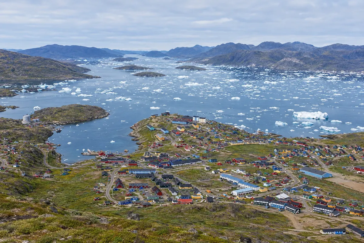
In the photo: Narsaq and the islands off the town, in the municipality of Kujalleq.
Illustrative images. The pictures in this guide are illustrations based on the real place, not photographs, and may differ from it.
The municipality
Kujalleq, which means "south" in Greenlandic, is the municipality at Greenland’s southern tip, where Cape Farewell (Nunap Isua) is located. It is the part of the country with the most green valleys and sheep farms, among fjords full of icebergs. The administrative center is Qaqortoq, the largest town in the south; the other towns are Narsaq and Nanortalik.
The fjords around Qassiarsuk, Igaliku and Hvalsey form Kujataa, a UNESCO World Heritage Site since 2017. It is a farming landscape: the Norse who came from Iceland with Erik the Red established the first Arctic farms there around the year 1000, and sheep farming returned to the same fields in the 20th century with Greenlandic families.
In Qassiarsuk are the ruins of Brattahlíð, Erik the Red’s farm, with reconstructions of a longhouse and a small turf church. Igaliku holds the ruins of Garðar, the seat of the Norse bishopric, among stone houses and pastures. The stone church of Hvalsey, near Qaqortoq, is the best-preserved Norse ruin in the country.
Qaqortoq has colorful houses around the harbor, a stone fountain in the square and several rock carvings around the town, from the Stone and Man (Sten og Menneske) project. Narsaq sits on a peninsula between two fjords, near the ice cap, and has a small museum in its old center.
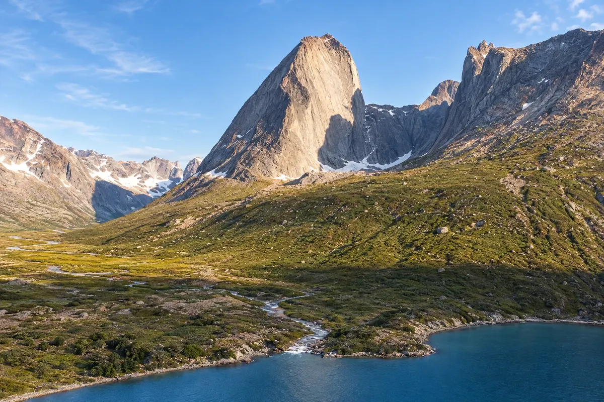
Further south, Nanortalik is the base for the Tasermiut fjord, with granite walls that attract climbers and trails through the valleys. Between Qaqortoq and Nanortalik, on the island of Uunartoq, hot water wells up from the ground and forms natural pools, visited on boat trips.
Destinations
Cities
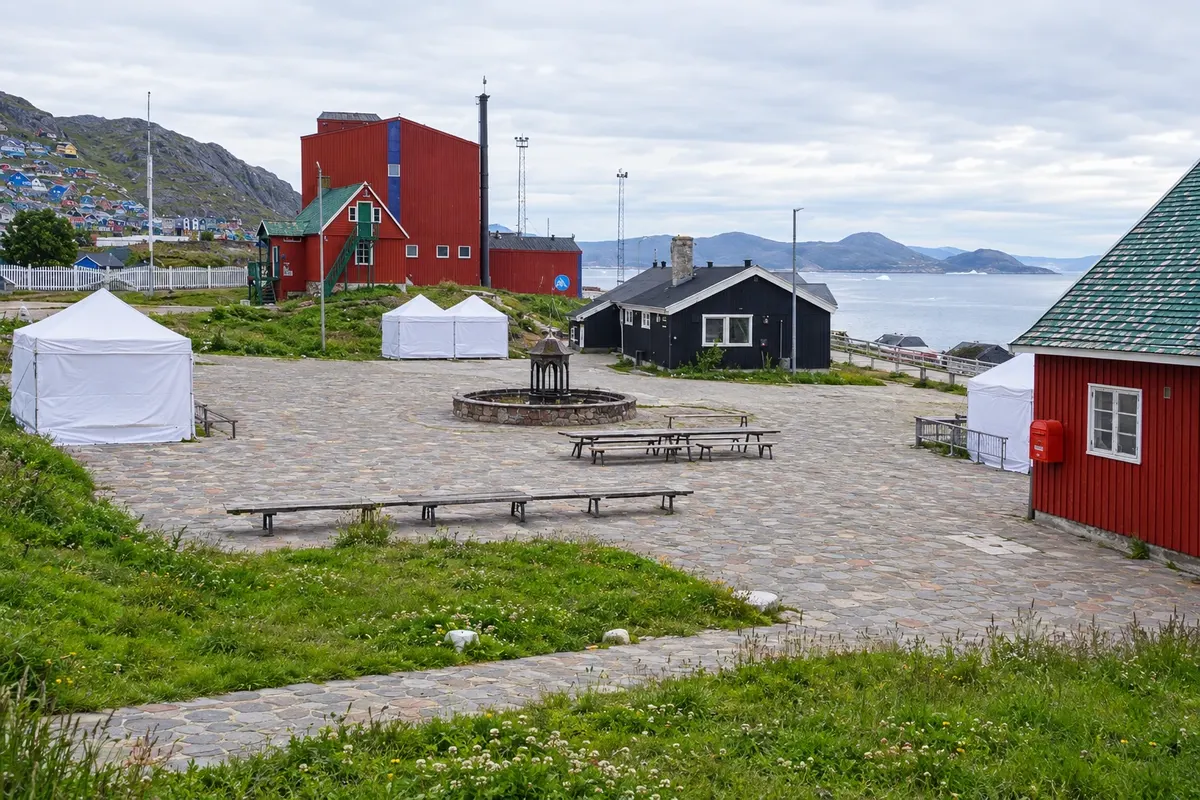
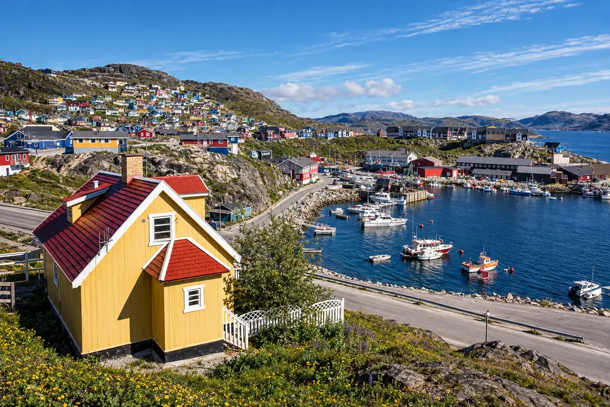
The largest town in southern Greenland and the seat of Kujalleq, with about three thousand residents, colorful houses arranged like an amphitheater above the harbor, and a square with the country’s oldest fountain. There are sculptures carved into the rocks around town, the museum in the old forge, and the red church from 1832. Boats depart from the harbor to Hvalsey Church and to the Uunartoq hot springs.
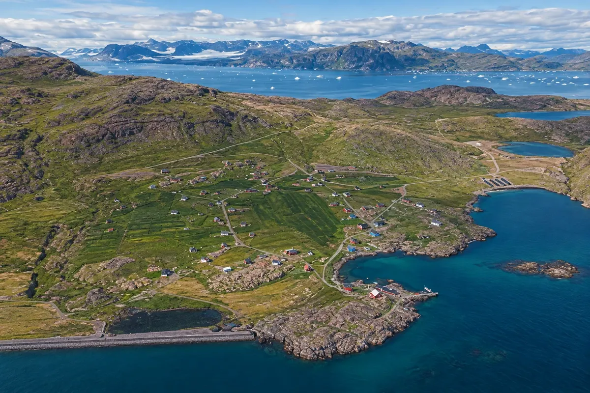
A village of sheep farmers with a few dozen residents, stone houses and green pastures by a fjord. In the middle of the houses are the foundations of Garðar, where the settlers’ bishop lived and where the cathedral stood. You reach it by boat to the Itilleq pier and then on foot, along a path of about 4 km.
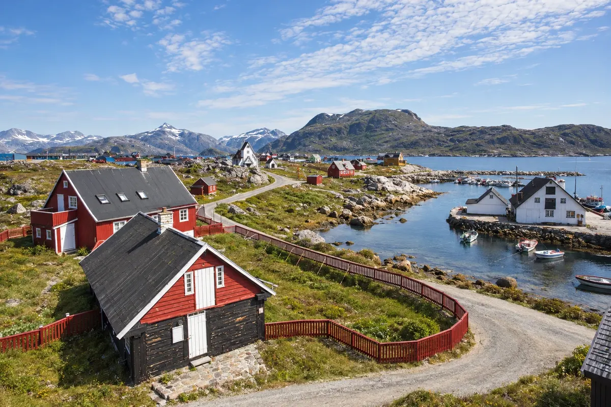
A small town of about a thousand inhabitants on an island at the extreme south, whose name means “place of polar bears” in Greenlandic. The old harbour houses became a museum, and trails lead from the streets up the island’s hills. This is the departure point for boats to the Tasermiut mountains and the hot bath at Uunartoq.
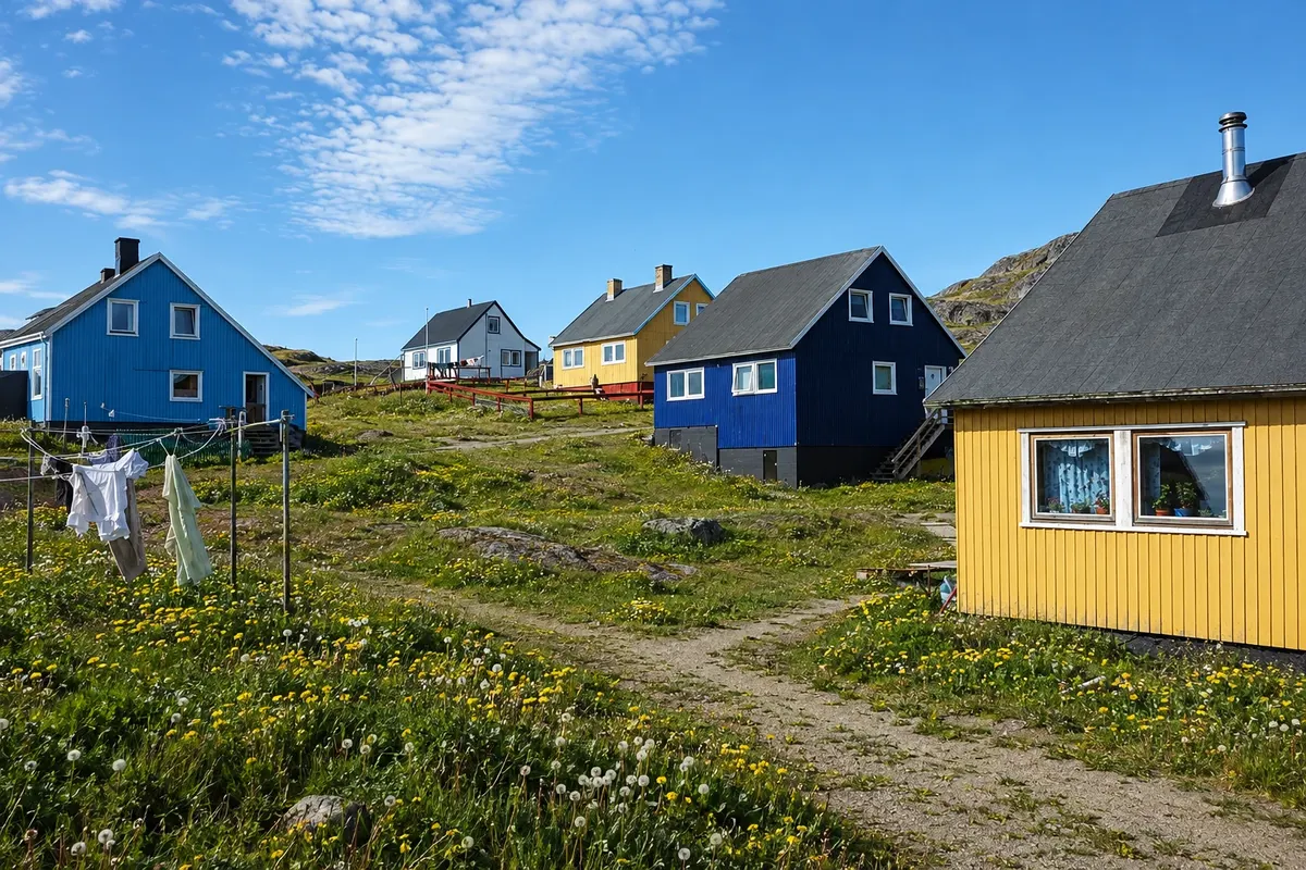
A town of just over a thousand inhabitants on a green plain between two fjords, at the foot of Mount Qaqqarsuaq, with colorful houses and an old harbor. It has a museum in the colonial buildings, trails to the mountains behind the town, nearby Norse ruins and views of the ice cap and the fjord’s icebergs.
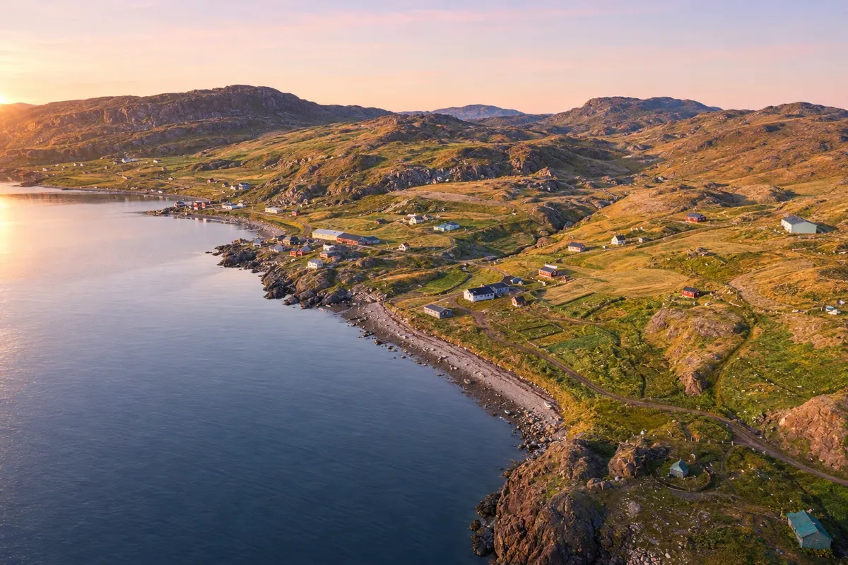
A settlement of sheep herders on the shore of the Tunulliarfik fjord, on the site of Brattahlíð, the farm of Erik the Red. It has Norse ruins, a reconstructed longhouse and church, a statue of Leif Eriksson, and trails through the farms. On the other side of the fjord is Narsarsuaq, where the hike to the Kiattuut glacier starts.
From June to August, boats operate through the fjords, the farm fields turn green and flowery, and trails between the ruins and villages are open. The south has Greenland’s mildest summers. In September the days shorten and the aurora borealis begins to appear when the sky is clear. In spring and early summer, ice flowing down the east coast can reach the fjords and delay navigation; in winter many boat excursions stop running.
Qaqortoq Airport (JJU) receives flights from Nuuk year-round and, in summer, flights from Iceland. From there, helicopters and boats continue to Narsarsuaq, Narsaq, Nanortalik and the settlements. Qassiarsuk is reached by boat, and Igaliku by boat with a short walk at the end. The church of Hvalsey is a boat crossing from Qaqortoq. There are no roads between the towns. Confirm routes before booking.
Your questions
It is the UNESCO World Heritage Site of southern Greenland, inscribed in 2017: a farming landscape at the edge of the ice cap, with Norse ruins about a thousand years old and present-day sheep farms. It comprises five areas, including Qassiarsuk, with Brattahlíð, Igaliku, with Garðar, and the church of Hvalsey.
By boat, from Qaqortoq Airport or from Narsarsuaq, with departures mainly in summer. For Igaliku, the boat usually drops travelers in a nearby cove, and the rest of the way is on foot. Schedules depend on ice and weather: arrange transport before you go.
Five to seven days allow you to see Qaqortoq and Hvalsey, sleep in Qassiarsuk or Igaliku and take boat trips among the icebergs. Nanortalik and the Tasermiut fjord require another two or three days. Boats and helicopters depend on the weather: leave buffer days.
It is the best-preserved Norse building in Greenland, with its stone walls still standing. The last written record about the Norse in the country mentions a wedding held there in 1408. It is reached by boat from Qaqortoq.
Yes. On the island of Uunartoq, between Qaqortoq and Nanortalik, hot water wells up from the ground and forms natural pools. The island has no permanent residents and is visited on boat excursions, usually in summer: confirm before you go.