

 Brazil
 Antarctica
 Argentina
 Bolivia
 Chile
 Colombia
 Ecuador
 Guyana
 French Guiana
 Falkland Islands (Malvinas)
 Paraguay
 Peru
 Suriname
 Uruguay
 Venezuela
 Germany
 Austria
 Belgium
 Croatia
 Denmark
 Slovakia
 Slovenia
 Spain
 Finland
 France
 Greece
 the Netherlands
 Hungary
 Ireland
 Iceland
 Italy
 Luxembourg
 Norway
 Poland
 Portugal
 the United Kingdom
 the Czech Republic
 Sweden
 Switzerland
 Turkey
 Bermuda
 Canada
 the United States
 Greenland
 Mexico
 the Dominican Republic
 South Africa
 Egypt
 Australia
 Fiji
 New Zealand
 Papua New Guinea
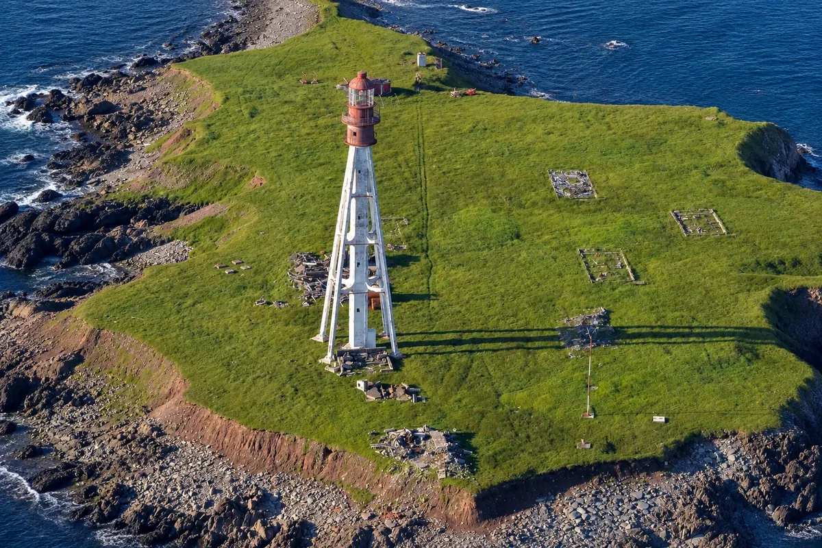
Lighthouse · Miquelon, Miquelon-Langlade
Pointe Plate Lighthouse
1881 lighthouse on the southwest tip of Langlade, with a 43 m metal tower clad in concrete. It is reached by a trail of about 16 km through the forest and Langlade’s plateaus.
Illustrative images. The pictures in this guide are illustrations based on the real place, not photographs, and may differ from it.




Discover
About Pointe Plate Lighthouse
The Pointe Plate lighthouse stands on Langlade’s southwest point, facing the open sea. It was first lit in 1881. The tower is about 43 m: a pyramidal iron framework with a central cylinder, which was clad in concrete in two stages, in 1928 and 1950, to limit corrosion. The lantern is red. The lighthouse remains active, with alternating red and white lights.
The official Pointe Plate trail is about 16 km, of medium difficulty and takes around 4h30. It starts at the end of the road by the Scierie parking area, follows the old Pointe Plate path through the forest, crosses the Ruisseau de l'Ouest, passes the first Plaine des Gaules and zigzags up to the plateau, from where it descends to the lighthouse. A detour that adds about an hour leads to the ruins of the Couillette farm.
From the heights you can see Langlade’s coast and, on a clear day, the isthmus and Miquelon to the north. The surrounding area can be explored, the tower is closed and the old keeper’s house is in ruins.
Before you go
Practical information
Cidade Turismo reviews its information regularly, but something may have changed. Check with the place before planning your trip.
How much time to set aside
About 4h30 on the trail, plus time at the lighthouse; reserve the day.
Best time
From July to September, on a clear day with stable forecast: the path is long and crosses isolated areas. In fog, the view disappears.
How to get there
The trail begins at the end of the road by the Scierie parking area, in Langlade. To reach Langlade: by car via the isthmus road or by seasonal ferry to Anse du Gouvernement.
Tip
Start early, bring water, food, warm clothing and the trail map, and tell someone your route: the path is long and isolated.
Official website
Get your questions answered
Frequently asked questions about Pointe Plate Lighthouse
How long does the trail to the Pointe Plate lighthouse take?
About 4h30 on a trail of roughly 16 km, of medium difficulty. With the detour to the ruins of the Couillette farm, add about an hour.
How tall is the Pointe Plate lighthouse?
The tower is about 43 m high. It is an iron structure clad in concrete, first lit in 1881.
Where does the Pointe Plate trail start?
At the end of the road at the Scierie parking area in Langlade, following the old Pointe Plate path.