Stara Fužina: the Alpine Dairy Farming Museum, the village, and the national park center
Odhod: Stara Fužina village center on foot about 2 hours morning or afternoon easy
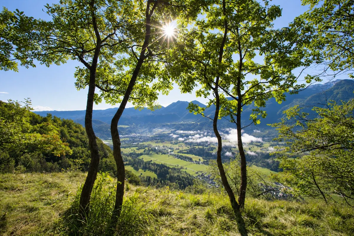
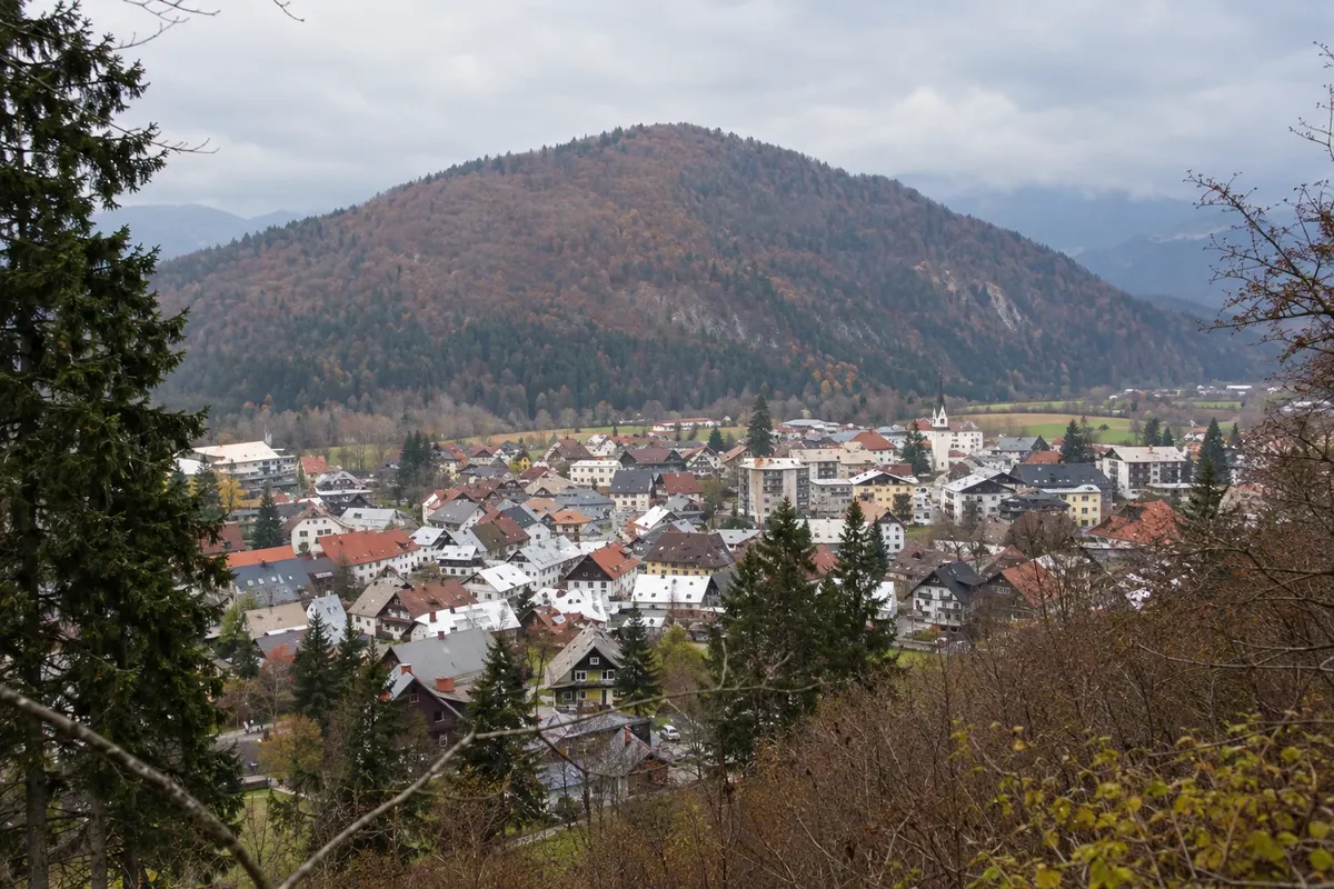
Stara Fužina lies on the eastern shore of Lake Bohinj, where the Mostnica Valley opens into the lake basin. The village’s name means “old foundry”: furnaces on the banks of the Mostnica once smelted iron ore brought down from the mountains, and Bohinj was the main center of mining and ironworking in the Julian Alps. At the end of the last ice age, the lake level was about 18 meters higher, and the water reached the site of the present-day village.
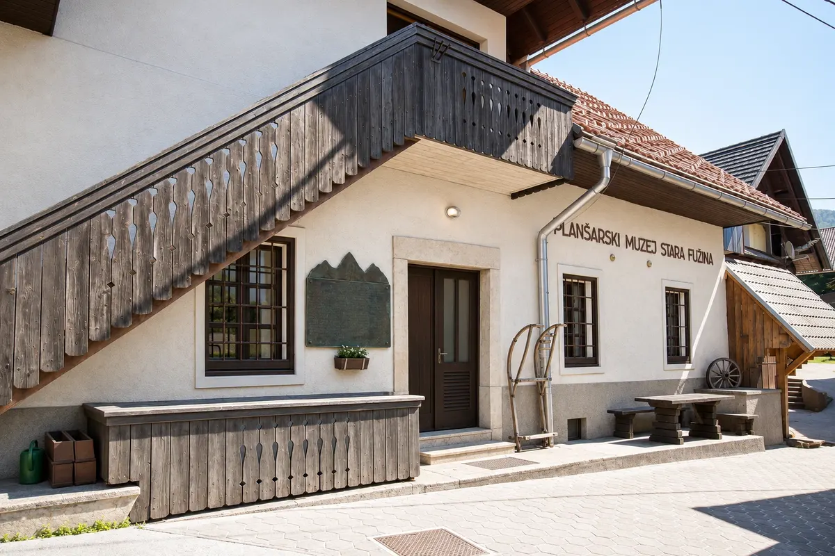
The visit begins at the Alpine Dairy Farming Museum (Planšarski muzej), housed in a former cheese dairy. Inside you can see the original workshop with its two built-in vats and cheese press, along with milk buckets, butter churns, a cauldron from the dairies on the Blato pasture, and the basket the herders carried up the mountain each year. Photographs show the work in the pastures and how the cheeses were brought down to the valley.
The village is also home to one of Bohinj’s tourist information offices and the Triglav National Park Center, which has a shop selling local products and a program of workshops and events. The stage of the Juliana Trail that leads to Bohinjska Bistrica starts there. The village gives its name to Fužina Bay (Fužinski zaliv), one of the lake’s two designated swimming areas. On summer evenings, the square in front of the cultural center often hosts markets featuring local producers, as well as music performances.
Kraji na poti: Stara Fužina, Alpine Dairy Farming Museum, Triglav National Park Center, Fužinski zaliv.
Vključuje: Museum admission costs extra. A combined ticket is available for the Bohinj museums. Check the current prices.
Nasvet: The museum isn’t open every day, so check its opening dates before you go. You can buy trail maps and tickets for the seasonal bus service at the village information office.
Najboljši čas za obisk: From May to October, when the information office is open daily.
Mostnica Gorge and the Voje Valley from Stara Fužina
Odhod: Stara Fužina (St. Paul’s Church, the village center, or the Vorenčkojca parking lot) marked out-and-back trail about 5 hours round trip to the waterfall; less if you turn back at the Voje mountain hut morning easy to moderate
The Mostnica is the river that flows through Stara Fužina, and it takes its name from the bridges that cross it: there are four bridges and a footbridge between the village and the waterfall. The gorge is about 2 km long. It formed because the side valley was left higher than the main Bohinj valley, so the river carved its way down through the rock. Erosion was fastest at the end of the ice age, as the ice melted. In places, the gorge is up to 20 m deep and its walls are only a shoulder’s width apart.
The entrance is at Hudičev most, the Devil’s Bridge, just above Zois Manor. Legend has it that the devil himself finished the bridge in exchange for the first soul to cross it, so the villagers sent a dog across first. Upstream, you’ll find round pools carved out by the water and an opening in the rock shaped like an elephant’s trunk. There’s a trail on each bank, so you can walk upstream on one side and back down on the other.
The gorge ends near the Voje mountain hut, where the pasture of the same name begins. It lies in a U-shaped glacial valley at an elevation of just over 700 m, with springs that rise from the ground. Cows now graze here only in the fall, so that’s when you’ll see them. At the end of the valley is the 21 m Mostnica Waterfall, the largest on the river.
Kraji na poti: Korita Mostnice, Hudičev most, Planina Voje, Mostnica Waterfall.
Vključuje: From April to November, there’s a separate admission fee for the gorge, payable in cash only. Check the current rates.
Nasvet: If you only want to see the gorge, turn back at the Voje mountain hut. The hike to the end of the valley takes about 2 hours and 30 minutes each way. Swimming is not allowed in the Mostnica. If there is snow or ice, check with the tourist information office in Stara Fužina before you set out.
Najboljši čas za obisk: May to October; the river usually flows more strongly after rain.
Peč and Rudnica: the hill that separates the two valleys
Odhod: Concrete bridge in Stara Fužina loop trail through the woods about 3 hours (40 minutes round trip if you only go as far as Peč) morning or afternoon easy
Rudnica is the wooded hill that rises in the middle of Bohinj, separating the upper and lower valleys. You can reach it from almost any village, with routes up four sides: from the lake, Stara Fužina, Brod, and Srednja vas. The most popular route starts in Stara Fužina and first takes you to the Peč viewpoint, at an elevation of 720 m, 50 m below the summit of Peč. It’s about a 20-minute climb on a well-maintained forest trail, with views of the lake, Ribčev Laz, and the Komna Plateau. Along the way, you can also see Stara Fužina itself and Mount Triglav.
From Peč, it’s a good hour’s walk to the summit of Rudnica at 946 m. The route alternates between a woodland path and a forest road, with a few short climbs. Rudnica takes its name from the ore once mined on its slopes. You can still see the old mine workings beside the trail. The route also crosses the clearing from which the ore was carried down to the valley by overhead cable. Most of the bauxite was mined during World War I.
From the summit, you can see the upper valley, the Senožeta meadows, and the surrounding mountains. A box holds a summit stamp and a hikers’ logbook. In spring, Rudnica is known for its flowers, including the Bohinj iris, the symbol of the International Wild Flower Festival, which includes a guided botanical hike up the hill.
Kraji na poti: Peč viewpoint, Rudnica, Stara Fužina.
Vključuje: There is no fee to use the trail.
Nasvet: On mornings when the valley is foggy, the summit of Rudnica is often above the clouds. Bring water: there is no shelter or spring along the trail.
Najboljši čas za obisk: Year-round, with suitable footwear when there is snow or ice. The flowers bloom in May and June.
Vogar: the climb to Kosijev dom and the two viewpoints above the lake
Odhod: Stara Fužina steep out-and-back trail about 3 hours morning moderate (short and steep)
At 1,054 m, Vogar is the eastern end of the ridge that runs along the northern shore of Lake Bohinj. The pasture here is one of the mountain pastures of Stara Fužina. From the village, the climb takes about an hour on a footpath that gains nearly 500 m in elevation.
There are two viewpoints at the top. You reach the first before the mountain hut, in a clearing that also serves as a paragliding launch site. From there you can see both Bohinj valleys, Rudnica, and the Senožeta meadows. A memorial in the clearing honors mountaineers and railroad workers who have died. The second viewpoint is about 20 minutes farther along a well-trodden path that passes Kosijev dom and continues west to the cliff edge. From there you can see the lake, Ukanc, and the stretch of the Bohinj and Tolmin mountains between Vogel and Komna.
Kosijev dom is a mountain hut that serves food and drinks and has a stamp and a visitors’ logbook. If you have the stamina for a longer hike, Vogar is also a starting point for walks in the surrounding area.
Kraji na poti: Vogar, Kosijev dom, Stara Fužina.
Vključuje: The trail is free. Meals at the mountain hut cost extra.
Nasvet: Wear hiking boots or trail shoes with good grip: the climb is steep from start to finish. Check ahead to see if the mountain hut is open. In summer, an early shuttle bus goes up to the junction of the Vogar and Blato forest roads.
Najboljši čas za obisk: May to October; outside that period, only if the trail is free of snow.
Studor and Srednja vas: the hayracks, Oplen House, and the Ribnica waterfalls
Odhod: Stara Fužina or the Senožeta parking lot in Srednja vas on foot or by bike between the villages about 4 hours morning or afternoon easy
The upper valley begins in Studor, a small village at the foot of the mountain of the same name. Just below the houses stands a group of wooden hayracks known as toplarji. These roofed double structures are typical of this part of Slovenia and are protected as an architectural monument. The village is also home to Oplen House (Oplenova hiša), a farmhouse turned museum. The living quarters include a black kitchen with three hearths and a main room with a table, benches, and a tiled stove with a bed on top. You can also see the looms used in winter and the attic where grain, clothes, and tools were stored. Almost everything on display belonged to the last owners.
Srednja vas, the next village, was once the administrative center of Bohinj. A fire in 1949 destroyed almost the entire village. The older buildings that survive are the 17th-century Špan and Preželj barns and the Baroque parish church of St. Martin, with paintings by Franc Jelovšek. In summer, the church hosts concerts as part of the Bohinj Music Festival.
Above the village, the Ribnica stream has carved a little-known gorge with several waterfalls. The two most beautiful are in the lower part of the gorge and are 10 to 15 meters high. The trail is short, shady, and cool even in summer. Before World War II, timber was floated down the stream. One of the springs along the trail supplies the village with water.
Kraji na poti: Studor, Oplen House, Srednja vas, St. Martin’s Church, Ribnica waterfalls.
Vključuje: Admission to Oplen House is paid separately. The trails are free to use.
Nasvet: Oplen House is open from April to October, but only every other day outside the peak summer season. It admits only a few visitors at a time, so check before you go. Swimming is not allowed in the Ribnica. The Bohinj bike path and the valley buses connect the villages.
Najboljši čas za obisk: May through October.
Vodnikov razglednik: from Jereka to Koprivnik along the stone-paved path
Odhod: The bridge in Jereka (or the village of Koprivnik for the shorter route) out-and-back hike about 2 hours from Jereka; 1 hour from Koprivnik morning easy to moderate
Vodnikov razglednik is a viewpoint at an elevation of 1,017 m on the edge of the Pokljuka Plateau, above the last villages in the upper valley. It is named for Valentin Vodnik, a poet and linguist who served as a priest in Koprivnik for three years and often climbed up here. Because of that connection, locals still call the place Gospodovec. It was in Bohinj that Vodnik met Žiga Zois, the owner of the valley’s foundries, who became his mentor.
The view is a geography lesson: the U-shaped upper valley between the hills of Rudnica and Studor traces the path of the Bohinj glacier. The lake lies to the west, and the Julian Alps form a ring around the valley. A sign at the top identifies the peaks, and there is a bench, a stamp, and a visitors’ logbook.
From Koprivnik, the walk takes about 30 minutes, with very little elevation change, and is suitable for all ages. From Jereka, on the valley floor, it is a good hour’s climb, with an elevation gain of 387 m. The route follows a cart track paved with stone in the 18th century to carry iron ore and charcoal from Pokljuka to the Bohinj foundries. You can still see the grooves the wheels wore into the stone. The path starts at the village bridge and comes out in Koprivnik, just below the viewpoint.
Kraji na poti: Jereka, Vodnikov razglednik, Koprivnik.
Vključuje: There is no fee for this walk.
Nasvet: At over 1,000 m, the viewpoint is often in the sun when morning fog fills the valley. The stage of the Juliana Trail that descends from Pokljuka passes through Koprivnik and Jereka, so you can combine a visit to the viewpoint with the hike to Srednja vas.
Najboljši čas za obisk: May to October; in winter, depending on snow conditions.


 Brazilija
 Antarktika
 Argentina
 Bolivija
 Čile
 Kolumbija
 Ekvador
 Gvajana
 Francoska Gvajana
 Falklandski otoki (Malvini)
 Paragvaj
 Peru
 Surinam
 Urugvaj
 Venezuela
 Nemčija
 Avstrija
 Belgija
 Hrvaška
 Danska
 Slovaška
 Španija
 Finska
 Francija
 Grčija
 Nizozemska
 Madžarska
 Irska
 Islandija
 Italija
 Luksemburg
 Norveška
 Poljska
 Portugalska
 Združeno kraljestvo
 Češka
 Švedska
 Švica
 Turčija
 Bermudi
 Kanada
 Združene države Amerike
 Grenlandija
 Mehika
 Sveta Peter in Mihael
 Dominikanska republika
 Japonska
 Južna Afrika
 Egipt
 Avstralija
 Fidži
 Nova Zelandija
 Papuanska Nova Gvineja