

 Brazil
 Argentina
 Bolivia
 Chile
 Colombia
 Ecuador
 Guyana
 French Guiana
 Falkland Islands (Malvinas)
 Paraguay
 Peru
 Suriname
 Uruguay
 Venezuela
 Germany
 Austria
 Belgium
 Croatia
 Denmark
 Spain
 Finland
 France
 Greece
 the Netherlands
 Hungary
 Ireland
 Iceland
 Italy
 Luxembourg
 Norway
 Poland
 Portugal
 the United Kingdom
 the Czech Republic
 Sweden
 Switzerland
 the Dominican Republic
 Fiji
Province · Mar Negro Ocidental
Kastamonu
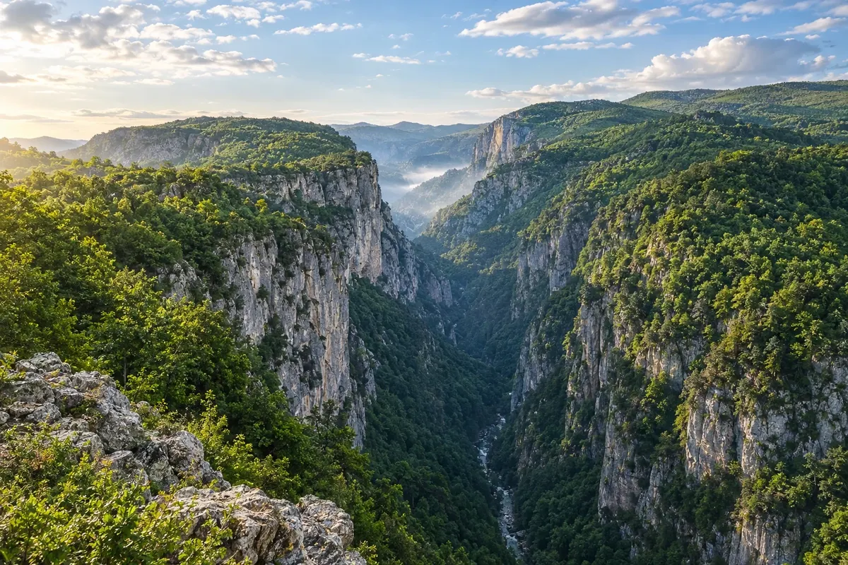
Canyons of the Küre Mountains National Park, the wooden mosque of Kasaba, a World Heritage site, and a capital with a castle and Ottoman houses.
In the photo: Valla Canyon, Küre Mountains National Park, Kastamonu
Illustrative images. The pictures in this guide are illustrations based on the real place, not photographs, and may differ from it.

The province
Get to know Kastamonu
Kastamonu stretches from the inland mountains to about 135 km of coastline on the Black Sea. Forests cover more than half the province, and the capital, also called Kastamonu, preserves neighborhoods of Ottoman houses beneath the castle.
To the north, Küre Mountains National Park (Küre Dağları Milli Parkı), shared with Bartın, is karst terrain of canyons, caves and waterfalls. Valla Canyon, near the Pınarbaşı district, has rock walls 800 to 1,200 metres high and a viewpoint at the top. In Horma Canyon, a roughly 3 km wooden walkway follows the river to Ilıca waterfall.
Fifteen kilometres from the capital, in the village of Kasaba, the Mahmut Bey Mosque, from 1366, has a hand-painted wooden ceiling and columns and was assembled without nails, using joinery. It is a UNESCO World Heritage site, along with other medieval wooden mosques of Anatolia.
Near Taşköprü lie the ruins of Pompeiópolis, a Roman-era town, and the area is known for garlic. To the south, Mount Ilgaz, at 2,587 metres, is a national park with a ski resort on the border with Çankırı. On the coast, İnebolu has the province's only port, and Cide lies on the road that follows the shoreline.
It was in Kastamonu, in 1925, that Atatürk announced the clothing reform that abolished the fez. The local cuisine is vast: a regional survey counted more than eight hundred typical dishes.
When to go
May to October is usually the season for the canyons and the park's trails, with rain possible in any month. In winter it is cold and snows inland; the ski season on Mount Ilgaz typically runs from December to March. On the coast, July and August are the beach months.
Getting there
Kastamonu Airport (KFS) has flights to Istanbul. Other gateways are Ankara Esenboğa (ESB) and Zonguldak Airport (ONQ), in Çaycuma. There are buses from Ankara and Istanbul to the provincial capital. Valla and Horma canyons are near Pınarbaşı in the north of the province, and visitors usually travel there by car or on organized tours.
Your questions
Frequently asked questions about Kastamonu
How to visit Horma Canyon?
The canyon is about 5 km from Pınarbaşı, inside Küre Mountains National Park. A roughly 3 km wooden walkway attached to the rock face follows the river to Ilıca waterfall. Wear sturdy footwear and allow half a day.
Can you enter Valla Canyon?
The most visited spot is the viewpoint at the top of the canyon, near Pınarbaşı. Descending to the riverbed requires a short, steep trail, and traversing the canyon from inside is a technical crossing that needs a guide and equipment. Check conditions with the park before you go.
Where is the wooden mosque of Kasaba?
The Mahmut Bey Mosque is in the village of Kasaba, 15 km from the city of Kastamonu, on the road to Daday. It dates from 1366 and is on the UNESCO World Heritage list. As it is used for prayer, confirm visiting hours before you go.
How many days to stay in Kastamonu?
Two days allow you to see the capital, the Kasaba mosque and one of the canyons. With three days you can do Horma and Valla at a relaxed pace and include either the coast or Mount Ilgaz.
Does Kastamonu have a beach?
Yes. The province has about 135 km of coastline on the Black Sea, with small towns such as İnebolu and Cide. The beach season is usually July and August.