

 Brazil
 Argentina
 Bolivia
 Chile
 Colombia
 Ecuador
 Guyana
 French Guiana
 Falkland Islands (Malvinas)
 Paraguay
 Peru
 Suriname
 Uruguay
 Venezuela
 Germany
 Austria
 Belgium
 Croatia
 Denmark
 Spain
 Finland
 France
 Greece
 the Netherlands
 Hungary
 Ireland
 Iceland
 Italy
 Luxembourg
 Norway
 Poland
 Portugal
 the United Kingdom
 the Czech Republic
 Sweden
 Switzerland
 the Dominican Republic
 Fiji
Province · Anatólia Oriental
Iğdır
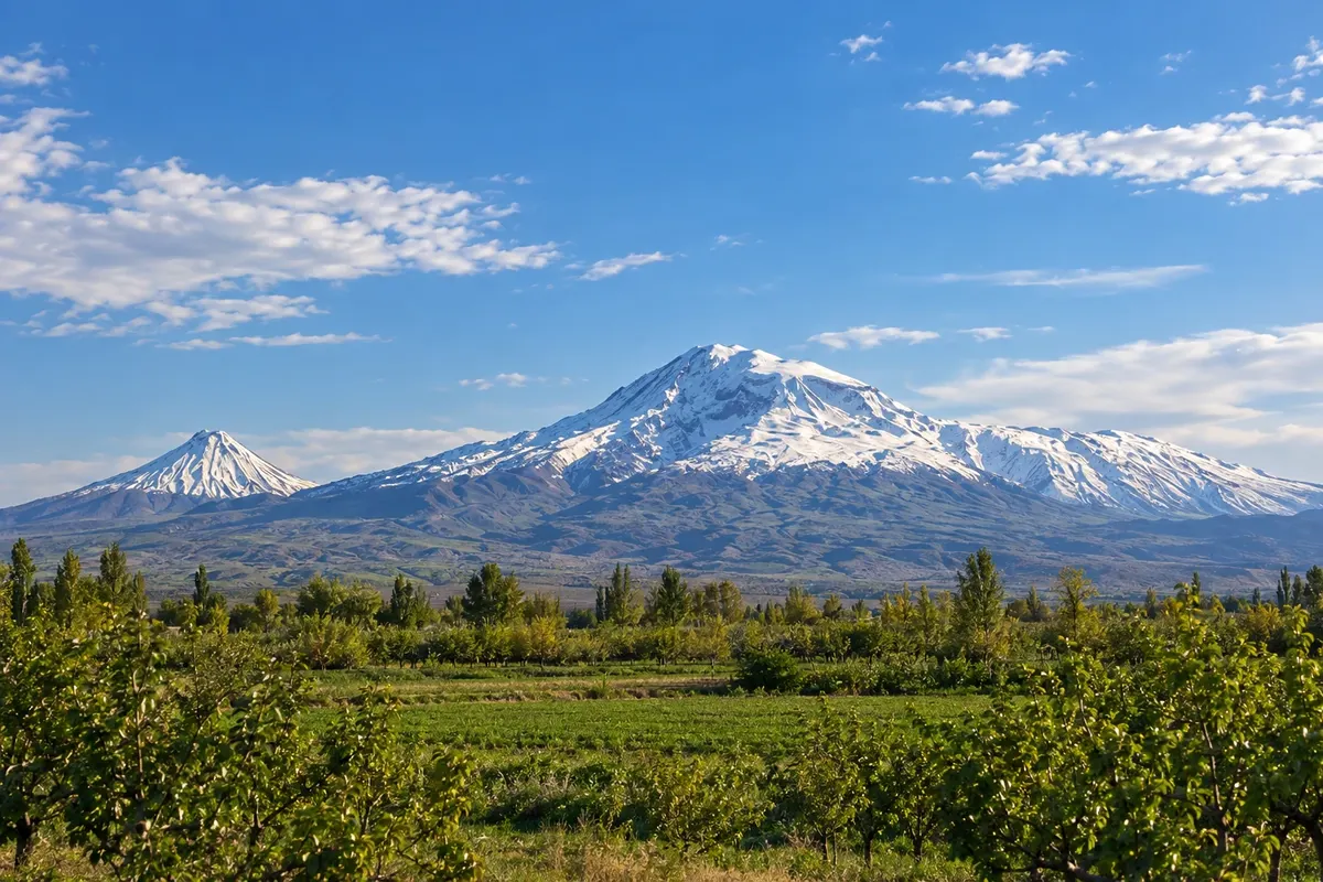
Iğdır is located in the Aras river valley, at the foot of the north face of Ararat, with apricot orchards, the Tuzluca salt mines and borders with Armenia, Iran and Nakhichevan (Azerbaijan).
In the photo: Mount Ararat seen from the Iğdır plain
Illustrative images. The pictures in this guide are illustrations based on the real place, not photographs, and may differ from it.

The province
Get to know Iğdır
Iğdır occupies the Aras river plain, lower and warmer than the surrounding plateau. Because of that it has hot summers and agriculture of orchards and cotton, and Iğdır apricot is known nationwide. The province borders Armenia, Iran and Nakhichevan, a territory of Azerbaijan.
The scenery is dominated by Mount Ararat (Ağrı Dağı), seen here from the north face, with Little Ararat beside it. The mountain lies between Iğdır and Ağrı, inside Mount Ağrı National Park, and one of the two routes to the summit departs from Iğdır’s side, always requiring prior authorization.
In Tuzluca, to the west, the salt mines (Tuzluca Tuz Mağaraları) are open to visitors with galleries carved into a rock-salt mountain. Nearby, striped red and yellow earth hills and remains of caravansaries recall the old trade route that crossed the valley.
The cuisine blends Caucasus and Iranian traditions, with bozbaş (meat and chickpea stew), dishes roasted in a tandır and thin breads. The capital has an airport and is a starting point for Doğubayazıt and Kars.
When to go
April to June and September to October usually have mild temperatures on the plain and, on dry days, good visibility of Ararat. July and August are hot in the valley. Winter is cold but is often less harsh than in the neighboring, higher provinces.
Getting there
Iğdır Airport (IGD) is about 15 km from the center and handles domestic flights. By road, Iğdır connects to Doğubayazıt to the south, skirting Ararat, and to Kars to the northwest.
Your questions
Frequently asked questions about Iğdır
Where is the best place to see Ararat from Iğdır?
The mountain appears from almost the entire plain, especially on the road between Iğdır and Doğubayazıt. The peak is usually more visible on dry mornings; with heat or clouds it can be obscured.
How to visit the Tuzluca salt mines?
The galleries are near the town of Tuzluca, west of Iğdır, and are reached by car or taxi. The visit is through tunnels excavated in the salt; bring a light jacket because the interior is cooler. Visiting days and hours can change: check locally in town.
Is Iğdır a good base for climbing Ararat?
For the northern route, yes; for the southern route and İshak Paşa Palace, Doğubayazıt is closer. Both routes require prior authorization and a local operator.
How many days should I allocate for Iğdır?
One day is enough for the capital, Tuzluca and the Ararat viewpoints. With two days you can include Doğubayazıt. Iğdır is usually included on routes linking Kars, Ağrı and Van.