

 Brazil
 Argentina
 Bolivia
 Chile
 Colombia
 Ecuador
 Guyana
 French Guiana
 Falkland Islands (Malvinas)
 Paraguay
 Peru
 Suriname
 Uruguay
 Venezuela
 Germany
 Austria
 Belgium
 Croatia
 Denmark
 Spain
 Finland
 France
 Greece
 the Netherlands
 Hungary
 Ireland
 Iceland
 Italy
 Luxembourg
 Norway
 Poland
 Portugal
 the United Kingdom
 the Czech Republic
 Sweden
 Switzerland
 the Dominican Republic
 Fiji
Province · Anatólia Oriental
Hakkâri
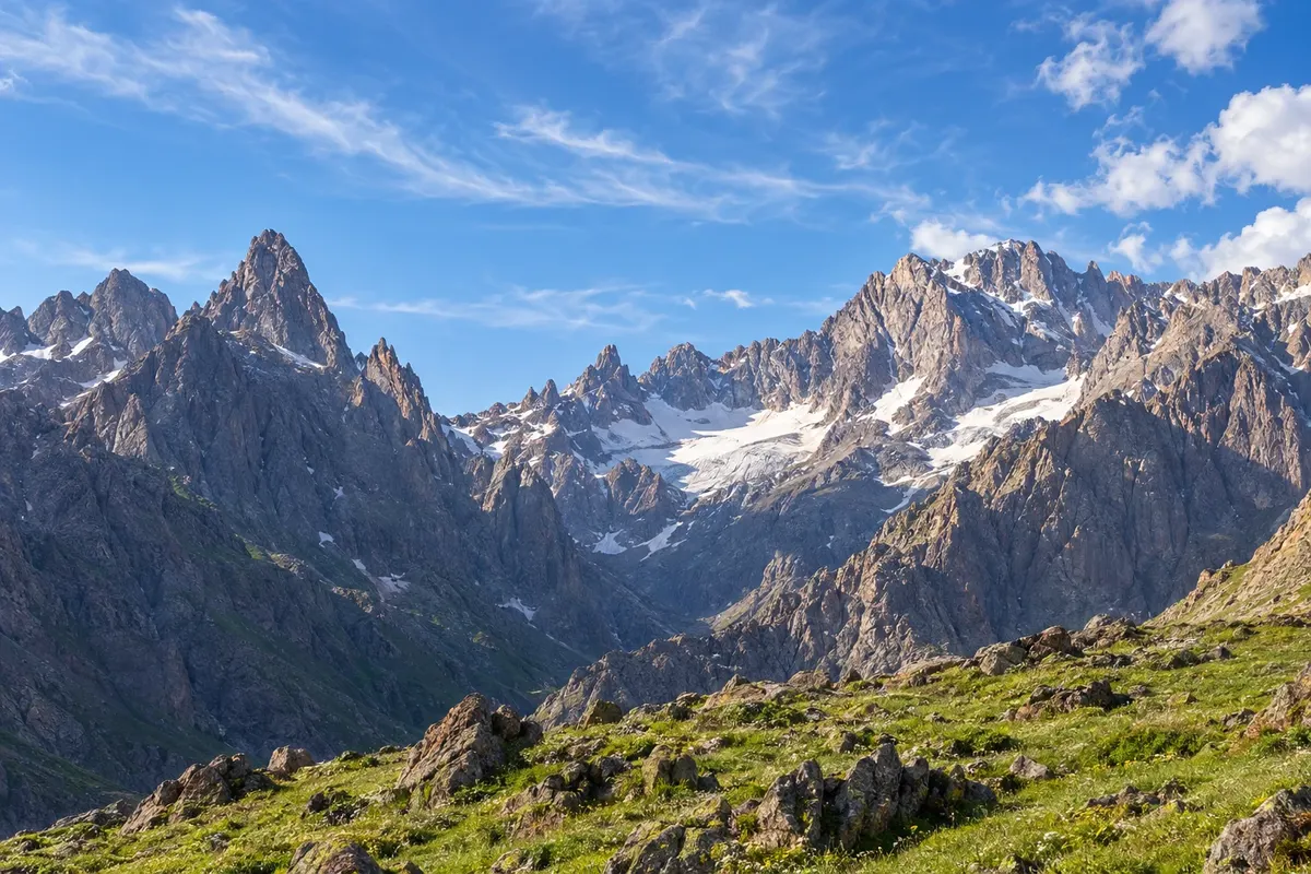
Hakkâri is the province of the highest mountains in the southeast: the Cilo-Sat National Park, with glaciers and high-altitude lakes, the Zap River valley and summer plateaus such as Berçelan.
In the photo: Cilo Mountains, Hakkâri
Illustrative images. The pictures in this guide are illustrations based on the real place, not photographs, and may differ from it.

The province
Get to know Hakkâri
Hakkâri is located at the far southeast of Turkey, next to Iran and Iraq, and is almost entirely mountainous. Uludoruk (Reşko) peak in the Cilo mountains reaches 4,135 meters, the country’s second highest, and still holds glaciers.
The Cilo and Sat mountains form a national park, with high-altitude lakes above 3,000 meters, such as the Sat lakes and the İkiyaka lakes, and valleys where snow remains into summer. Hikes are done with local guides; from Yüksekova, part of the route to the Sat lakes is by road and the remainder on foot or on horseback.
The Zap River runs through a deep valley between the provincial capital and Çukurca, where stone houses cling to the slopes. In the capital, the Meydan Medresesi, dated 1700–1701, is the main monument. In Şemdinli, the ruined Kayme palace and the Nehri waterfall lie among forests.
The Berçelan plateau above the capital receives shepherds in summer, amid flowers and patches of snow, near Seyithan lake. The region is known for its honey, walnuts and herb cheese, and kilim weaving is an old tradition.
When to go
July to September is usually the hiking season in Cilo-Sat and Berçelan, when snow recedes from the high trails. June can still have snow at the lakes; from November to April, mountain roads often close frequently. In the capital, winter is long.
Getting there
Yüksekova Selahaddin Eyyubi Airport (YKO), east of the provincial capital, handles domestic flights and is closer to the Sat mountains. Van Airport (VAN) is another option, about 200 km from the capital by mountain road. Plan ahead and hire a local guide for the mountains.
Your questions
Frequently asked questions about Hakkâri
Do you need a guide for Cilo-Sat?
Yes, it is recommended: the routes are high-mountain, with little signage and rapid weather changes. Operators from Yüksekova and the provincial capital organize hikes and camps.
When do the Sat lakes become free of snow?
Snow usually recedes starting in July; before that, parts of the trail can still be covered. Check conditions with local guides.
How many days should I set aside for Hakkâri?
Two days for the provincial capital, the Zap valley and Berçelan; three to five days for a crossing in Cilo-Sat.
Which airport should I use for Hakkâri?
Yüksekova’s airport is closer to the Sat mountains; Van has more flights and is about three hours by road from the provincial capital.