

 Brazil
 Argentina
 Bolivia
 Chile
 Colombia
 Ecuador
 Guyana
 French Guiana
 Falkland Islands (Malvinas)
 Paraguay
 Peru
 Suriname
 Uruguay
 Venezuela
 Germany
 Austria
 Belgium
 Croatia
 Denmark
 Spain
 Finland
 France
 Greece
 the Netherlands
 Hungary
 Ireland
 Iceland
 Italy
 Luxembourg
 Norway
 Poland
 Portugal
 the United Kingdom
 the Czech Republic
 Sweden
 Switzerland
 the Dominican Republic
 Fiji
Province · Mar Negro Oriental
Giresun
Land of the hazelnut and of Giresun Island, the ancient Aretias of the Argonauts’ legends, with a castle above the town and green plateaus inland.
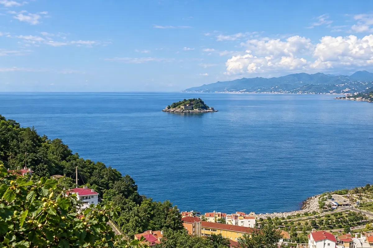
In the photo: Giresun Island (Giresun Adası), Giresun
Illustrative images. The pictures in this guide are illustrations based on the real place, not photographs, and may differ from it.

The province
Get to know Giresun
Giresun lies on the Eastern Black Sea, between Ordu and Trabzon, and is one of Turkey’s hazelnut centers: the steep slopes near the sea are covered with hazel trees, and during harvest the nuts are sun-dried by the roads. The name comes from ancient Kerasous, linked to the cherry.
About 1.2 km off the coast, Giresun Island covers roughly 4 hectares, with remains of walls and a monastery. In Antiquity it was called Aretias, and legends connect it to the Amazons and the Argonauts’ voyage in search of the Golden Fleece. The island is a protected area and has no permanent residents; visits are made by boats from the port, especially in summer.
Every May 20 the town holds the Aksu Festival at the mouth of the Aksu stream, east of the center. The celebration preserves the old “Mayıs Yedisi” custom: people throw small stones into the water, make wishes and circumnavigate the island by boat.
High above the center, Giresun Castle crowns the hill and serves as a viewpoint. The Giresun Museum operates in the former Gogora Church, from the 19th century. Inland, the plateaus of Kümbet and Bektaş in the mountains host summer festivals and families who go up for the season.
When to go
May to September is usually the warmest period with the least rain. May features the Aksu Festival, and July and August are the months for plateaus and summer festivities. Hazelnut harvest typically takes place in August. From October to March there is more rain, and high-altitude roads can have snow.
Getting there
Ordu–Giresun Airport (OGU), built on reclaimed land in the sea, is about 28 km from Giresun and 18 km from Ordu, with buses to both towns. Along the coastal road, Giresun lies between Ordu and Trabzon, with frequent buses. Confirm schedules before purchasing tickets.
Your questions
Frequently asked questions about Giresun
How to visit Giresun Island?
Fishing and tour boats depart from Giresun’s port, especially in summer, and local agencies organize the crossing, which takes about half an hour. The island is a protected area, with remains of walls and a monastery.
When is the Aksu Festival?
The festival begins on May 20, at the mouth of the Aksu stream east of Giresun’s center. There is music, dance and the custom of circling the island by boat while making wishes.
Which airport to use for Giresun?
Ordu–Giresun Airport (OGU), between the two towns, is about 28 km from Giresun. There are buses to the center. Trabzon Airport is another option, followed by the coastal road.
What to bring from Giresun?
Hazelnuts are the best-known product, sold raw, roasted or as paste and in sweets. The new harvest reaches shops after the August gathering.
Which plateaus to visit in Giresun?
Kümbet and Bektaş are the most popular, in the inland mountains, with summer festivals and wooden houses. High-altitude roads are usually open from June to September; check conditions beforehand.