

 Brazil
 Argentina
 Bolivia
 Chile
 Colombia
 Ecuador
 Guyana
 French Guiana
 Falkland Islands (Malvinas)
 Paraguay
 Peru
 Suriname
 Uruguay
 Venezuela
 Germany
 Austria
 Belgium
 Croatia
 Denmark
 Spain
 Finland
 France
 Greece
 the Netherlands
 Hungary
 Ireland
 Iceland
 Italy
 Luxembourg
 Norway
 Poland
 Portugal
 the United Kingdom
 the Czech Republic
 Sweden
 Switzerland
 the Dominican Republic
 Fiji
Province · Anatólia Oriental
Erzincan
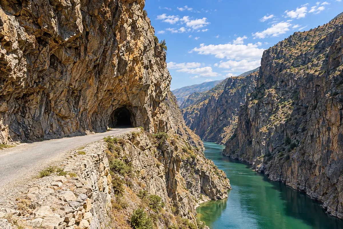
Erzincan has the Dark Canyon (Karanlık Kanyon) of the Euphrates, the old houses of Kemaliye, the Girlevik waterfall, the Ergan ski resort and tulum cheese.
In the photo: Karanlık Kanyon and the Taş Yolu road, Kemaliye
Illustrative images. The pictures in this guide are illustrations based on the real place, not photographs, and may differ from it.

The province
Get to know Erzincan
Erzincan sits on a plain surrounded by mountains in the upper Euphrates (Fırat) valley, with the Munzur mountains to the south. The provincial capital lies on the route between Sivas and Erzurum and is a stop for the Doğu Ekspresi train.
The highlight is Kemaliye (Eğin), to the southwest, with hundreds of protected stone-and-wood houses and old paved streets; the town is on the World Heritage tentative list. From there, the Taş Yolu road, hand-carved into the rock over more than a century, runs above the Karanlık Kanyon, the Dark Canyon of the Euphrates, with dozens of narrow unlit tunnels and cliff faces hundreds of meters high.
Closer to the city, the Girlevik waterfall steps down the hillside and often freezes in winter, when it attracts ice climbers. The Ergan ski area, about 12 km from the centre, has a cable car and runs that rise above 2,600 meters. Kemah Castle and the Urartian site of Altıntepe round out the historical itinerary.
Erzincan tulum cheese, made from sheep’s milk, crumbly and cured in skin, is sold across the country, and the coppersmiths’ bazaar keeps copperwork alive in the city centre.
When to go
June to September is usually the best time for Kemaliye, the canyon and Girlevik, with long days and open roads. For skiing at Ergan, the season typically runs from December to March. Winters are very cold and some mountain sections can close due to snow.
Getting there
Erzincan Airport (ERC) is near the city and handles domestic flights. The railway station is served by the Doğu Ekspresi, which connects Ankara to Kars. Kemaliye is a few hours’ drive from the provincial capital; the stretch along the Taş Yolu is narrow and requires careful, unhurried driving.
Your questions
Frequently asked questions about Erzincan
How to visit the Karanlık Kanyon?
There are two ways: via the Taş Yolu road between İliç and Kemaliye, which passes through tunnels carved in the rock above the river, and by boat trips that depart from Kemaliye and take about an hour to reach the canyon. Boat services depend on the season and water level; check locally.
Is it worth staying overnight in Kemaliye?
Yes — to stroll the streets of old houses at leisure and do the canyon without rushing. There are guesthouses in traditional houses.
How many days to allocate for Erzincan?
One day for the provincial capital, Girlevik and Ergan; another one or two days for Kemaliye and the canyon.
What is Erzincan tulum cheese?
It is a sheep‑milk cheese, crumbly and salty, cured in skin sacks. It is sold in shops in the centre and commonly served at breakfast.