

 Brazil
 Argentina
 Bolivia
 Chile
 Colombia
 Ecuador
 Guyana
 French Guiana
 Falkland Islands (Malvinas)
 Paraguay
 Peru
 Suriname
 Uruguay
 Venezuela
 Germany
 Austria
 Belgium
 Croatia
 Denmark
 Spain
 Finland
 France
 Greece
 the Netherlands
 Hungary
 Ireland
 Iceland
 Italy
 Luxembourg
 Norway
 Poland
 Portugal
 the United Kingdom
 the Czech Republic
 Sweden
 Switzerland
 the Dominican Republic
 Fiji
Province · Pamukkale e Região dos Lagos
Afyonkarahisar
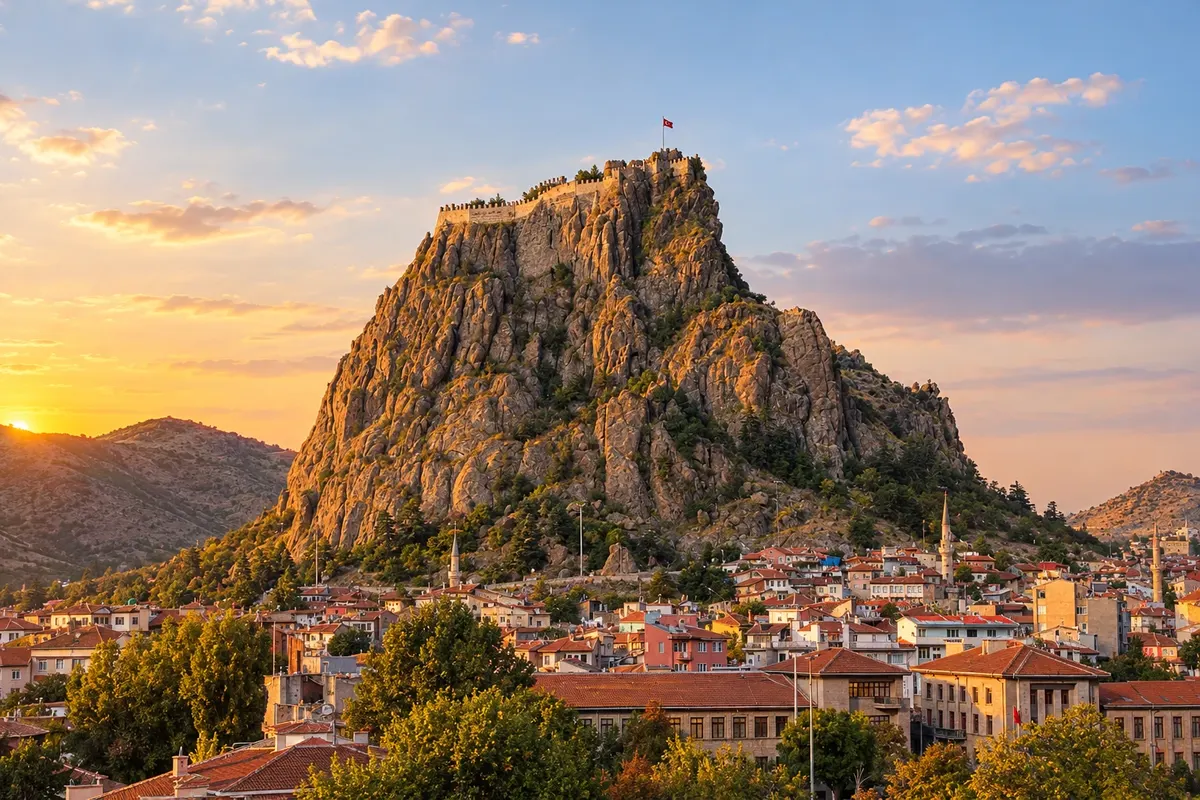
Afyonkarahisar grew at the foot of a volcanic rock crowned by a fortress and is known for its thermal waters, its kaymak, and the Phrygian monuments carved into the rock.
In the photo: Afyonkarahisar Castle (Afyonkarahisar Kalesi)
Illustrative images. The pictures in this guide are illustrations based on the real place, not photographs, and may differ from it.

The province
Get to know Afyonkarahisar
The city of Afyonkarahisar is located in western Anatolia, at the crossroads of the roads connecting Istanbul, Ankara, Izmir, Antalya and Konya. Karahisar means "black fortress": the castle occupies the top of a dark volcanic rock that rises in the middle of the city, and the climb, via a stairway of hundreds of steps, ends with a wide view of roofs and minarets.
At the foot of the rock, the old center preserves Ottoman houses with wooden balconies and the Ulu Camii, from the late 13th century. The mosque has dozens of columns and a wooden ceiling and is part of the group of medieval wooden mosques of Anatolia, a UNESCO World Heritage Site.
The province is one of Turkey’s thermal tourism hubs, with hot-water spas around the capital. To the north, the Phrygian Valley (Frig Vadisi), which stretches to Eskişehir and Kütahya, holds tombs and facades carved by the Phrygians and Byzantine rock churches, such as those at Ayazini.
At the table, Afyonkarahisar is known for its kaymak, the thick cream served with honey at breakfast, for sucuk, a spiced sausage, and for lokum filled with kaymak. The city lies on the natural route between Istanbul or Ankara and the Pamukkale region, which makes it a common stop on car or bus trips through the interior.
When to go
April to June and September to October usually have mild days for climbing the castle and exploring the Phrygian Valley. Summer is hot and dry. Winter, from December to February, is typically cold, with frost and snow on some days; it is when the thermal waters are most sought after.
Getting there
The nearest airport is Zafer (KZR), in Altıntaş in Kütahya province, about 60 km from the city, with domestic flights from Istanbul. Afyonkarahisar is a road junction, with frequent buses to Ankara, Izmir, Antalya, Konya and Denizli. For the Phrygian Valley, a car gives more freedom.
Your questions
Frequently asked questions about Afyonkarahisar
Is it worth stopping in Afyonkarahisar between Istanbul and Pamukkale?
Yes, for those traveling by car or bus through the interior. Half a day is enough to climb the castle and see the old center; one night allows for a thermal bath.
What is the climb up Afyonkarahisar Castle like?
It is done on foot, via a long staircase cut into the rock itself. Bring water, wear sturdy shoes and avoid the hottest hours of summer: at the top there is almost no shade.
What is Afyon kaymak?
It is a thick cream traditionally made from buffalo milk, served with honey at breakfast and used in sweets such as lokum and ekmek kadayıfı. Afyonkarahisar is one of the product’s references in Turkey.
What is the Phrygian Valley?
It is a region of plateaus and volcanic rocks between Afyonkarahisar, Eskişehir and Kütahya, with monuments carved by the Phrygians about 2,700 years ago and Byzantine rock churches. The roads are secondary and signage is scarce; go by car or with a local guide.