

 Brazil
 Argentina
 Bolivia
 Chile
 Colombia
 Ecuador
 Guyana
 French Guiana
 Falkland Islands (Malvinas)
 Paraguay
 Peru
 Suriname
 Uruguay
 Venezuela
 Germany
 Austria
 Belgium
 Croatia
 Denmark
 Slovakia
 Slovenia
 Spain
 Finland
 France
 Greece
 the Netherlands
 Hungary
 Ireland
 Iceland
 Italy
 Luxembourg
 Norway
 Poland
 Portugal
 the United Kingdom
 the Czech Republic
 Sweden
 Switzerland
 Turkey
 Bermuda
 Canada
 the United States
 Mexico
 the Dominican Republic
 South Africa
 Egypt
 Australia
 Fiji
 Papua New Guinea
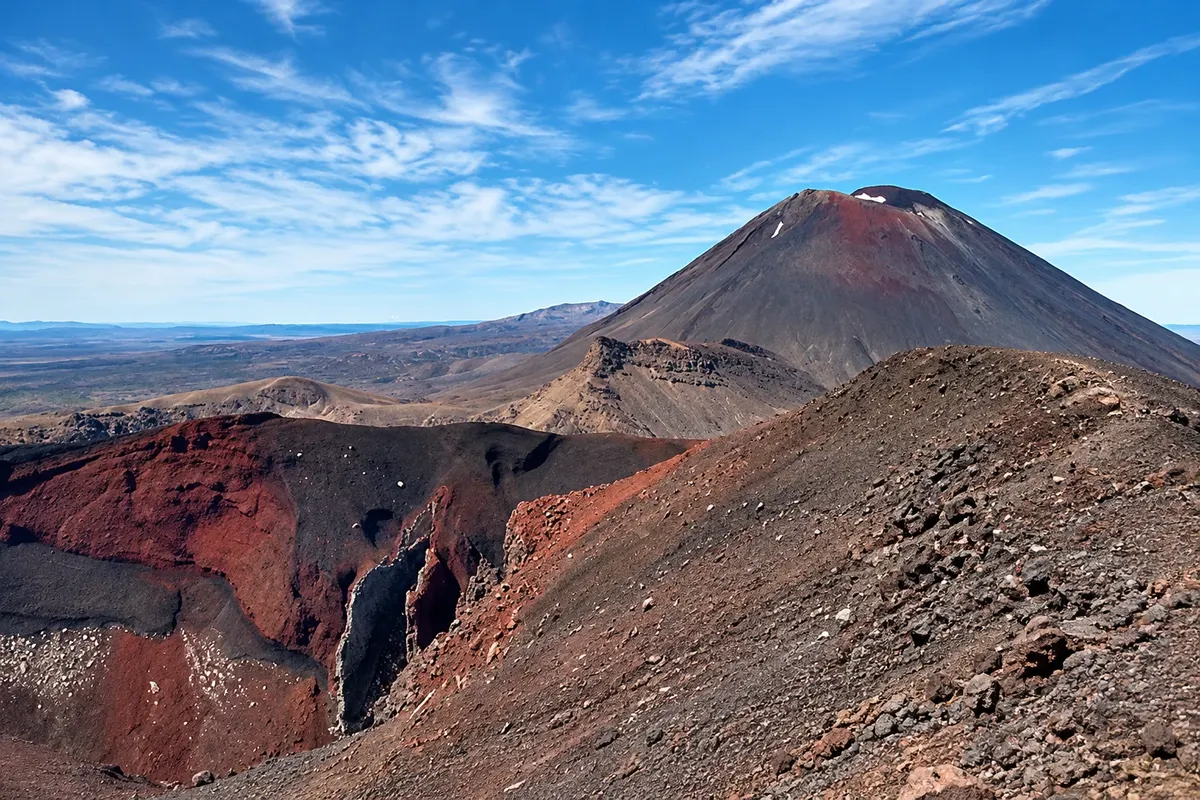
Trail · Whakapapa Village, Manawatū-Whanganui
Tongariro Alpine Crossing
A one-day hike of about 20 km through Tongariro National Park, across craters, lava fields, the Red Crater and the Emerald Lakes, with a climb up to about 1,886 meters.
Illustrative images. The pictures in this guide are illustrations based on the real place, not photographs, and may differ from it.



Discover
About Tongariro Alpine Crossing
The Tongariro Alpine Crossing traverses the Tongariro volcanic massif end to end, covering about 20 km in one direction. The route starts in the Mangatepopo valley at roughly 1,120 meters and finishes on the Ketetahi road on the north side after 6 to 8 hours of walking.
The first section climbs the valley between lava fields up to the Devil’s Staircase, a steep ascent that leads to the South Crater, a plain between Tongariro and the Ngāuruhoe cone. From there the path ascends to the Red Crater, the highest point at about 1,886 meters, with reddish rocks and steam emerging from the ground.
From the top you descend scree slopes to the Emerald Lakes, three craters filled with green water colored by minerals. Further on are the Blue Lake, sacred to the Māori, and the long descent down the northern slope with views of Lake Taupō, passing near the Ketetahi hot springs in an area closed to visitors.
The Department of Conservation (DOC) requires bookings for the crossing, and Mangatepopo car park has a four-hour limit: people doing the full route use vans that depart from Taupō, National Park and Whakapapa. Weather changes quickly, and outside summer the crossing demands alpine equipment and experience.
Before you go
Practical information
Cidade Turismo reviews its information regularly, but something may have changed. Check with the place before planning your trip.
How much time to set aside
About 6 to 8 hours of walking, plus return transport.
Best time
From December to April on days with stable forecasts, starting early. Check the mountain forecast the night before and on the day; with strong wind or low cloud, vans may cancel departures. From May to November, with snow and ice, only attempt with a guide or alpine experience.
How to get there
By van from Taupō, the village of National Park or Whakapapa, with morning departures to Mangatepopo and return pickups from Ketetahi in the late afternoon. Mangatepopo car park has a four-hour limit.
Tip
Book the crossing on the DOC website and reserve your van in advance. Bring warm layers, a windproof jacket, hat, gloves, sunscreen, plenty of water and food: there are no services along the route. Do not climb the summits or enter the lakes, which are sacred to the Māori.
Official website
Get your questions answered
Frequently asked questions about Tongariro Alpine Crossing
How long does the Tongariro Alpine Crossing take?
About 6 to 8 hours of walking, covering roughly 20 km one-way.
Do you need to book the Tongariro Alpine Crossing?
Yes. DOC asks that you book the crossing, and the shuttle vans also need to be reserved, especially in summer.
Can you park at the start of the Tongariro Alpine Crossing?
Mangatepopo car park has a four-hour limit, which is insufficient for the full crossing. That’s why shuttle vans that run from Taupō, National Park and Whakapapa are used.
Is the Tongariro Alpine Crossing difficult?
It’s demanding: there are steep climbs, sections of scree, and unstable weather. It requires good fitness, appropriate clothing and attention to the forecast.
Can you do the Tongariro Alpine Crossing in winter?
Only with snow equipment such as an ice axe and crampons and alpine experience, or with a hired guide.