Jequitinhonha Valley

MG · Brazil

Jequitinhonha Valley

The Jequitinhonha River valley, in the northeast of Minas Gerais: clay dolls, choirs of traditional songs, and Araçuaí, city of Brazil’s heat record.

Southeast

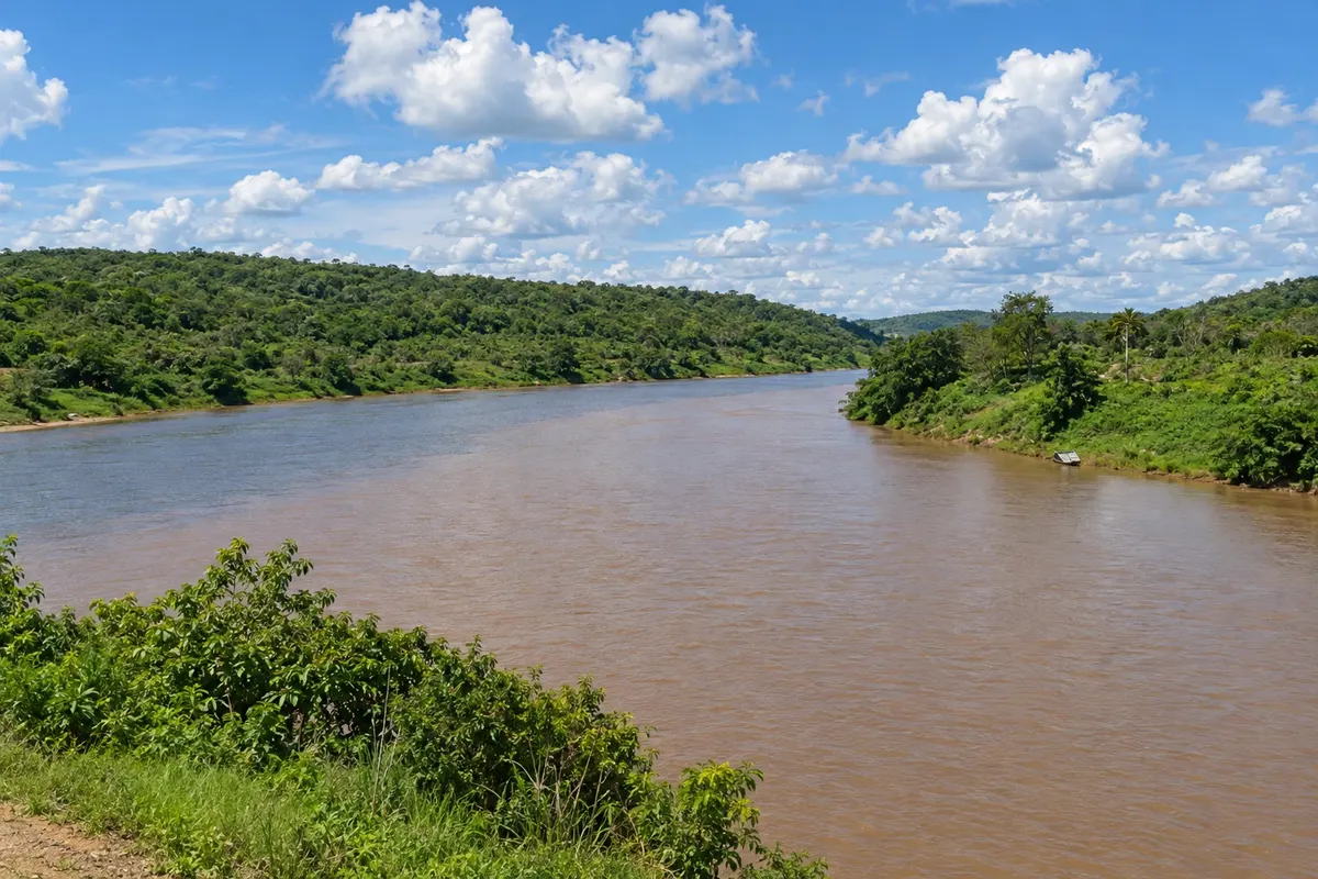
In the photo: Araçuaí and Jequitinhonha rivers in Itira, in the municipality of Araçuaí.

Illustrative images. The pictures in this guide are illustrations based on the real place, not photographs, and may differ from it.

Get to know the place

A region to enjoy
at your own pace.

The Jequitinhonha Valley is the region in the northeast of Minas Gerais watered by the Jequitinhonha River and its tributaries, such as the Araçuaí. The river rises in the Serra do Espinhaço and flows eastward toward Bahia, where it reaches the Atlantic. Along its course there are old towns, rural communities and a landscape of hills, plateaus and vegetation transitional between cerrado and caatinga.

The valley became known nationwide for its popular culture. The dolls and clay figures made by craftswomen in rural communities circulate in markets and museums, and each village has its own style. Choirs and groups that perform traditional songs preserve benditos, work songs and festive music collected in homes and on the farms.

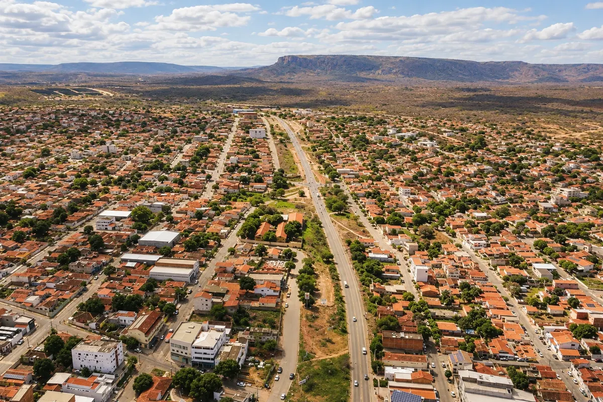
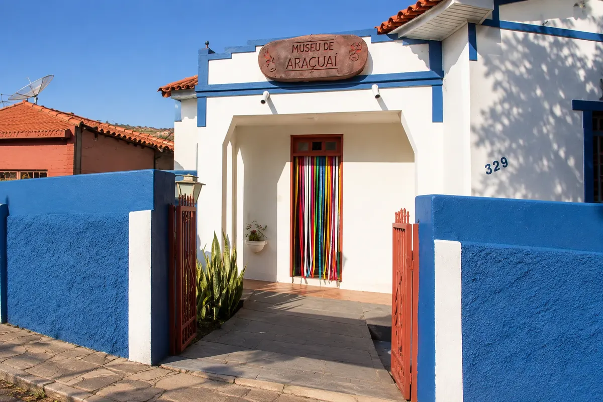
Araçuaí, on the banks of the river that gives it its name, is the main town of the Middle Jequitinhonha. There the Dutch Franciscan friar Frei Chico founded the Coral Trovadores do Vale and, together with artist Lira Marques, created the Araçuaí Museum, dedicated to the region’s religiosity and customs. The Festa do Rosário, with the brotherhood’s drummers, usually takes place in October.

The climate is hot and dry for much of the year. On November 19, 2023, the National Institute of Meteorology station in Araçuaí recorded 44.8 °C, the highest temperature ever measured in Brazil. Diamantina, high in the valley, belongs to another destination: the historical towns of Minas.

This destination brings together 1 city: Araçuaí.

Share: WhatsApp
Traveler, share your experiences through photos Up to 5 photos of each place you visited.

One destination, many paths

The cities on this trip

Start with one city or combine several in your itinerary.

Where Jequitinhonha Valley is The star marks the nearest capital, Belo Horizonte.
Belo HorizonteAraçuaí

Map: @svg-maps/brazil, CC BY 4.0

How to get there: Jequitinhonha Valley

Araçuaí is about 680 km from Belo Horizonte; the most used route passes through Diamantina and continues along BR-367. There are buses from Belo Horizonte to Araçuaí on a long trip. The region has no regular flights; access is usually by car or bus. Check roads and schedules before you go.

The local experience

Things to do in Jequitinhonha Valley

Before you go

Practical information

A little planning leaves more time to enjoy the journey.

When to go

From May to August temperatures are milder, with dry days and cool nights — a good time to get around the towns. From September to November the heat is intense, sometimes above 40 °C. Rainfall is usually concentrated from November to March. The Festa do Rosário in Araçuaí usually takes place in October.

The seasons shown are the most usual ones; nature doesn't always follow the calendar.

How many days to stay

Two days in Araçuaí are enough for the museum, the riverbank and, if the schedule helps, a choir performance. Those who want to visit the communities of clay craftswomen should allow more days and arrange the visit in advance. Given the distance from Belo Horizonte, the region is not suitable for a day trip.

Which city to stay in

Araçuaí concentrates most of the Middle Jequitinhonha’s accommodations, between hotels and pousadas in the center, near the square and the bus station. Staying downtown allows you to walk to the museum, the churches and the riverbank. In the rural artisan communities lodging is rare and must be arranged in advance.

Respect the place

Take your trash with you, follow the signs and support local businesses. In natural areas, follow the visiting guidelines.

Get your questions answered

Frequently asked questions about Jequitinhonha Valley

Where is the Jequitinhonha Valley located?

In the northeast of Minas Gerais, along the Jequitinhonha River and its tributaries, such as the Araçuaí. The river rises in the Serra do Espinhaço and continues to Bahia, where it flows into the Atlantic.

What was the highest temperature ever recorded in Brazil?

44.8 °C, measured by the National Institute of Meteorology in Araçuaí, in the Jequitinhonha Valley, on November 19, 2023. The previous record was 44.7 °C, in Bom Jesus, Piauí, in 2005.

What is the handicraft of the Jequitinhonha Valley?

The best known is clay work: dolls, brides, animals and figures of daily life modeled by craftswomen in rural communities, each with its own style. There are also embroidery, weaving and woodwork.

What is the best time to visit the Jequitinhonha Valley?

From May to August, when days are dry and temperatures milder. From September to November the heat tends to be strong, and rains are concentrated from November to March.

Do you need a car to travel around the Jequitinhonha Valley?

It helps a lot. There are buses between towns, but the rural artisan communities are far from the municipal centers and have limited transport.

Explore other destinations Search by state and city