

 Brazil
 Argentina
 Bolivia
 Chile
 Colombia
 Ecuador
 Guyana
 French Guiana
 Falkland Islands (Malvinas)
 Paraguay
 Peru
 Suriname
 Uruguay
 Venezuela
 Germany
 Austria
 Belgium
 Croatia
 Denmark
 Spain
 Finland
 France
 Greece
 the Netherlands
 Hungary
 Ireland
 Iceland
 Italy
 Luxembourg
 Norway
 Poland
 Portugal
 the United Kingdom
 the Czech Republic
 Sweden
 Switzerland
 Turkey
 the Dominican Republic
 South Africa
 Fiji
State · Veracruz e o Golfo
Veracruz
Veracruz, on the Gulf of Mexico: the historic port and the fortress of San Juan de Ulúa, El Tajín and the voladores of Papantla, Xalapa, Coatepec coffee and Tlacotalpan.
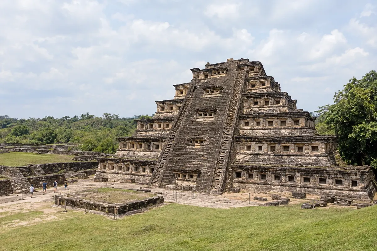
In the photo: Pyramid of the Niches, El Tajín
Illustrative images. The pictures in this guide are illustrations based on the real place, not photographs, and may differ from it.

The state
Get to know Veracruz
Veracruz stretches for more than 600 km along the Gulf of Mexico, from the coastal tropical plain to the mountains where Pico de Orizaba, the country's highest point, is located. It was there that the Spaniards arrived in 1519, and the state's culture blends indigenous, Spanish and African roots, with the music of son jarocho and the danzón.
The port of Veracruz has a historic center, a malecón and the fortress of San Juan de Ulúa, which defended the bay's entrance for centuries. The Carnival of Veracruz, held before Lent, is one of Mexico's liveliest. Tlacotalpan, on the banks of the Papaloapan River, is a town of houses with arcades painted in bright colors, a World Heritage Site.
In the north, El Tajín, a Totonac city and World Heritage Site, has the Pyramid of the Niches, with 365 niches on its façade. In Papantla, the voladores, an intangible UNESCO heritage, spin around a tall pole, suspended by ropes, in an ancient ceremony. Xalapa, the capital, houses the Museum of Anthropology with colossal Olmec heads, and nearby Coatepec is coffee country.
In the highlands, Pico de Orizaba, over 5,600 meters high, can be seen from afar on clear days, and in the south the Los Tuxtlas region has Lake Catemaco and tropical rainforest. At the table, pescado a la veracruzana with tomato, olives and capers, and the gulf's seafood.
When to go
From November to April there is less rain and the heat is more bearable on the coast, although northerly winds (nortes) can bring cool days and rough seas between October and March. From June to October there is heavy rain and it is hurricane season. Carnival takes place before Lent, in February or March. Veracruz is 3 hours behind Brasília.
Getting there
Veracruz airport (VER) receives flights from Mexico City and other cities. From the national capital, the port is about a 5-hour bus ride, and Xalapa about 4 hours. Papantla and El Tajín are about 4 hours from the port, and are closer to Poza Rica airport. Tlacotalpan is about an hour and a half south of the port.
Your questions
Frequently asked questions about Veracruz
How many days to set aside for Veracruz?
Four to five days allow for the port and Tlacotalpan, Xalapa and Coatepec, and El Tajín with Papantla.
When to see the voladores of Papantla?
The voladores perform at El Tajín and in Papantla throughout the year, at times that vary. Confirm before you go.
When is the Carnival of Veracruz?
Before Lent, in February or March, with parades along the port's malecón.
What to try in Veracruz?
Pescado a la veracruzana, the Gulf seafood and, in Coatepec, the highland coffee.