

 Brazil
 Antarctica
 Argentina
 Bolivia
 Chile
 Colombia
 Ecuador
 Guyana
 French Guiana
 Falkland Islands (Malvinas)
 Paraguay
 Peru
 Suriname
 Uruguay
 Venezuela
 Germany
 Austria
 Belgium
 Croatia
 Denmark
 Slovakia
 Slovenia
 Spain
 Finland
 France
 Greece
 the Netherlands
 Hungary
 Ireland
 Iceland
 Luxembourg
 Norway
 Poland
 Portugal
 the United Kingdom
 the Czech Republic
 Sweden
 Switzerland
 Turkey
 Bermuda
 Canada
 the United States
 Greenland
 Mexico
 Saint Pierre and Miquelon
 the Dominican Republic
 Japan
 South Africa
 Egypt
 Australia
 Fiji
 New Zealand
 Papua New Guinea
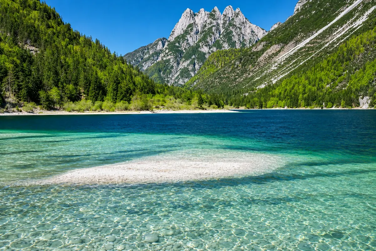
Lakes · Tarvisio, Friuli Venezia Giulia
Lakes of Fusine
Two glacial lakes in a wooded valley of the Julian Alps, with trails along the shore and views of the rocky walls of the Mangart group.
In the photo: Laghi di Fusine, in Tarvisio.
Illustrative images. The pictures in this guide are illustrations based on the real place, not photographs, and may differ from it.

Discover
About Lakes of Fusine
The Laghi di Fusine occupy a forested valley in the municipality of Tarvisio. Lago Inferiore is next to the arrival by road. Lago Superiore is higher up, behind the strip of woodland that separates the two. The rocky walls of the Mangart group appear above the treetops and give scale to the basin. The mountains’ position relative to the shore changes noticeably as you walk.
The lakes formed in glacially shaped terrain. The path brings visitors close to the water and then climbs between trees. From shore level, note the transition from riparian vegetation to the denser forest and the boulders that appear near the trail. The water’s color varies with the light and the sky, especially where the forest forms the background.
You can explore only the shore of the lower lake. To link the two, follow the footpath signs across boardwalks and dirt sections with roots, stones and small steps. The ascent from one lake to the other requires sturdy footwear. The car route and the walking return have different accesses, so check your starting point when you park.
The access road leaves from Fusine Valromana. If you come by bike, expect the paved climb and plan the walk separately. Take water and a protective layer, since shade accompanies part of the circuit. On cold days or after rain, prefer sections with firm ground and confirm access before leaving Tarvisio.
Before you go
Practical information
Cidade Turismo reviews its information regularly, but something may have changed. Check with the place before planning your trip.
How much time to set aside
About 2 hours for the short circuit, allowing time to stop at the shores.
Best time
From June to September, during daylight. In May or October, check trail condition. After rain, look for a firm section beside the lower lake.
How to get there
Leave Tarvisio on the SS54 toward Fusine Valromana. Follow the Laghi di Fusine signs up the paved climb to the marked parking areas.
Tip
Wear shoes with grip for roots and stones. Check vehicle access rules and the condition of boardwalks before you set out.
Official website
Your questions
Frequently asked questions about Lakes of Fusine
Are there two lakes accessible on the same walk?
Yes. Start at the lower lake and follow the signs on foot to the upper one.
Is the route fully paved?
The access road is paved. Trails beside the water include dirt, stones and boardwalks.
What to do if you have little time?
Stay at the lower lake and walk a stretch along the shore from the access point.
Can you go by bicycle?
The Fusine Valromana road leads to the lakes via a climb. Plan the return on foot along the shores.
Beyond the guide


