

 Brazil
 Antarctica
 Argentina
 Bolivia
 Chile
 Colombia
 Ecuador
 Guyana
 French Guiana
 Falkland Islands (Malvinas)
 Paraguay
 Peru
 Suriname
 Uruguay
 Venezuela
 Germany
 Austria
 Belgium
 Croatia
 Denmark
 Slovakia
 Slovenia
 Spain
 Finland
 France
 Greece
 the Netherlands
 Hungary
 Ireland
 Iceland
 Italy
 Luxembourg
 Norway
 Poland
 Portugal
 the United Kingdom
 the Czech Republic
 Sweden
 Switzerland
 Turkey
 Bermuda
 Canada
 the United States
 Mexico
 the Dominican Republic
 South Africa
 Egypt
 Australia
 Fiji
 New Zealand
 Papua New Guinea
Natural landscape · Qeqertarsuaq, Qeqertalik
Kuannit
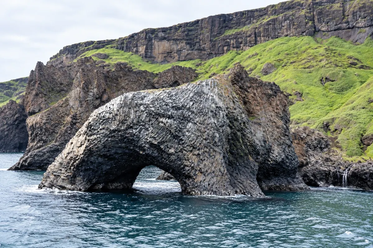
A stretch of coast east of Qeqertarsuaq with basalt formations, columns, caves and slopes covered with angelica in summer, reached by trail from town.
Illustrative images. The pictures in this guide are illustrations based on the real place, not photographs, and may differ from it.




Discover
About Kuannit
Kuannit is a stretch of the southern coast of Disko Island, east of Qeqertarsuaq, where basalt layers of volcanic origin form columns, reddish cliffs and small sea caves along the shore.
In summer, the slopes become very green by Greenlandic standards, covered with angelica, a tall plant that locals harvest and use in cooking. The name Kuannit comes precisely from this plant.
The trail starts from town and follows the coast, with short ups and downs. Along the way it’s common to see seabirds and, in the warm months, whales near the shore and icebergs drifting in the bay.
It’s one of Qeqertarsuaq’s easiest hikes and pairs well with a visit to town on a fine day.
Before you go
Practical information
Cidade Turismo reviews its information regularly, but something may have changed. Check with the place before planning your trip.
How much time to set aside
Three to four hours, round trip.
Best time
From July to September, when the slopes are green and the trail is dry.
How to get there
On foot, along the trail that leaves Qeqertarsuaq and follows the coast.
Tip
Stay on the trails and away from cliff edges: the basalt crumbles and stones can fall.
Get your questions answered
Frequently asked questions about Kuannit
What can you see in Kuannit?
Basalt columns and cliffs, sea caves and slopes covered in angelica in summer.
Is the Kuannit trail difficult?
It’s one of the region’s easiest, along the coast with short climbs. It takes three to four hours round trip.
Where does the name Kuannit come from?
From angelica, the plant that covers the slopes in summer and is used in the local cuisine.