

 Brazil
 Argentina
 Bolivia
 Chile
 Colombia
 Ecuador
 Guyana
 French Guiana
 Falkland Islands (Malvinas)
 Paraguay
 Peru
 Suriname
 Uruguay
 Venezuela
 Germany
 Austria
 Belgium
 Croatia
 Denmark
 Slovakia
 Slovenia
 Spain
 Finland
 France
 Greece
 the Netherlands
 Hungary
 Ireland
 Iceland
 Italy
 Luxembourg
 Norway
 Poland
 Portugal
 the United Kingdom
 the Czech Republic
 Sweden
 Switzerland
 Turkey
 Bermuda
 Canada
 Mexico
 the Dominican Republic
 South Africa
 Egypt
 Australia
 Fiji
 New Zealand
 Papua New Guinea
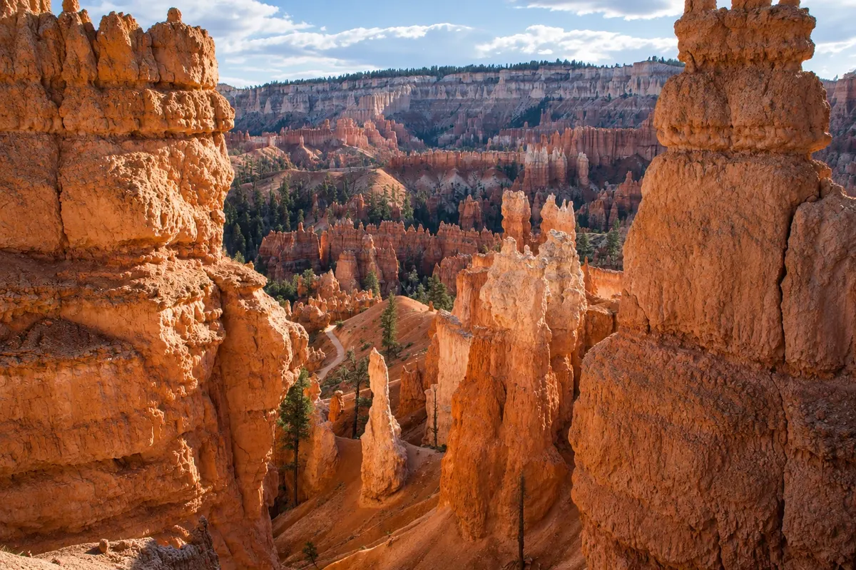
Trail · Bryce Canyon City, Utah
Navajo Loop and Queen's Garden
Two linked trails that descend from the rim to the bottom of Bryce’s amphitheater, winding among the pinnacles, with the Wall Street corridors and the Queen Victoria formation. About 4.6 km in length.
Illustrative images. The pictures in this guide are illustrations based on the real place, not photographs, and may differ from it.



Discover
About Navajo Loop and Queen's Garden
The Navajo Loop and Queen's Garden combination is the most popular way to enter Bryce’s amphitheater and walk among the pinnacles, rather than just viewing them from above. The route is about 4.6 km and links Sunrise Point to Sunset Point across the amphitheater floor.
The gentler descent is via Queen's Garden from Sunrise Point. The trail passes short tunnels cut into the rock and reaches a formation that resembles Queen Victoria seated on a throne, which gives the section its name. On the floor, the path crosses a stand of pine trees between the colorful walls.
The return climb is by the Navajo Loop, which has two branches. Wall Street climbs through a narrow, shaded corridor between cliffs, with tall pines growing on the floor in sharp switchbacks; Two Bridges passes under natural rock bridges and near Thor's Hammer. One of the branches can be closed due to rockfall or in winter; check at the visitor center.
The trail is dirt and gravel, with an uphill of about 180 meters at the end, which feels heavy at altitude.
Before you go
Practical information
Cidade Turismo reviews its information regularly, but something may have changed. Check with the place before planning your trip.
How much time to set aside
Two to three hours.
Best time
In the morning, after sunrise at Sunrise Point. In winter, use ice grips on your boots.
How to get there
The start is at Sunrise Point and the end at Sunset Point, about 800 meters apart along the Rim Trail. Both have parking and a shuttle stop in season.
Tip
Descend via Queen's Garden and ascend via Navajo Loop: the uphill is shorter but steeper. Bring water; there are no refill points on the floor.
Official website
Get your questions answered
Frequently asked questions about Navajo Loop and Queen's Garden
Is the Navajo Loop with Queen's Garden trail difficult?
It’s moderate: about 4.6 km, with a climb of roughly 180 meters at the end, at over 2,400 meters elevation. Older children and adults with some fitness usually manage it without problems.
Is the Wall Street section open?
It closes sometimes due to rockfalls and is often closed in winter. When closed, the return route is via the Two Bridges spur. Check at the visitor center.
Which direction should I do the Navajo Loop with Queen's Garden?
The most common is to descend via Queen's Garden from Sunrise Point and climb the Navajo Loop up to Sunset Point, which has the shorter ascent.