

 Brazil
 Argentina
 Bolivia
 Chile
 Colombia
 Ecuador
 Guyana
 French Guiana
 Falkland Islands (Malvinas)
 Paraguay
 Peru
 Suriname
 Uruguay
 Venezuela
 Germany
 Austria
 Belgium
 Croatia
 Denmark
 Slovakia
 Slovenia
 Spain
 Finland
 France
 Greece
 the Netherlands
 Hungary
 Ireland
 Iceland
 Italy
 Luxembourg
 Norway
 Poland
 Portugal
 the United Kingdom
 the Czech Republic
 Sweden
 Switzerland
 Turkey
 Canada
 Mexico
 the Dominican Republic
 South Africa
 Australia
 Fiji
 New Zealand
 Papua New Guinea
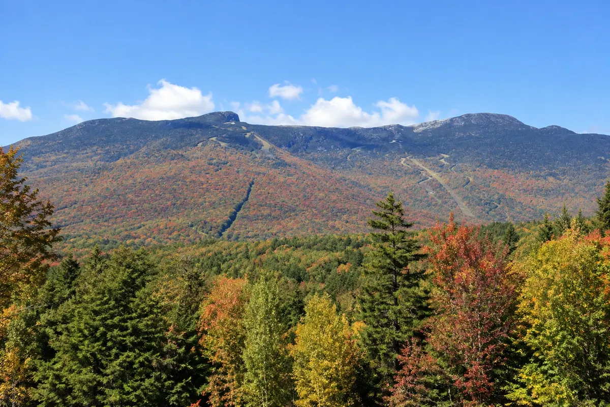
Mountain · Stowe, Vermont
Mount Mansfield
Vermont’s highest point, at 1,339 meters, whose ridge resembles a profile of a face. At the top there is an area of alpine tundra; the east slope is the Stowe ski area.
Illustrative images. The pictures in this guide are illustrations based on the real place, not photographs, and may differ from it.



Discover
About Mount Mansfield
Mount Mansfield is about 1,339 meters high and is Vermont’s highest point. Seen from the east or the west, the ridge profile resembles a lying face, so the peaks carry names of facial parts: the Forehead to the south, the Nose, the Lips, the Chin, which is the summit, and the Adam’s Apple to the north.
At the top of the ridge there are roughly 80 hectares of alpine tundra, low-growing vegetation that has persisted since the last ice age and is one of the few areas of this kind in Vermont. The Long Trail, which crosses the state from south to north, follows the ridge. Visitors should walk only on rocks and marked trails to avoid trampling the plants.
The east slope is occupied by the Stowe ski area, one of the oldest in the United States, with runs opened in the 1930s. In summer and fall, a toll road of about 7 km, mostly unpaved and with tight turns, climbs to near the Nose, and a gondola lift takes visitors to another point on the slope.
From the summit, on clear days, the view reaches Lake Champlain, the Adirondack Mountains, New Hampshire’s White Mountains and Quebec.
Before you go
Practical information
Cidade Turismo reviews its information regularly, but something may have changed. Check with the place before planning your trip.
How much time to set aside
Half a day to go up by car or gondola and walk the ridge; a full day to hike to the summit on foot.
Best time
From mid-summer to mid-October, when the road and gondola usually operate, on clear days. Weather changes quickly at the top. In winter the mountain is a ski area.
How to get there
The toll road and gondola depart from Mountain Road (Route 108), about 11 km from Stowe village. The road and gondola are paid and operate in season; check schedules and operating days before you go.
Tip
Bring a jacket and hiking footwear even in summer: it’s windy and cold on the ridge. Stay on trails and rocks to protect the alpine tundra.
Official website
Get your questions answered
Frequently asked questions about Mount Mansfield
How high is Mount Mansfield?
About 1,339 meters. It is the highest point in Vermont.
Can you drive up Mount Mansfield?
Yes, via the ski area’s toll road, open in season, which reaches near the Nose. From the parking lot, a walk along the ridge leads to the Chin, the highest point.
Why does Mount Mansfield look like a face?
The ridge, seen from the side, forms a profile with forehead, nose, lips, chin and Adam’s apple, and the peaks were given those names.