

 Brazil
 Argentina
 Bolivia
 Chile
 Colombia
 Ecuador
 Guyana
 French Guiana
 Falkland Islands (Malvinas)
 Paraguay
 Peru
 Suriname
 Uruguay
 Venezuela
 Germany
 Austria
 Belgium
 Croatia
 Denmark
 Slovakia
 Slovenia
 Spain
 Finland
 France
 Greece
 the Netherlands
 Hungary
 Ireland
 Iceland
 Italy
 Luxembourg
 Norway
 Poland
 Portugal
 the United Kingdom
 the Czech Republic
 Sweden
 Switzerland
 Turkey
 Canada
 Mexico
 the Dominican Republic
 South Africa
 Australia
 Fiji
 New Zealand
 Papua New Guinea
National park · Kahului, Hawaii
Haleakalā National Park
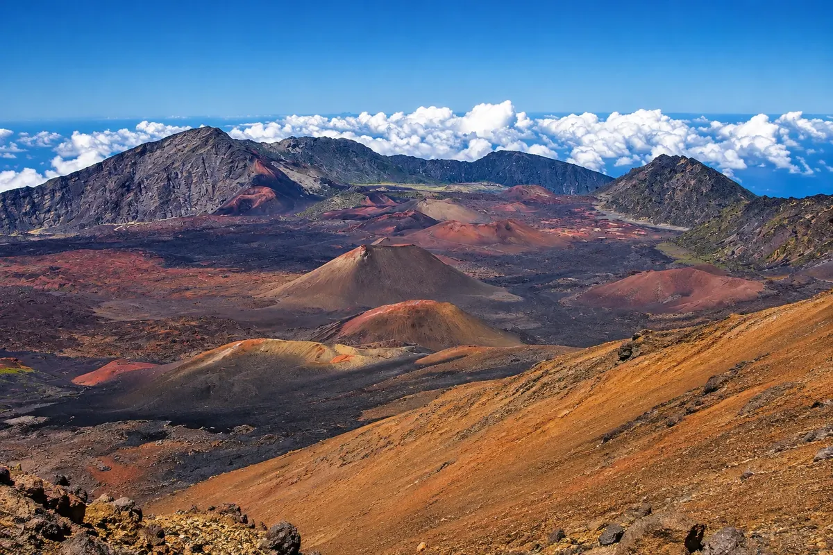
The park of the volcano that forms eastern Maui, with a summit at 3,055 meters. At the top a large depression of red cones, sunrise above the clouds, trails across volcanic sand and the ʻāhinahina plant, which exists only there.
Illustrative images. The pictures in this guide are illustrations based on the real place, not photographs, and may differ from it.



Discover
About Haleakalā National Park
Haleakalā means "house of the sun" in Hawaiian. According to tradition, it was atop the mountain that the demigod Maui lassoed the sun to lengthen the days. The volcano forms most of Maui, and its highest point, Puʻu ʻUlaʻula, reaches 3,055 meters. It’s about 60 km from Kahului via a winding paved road.
The summit features a large depression roughly 11 km long and nearly 800 meters deep, opened by erosion and later partly filled by eruptions. The floor is covered with ash cones in shades of red, ochre and gray. The Sliding Sands and Halemauʻu trails descend into the interior, and you need good lungs for the return at high altitude.
The park protects species found only on the islands, such as the ʻāhinahina, a silvery plant that blooms once and then dies, and the nēnē, the Hawaiian goose, reintroduced to the area in 1962. Near the summit, outside park boundaries, are the University of Hawaiʻi observatories.
Sunrise, seen from the visitor center or the summit, is the most sought-after experience: to enter by car at that time you must book a reservation in advance. Sunset and stargazing also attract visitors. The park also includes the Kīpahulu district on the coast near Hana, reached by a different road.
Before you go
Practical information
Cidade Turismo reviews its information regularly, but something may have changed. Check with the place before planning your trip.
How much time to set aside
Half a day to go up, see the summit and do a short trail; a full day to descend via the Sliding Sands trail.
Best time
Dawn, with a reservation, or late afternoon, when clouds often sit below the summit. Mornings tend to have clearer skies than afternoons. Temperatures at the top can be near zero before sunrise, at any time of year.
How to get there
From Kahului, take routes 37, 377 and 378—about 60 km and two hours’ drive to the summit. There is no public transport. Entry is by vehicle and valid for several days; sunrise reservations are made on recreation.gov. Check the park website.
Tip
Bring a jacket, hat and gloves for dawn. Fill the tank before driving up: there are no gas stations or food services on the park road. Do not approach the ʻāhinahina plants or the geese.
Official website
Get your questions answered
Frequently asked questions about Haleakalā National Park
What is the elevation of Haleakalā?
The highest point, Puʻu ʻUlaʻula, is 3,055 meters. The summit visitor center is a little lower, at about 2,970 meters.
Is it cold at the top of Haleakalā?
Yes. Before sunrise temperatures can approach 0 °C, with wind. Bring a jacket, hat and gloves even in summer.
How long from Kahului to the Haleakalā summit?
About a two-hour drive, on a winding road of roughly 60 km.