

 Brazil
 Argentina
 Bolivia
 Chile
 Colombia
 Ecuador
 Guyana
 French Guiana
 Falkland Islands (Malvinas)
 Paraguay
 Peru
 Suriname
 Uruguay
 Venezuela
 Germany
 Austria
 Belgium
 Croatia
 Denmark
 Spain
 Finland
 France
 Greece
 the Netherlands
 Hungary
 Ireland
 Iceland
 Italy
 Luxembourg
 Norway
 Poland
 Portugal
 the United Kingdom
 the Czech Republic
 Sweden
 Switzerland
 Turkey
 the Dominican Republic
 South Africa
 Fiji
State · Bajío e cidades coloniais
Aguascalientes
Aguascalientes, in central Mexico: the Feria de San Marcos in April and May, the cathedral on Plaza de la Patria, the José Guadalupe Posada museum and the National Museum of Death.
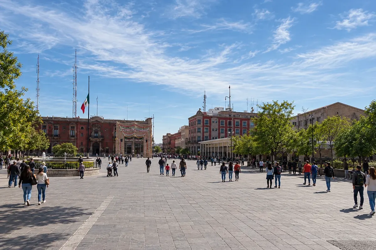
In the photo: Plaza de la Patria, Aguascalientes
Illustrative images. The pictures in this guide are illustrations based on the real place, not photographs, and may differ from it.

The state
Get to know Aguascalientes
Aguascalientes is one of the smaller states in Mexico, on the central-northern plateau, at about 1,900 meters above sea level. The name comes from the hot springs that existed where the city was founded in the 16th century, on the route that carried silver from the northern mines to the capital.
The capital, also called Aguascalientes, has its center around Plaza de la Patria, with the baroque cathedral and the red stone Government Palace, with murals in the courtyard. Nearby is the museum dedicated to José Guadalupe Posada, the engraver who created the elegant skull that gave rise to La Catrina, and the National Museum of Death, with objects linked to the cult of the dead in Mexico.
The Feria Nacional de San Marcos, between April and May, is one of the country's largest popular festivals, with bullfights, musical performances, exhibitions and the Jardín de San Marcos filled with people. Outside the capital, Real de Asientos is a mining village with cobbled streets, and Calvillo is known for its guavas and its embroidery.
Aguascalientes sits in the middle of the Bajío and pairs well with Zacatecas, about 120 km away, and with Guanajuato and San Miguel de Allende further south. On the table, San Marcos–style chicken and guava sweets.
When to go
From October to May there is little rain and days are usually sunny, with cold nights from December to February. The Feria de San Marcos usually runs from mid-April to mid-May. From June to September it rains in the afternoons. Aguascalientes is 3 hours behind Brasília.
Getting there
Aguascalientes airport (AGU) receives flights from Mexico City and other cities in the country. By bus, the city is about 6 hours from the national capital, and less than 2 hours from Zacatecas and León. The roads of the Bajío are good for those who want to combine the colonial cities by car.
Your questions
Frequently asked questions about Aguascalientes
When is the Feria de San Marcos?
It usually takes place between mid-April and mid-May, with a program that changes each year. Confirm the dates before traveling.
Who was José Guadalupe Posada?
A Mexican engraver who created the elegant skull that gave rise to La Catrina, one of the symbols of the Day of the Dead. The city has a museum dedicated to him.
Can Aguascalientes be combined with Zacatecas?
Yes. Zacatecas is about 120 km away, roughly a 2-hour drive.
Is it cold in Aguascalientes?
Nights from December to February are usually cold because of the altitude. During the day, the sun warms things up.