

 Brazil
 Argentina
 Bolivia
 Chile
 Colombia
 Ecuador
 Guyana
 French Guiana
 Falkland Islands (Malvinas)
 Paraguay
 Peru
 Suriname
 Uruguay
 Venezuela
 Germany
 Austria
 Belgium
 Croatia
 Denmark
 Slovakia
 Slovenia
 Spain
 Finland
 France
 Greece
 the Netherlands
 Hungary
 Ireland
 Iceland
 Italy
 Luxembourg
 Norway
 Poland
 Portugal
 the United Kingdom
 the Czech Republic
 Sweden
 Switzerland
 Turkey
 Canada
 Mexico
 the Dominican Republic
 South Africa
 Australia
 Fiji
 New Zealand
 Papua New Guinea
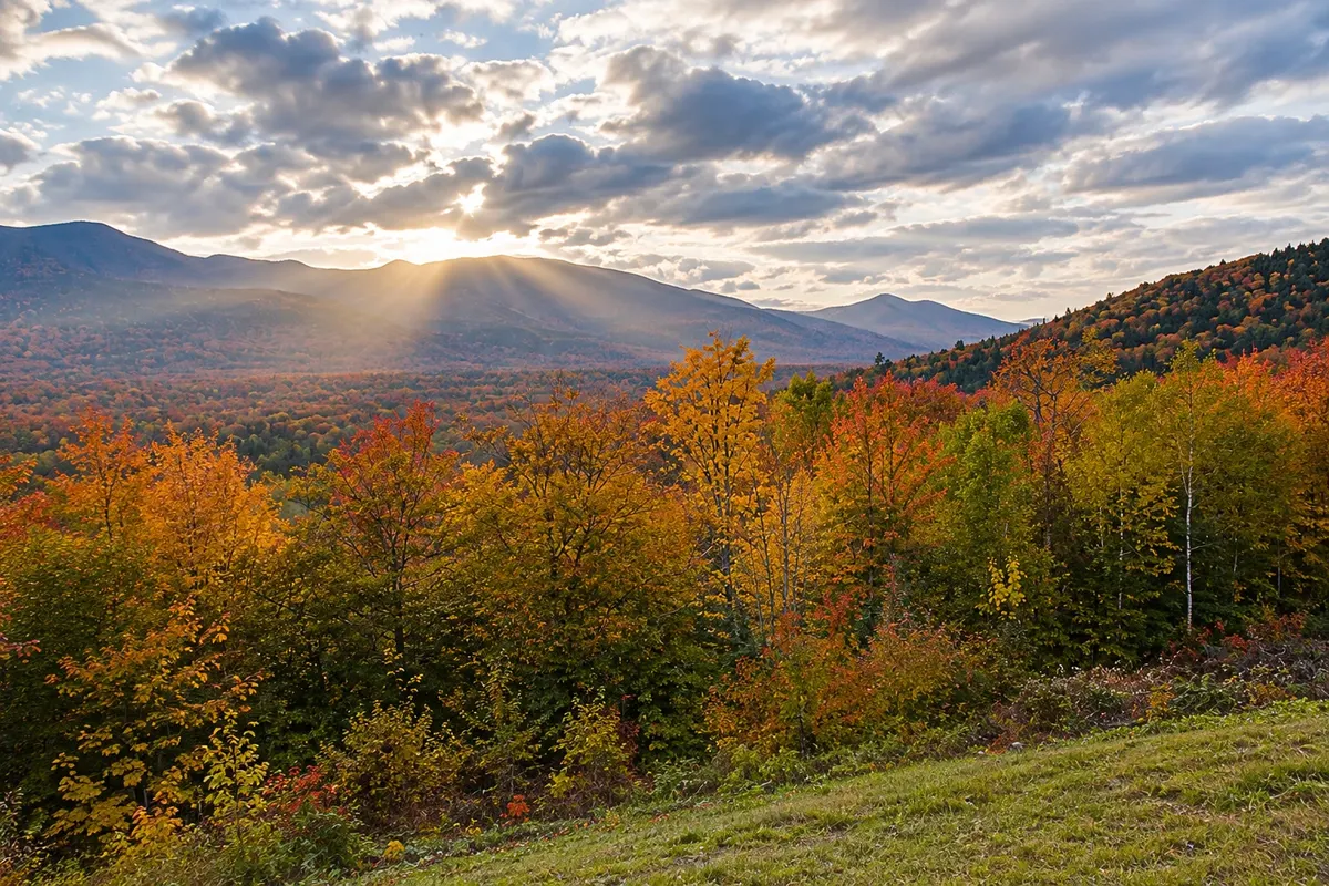
Scenic drive · Lincoln, New Hampshire
Kancamagus Highway
A mountain road over 50 km long between Lincoln and Conway, with no towns or gas stations along the way, crossing the White Mountain National Forest with viewpoints, waterfalls and rivers running over bedrock.
Illustrative images. The pictures in this guide are illustrations based on the real place, not photographs, and may differ from it.



Discover
About Kancamagus Highway
The Kancamagus Highway is the section of Route 112 between Lincoln and Conway, running for more than 50 km through the White Mountain National Forest. Opened in 1959, it is named for Kancamagus, leader of the Penacook confederation in the late 17th century. It is a national scenic byway and has no towns, hotels or gas stations along the route.
Leaving Lincoln, the road climbs in curves to Kancamagus Pass, at 870 meters, the highest point. Near the summit are overlooks with views of the Pemigewasset and Sandwich ranges, the most popular spots to see fall colors. After that the road descends following the Swift River.
Heading east there are short stops: the trail to Sabbaday Falls, which drops through a narrow gorge; Lower Falls and Rocky Gorge, where the river flows over slabs of granite; and the Albany covered wooden bridge near the eastern end.
In winter the road remains open and is plowed, but it can close for a few hours during storms. In the national forest parking areas you must display a paid day-use pass.
Before you go
Practical information
Cidade Turismo reviews its information regularly, but something may have changed. Check with the place before planning your trip.
How much time to set aside
About an hour and a half without stops; half a day or a full day with the overlooks, waterfalls and a short hike.
Best time
In autumn, when colors usually peak between late September and mid-October; weekends are very busy then. In summer the rivers attract people who want to swim in cold water.
How to get there
It begins at exit 32 off I-93 in Lincoln and ends in Conway on Route 16. A car is required. Parking at overlooks and visitor areas requires a paid national forest day-use pass; check where to buy one.
Tip
Fill your tank before you go — there are no gas stations on the route. Drive early on foliage weekends to avoid traffic.
Official website
Get your questions answered
Frequently asked questions about Kancamagus Highway
How long is the Kancamagus Highway?
More than 50 km between Lincoln and Conway, along Route 112, with no towns or gas stations en route.
Do you have to pay to drive the Kancamagus Highway?
Driving the road is free, but parking at overlooks and in U.S. Forest Service recreation areas requires a paid daily pass.
Is the Kancamagus Highway open in winter?
Yes, it is plowed, but it can close for several hours during storms. Drive with tires suitable for winter conditions.
What are the best stops on the Kancamagus Highway?
The overlooks near Kancamagus Pass, the Sabbaday Falls trail, Lower Falls, Rocky Gorge and the Albany covered bridge.