

 Brazil
 Argentina
 Bolivia
 Chile
 Colombia
 Ecuador
 Guyana
 French Guiana
 Falkland Islands (Malvinas)
 Paraguay
 Peru
 Suriname
 Uruguay
 Venezuela
 Germany
 Austria
 Belgium
 Croatia
 Denmark
 Slovakia
 Slovenia
 Spain
 Finland
 France
 Greece
 the Netherlands
 Hungary
 Ireland
 Iceland
 Italy
 Luxembourg
 Norway
 Poland
 Portugal
 the United Kingdom
 the Czech Republic
 Sweden
 Switzerland
 Turkey
 Canada
 Mexico
 the Dominican Republic
 South Africa
 Australia
 Fiji
 New Zealand
 Papua New Guinea
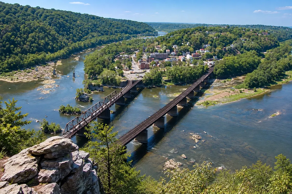
Trail and viewpoint · Harpers Ferry, West Virginia
Maryland Heights
A steep trail on the Maryland side of the Potomac that climbs to a rock viewpoint over Harpers Ferry and the river confluence.
Illustrative images. The pictures in this guide are illustrations based on the real place, not photographs, and may differ from it.



Discover
About Maryland Heights
Maryland Heights is the slope that rises on the Maryland side of the Potomac, opposite Harpers Ferry. During the Civil War, Union forces placed cannons on the heights, and remnants of fortifications and artillery positions can still be seen along the trails.
To reach it you cross the river on the pedestrian bridge beside the railroad from the lower town. The trail starts on the former C&O Canal path and climbs through forest to a rock viewpoint with the best‑known view of Harpers Ferry: the town, the bridges and the meeting of the Shenandoah and Potomac.
The round trip to the viewpoint is about 7 km with a steep elevation gain; a longer loop passes the fortifications on the heights.
The cliffs of Maryland Heights are also used by licensed climbers.
Before you go
Practical information
Cidade Turismo reviews its information regularly, but something may have changed. Check with the place before planning your trip.
How much time to set aside
Two to four hours.
Best time
Spring and fall, in the morning, with light on the town. In summer, start early to avoid the heat.
How to get there
On foot, leaving from Harpers Ferry’s lower town and crossing the pedestrian bridge over the Potomac to the canal path.
Tip
Bring water and trail shoes: the climb is steep and rocky. Do not approach the edge of the viewpoint.
Official website
Get your questions answered
Frequently asked questions about Maryland Heights
Is the Maryland Heights trail difficult?
It’s moderate to difficult: about 7 km round trip to the overlook, with a steep climb.
Where does the Maryland Heights trail start?
From the C&O Canal towpath on the other side of the Potomac, after the pedestrian bridge that leads out of the lower town of Harpers Ferry.
What can you see from the Maryland Heights overlook?
The town of Harpers Ferry, the bridges, and the meeting of the Shenandoah and Potomac rivers.