

 Brazil
 Argentina
 Bolivia
 Chile
 Colombia
 Ecuador
 Guyana
 French Guiana
 Falkland Islands (Malvinas)
 Paraguay
 Peru
 Suriname
 Uruguay
 Venezuela
 Germany
 Austria
 Belgium
 Croatia
 Denmark
 Slovakia
 Slovenia
 Spain
 Finland
 France
 Greece
 the Netherlands
 Hungary
 Ireland
 Iceland
 Italy
 Luxembourg
 Norway
 Poland
 Portugal
 the United Kingdom
 the Czech Republic
 Sweden
 Switzerland
 Turkey
 Canada
 Mexico
 the Dominican Republic
 South Africa
 Australia
 Fiji
 New Zealand
 Papua New Guinea
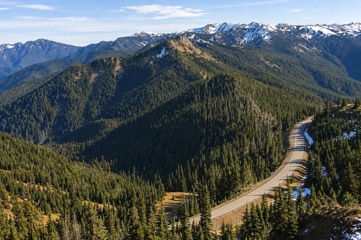
Viewpoint · Port Angeles, Washington State
Hurricane Ridge
A mountain ridge about 1,600 meters above sea level in Olympic National Park, 27 km from Port Angeles by a winding road. At the top, summer wildflower meadows, short trails and views of the snow-covered Olympic Mountains and their glaciers.
Illustrative images. The pictures in this guide are illustrations based on the real place, not photographs, and may differ from it.



Discover
About Hurricane Ridge
Hurricane Ridge is the most accessible part of the Olympic Mountains. A paved road of about 27 km climbs from Port Angeles, passes the park entrance at Heart O' the Hills and ends at a parking area around 1,600 meters in elevation. The name comes from the strong winds that blow along the ridge, especially in winter.
From the top, views open to the south over the park’s valleys and peaks, such as the Bailey Range and the mass of Mount Olympus, with its glaciers. To the north, you can see the Strait of Juan de Fuca and, on a clear day, Vancouver Island, Canada. In the meadows it’s common to see black-tailed deer grazing and Olympic marmots, a species found only on this peninsula.
Several short trails start from the parking area. The most popular is Hurricane Hill, paved, about 2.6 km each way with roughly 200 meters of elevation gain to a summit with views in all directions. In summer the meadows bloom, generally from July to August. In winter the area offers cross-country skiing, snowshoeing and a small ski area with surface lifts.
The visitor center building that stood at the top was destroyed by a fire in 2023. The road and trails remain open in season, with restrooms at the parking area.
Before you go
Practical information
Cidade Turismo reviews its information regularly, but something may have changed. Check with the place before planning your trip.
How much time to set aside
Half a day, counting the drive up, stops at viewpoints and the Hurricane Hill trail.
Best time
From July to September, when the road is usually free of snow and the meadows are in bloom. Mornings tend to have fewer clouds and fewer cars. In winter the road opens only some days of the week depending on conditions, and tire chains may be required: check before you go.
How to get there
From Port Angeles, follow Race Street, which becomes Mount Angeles Road, to Hurricane Ridge Road: about 27 km and 45 minutes by car. In summer there is a special bus service from downtown Port Angeles. Park entrance fees apply; check the park website.
Tip
Stop at the park visitor center at the base of the road in Port Angeles to check current conditions. Bring warm clothing, because the wind on the ridge cools even August afternoons. Do not feed the deer or the marmots.
Official website
Get your questions answered
Frequently asked questions about Hurricane Ridge
How do you get to Hurricane Ridge?
By car from Port Angeles via a roughly 27 km road that climbs to about 1,600 meters. In summer there is a special shuttle bus service from downtown.
Does the Hurricane Ridge road open in winter?
Only on some days of the week and depending on snow and wind, with tire chains required. In summer the road is open daily. Check before you go.
What is the most famous trail at Hurricane Ridge?
Hurricane Hill, paved, about 2.6 km each way, with views of the Olympic Mountains and the Strait of Juan de Fuca.