

 Brazil
 Argentina
 Bolivia
 Chile
 Colombia
 Ecuador
 Guyana
 French Guiana
 Falkland Islands (Malvinas)
 Paraguay
 Peru
 Suriname
 Uruguay
 Venezuela
 Germany
 Austria
 Belgium
 Croatia
 Denmark
 Slovakia
 Slovenia
 Spain
 Finland
 France
 Greece
 the Netherlands
 Hungary
 Ireland
 Iceland
 Italy
 Luxembourg
 Norway
 Poland
 Portugal
 the United Kingdom
 the Czech Republic
 Sweden
 Switzerland
 Turkey
 Canada
 Mexico
 the Dominican Republic
 South Africa
 Australia
 Fiji
 New Zealand
 Papua New Guinea
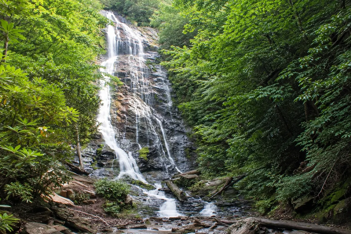
Waterfall · Cherokee, North Carolina
Mingo Falls
Approximately 37-meter waterfall in the Qualla Boundary, near Cherokee, reached by a short steep stairway.
Illustrative images. The pictures in this guide are illustrations based on the real place, not photographs, and may differ from it.


Discover
About Mingo Falls
Mingo Falls is on the lands of the Eastern Band of Cherokee Indians, outside the national park boundaries, a few kilometers from Cherokee. At around 37 meters high, it’s one of the tallest waterfalls in the southern Appalachians.
A stairway of just over 160 steps climbs through the woods beside the stream, followed by a short trail to a wooden bridge in front of the falls. The water drops over a moss-covered rock wall, in several ribbons.
The waterfall usually has more water in spring and after rains. The area is maintained by the Cherokee community, and the parking lot is small, which can make the bridge crowded on autumn weekends.
Before you go
Practical information
Cidade Turismo reviews its information regularly, but something may have changed. Check with the place before planning your trip.
How much time to set aside
About 30 minutes to one hour round trip.
Best time
In spring and after rains, when it usually has more water. In the morning there are fewer people on the bridge.
How to get there
It’s on Big Cove Road, about 8 km from downtown Cherokee, with parking at the stairway.
Tip
Go up slowly and wear sturdy footwear: the steps are high and can be wet.
Official website
Get your questions answered
Frequently asked questions about Mingo Falls
How tall is Mingo Falls?
About 37 meters.
Is the Mingo Falls trail difficult?
It’s short but includes a steep stairway of just over 160 steps.
Where is Mingo Falls located?
On Big Cove Road, about 8 km from downtown Cherokee.