
 Brazil
 Argentina
 Bolivia
 Chile
 Colombia
 Ecuador
 Guyana
 French Guiana
 Falkland Islands (Malvinas)
 Paraguay
 Peru
 Suriname
 Uruguay
 Venezuela
 Germany
 Austria
 Belgium
 Croatia
 Denmark
 Spain
 Finland
 France
 Greece
 the Netherlands
 Hungary
 Ireland
 Iceland
 Italy
 Luxembourg
 Norway
 Poland
 Portugal
 the United Kingdom
 the Czech Republic
 Sweden
 Switzerland
 Turkey
 the United States
 Mexico
 the Dominican Republic
 South Africa
 Australia
 Fiji
 New Zealand
 Papua New Guinea
Province · Northern Canada
Yukon
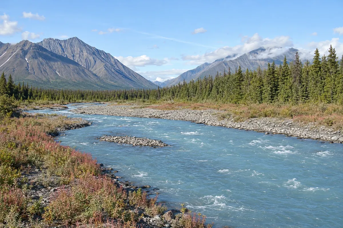
Whitehorse and the Yukon River, Dawson City and the Klondike gold rush, the Kluane mountains and aurora borealis nights.
In the photo: Quill Creek, Kluane region, Yukon
Illustrative images. The pictures in this guide are illustrations based on the real place, not photographs, and may differ from it.

The province
Get to know Yukon
Yukon is Canada’s westernmost northern territory, bordering Alaska. Mountains, rivers and forests cover most of the land, and the majority of the population lives in Whitehorse, the capital. The Yukon River has its source near the British Columbia border and flows northwest into Alaska.
Whitehorse, on the riverbank, has the SS Klondike sternwheeler, Miles Canyon and First Nations cultural centres. The city is a base for canoe trips in summer and, in winter, for dog-sledding and aurora borealis viewing away from the lights.
Dawson City was born from the Klondike gold rush, starting in 1896. Dirt streets, wooden sidewalks and false-front buildings from that era make up the town, and the Tr’ondëk-Klondike is a UNESCO World Heritage Site. Dawson City is also the starting point of the Dempster Highway, which continues north to Inuvik in the Northwest Territories.
In the southwest, Kluane National Park has Mount Logan, Canada’s highest peak, and ice fields that are part of a World Heritage Site shared with Alaska and British Columbia. Haines Junction is the park gateway village.
The Alaska Highway crosses the southern part of the territory, and the historic White Pass & Yukon Route railway runs in summer from Skagway, Alaska, along the 1898 prospectors’ route.
When to go
Summer, from June to August, has very long days with daylight late into the night, and is the season for canoeing, hiking and road travel to Dawson City. The aurora borealis commonly appears from mid‑August to April, on dark, cloudless nights. Winter is very cold, with temperatures that can drop below −30 °C, and it is the season for dog-sled tours and the Yukon Quest sled-dog race in February.
Getting there
Whitehorse Erik Nielsen International Airport (YXY) has flights to Vancouver, Calgary, Edmonton and other Canadian cities, and Dawson City has regional flights. By road, the Alaska Highway enters Yukon from British Columbia and continues to Alaska; Whitehorse is about 530 km from Dawson City via the Klondike Highway. The Top of the World Highway and the Dempster Highway usually open from late spring through September.
Your questions
Frequently asked questions about Yukon
When to see the aurora borealis in Yukon?
The season is typically mid‑August to April, when nights are dark. Chances are higher on cloudless nights and away from city lights, and many Whitehorse operators take visitors to prepared viewing areas outside town. Booking three or more nights helps overcome cloudy weather.
How to get from Whitehorse to Dawson City?
It’s about 530 km via the Klondike Highway, roughly six hours by car, with few service stations along the way. There are also regional flights between the two towns. In summer, some travellers do part of the route by canoe on the Yukon River with local operators.
What is the Dempster Highway?
It is a gravel road of about 740 km that starts near Dawson City, crosses the Arctic Circle and reaches Inuvik in the Northwest Territories. Services are scarce: carry spare tires and extra fuel, and check road and ferry conditions before you go.
Does Yukon observe daylight saving time?
No. Yukon uses UTC−7 year‑round and does not change the clocks.