
 Brazil
 Argentina
 Bolivia
 Chile
 Colombia
 Ecuador
 Guyana
 French Guiana
 Falkland Islands (Malvinas)
 Paraguay
 Peru
 Suriname
 Uruguay
 Venezuela
 Germany
 Austria
 Belgium
 Croatia
 Denmark
 Spain
 Finland
 France
 Greece
 the Netherlands
 Hungary
 Ireland
 Iceland
 Italy
 Luxembourg
 Norway
 Poland
 Portugal
 the United Kingdom
 the Czech Republic
 Sweden
 Switzerland
 Turkey
 the United States
 Mexico
 the Dominican Republic
 South Africa
 Australia
 Fiji
 New Zealand
 Papua New Guinea
Province · Northern Canada
Nunavut
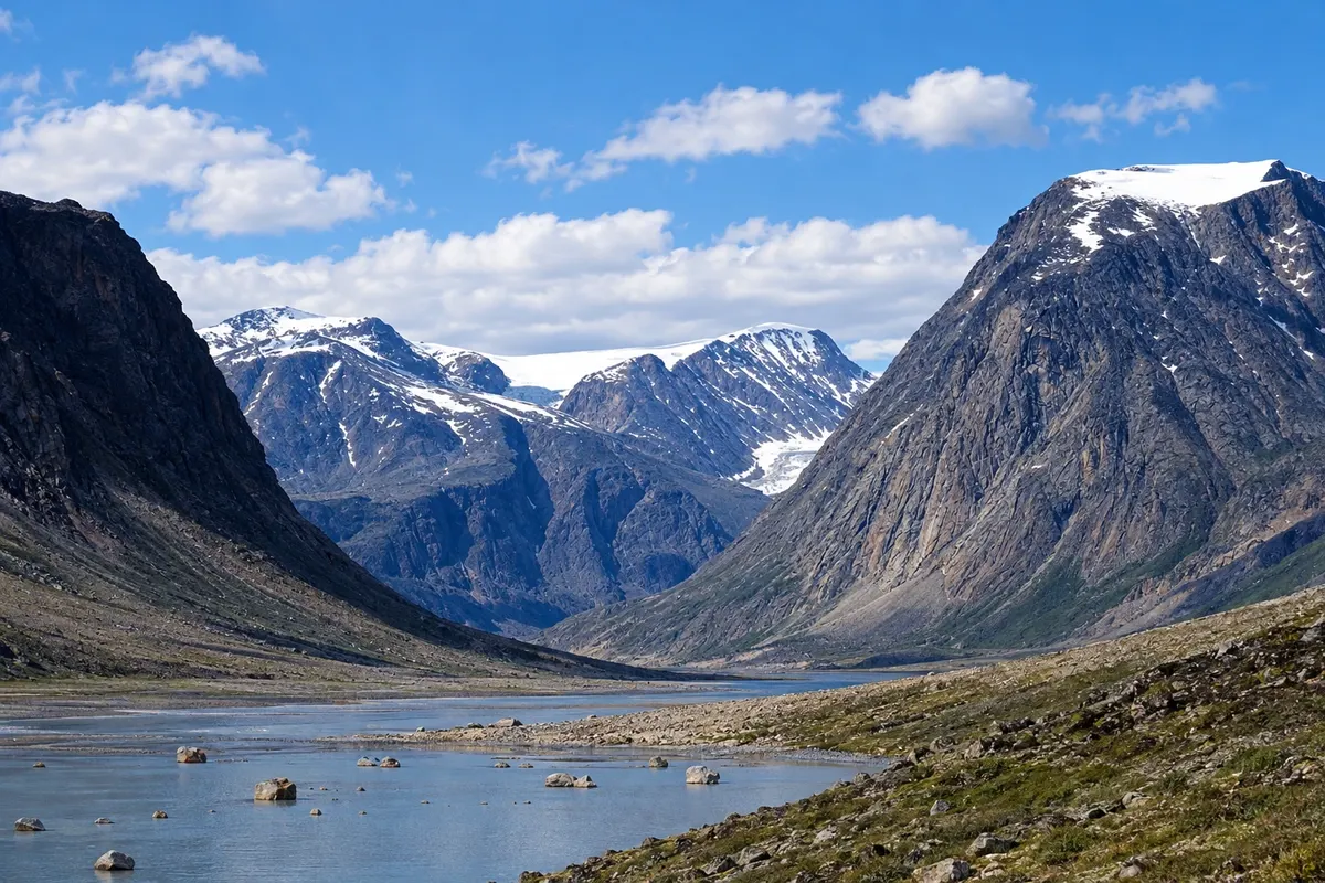
The Inuit homeland: Iqaluit, Baffin Island, the fjords and peaks of Auyuittuq, the midnight sun and the art of Kinngait.
In the photo: Pangnirtung fjord, Baffin Island, Nunavut
Illustrative images. The pictures in this guide are illustrations based on the real place, not photographs, and may differ from it.

The province
Get to know Nunavut
Nunavut is Canada’s largest and newest territory, created in 1999 from part of the Northwest Territories. It covers much of the Arctic archipelago and the mainland north of the tree line. Most of the population is Inuit, and Inuktitut is spoken daily alongside English and French. Iqaluit, on Baffin Island, is the capital.
No community is connected to another or to the south of the country by road: people and goods arrive by plane and, in summer, by ship. Iqaluit has the Legislative Assembly building, the Nunatta Sunakkutaangit Museum with Inuit art and artifacts, and Sylvia Grinnell Territorial Park on the riverbank.
On Baffin Island, Auyuittuq National Park near Pangnirtung features the Akshayuk Pass crossing through granite peaks and glaciers, such as Mount Thor. Farther north, Pond Inlet is the base for Sirmilik National Park and for spotting narwhals, birds and icebergs at the edge of the sea ice in early summer.
Kinngait, also called Cape Dorset, is known for Inuit printmaking and carving, and Pangnirtung for its tapestry. Hunting, fishing and working with furs are part of community life, and traditional food, called country food, includes caribou, Arctic fish and seal meat.
When to go
From June to August there is midnight sun across much of the territory, and this is the season for trails, boating and wildlife viewing; the sea-ice edge typically draws visitors in June. The aurora borealis usually appears on dark nights in autumn and winter. Winter is long and very cold, with weeks without sun in the northernmost communities.
Getting there
Iqaluit (YFB) receives flights from Ottawa and Montreal; Rankin Inlet and Cambridge Bay receive flights from Winnipeg and Yellowknife. From regional hubs, smaller aircraft serve other communities. In summer, expedition cruises pass through the Canadian Arctic. Visits to national parks require registration and guidance from Parks Canada.
Your questions
Frequently asked questions about Nunavut
How do you get to Iqaluit?
Only by plane or, in summer, by ship. There are regular flights from Ottawa and Montreal, about three hours of travel. From Iqaluit, regional flights continue to Pangnirtung, Pond Inlet, Kinngait and other Baffin Island communities.
When is there midnight sun in Nunavut?
North of the Arctic Circle the sun does not set for weeks around June, and the period is longer the farther north you go. Iqaluit sits slightly south of the circle: there the sun does set, but June and July nights are bright.
Do you need a guide to visit Nunavut’s parks?
National parks such as Auyuittuq and Sirmilik require registration and an orientation with Parks Canada before visiting. There are no waymarked trails or services in most of them, and many visitors go with local guides and operators who arrange boat or snowmobile transport.
How can you recognize authentic Inuit art?
Sculptures and prints made by Inuit artists often carry the Igloo Tag label, a mark created by the Canadian government to identify authorship. In Nunavut it is common to buy directly from artists in the communities or from art shops and cooperatives.