

 Brazil
 Argentina
 Bolivia
 Chile
 Colombia
 Ecuador
 Guyana
 French Guiana
 Falkland Islands (Malvinas)
 Paraguay
 Peru
 Suriname
 Uruguay
 Venezuela
 Germany
 Austria
 Belgium
 Croatia
 Denmark
 Slovakia
 Slovenia
 Spain
 Finland
 France
 Greece
 the Netherlands
 Hungary
 Ireland
 Iceland
 Italy
 Luxembourg
 Norway
 Poland
 Portugal
 the United Kingdom
 the Czech Republic
 Sweden
 Switzerland
 Turkey
 the United States
 Mexico
 the Dominican Republic
 South Africa
 Australia
 Fiji
 New Zealand
 Papua New Guinea
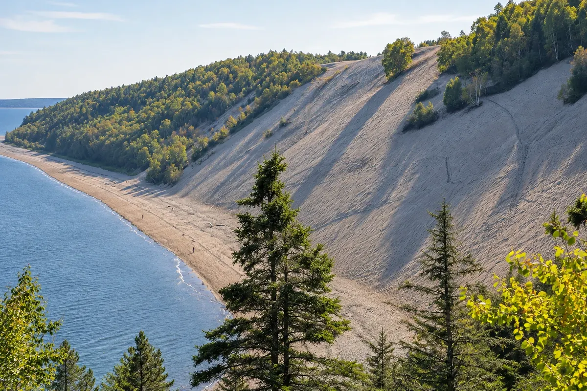
Natural landscape · Tadoussac, Quebec
Dunes of Tadoussac
Sand terraces formed at the end of the last glaciation, about 5 km from Tadoussac centre, on a high slope above the St. Lawrence, with the Maison des Dunes.
Illustrative images. The pictures in this guide are illustrations based on the real place, not photographs, and may differ from it.



Discover
About Dunes of Tadoussac
The Tadoussac dunes are sand terraces deposited at the end of the last glaciation, when the sea covered the area and the land level was lower. Today they form a high sandy slope above the St. Lawrence, about 5 km from the village centre.
The Maison des Dunes, a former summer house, houses a small interpretation centre about dune formation, vegetation and the birds of prey that migrate along the coast in autumn. Trails lead to the top of the slope, from where you can see the river and, on clear days, the south shore.
The area is part of the Saguenay Fjord National Park. To protect vegetation, stay on marked trails. Check the centre’s season and the current schedule.
Before you go
Practical information
Cidade Turismo reviews its information regularly, but something may have changed. Check with the place before planning your trip.
How much time to set aside
One to two hours.
Best time
From June to October; in September and October for the raptor migration.
How to get there
Access via rue des Pionniers and chemin du Moulin-à-Baude, about 5 km from Tadoussac centre.
Tip
Stay on the trails and away from the cliff edge: the sand is unstable.
Official website
Get your questions answered
Frequently asked questions about Dunes of Tadoussac
How were Tadoussac's dunes formed?
They are sand terraces deposited at the end of the last glaciation, when the sea covered the area.
What is the distance from Tadoussac centre to the dunes?
About 5 km.
What is the Maison des Dunes?
A small national park interpretation centre about the dunes, vegetation and birds.