

 Brazil
 Argentina
 Bolivia
 Chile
 Colombia
 Ecuador
 Guyana
 French Guiana
 Falkland Islands (Malvinas)
 Paraguay
 Peru
 Suriname
 Uruguay
 Venezuela
 Germany
 Austria
 Belgium
 Croatia
 Denmark
 Spain
 Finland
 France
 Greece
 the Netherlands
 Hungary
 Ireland
 Iceland
 Italy
 Luxembourg
 Norway
 Poland
 Portugal
 the United Kingdom
 the Czech Republic
 Sweden
 Switzerland
 Turkey
 the United States
 Mexico
 the Dominican Republic
 South Africa
 Australia
 Fiji
 New Zealand
Province · Papua Region
Central
Central Province surrounds Port Moresby: the Sogeri plateau, Varirata National Park, the start of the Kokoda Track and the Coral Sea coast.
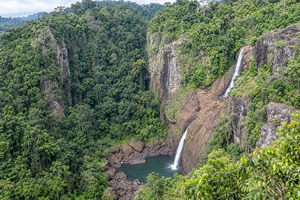
In the photo: Rouna Falls
Illustrative images. The pictures in this guide are illustrations based on the real place, not photographs, and may differ from it.

The province
Get to know Central
Central Province occupies the southern coast of the island of New Guinea around the National Capital District, from the Coral Sea shoreline up to the slopes of the Owen Stanley Range. The provincial administration is in Port Moresby, and almost all travel in the province begins in the capital.
The road that climbs from Port Moresby to the Sogeri plateau passes the Rouna Falls on the Laloki River and reaches Varirata National Park, with forest trails, coastal lookouts and birdwatching, including birds-of-paradise. On the same plateau there are memorials from the 1942 campaign.
At Owers' Corner the Kokoda Track begins to the south, the footpath across the Owen Stanley Range where Australian and Japanese forces fought in 1942. The full crossing finishes at Kokoda in Oro Province and takes several days; shorter sections from Owers' Corner are also done with licensed operators.
On the coast, the bays southeast of the capital, such as Bootless Bay, have reefs, small islands and diving departures. Coastal villages of the Motu and other peoples maintain fishing, pottery and the canoes that originated the hiri voyages.
When to go
The coast has the same climate as Port Moresby: May to November is generally the driest period, and December to April has more rain. On the higher Sogeri plateau nights are cooler. For the Kokoda Track, the crossing season is generally from April to November, the drier months.
Getting there
You get there via the capital: Jacksons International Airport in Port Moresby handles international and domestic flights. From Port Moresby, roads lead to the Sogeri plateau, Varirata and Owers' Corner to the east, and along the coast to the southeast and northwest. For the Kokoda Track, operators transfer travelers by road from the capital to Owers' Corner.
Your questions
Frequently asked questions about Central
Can you visit Varirata National Park on a day trip from Port Moresby?
Yes. The park is on the Sogeri plateau east of the capital, and a typical day trip includes the forest trails, the coastal lookout and, en route, Rouna Falls. To see birds-of-paradise, the early morning hours are best, with a local guide.
Do you need permission to hike the Kokoda Track?
Yes. Every walker pays the Kokoda Track Authority permit, and crossing operators need a commercial licence from the authority. In practice most travelers hire a licensed operator who handles the permit, guides, porters and transport to Owers' Corner.
How long does the Kokoda Track take?
The full crossing between Owers' Corner and Kokoda takes several days, typically six to ten days depending on the itinerary and each person’s fitness. There are steep climbs and descents, rivers to cross and mud in the rainy season. Shorter hikes from Owers' Corner are also available.
Where to dive near Port Moresby?
The bays southeast of the capital, like Bootless Bay, have reefs and small islands, with diving and boat trips organised by local operators and accommodation providers. Book the trip in advance and confirm sea conditions.