

 Brazil
 Argentina
 Bolivia
 Chile
 Colombia
 Ecuador
 Guyana
 French Guiana
 Falkland Islands (Malvinas)
 Paraguay
 Peru
 Suriname
 Uruguay
 Venezuela
 Germany
 Austria
 Belgium
 Croatia
 Denmark
 Slovakia
 Slovenia
 Spain
 Finland
 France
 Greece
 the Netherlands
 Hungary
 Ireland
 Iceland
 Italy
 Luxembourg
 Norway
 Poland
 Portugal
 the United Kingdom
 the Czech Republic
 Sweden
 Switzerland
 Turkey
 the United States
 Mexico
 the Dominican Republic
 South Africa
 Australia
 Fiji
 New Zealand
 Papua New Guinea
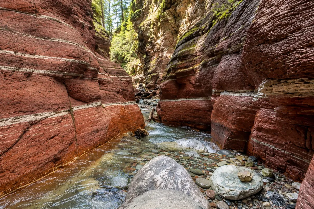
Canyon · Waterton Park, Alberta
Red Rock Canyon
A narrow canyon of red and green rock at the end of the Red Rock Parkway, about 15 km from the village of Waterton Park, with a short trail along the rim.
Illustrative images. The pictures in this guide are illustrations based on the real place, not photographs, and may differ from it.



Discover
About Red Rock Canyon
Red Rock Canyon is at the end of the Red Rock Parkway, a scenic road of about 15 km that leaves the village of Waterton Park through the Blakiston Creek valley. Along the way, the road passes prairie meadows and mountains where bears, deer and elk are commonly seen.
The canyon is narrow and shallow, carved by Red Rock Creek into layers of argillite. Iron in the rock gives the red color; where the iron has not oxidized the rock is green. A short trail of about 0.7 km follows the canyon rim, with bridges over the creek, and ancient ripple marks appear on the bedrock slabs.
Early in the summer the creek’s water is usually higher. The road typically opens to vehicles from mid-spring through fall; check dates.
Before you go
Practical information
Cidade Turismo reviews its information regularly, but something may have changed. Check with the place before planning your trip.
How much time to set aside
One hour, plus the road drive.
Best time
From June to September, morning or late afternoon, to see wildlife along the road.
How to get there
On the Red Rock Parkway, about 15 km from the village of Waterton Park.
Tip
Drive slowly on the Red Rock Parkway: animals often cross the road.
Official website
Get your questions answered
Frequently asked questions about Red Rock Canyon
Why are the rocks in Red Rock Canyon red?
Because the iron in the rock has oxidized; where it hasn’t oxidized the rock is green.
How far is the village from Red Rock Canyon?
About 15 km via the Red Rock Parkway.
Is the Red Rock Parkway open year-round?
It’s usually open to vehicles from spring through fall. Check the dates.