

 Brazil
 Argentina
 Bolivia
 Chile
 Colombia
 Ecuador
 Guyana
 French Guiana
 Falkland Islands (Malvinas)
 Paraguay
 Peru
 Suriname
 Uruguay
 Venezuela
 Germany
 Austria
 Belgium
 Croatia
 Denmark
 Slovakia
 Slovenia
 Spain
 Finland
 France
 Greece
 the Netherlands
 Hungary
 Ireland
 Iceland
 Italy
 Luxembourg
 Norway
 Poland
 Portugal
 the United Kingdom
 the Czech Republic
 Sweden
 Switzerland
 Turkey
 the United States
 Mexico
 the Dominican Republic
 South Africa
 Australia
 Fiji
 New Zealand
 Papua New Guinea
Geological site · Tuktoyaktuk, Northwest Territories
Ibyuk Pingo
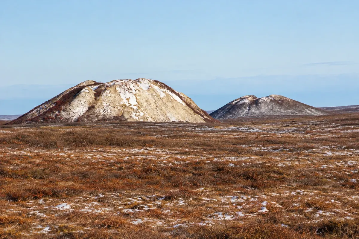
Ice-cored hills covered with soil that rise from the tundra near Tuktoyaktuk, protected as a natural landmark; the largest is about 49 meters tall.
Illustrative images. The pictures in this guide are illustrations based on the real place, not photographs, and may differ from it.



Discover
About Ibyuk Pingo
Pingos are cone-shaped hills that form in areas of frozen ground when a lake dries and the remaining water at the bottom freezes and expands, pushing the soil upward. Inside they have an ice core; on the outside they are covered by soil and tundra vegetation.
The Tuktoyaktuk peninsula has one of the largest concentrations of pingos in the world, with about 1,350. Eight of them, near the community, make up the Pingo Canadian Landmark, a protected area. The largest, Ibyuk, is about 49 meters high and is one of the largest known; it grows a few centimeters per year.
Pingos appear as isolated mounds on the flat landscape and served as landmarks for the Inuvialuit when travelling. The protected area has no trails or facilities; locals offer guided boat or walking tours.
Before you go
Practical information
Cidade Turismo reviews its information regularly, but something may have changed. Check with the place before planning your trip.
How much time to set aside
One to two hours.
Best time
From July to August, when the tundra is green. Visit with a local guide.
How to get there
About 5 km west of Tuktoyaktuk, visible from the road and the community; to get closer, take a guided boat or walking tour.
Tip
Do not climb on the pingos: the vegetation is fragile and erosion exposes the ice core.
Official website
Get your questions answered
Frequently asked questions about Ibyuk Pingo
What is a pingo?
A hill with an ice core, covered by soil, that forms in frozen ground.
How tall is the largest pingo in Tuktoyaktuk?
Ibyuk is about 49 meters tall.
Can you climb the pingos?
It is not recommended; the vegetation is fragile and the area is protected.