

 Brazil
 Argentina
 Bolivia
 Chile
 Colombia
 Ecuador
 Guyana
 French Guiana
 Falkland Islands (Malvinas)
 Paraguay
 Peru
 Suriname
 Uruguay
 Venezuela
 Germany
 Austria
 Belgium
 Croatia
 Denmark
 Slovakia
 Slovenia
 Spain
 Finland
 France
 Greece
 the Netherlands
 Hungary
 Ireland
 Iceland
 Italy
 Luxembourg
 Norway
 Poland
 Portugal
 the United Kingdom
 the Czech Republic
 Sweden
 Switzerland
 Turkey
 the United States
 Mexico
 the Dominican Republic
 South Africa
 Australia
 Fiji
 New Zealand
 Papua New Guinea
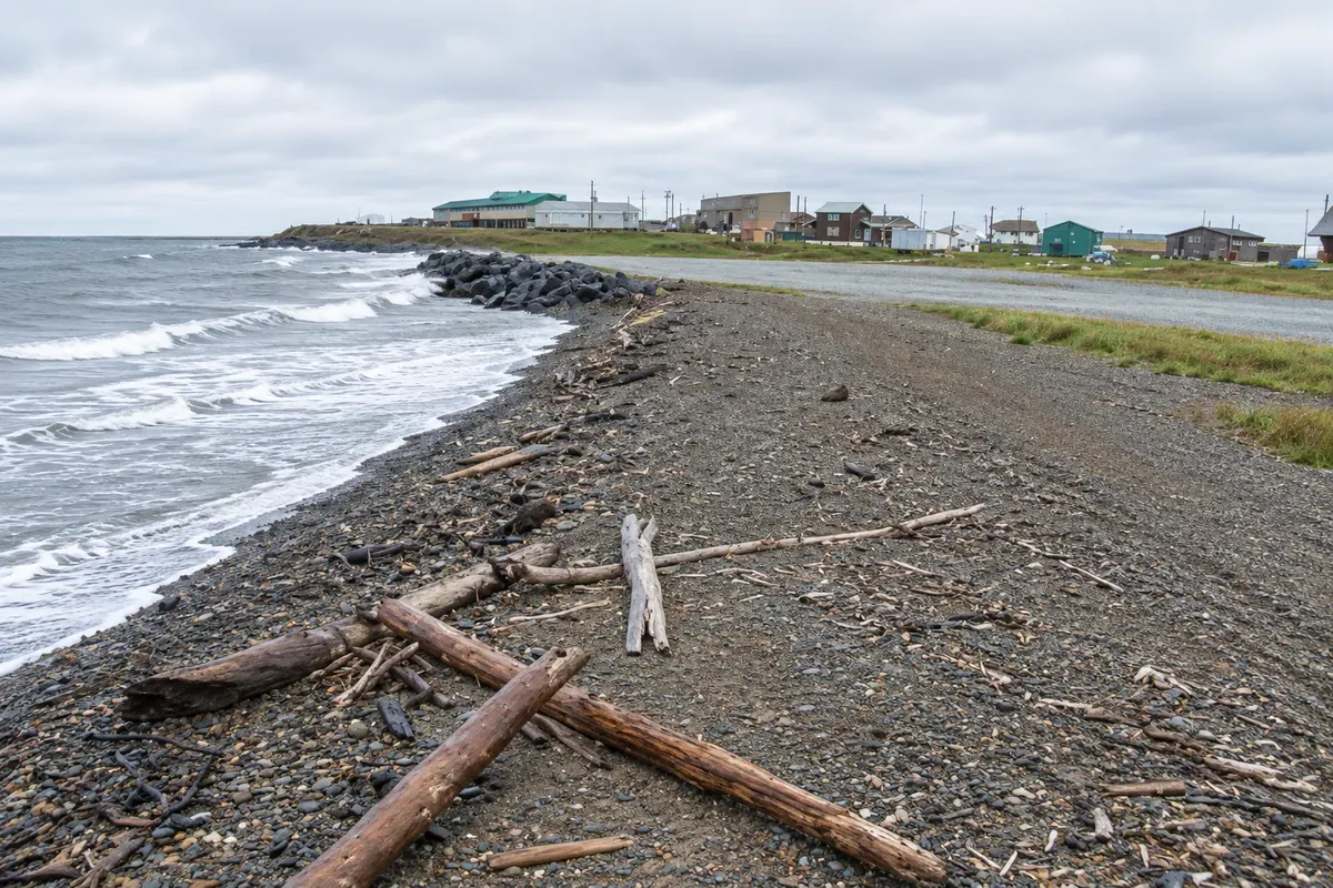
Waterfront · Tuktoyaktuk, Northwest Territories
Arctic Ocean sign
The tip of Tuktoyaktuk on the shore of the Beaufort Sea, with the Arctic Ocean sign where visitors arriving by road put a hand or a foot in the water.
Illustrative images. The pictures in this guide are illustrations based on the real place, not photographs, and may differ from it.



Discover
About Arctic Ocean sign
The tip of Tuktoyaktuk projects into the Beaufort Sea, part of the Arctic Ocean. Since the road opened in 2017, it is where those who drive from Inuvik finish their trip, beside a sign marking the Arctic Ocean.
The shore has a gravel beach, driftwood brought by the sea and a view of the open northern horizon. In summer the water is ice-free for a few weeks, but remains very cold. Many visitors wet a hand or a foot; the most daring go in the water.
Near the tip are community houses, fishing boats and, in some spots, fish-drying racks. Inuvialuit residents offer guided community tours and tell the story of beluga whale hunting and life in the Arctic.
Before you go
Practical information
Cidade Turismo reviews its information regularly, but something may have changed. Check with the place before planning your trip.
How much time to set aside
About one hour.
Best time
From July to August, when the water is ice-free.
How to get there
At the end of the road that crosses Tuktoyaktuk, about 2 km from the community entrance.
Tip
Bring a towel and dry clothes if you plan to get your feet wet; the shore wind is cold even in high summer.
Official website
Get your questions answered
Frequently asked questions about Arctic Ocean sign
Can you reach the Arctic Ocean by car?
Yes, at Tuktoyaktuk, via the road that comes from Inuvik.
When does the sea become ice-free at Tuktoyaktuk?
For a few weeks in summer, generally in July and August.
Is the Arctic Ocean water very cold?
Yes, even in summer.