
 Brazil
 Argentina
 Bolivia
 Chile
 Colombia
 Ecuador
 Guyana
 French Guiana
 Falkland Islands (Malvinas)
 Paraguay
 Peru
 Suriname
 Uruguay
 Venezuela
 Germany
 Austria
 Belgium
 Croatia
 Denmark
 Spain
 Finland
 Greece
 the Netherlands
 Hungary
 Ireland
 Iceland
 Luxembourg
 Norway
 Poland
 Portugal
 the Czech Republic
 Sweden
 Turkey
 the United States
 Mexico
 the Dominican Republic
 South Africa
 Australia
 Fiji
Cross-border route · Europe
Via Francígena on foot: from Canterbury to Roma
The ancient pilgrims' route to Roma: from Canterbury Cathedral, through France and Switzerland, over the Alps via the Grande São Bernardo and across Tuscany to São Pedro Square.
 the United Kingdom
 France
 Switzerland
 Italy
9 cities 4 countries
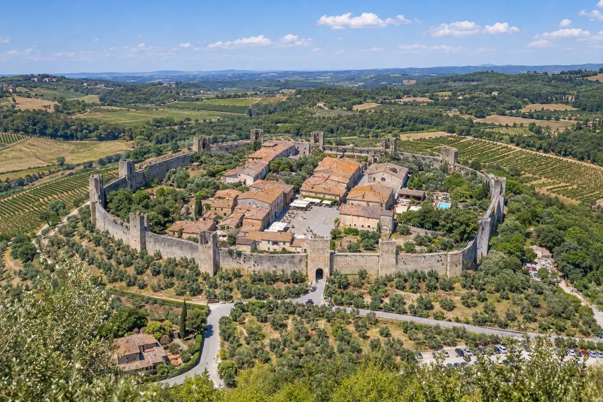
In the photo: Walled village of Monteriggioni
Illustrative images. The pictures in this guide are illustrations based on the real place, not photographs, and may differ from it.

The route
What is Via Francígena on foot: from Canterbury to Roma
The Via Francígena follows the route recorded by Archbishop Sigeric, who in 990 returned from Roma to Canterbury noting the stops. Today it is a Cultural Route of the Council of Europe and links Canterbury Cathedral, in England, to Roma, at about 1,800 to 2,000 km depending on the source and route, passing through four countries: United Kingdom, France, Switzerland and Itália.
After crossing the English Channel between Dover and Calais, the route crosses northern France via Arras and Reims, descends through the Champagne region and Franche-Comté to Besançon, enters Switzerland via the Jura and reaches Lake Léman in Lausanne. It follows the Rhône valley and crosses the Alps at the Grande São Bernardo pass, at 2,469 metres, down to Aosta in Itália. From there it crosses the Po plain, the Apennines and Tuscany, through Lucca, San Gimignano and Siena, and the Lácio, to Roma.
Few do the entire route at once, which takes about three months. Most people walk a section, and the most popular parts are in Itália: from Lucca to Siena through Tuscany, and from Siena to Roma via the Val d'Orcia and Lake Bolsena. Those who walk at least the last 100 km to Roma can request the Testimonium, the pilgrimage certificate.
The map
9 cities in 4 countries
Outlines: Natural Earth, public domain. Adapted by Cidade Turismo.
The journey
City by city
Distances and times are approximate: check before you set out.
-
 1 · the United Kingdom
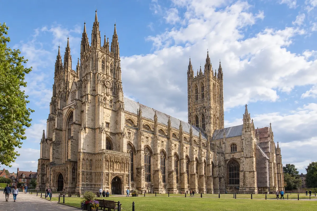
Canterbury
O caminho começa na catedral de Canterbury, sede da Igreja anglicana e Patrimônio Mundial. A pedra do quilômetro zero fica ao lado da catedral. A primeira etapa vai até Dover, onde a balsa atravessa o canal da Mancha até Calais, na França.
→ Reims cerca de 3 semanas a pé Canterbury–Dover a pé, balsa Dover–Calais e, na França, Wisques, Arras, Péronne, Laon e Reims, por campos de trigo e cemitérios da Primeira Guerra.
-
 2 · France
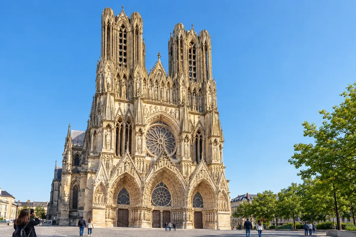
Reims
After Calais, Wisques, Arras, Péronne and Laon, the route reaches Reims in the Champagne region. The Notre-Dame cathedral, where the kings of France were crowned, and the champagne cellars are the main sights. From here the route continues via Châlons-en-Champagne and Langres.
→ Besançon cerca de 2 a 3 semanas a pé Por Châlons-en-Champagne, Bar-sur-Aube, Langres e Champlitte, entre vinhedos de champanhe e planaltos.
-
 3 · France
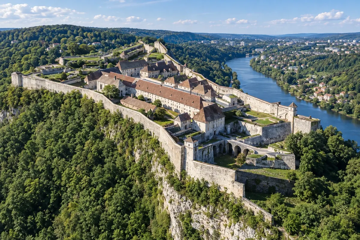
Besançon
Besançon sits on a bend of the Doubs river, with Vauban's citadel above it, a World Heritage Site, and a centre of stone buildings. After the town, the route climbs the Jura mountains to Pontarlier and crosses the border into Switzerland.
→ Lausanne cerca de 1 semana a pé Pelas montanhas do Jura, Pontarlier, a fronteira suíça em Jougne, Orbe e Lausanne.
-
 4 · Switzerland
Lausanne
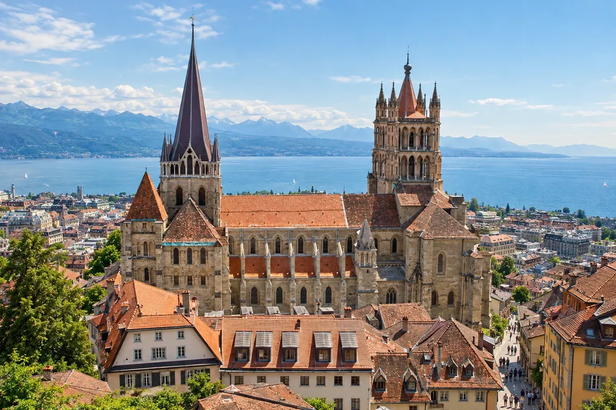
After Orbe, the route reaches Lausanne on the shores of Lake Léman, with the Gothic cathedral above the old town. It follows the lakeshore via Vevey and Montreux, climbs the Rhône valley via Saint-Maurice and Martigny and begins the Alpine ascent.
→ Aosta cerca de 1 semana a pé Pela margem do lago Léman (Vevey e Montreux), o vale do Ródano (Saint-Maurice e Martigny), Bourg-Saint-Pierre, o passo do Grande São Bernardo e a descida a Aosta.
-
 5 · Italy
Aosta
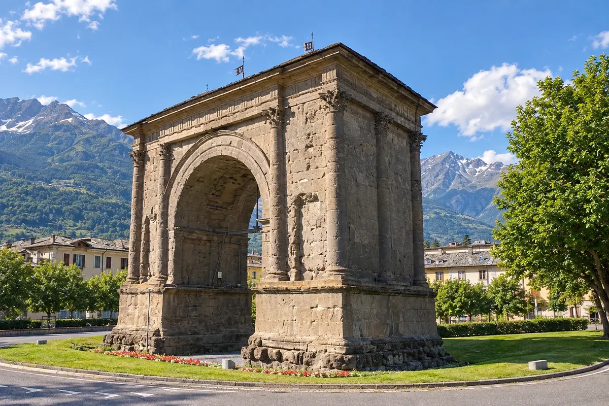
After Bourg-Saint-Pierre and the Grande São Bernardo pass at 2,469 metres, with the canons' hospice, the route descends to Aosta, the first Italian town. Aosta preserves the Porta Pretoria, the Arch of Augustus and the Roman theatre. From there the route continues via Ivrea, Vercelli, Pavia, Piacenza and across the Apennines.
→ Lucca cerca de 4 semanas a pé Pelo vale de Aosta, Ivrea, Vercelli, Pavia e Piacenza, na planície do Pó, Fidenza, o passo da Cisa nos Apeninos, Pontremoli, Sarzana e Camaiore.
-
 6 · Italy
Lucca
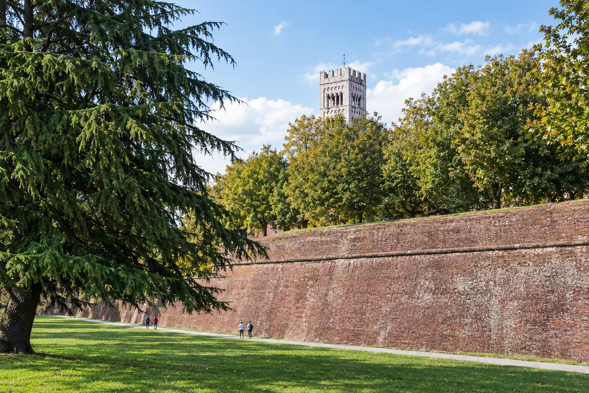
After the Cisa pass, Pontremoli and the Ligurian coast, the route reaches Lucca, surrounded by walls that have been turned into a treelined promenade. It is the most common starting point for the Tuscan section, which continues via Altopascio, San Miniato and Gambassi Terme.
→ San Gimignano cerca de 4 dias a pé Por Altopascio, San Miniato e Gambassi Terme, entre colinas da Toscana e estradas de terra.
-
 7 · Italy
San Gimignano
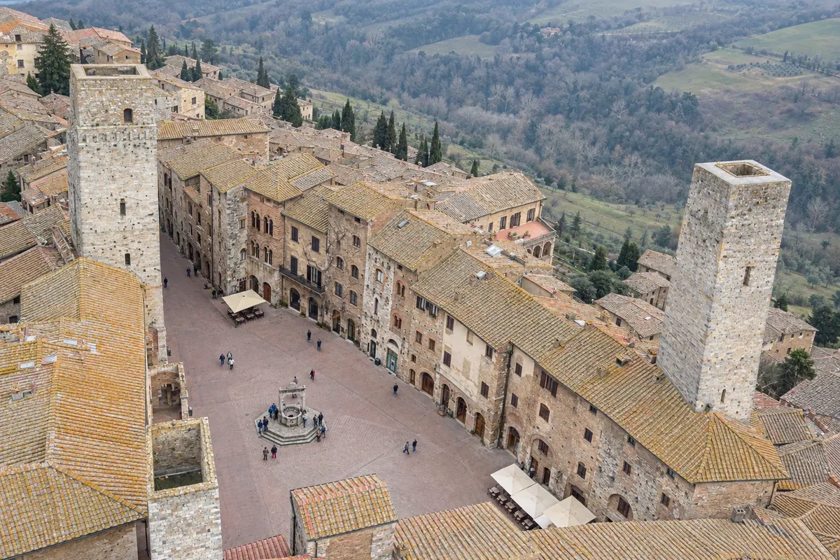
San Gimignano is the town of medieval towers, atop a hill among vineyards. From here the route continues via Colle di Val d'Elsa and the walled village of Monteriggioni to Siena.
→ Siena cerca de 1 a 2 dias a pé Por Colle di Val d'Elsa e Monteriggioni, entre bosques e vinhedos.
-
 8 · Italy
Siena
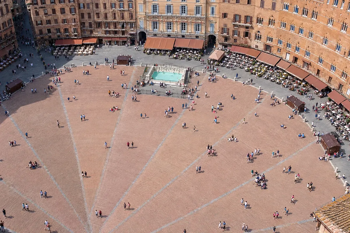
Siena has the Piazza del Campo, where the Palio runs, the striped marble cathedral and medieval streets on the slope. After Siena, the route crosses the Val d'Orcia via San Quirico d'Orcia and Radicofani and enters the Lácio.
→ Roma cerca de 2 semanas a pé Pelo Val d'Orcia (Ponte d'Arbia, San Quirico d'Orcia, Radicofani), Acquapendente, o lago de Bolsena, Montefiascone, Viterbo, Vetralla, Sutri, Campagnano di Roma e La Storta até a praça de São Pedro. De Viterbo a Roma são os últimos cerca de 100 km.
-
 9 · Italy
Roma
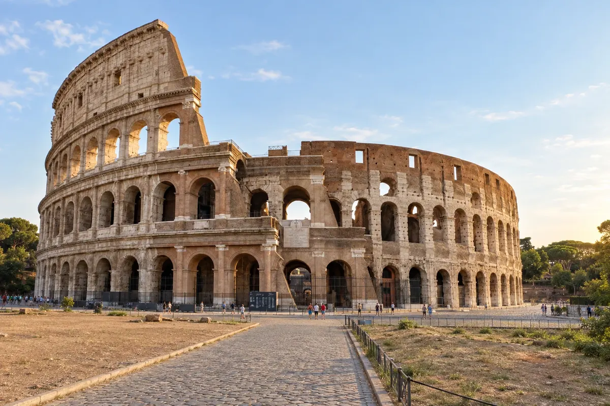
After Acquapendente, Bolsena, Montefiascone, Viterbo, Sutri and La Storta, the route enters Roma via Monte Mario and ends at São Pedro Square, where the Testimonium is requested.
How to travel
The way and the tickets
On foot, in stages of 15 to 30 km, following signs with a pilgrim symbol and, in Itália, the white-and-red waymarks. It can also be done by bicycle, with a dedicated route for parts of the way. Many do the route in sections, on different trips, returning to the point where they stopped.
Best time to go
When to go: month by month
May, June and September, with early October: good temperatures for walking in Tuscany and the Lácio. The crossing of the Grande São Bernardo on foot is usually only possible in summer, from late June to September, when the snow melts. July and August are very hot in Tuscany and the Lácio, with long exposed sections in the sun.
The seasons shown are the most usual ones; nature doesn't always follow the calendar.
Planning
Planning the trip
How many days
The whole route takes about three months on foot. In Tuscany, from Lucca to Siena, about 6 days. The last 100 km, from Viterbo to Roma, about 5 to 6 days. By bicycle, the Italian section takes roughly two weeks.
Who it is for
For those who want a pilgrimage on foot ending in Roma, for those who enjoy walking among medieval villages, vineyards and Roman roads, and for those who prefer a route less crowded than the Camino de Santiago.
Your questions answered
Frequently asked questions about Via Francígena on foot: from Canterbury to Roma
Quantos quilômetros tem a Via Francígena?
De Canterbury a Roma, cerca de 1.800 a 2.000 km, conforme a fonte e as variantes do traçado. A parte italiana, do Grande São Bernardo a Roma, tem cerca de 945 km.
Qual o trecho mais procurado?
A Toscana, de Lucca a Siena, em cerca de 6 dias, e o trecho de Siena a Roma, pelo Val d'Orcia e pelo lago de Bolsena. Quem quer o Testimonium com a distância mínima costuma começar em Viterbo.
O que é o Testimonium?
É o certificado da peregrinação a Roma, entregue a quem fez a pé pelo menos os últimos 100 km, ou de bicicleta pelo menos os últimos 200 km, e mostra a credencial carimbada. Costuma ser retirado no ponto de acolhida junto à basílica de São Pedro: confirme antes onde e em que horário.
Onde conseguir a credencial?
A credencial do peregrino é distribuída pela Associação Europeia das Vias Francígenas e por postos de turismo, igrejas, albergues e associações ao longo do caminho, na Inglaterra, na França, na Suíça e na Itália.
Dá para atravessar o Grande São Bernardo a pé o ano todo?
Não. A trilha do passo costuma ficar sem neve só no verão, de fim de junho a setembro. Fora dessa época, quem segue pelo caminho atravessa os Alpes de ônibus, pelo túnel. Confirme as condições antes.
Precisa mostrar passaporte?
Sim, na saída do Reino Unido, que não está no espaço Schengen: o controle de fronteira é feito no porto de Dover. Entre a França, a Suíça e a Itália não há controle fixo de passaporte, mas a Suíça não está na União Europeia e pode haver controle de alfândega.