
 Brazil
 Argentina
 Bolivia
 Chile
 Colombia
 Ecuador
 Guyana
 French Guiana
 Falkland Islands (Malvinas)
 Paraguay
 Peru
 Suriname
 Uruguay
 Venezuela
 Germany
 Austria
 Belgium
 Croatia
 Denmark
 Finland
 Greece
 the Netherlands
 Hungary
 Ireland
 Iceland
 Italy
 Luxembourg
 Norway
 Poland
 Portugal
 the United Kingdom
 the Czech Republic
 Sweden
 Switzerland
 Turkey
 the United States
 Mexico
 the Dominican Republic
 South Africa
 Australia
 Fiji
Cross-border route · Europe
French Way of the Camino de Santiago on foot
The most walked pilgrimage route to Santiago de Compostela: from the French Pyrenees to Galicia, on foot, via Pamplona, Burgos and León, following the yellow arrows.
 France
 Spain
9 cities 2 countries
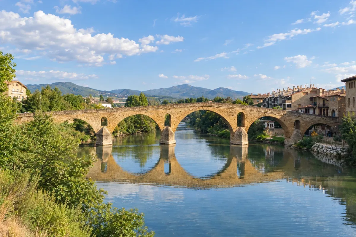
In the photo: Romanesque bridge of Puente la Reina over the Arga River
Illustrative images. The pictures in this guide are illustrations based on the real place, not photographs, and may differ from it.

The route
What is French Way of the Camino de Santiago on foot
The French Way is the best-known and most traveled route of the Camino de Santiago, recognized by UNESCO as a World Heritage Site. The most common starting point is Saint-Jean-Pied-de-Port, in France, at the foot of the Pyrenees. From there it is about 770 km to Santiago de Compostela, in around 33 stages, or five to six weeks of walking.
The route crosses the Pyrenees to Roncesvalles, goes through Pamplona and the vineyards of La Rioja to Logroño, reaches Burgos and its Gothic cathedral, crosses the meseta—the wheat plains of Castilla—to León, and continues through Astorga and Ponferrada. It then climbs to O Cebreiro, enters Galicia and descends via Sarria, Portomarín, Palas de Rei and Arzúa to the Plaza del Obradoiro.
Those with limited time usually start in Sarria, about 115 km from Santiago, the minimum distance required to request the Compostela, the pilgrimage certificate. The route is marked with yellow arrows and the scallop shell, and there are pilgrim hostels in almost every village.
The map
9 cities in 2 countries
Outlines: Natural Earth, public domain. Adapted by Cidade Turismo.
The journey
City by city
Distances and times are approximate: check before you set out.
-
 1 · France
Saint-Jean-Pied-de-Port
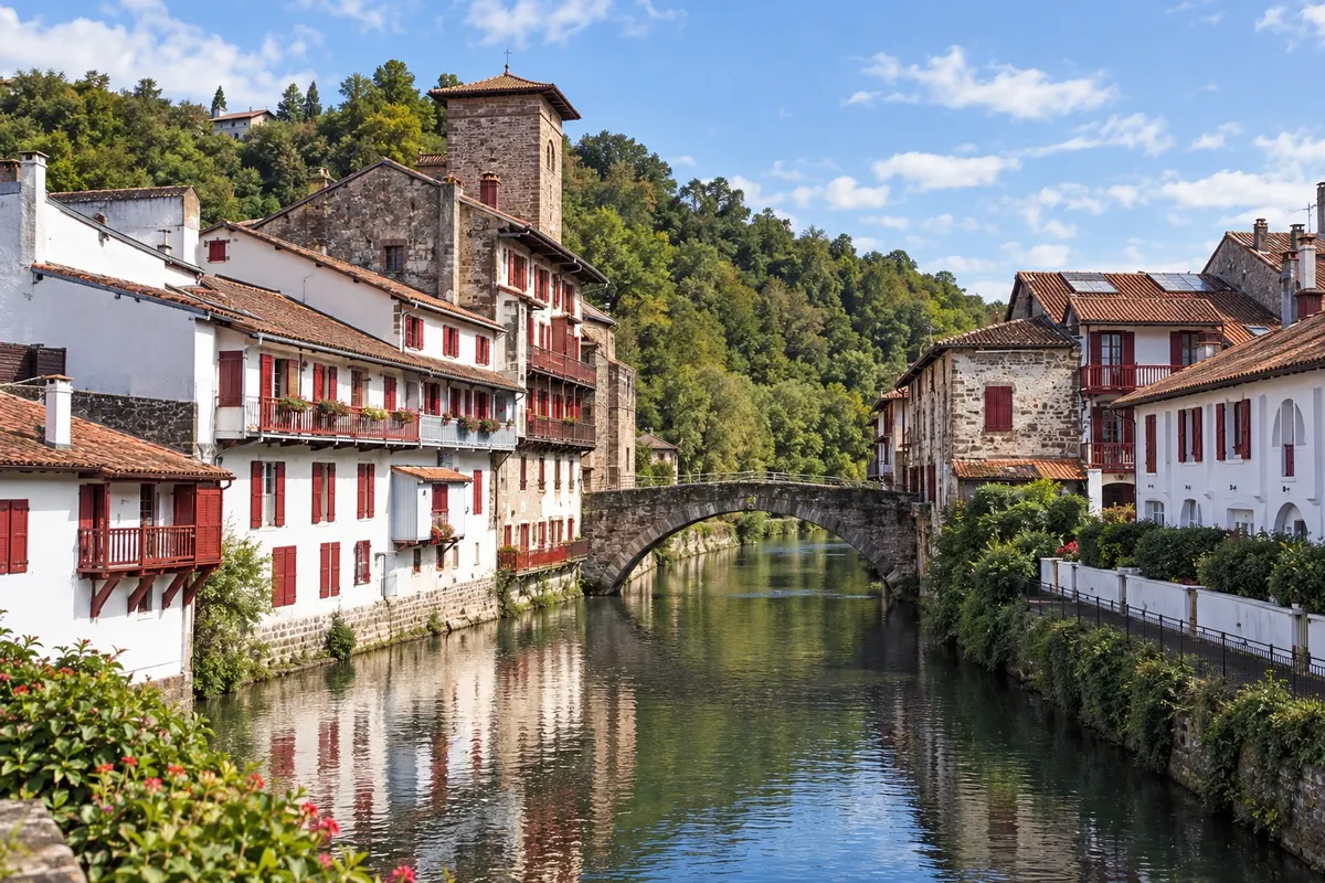
Saint-Jean-Pied-de-Port is a walled French Basque village on the banks of the Nive River, at the foot of the Pyrenees. The pilgrims' welcome office, on rue de la Citadelle, issues the pilgrim credential and tells you if the Route of Napoleon is open. The first stage, to Roncesvalles, is the hardest of the route, with about 1,250 meters of ascent.
→ Pamplona about 66 km cerca de 3 dias a pé 3 etapas: Saint-Jean-Pied-de-Port–Roncesvalles (24 km, pela travessia dos Pireneus), Roncesvalles–Zubiri (21 km) e Zubiri–Pamplona (20 km).
-
 2 · Spain
Pamplona
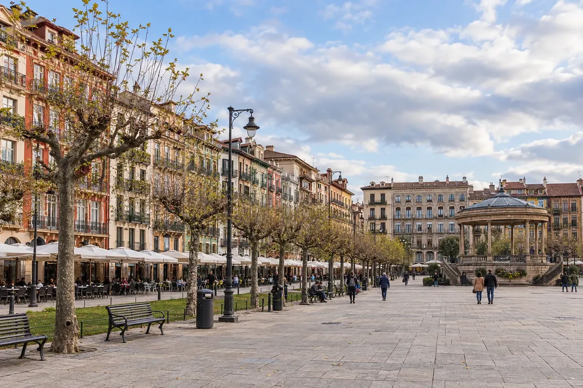
After Roncesvalles and Zubiri, the route enters Pamplona via the medieval bridge and the city walls. Pamplona is the capital of Navarra, with its cathedral, the citadel, Praça do Castelo and the streets of the bull run for the São Firmino festivities in July.
→ Logroño about 94 km cerca de 4 dias a pé 4 etapas: Pamplona–Puente la Reina (24 km, pelo Alto do Perdão), Puente la Reina–Estella (22 km), Estella–Los Arcos (21 km) e Los Arcos–Logroño (28 km).
-
 3 · Spain
Logroño
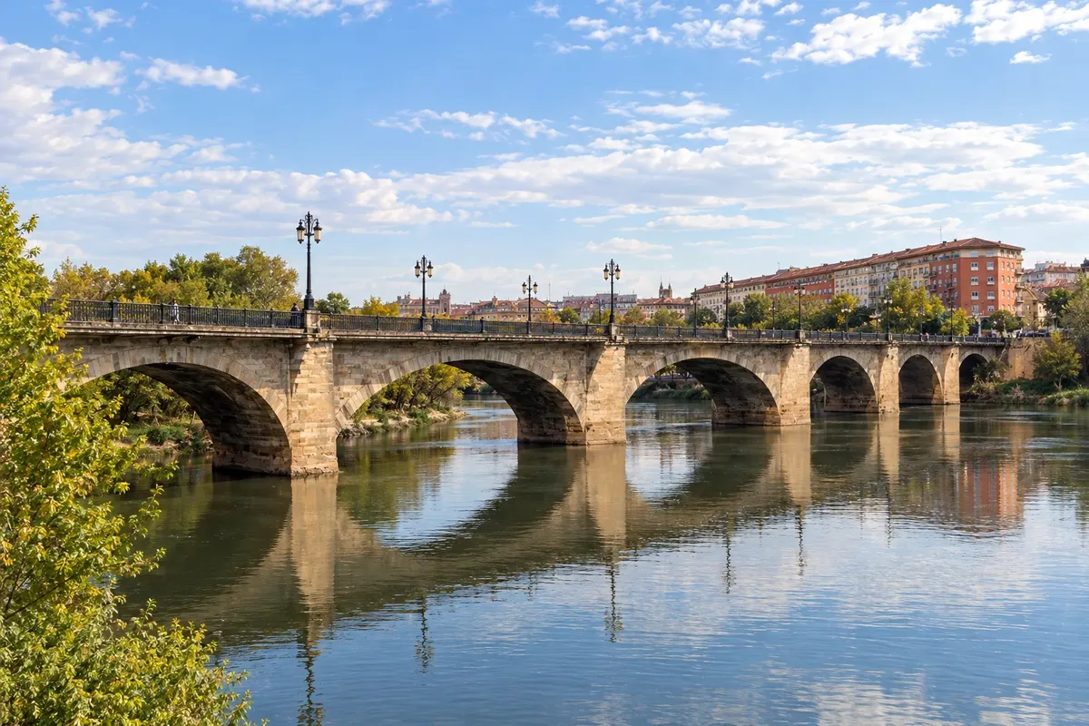
After Puente la Reina, with its Romanesque bridge, and Estella, the route reaches Logroño, the capital of La Rioja, a wine region. Calle Laurel and the streets of the center are known for their pinchos bars. From here the route continues through Nájera and Santo Domingo de la Calzada.
→ Burgos about 121 km cerca de 5 dias a pé 5 etapas: Logroño–Nájera (29 km), Nájera–Santo Domingo de la Calzada (21 km), Santo Domingo–Belorado (22 km), Belorado–San Juan de Ortega (24 km) e San Juan de Ortega–Burgos (26 km).
-
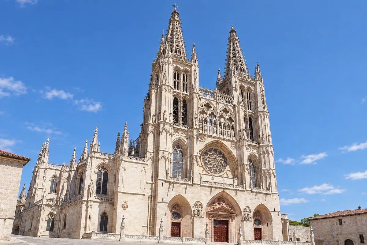 4 · Spain
Burgos
Burgos has the Gothic cathedral of Santa María, a World Heritage Site, the Arco de Santa María and the banks of the Arlanzón River. Many pilgrims take a rest day here before the meseta, the flat stretch of wheat fields to León.
→ León about 181 km cerca de 8 dias a pé 8 etapas pela meseta: Hornillos, Castrojeriz, Frómista, Carrión de los Condes, Sahagún, El Burgo Ranero, Mansilla de las Mulas e León. Carrión–Sahagún é a etapa mais longa (37 km), com poucos serviços.
-
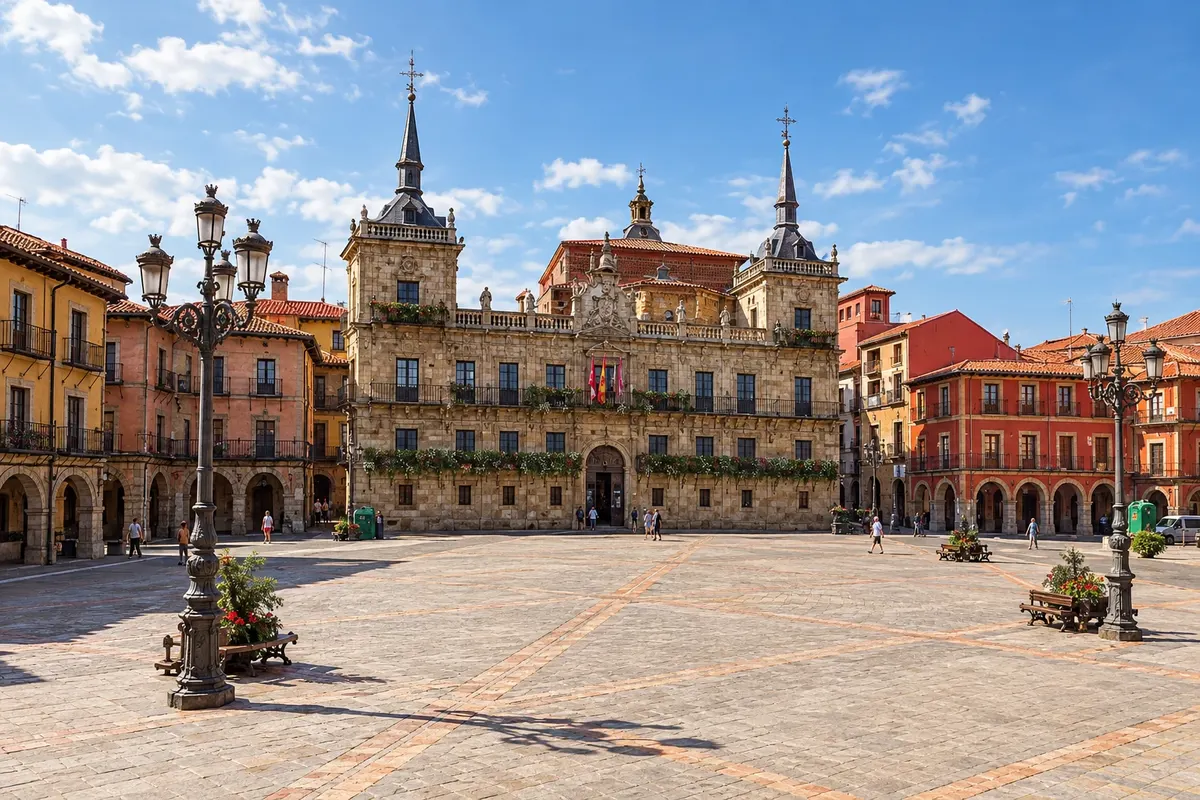 5 · Spain
León
After the meseta, passing Castrojeriz, Frómista, Carrión de los Condes and Sahagún, the route reaches León. The cathedral houses a collection of medieval stained glass, and the Real Colegiata de San Isidoro contains Romanesque paintings. The former Hostal de San Marcos was a hospital for pilgrims.
→ Astorga about 48 km cerca de 2 dias a pé 2 etapas: León–Villadangos del Páramo (20 km) e Villadangos–Astorga (28 km), passando pela ponte medieval de Hospital de Órbigo.
-
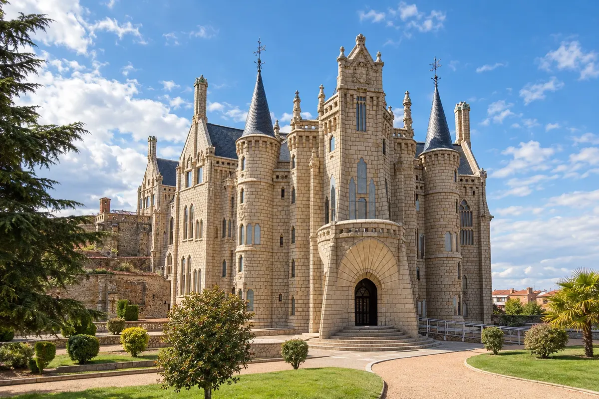 6 · Spain
Astorga
Astorga has Roman walls, the cathedral and the Episcopal Palace designed by Gaudí. It is also known for its chocolate and the cocido maragato. After Astorga, the route climbs the hills of León up to the Cruz de Ferro, where pilgrims leave a stone.
→ Ponferrada about 53 km cerca de 2 a 3 dias a pé Astorga–Rabanal del Camino (20 km) e Rabanal–Molinaseca (25 km), pela Cruz de Ferro, perto do ponto mais alto do caminho, com cerca de 8 km a mais até Ponferrada.
-
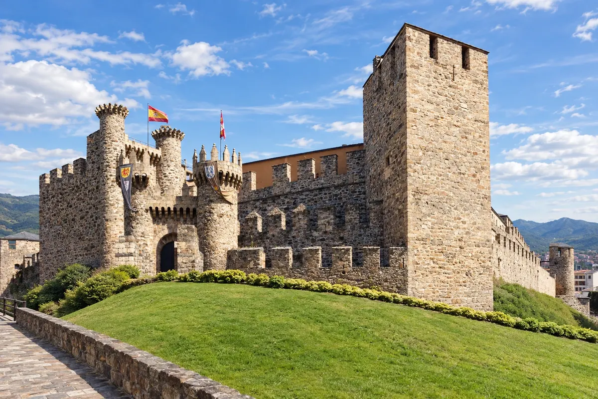 7 · Spain
Ponferrada
After the descent through Molinaseca, the route reaches Ponferrada, with the Templar castle above the Sil River. The town is the capital of the El Bierzo comarca, known for wines and green valleys. Next come Villafranca del Bierzo and the climb up to O Cebreiro, already in Galicia.
→ Sarria about 91 km cerca de 4 dias a pé Ponferrada–Villafranca del Bierzo (cerca de 24 km), Villafranca–O Cebreiro (28 km, com a subida mais forte depois dos Pireneus), O Cebreiro–Triacastela (21 km) e Triacastela–Sarria (18 km).
-
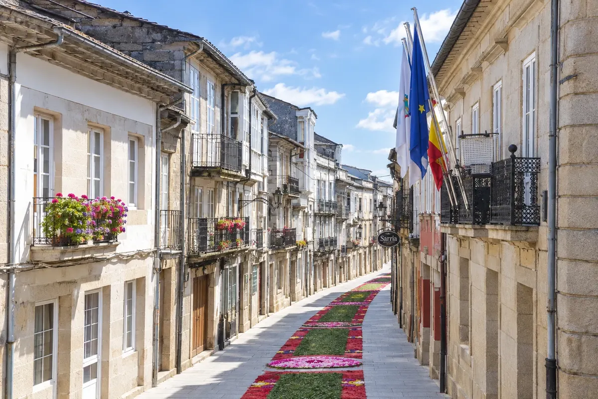 8 · Spain
Sarria
After O Cebreiro and Triacastela, the route reaches Sarria, about 115 km from Santiago, the most common starting point for those who want to walk only the minimum required for the Compostela. From here the route becomes much busier. Next are Portomarín, Palas de Rei, Melide, Arzúa and O Pedrouzo.
→ Santiago de Compostela about 115 km cerca de 5 dias a pé 5 etapas: Sarria–Portomarín (22 km), Portomarín–Palas de Rei (25 km), Palas de Rei–Arzúa (29 km, por Melide), Arzúa–O Pedrouzo (20 km) e O Pedrouzo–Santiago (19 km).
-
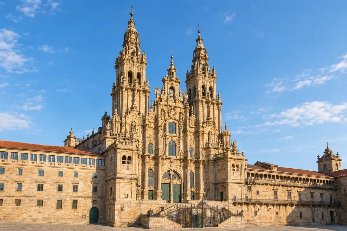 9 · Spain
Santiago de Compostela
The arrival is via the Monte do Gozo, from which you can see the cathedral towers, and through the old town to the Plaza del Obradoiro. The Pilgrim's Office, near the cathedral, issues the Compostela.
How to travel
The way and the tickets
On foot, following the yellow arrows, carrying a backpack or using luggage transport services between stages offered by companies and some hostels. Stages are generally 18 to 30 km. Many do the route in sections, on different trips, returning to the point where they stopped.
Best time to go
When to go: month by month
May, June and September, into early October: pleasant temperatures for walking and hostels open. July and August are hot on the meseta and very crowded from Sarria onward. In winter it is cold, it can snow in the Pyrenees and at O Cebreiro, and many hostels close; the high Pyrenean pass, the Route of Napoleon, is often closed from November to March, and the route follows the Valcarlos variant.
The seasons shown are the most usual ones; nature doesn't always follow the calendar.
Planning
Planning the trip
How many days
The entire route takes 5 to 6 weeks on foot. From Sarria, about 5 days of walking; from León, roughly 2 weeks. Add one extra day in Santiago on arrival and one day to reach the starting point.
Who it is for
For those who want to do the Camino de Santiago along the traditional route, with plenty of infrastructure and the company of pilgrims from around the world; for those who enjoy walking for several weeks; and for those looking for a journey of faith, reflection or physical challenge.
Your questions answered
Frequently asked questions about French Way of the Camino de Santiago on foot
Quantos quilômetros tem o Caminho Francês?
Cerca de 770 km de Saint-Jean-Pied-de-Port a Santiago, em cerca de 33 etapas. De Sarria, cerca de 115 km. As distâncias mudam um pouco conforme a fonte e as variantes do traçado.
Onde a maioria começa?
Quem faz o caminho inteiro começa em Saint-Jean-Pied-de-Port ou em Roncesvalles. Quem tem uma semana costuma começar em Sarria, o ponto mais comum para quem quer a Compostela com a distância mínima. Outros começam em León, Astorga ou Ponferrada.
O que é a Compostela e como se consegue?
É o certificado da peregrinação, emitido pela Oficina do Peregrino, da Catedral de Santiago. Segundo a Oficina, é preciso fazer a pé pelo menos os últimos 100 km seguidos, num caminho reconhecido, terminando na catedral, e mostrar a credencial carimbada. Confirme as regras no site da Oficina do Peregrino antes de sair.
O que é a credencial do peregrino?
É o passaporte do peregrino, onde se juntam os carimbos do caminho. Dá acesso aos albergues de peregrinos e serve de prova para pedir a Compostela. Pode ser obtida no escritório de acolhida de Saint-Jean-Pied-de-Port, em igrejas, em associações de amigos do Caminho e em albergues; existe também uma versão digital, em aplicativo da Oficina do Peregrino.
A travessia dos Pireneus é difícil?
É a etapa mais dura, com cerca de 1.250 metros de subida em 24 km. A Rota de Napoleão, pelo alto, costuma fechar de novembro a março e em dias de mau tempo; nesses casos o caminho segue pela variante de Valcarlos, pelo vale. Pergunte no escritório de acolhida antes de sair.
Precisa reservar os albergues?
Os albergues públicos e paroquiais costumam funcionar por ordem de chegada, sem reserva, e só para quem tem credencial. Os privados aceitam reserva. A partir de Sarria e no verão, reserve os privados ou chegue cedo.
Qual a diferença para o Caminho Português?
O Caminho Francês é mais longo, mais percorrido e com mais estrutura, e atravessa paisagens variadas: montanha, vinhedos, a meseta e a Galícia. O Caminho Português é mais curto e costuma ser menos cheio.