Byron Bay

New South Wales · Australia

Byron Bay

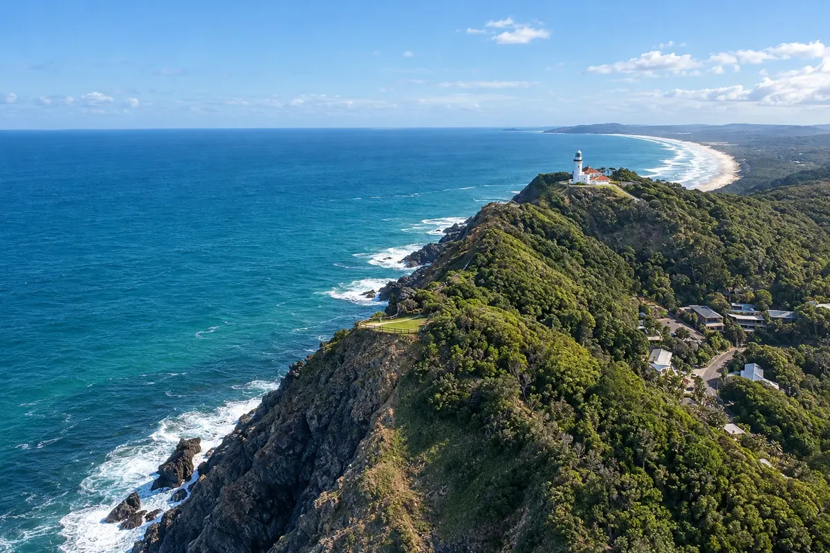
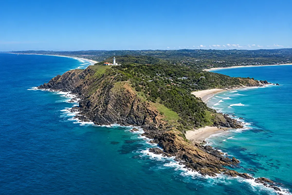
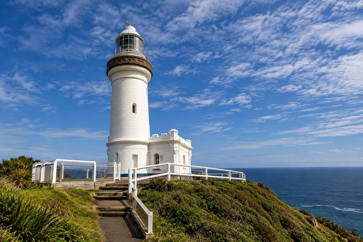
Northern coast of New South Wales with Cape Byron lighthouse, the easternmost point of the Australian continent, surf beaches, whales in winter and Gondwana forests inland.

New South Wales and Canberra (Sydney)

In the photo: Cape Byron and its coast

Illustrative images. The pictures in this guide are illustrations based on the real place, not photographs, and may differ from it.

Get it on Google Play Send your photos

Get to know the place

A region to enjoy
at your own pace.

Byron Bay sits at the far north of the New South Wales coast, near the border with Queensland, land of the Bundjalung and, within it, the Arakwal, who jointly manage the cape reserve. The town spreads between pale-sand beaches facing north and east, known for surfing and outdoor life.

Cape Byron is the easternmost point of the Australian continent. At the top, the 1901 lighthouse marks the start of a circular trail along the headland, where dolphins can be seen year-round and, between June and November, humpback whales pass offshore during their migration.

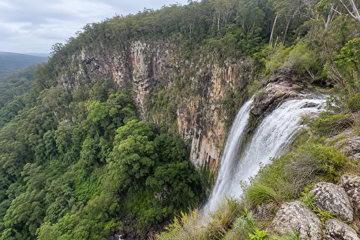
Inland, green hills lead to the forests of the Gondwana Rainforests World Heritage Area, such as Nightcap National Park, with waterfalls like Minyon Falls.

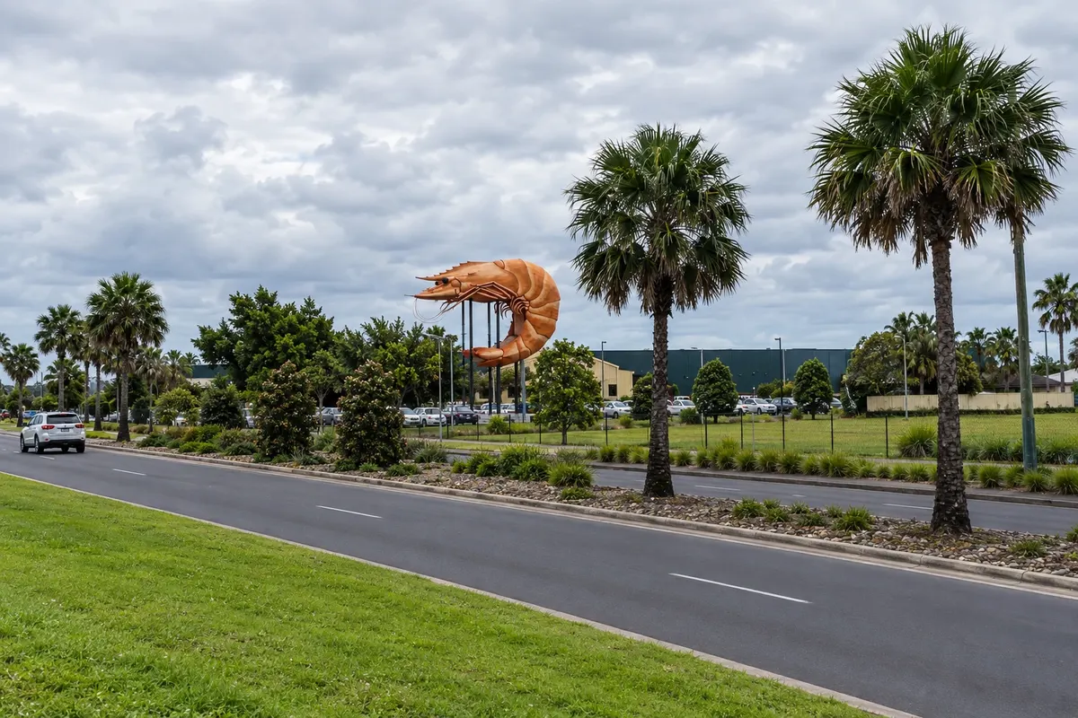
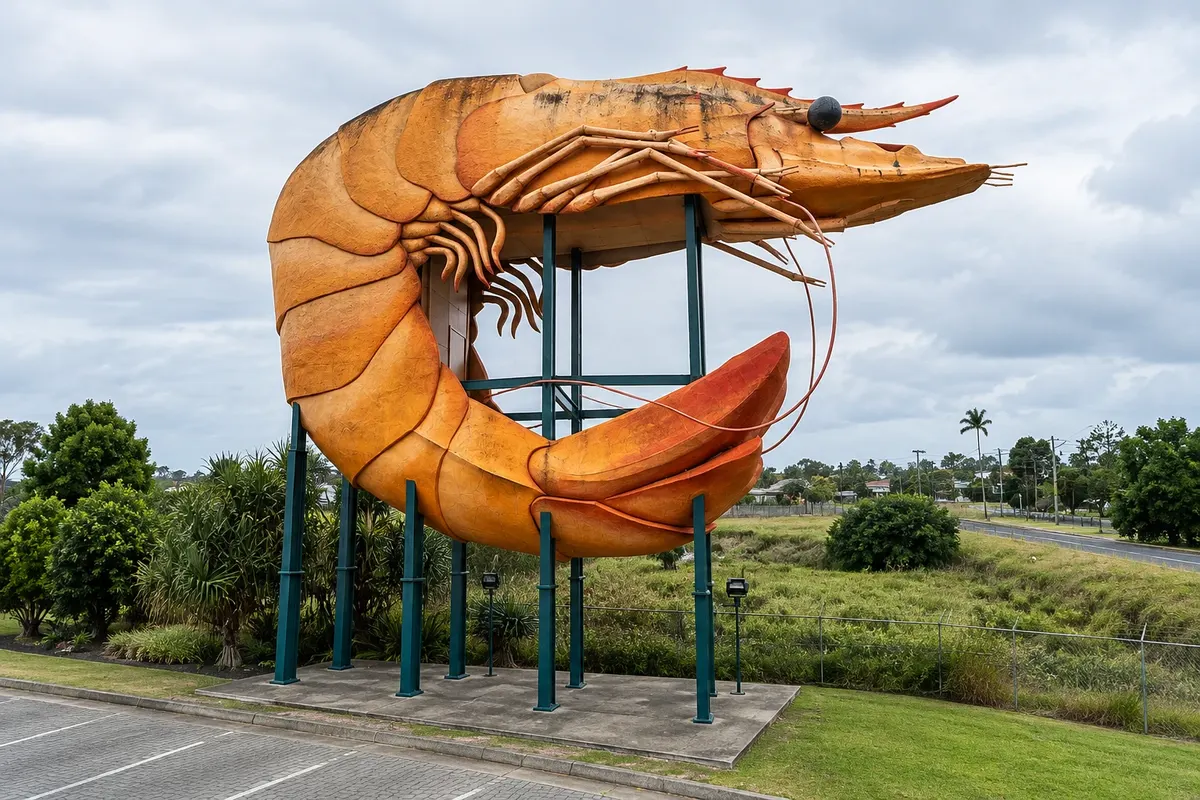
Ballina, about 34 km to the south on the Richmond River, has the nearest airport, calm beaches and the Big Prawn, a giant prawn that became a symbol of the coastal highway.

This destination brings together 2 cities: Byron Bay, Ballina.

Share: WhatsApp
Traveler, share your experiences through photos Up to 5 photos of each place you visited.

One destination, many paths

The cities on this trip

Start with one city or combine several in your itinerary.

Where Byron Bay is
Byron BayBallina

Boundaries: Australian Bureau of Statistics / geoBoundaries (CC BY 4.0). Adapted by Cidade Turismo.

How to get there: Byron Bay

✈ Aeroporto de Ballina Byron (BNK), in Ballina · 30 km to Byron Bay

✈ Aeroporto da Gold Coast (OOL), in Coolangatta · 90 km to Byron Bay

Ballina Airport (BNK), about 30 minutes from Byron Bay, has flights from Sydney and Melbourne. Gold Coast Airport (OOL), in Coolangatta, is about a 1-hour drive. From Brisbane it’s around 2 hours by road, and from Sydney about 770 km along the Pacific Highway; there are scheduled buses.

Suggested arrival point: Byron Bay

The local experience

Things to do in Byron Bay

Cape Byron and Lighthouse (Cape Byron Lighthouse)
Byron Bay · New South Wales · Viewpoint

Cape Byron and Lighthouse (Cape Byron Lighthouse)

Promontory that is the easternmost point of the Australian continent, with a 1901 lighthouse, a circular coastal trail and viewpoints for dolphins and, from June to November, humpback whales.

Richmond River Lighthouse and Lighthouse Beach
Ballina · New South Wales · Beach

Richmond River Lighthouse and Lighthouse Beach

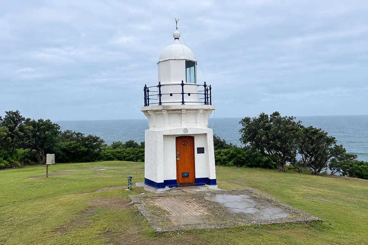
1880 lighthouse on the Richmond River headland in East Ballina, with a lookout over the coast and Lighthouse Beach just below.

The Big Prawn
Ballina · New South Wales · Monument

The Big Prawn

A giant prawn of concrete and fibreglass at the entrance to Ballina, one of the Australian “Big Things,” restored and installed next to a parking area.

Byron Bay Beaches
Byron Bay · New South Wales · Beach

Byron Bay Beaches

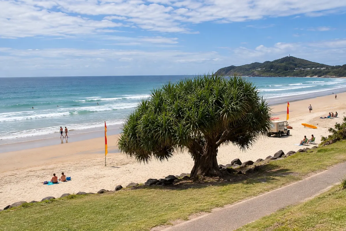
Main Beach, Clarkes Beach, The Pass and Wategos — the town beaches of Byron Bay up to the foot of the cape, with patrolled areas, surf for various levels and views of the lighthouse.

See 1 more place in Byron Bay
Minyon Falls and Nightcap National Park
Byron Bay · New South Wales · Waterfall

Minyon Falls and Nightcap National Park

About a 100-meter waterfall on a volcanic rock cliff, between the Whian Whian Conservation Area and Nightcap National Park, within the Gondwana forests.

Before you go

Practical information

A little planning leaves more time to enjoy the journey.

When to go

All year. Summer, from December to February, is hot and the busiest beach season. Spring and autumn usually bring mild, quieter days. Between June and November, humpback whales commonly pass offshore from the cape.

The seasons shown are the most usual ones; nature doesn't always follow the calendar.

How many days to stay

Three days: one for the cape and lighthouse, one for the beaches and one for the inland area with Nightcap National Park and hill villages. Ballina can be visited en route from the airport.

Which city to stay in

Byron Bay has accommodation of all kinds near the town center and the Main Beach and Clarkes Beach; Wategos, by the cape, is quieter. Ballina, near the airport and river, has more budget options. Inland there are rural guesthouses.

Respect the place

Take your trash with you, follow the signs and support local businesses. In natural areas, follow the visiting guidelines.

Get your questions answered

Frequently asked questions about Byron Bay

How many days to stay in Byron Bay?

Three days: one for the cape and lighthouse, one for the beaches and surfing and one for the forests and inland villages.

Which airport to use for Byron Bay?

Ballina, about 30 minutes away, or Gold Coast, in Coolangatta, about 1 hour away. There are shuttle buses from both airports.

Do you need a car in Byron Bay?

Not for the town center, the beaches and the cape. For the inland area and Nightcap National Park, a car or an organized tour is recommended. In Australia you drive on the left.

When to see whales in Byron Bay?

Between June and November, during the humpback whale migration, from Cape Byron lookout or on boat tours.

What time zone is Byron Bay in?

New South Wales time, UTC+10, with daylight saving (UTC+11) from October to April.

Explore other destinations Search by state and city