

 Brazil
 Argentina
 Bolivia
 Chile
 Colombia
 Ecuador
 Guyana
 French Guiana
 Falkland Islands (Malvinas)
 Paraguay
 Peru
 Suriname
 Uruguay
 Venezuela
 Germany
 Austria
 Belgium
 Croatia
 Denmark
 Spain
 Finland
 France
 Greece
 the Netherlands
 Hungary
 Ireland
 Iceland
 Italy
 Luxembourg
 Norway
 Poland
 Portugal
 the United Kingdom
 the Czech Republic
 Sweden
 Switzerland
 Turkey
 the Dominican Republic
 South Africa
 Fiji
State · Bajío e cidades coloniais
Guanajuato
Guanajuato: San Miguel de Allende and the city of Guanajuato, World Heritage sites, the colorful tunnels and alleys, the silver mines and Dolores Hidalgo, cradle of independence.
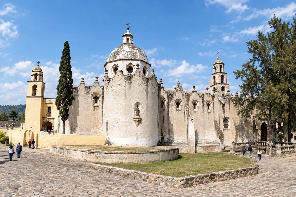
In the photo: Santuário de Atotonilco
Illustrative images. The pictures in this guide are illustrations based on the real place, not photographs, and may differ from it.

The state
Get to know Guanajuato
Guanajuato lies in the Bajío, the fertile plateau of central Mexico. In the 17th and 18th centuries, the region’s silver mines were among the richest in the world and funded the churches and mansions that today make the state one of the country’s top colonial destinations. It was also where the war of independence began, in 1810.
San Miguel de Allende has cobblestone streets, houses in ochre and red tones and the parish of San Miguel Arcángel, with pink-stone neo-Gothic towers. Together with the sanctuary of Jesús Nazareno de Atotonilco, on the outskirts, it is a World Heritage site, and hosts galleries, art schools and a large artist community.
The city of Guanajuato, also a World Heritage site, is squeezed into a narrow valley, with colorful houses on the hillsides, underground streets that run through former riverbeds and alleys such as the Callejón del Beso. Teatro Juárez, the Alhóndiga de Granaditas, Mercado Hidalgo and the Mummy Museum are among the attractions, and the mines and the funicular offer views of the city from above. In October, the Festival Internacional Cervantino fills theaters and plazas.
Dolores Hidalgo is the town where Father Miguel Hidalgo called the people to revolt on 16 September 1810, the Cry of Independence; it is also known for its ceramics and for ice creams with unusual flavors. León, the state’s largest city, is the center of the leather industry.
When to go
From October to May days are usually sunny and dry, with cold nights from December to February. From June to September it rains in the afternoons. The Cervantino Festival typically takes up much of October, and independence is celebrated on September 15 and 16. Guanajuato is 3 hours behind Brasília.
Getting there
Del Bajío International Airport (BJX), in León, is about 30 km from Guanajuato and about an hour and a half from San Miguel de Allende; Querétaro airport (QRO) is another option for San Miguel. From Mexico City, San Miguel is about a 4-hour bus ride. There are buses and vans between San Miguel, Guanajuato and Dolores Hidalgo.
Your questions
Frequently asked questions about Guanajuato
What is the difference between San Miguel de Allende and Guanajuato?
San Miguel is smaller, with flat streets in the center, galleries and the neo-Gothic parish. Guanajuato sits in a narrow valley, with tunnels, alleys and a university atmosphere. The two are about an hour and a half apart.
How many days should you stay in Guanajuato and San Miguel?
Two days in each city, with a stop in Dolores Hidalgo or Atotonilco along the way.
When is the Cervantino Festival?
It usually takes place in October, with theater, music and dance in Guanajuato. Accommodations fill up; book in advance.
Which airport should I use for San Miguel de Allende?
León (BJX) or Querétaro (QRO), both about an hour and a half by road. It is also possible to go by bus from Mexico City.