

 Brazil
 Argentina
 Bolivia
 Chile
 Colombia
 Ecuador
 Guyana
 French Guiana
 Falkland Islands (Malvinas)
 Paraguay
 Peru
 Suriname
 Uruguay
 Venezuela
 Germany
 Austria
 Belgium
 Croatia
 Denmark
 Spain
 Finland
 France
 Greece
 the Netherlands
 Hungary
 Ireland
 Iceland
 Italy
 Luxembourg
 Norway
 Poland
 Portugal
 the United Kingdom
 the Czech Republic
 Sweden
 Switzerland
 Turkey
 Canada
 the United States
 Mexico
 the Dominican Republic
 South Africa
 Fiji
 New Zealand
 Papua New Guinea
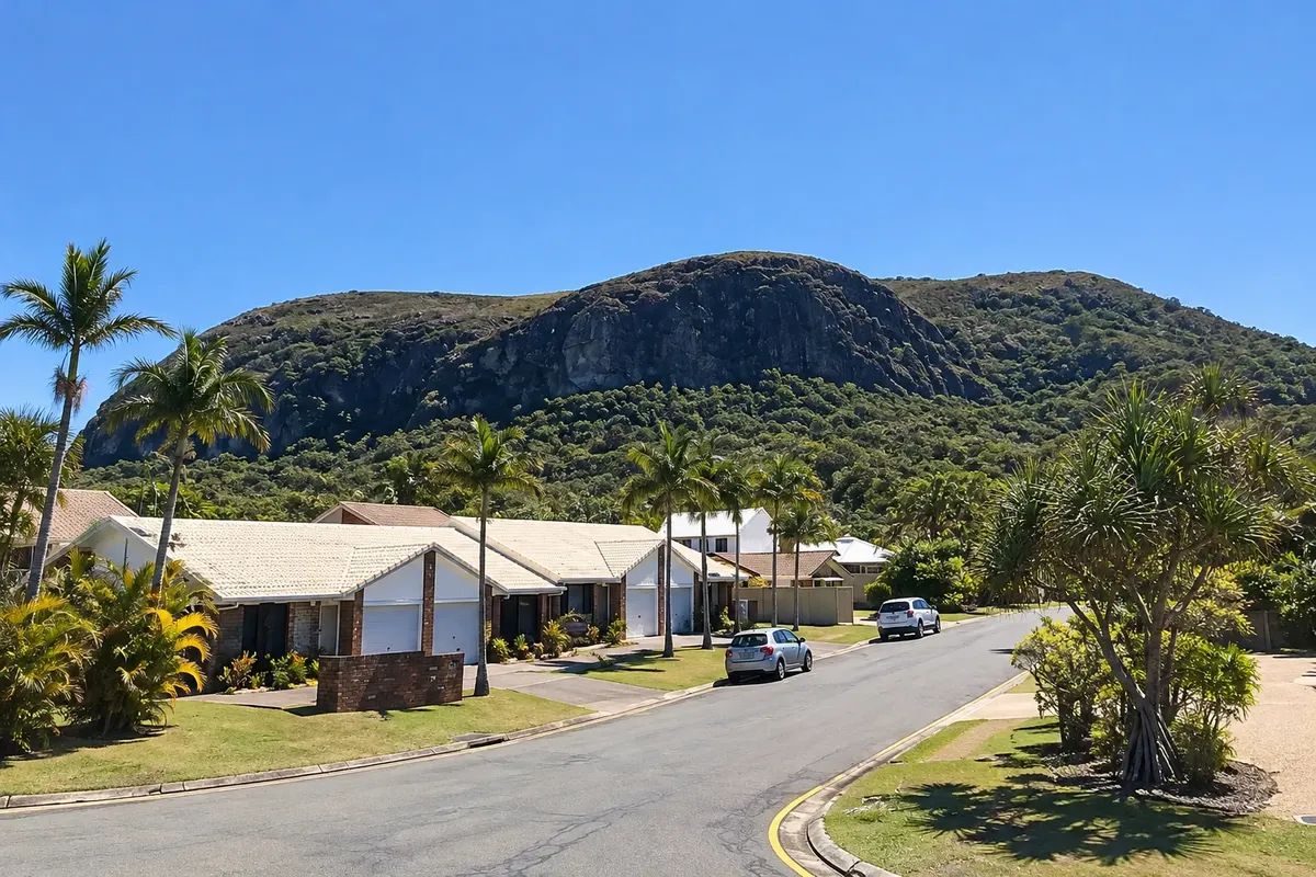
National park · Maroochydore, Queensland
Mount Coolum
Isolated volcanic-rock hill by the coast north of Maroochydore, with a short steep trail to the summit and views over the Sunshine Coast beaches.
Illustrative images. The pictures in this guide are illustrations based on the real place, not photographs, and may differ from it.

Discover
About Mount Coolum
Mount Coolum is an isolated volcanic-rock hill rising from the coastal plain near Coolum Beach, north of Maroochydore. It forms part of Mount Coolum National Park and is one of the Sunshine Coast’s most sought-after natural viewpoints.
The trail to the summit is short but steep, with stone steps and rock sections. From the top, the view stretches along the coast from Noosa to Mooloolaba and inland to the Glass House Mountains in the distance.
The vegetation includes rare plants that grow on the rocky slopes, and the park protects these species. The climb is exposed to the sun, with no shade at the summit.
Locals often hike early to watch the sunrise over the sea.
Before you go
Practical information
Cidade Turismo reviews its information regularly, but something may have changed. Check with the place before planning your trip.
How much time to set aside
1 to 1.5 hours round trip.
Best time
At sunrise or late afternoon, when it’s cooler. Avoid climbing in rain, when the rock becomes slippery.
How to get there
By car to the parking area at the base near Coolum Beach, about 15 km north of Maroochydore. Regional buses serve the area.
Tip
Bring water and wear sturdy footwear. Do not leave the marked trail to protect the rare plants on the slopes.
Official website
Get your questions answered
Frequently asked questions about Mount Coolum
Is the Mount Coolum trail difficult?
It’s short but steep, with stone steps. It takes about 1 hour round trip.
What can you see from the top of Mount Coolum?
The Sunshine Coast coastline from Noosa to Mooloolaba, and the Glass House Mountains inland.
Where is Mount Coolum?
Near Coolum Beach, about 15 km north of Maroochydore.