1 city

 the Dominican Republic
 Brazil
 Argentina
 Bolivia
 Chile
 Colombia
 Ecuador
 Guyana
 French Guiana
 Falkland Islands (Malvinas)
 Paraguay
 Peru
 Suriname
 Uruguay
 Venezuela
 Germany
 Austria
 Belgium
 Croatia
 Denmark
 Spain
 Finland
 France
 Greece
 the Netherlands
 Hungary
 Ireland
 Iceland
 Italy
 Luxembourg
 Norway
 Poland
 Portugal
 the United Kingdom
 the Czech Republic
 Sweden
 Switzerland
 Turkey
 Mexicothe Dominican Republic
 South Africa
 Fiji
Province · Costa Leste: Punta Cana e La Romana
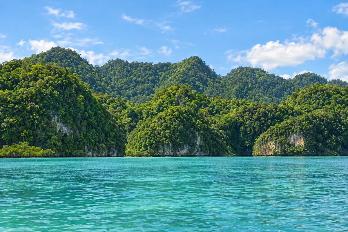
Hato Mayor is the southern gateway to Los Haitises: the limestone hills that rise from the water, the mangroves and the Taíno caves visited by boat from Sabana de la Mar, and inland, orange groves and ranches.
In the photo: Mogotes de Los Haitises na baía de Samaná (Hato Mayor)
Illustrative images. The pictures in this guide are illustrations based on the real place, not photographs, and may differ from it.

The province
Hato Mayor is a province in the east, between the Cordillera Oriental and Samaná Bay. The interior has green hills, pastures, cattle ranches and orange and other citrus plantations, which made the capital, Hato Mayor del Rey, a town of agricultural fairs.
What draws travelers to the province is in the north, in Sabana de la Mar, a port town on the southern shore of Samaná Bay, which the guide includes in the Peninsula of Samaná destination. From there boats depart for Parque Nacional Los Haitises, a landscape of hundreds of rounded limestone mogotes covered in forest, separated by mangrove channels.
In the park, boats pass islets where pelicans and frigatebirds nest and stop at caves such as San Gabriel and La Línea, with paintings and engravings left by the Taínos. At the entrance to Caño Hondo, near Sabana de la Mar, a river drops into natural freshwater pools surrounded by forest.
From Sabana de la Mar speedboats also cross the bay to Santa Bárbara de Samaná, a shortcut for those combining Los Haitises with whale watching from January to March.
Destinations
Cities
Los Haitises can be visited year-round. From December to April there is less rain and the bay is usually calmer for boats; from January to March the crossing to Samaná allows whale watching. From June to November there is a hurricane risk in Los Haitises, and boat trips may be suspended on days of heavy rain.
From Santo Domingo, the road passes through Hato Mayor del Rey and reaches Sabana de la Mar in about two and a half hours. From Punta Cana, the quickest route is via the new Miches road, in about two hours. From Samaná, speedboats cross the bay in around one hour. The nearest international airport is Punta Cana (PUJ) or Santo Domingo (SDQ).
Your questions
Sabana de la Mar, in Hato Mayor, is the closest: boats reach the mangroves and caves in just a few minutes. There are also tours departing from Samaná, Las Terrenas and Punta Cana.
Limestone mogotes covered in forest rising from the water, mangroves, islets with seabirds and caves with Taíno paintings.
Yes, speedboats cross the bay in about one hour, depending on sea conditions.
It is an agricultural town of commerce and fairs, known for the region's orange groves; most travelers pass through it on their way to Sabana de la Mar.