

 Brazil
 Argentina
 Bolivia
 Chile
 Colombia
 Ecuador
 Guyana
 French Guiana
 Falkland Islands (Malvinas)
 Paraguay
 Peru
 Suriname
 Uruguay
 Venezuela
 Germany
 Austria
 Belgium
 Croatia
 Denmark
 Spain
 Finland
 France
 Greece
 the Netherlands
 Hungary
 Ireland
 Iceland
 Italy
 Luxembourg
 Norway
 Poland
 Portugal
 the United Kingdom
 the Czech Republic
 Sweden
 Switzerland
 Turkey
 the United States
 Mexico
 the Dominican Republic
 South Africa
 Australia
 Fiji
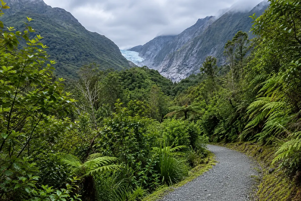
Glacier · Franz Josef / Waiau, West Coast
Franz Josef Glacier
A roughly 12 km glacier that descends from the Southern Alps into the forest, 5 km from the village. Valley walk to a viewpoint, scenic flights and guided glacier walks that arrive by helicopter.
Illustrative images. The pictures in this guide are illustrations based on the real place, not photographs, and may differ from it.

Discover
About Franz Josef Glacier
The Franz Josef Glacier descends about 12 km from the Southern Alps toward the sea, ending in a valley surrounded by temperate rainforest. The Māori name, Kā Roimata o Hine Hukatere, means "the tears of Hine Hukatere": according to legend, the young woman led her beloved Tuawe to climb the mountain, he died in an avalanche, and her tears were frozen by the sky father Rangi, forming the ice.
The glacier has retreated significantly in recent decades and now terminates about 19 km from the sea. The glacier front is unstable: after a collapse in 2012, the approach on foot is limited to a viewpoint about 3 km from the front, at the end of the valley trail that follows the stony bed of the Waiho River. Along the way, small paths lead to Peters Pool, a lake formed by ice left on the moraine around 1805, which often reflects the mountains.
To reach the ice, helicopter flights depart from the village and drop groups on the upper glacier among icefalls for guided walks of one to two hours, with crampons provided by the operators. There are also scenic flights by plane and helicopter, some with snow landings. All activities depend on the weather, which changes rapidly in the region.
Before you go
Practical information
Cidade Turismo reviews its information regularly, but something may have changed. Check with the place before planning your trip.
How much time to set aside
About 1½ hours for the valley walk return; 3 to 4 hours for a guided glacier walk including the flight.
Best time
In the morning, when the weather is usually more stable and there’s a higher chance of clear skies. After heavy rain the valley can close due to flood risk; check conditions at the information centre.
How to get there
The glacier car park is about 5 km from Franz Josef village, on a sealed road off Highway 6. You can drive, cycle or walk there. Flights depart from the village.
Tip
Respect the viewpoint barriers: the glacier front can collapse and the river rises quickly. Flights and guided walks are paid activities and may be cancelled due to weather; book with at least a day’s buffer.
Get your questions answered
Frequently asked questions about Franz Josef Glacier
Pode andar na Geleira Franz Josef?
Only on a guided walk with a helicopter drop-off to the upper part. On foot, the valley trail goes to a viewpoint set apart from the glacier face.
What does the Māori name of Franz Josef Glacier mean?
Kā Roimata o Hine Hukatere means "the tears of Hine Hukatere", referring to a legend about a young woman who lost her lover in an avalanche.
Is Franz Josef Glacier shrinking?
Yes. It retreated by about 1.5 km between 2008 and 2017 and now ends roughly 19 km from the sea.
What is Peters Pool?
A small lake in the glacier valley, formed by ice that became trapped in the moraine around 1805. It is near the valley trail.