

 Brazil
 Argentina
 Bolivia
 Chile
 Colombia
 Ecuador
 Guyana
 French Guiana
 Falkland Islands (Malvinas)
 Paraguay
 Peru
 Suriname
 Uruguay
 Venezuela
 Germany
 Austria
 Belgium
 Croatia
 Denmark
 Spain
 Finland
 Greece
 the Netherlands
 Hungary
 Ireland
 Iceland
 Italy
 Luxembourg
 Norway
 Poland
 Portugal
 the United Kingdom
 the Czech Republic
 Sweden
 Switzerland
 Turkey
 the United States
 Mexico
 the Dominican Republic
 South Africa
 Australia
 Fiji
Park · Aix-en-Provence, Provence-Alpes-Côte d'Azur
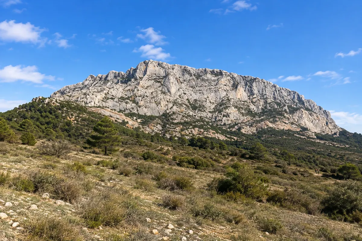
Montagne Sainte-Victoire
Limestone massif east of Aix, painted more than 80 times by Cézanne, with trails up to the Croix de Provence and the priory at the summit. In summer, access can be restricted due to fire risk.
Illustrative images. The pictures in this guide are illustrations based on the real place, not photographs, and may differ from it.

Discover
About Montagne Sainte-Victoire
The Montagne Sainte-Victoire is a limestone massif about 12 km long, east of Aix-en-Provence, reaching 1,011 meters at the Pic des Mouches. It became world-famous through Paul Cézanne's paintings, which depicted it in 44 oil canvases and 43 watercolors.
The most visited summit is the Croix de Provence, a large cross at about 950 meters on the western end of the ridge. Just below is the Prieuré de Sainte-Victoire, an old priory with a shelter. The most used trail starts on the north side, near the village of Vauvenargues, and requires several hours of hiking with a steep ascent.
The massif has over 400 km of trails, climbing areas on the south face and routes for cycling. On the west side, the Roques-Hautes area and the lake at the barrage de Bimont offer easier walks. The D17 road, called Route de Cézanne, runs along the south face with several viewpoints.
In summer the fire risk is high across the region. From June to September, access to the forest massifs of the Bouches-du-Rhône is regulated daily according to wind and drought and may be prohibited. Check the day's risk level before you set out.
Before you go
Practical information
Cidade Turismo reviews its information regularly, but something may have changed. Check with the place before planning your trip.
How much time to set aside
For the Croix de Provence, allow half a day for the round trip. A short hike at Bimont or Roques-Hautes takes 1–2 hours. By road, with stops, half a day.
Best time
Spring and autumn, when temperatures are good for hiking. From June to September access to the massifs in the Bouches-du-Rhône is regulated daily for fire risk and may be prohibited: check on the day before you go. On a mistral day, the wind at the summit is very strong.
How to get there
By car, about 15 km from Aix to Vauvenargues or to the parking lots on the south side. Regional buses run from Aix coach station to Vauvenargues and to the mountain's southern side; check timetables.
Tip
Bring plenty of water, sunscreen and hiking shoes: there is little shade and no water source on the route. Start early. If you don't feel like the ascent, drive the Route de Cézanne (D17) and stop at the viewpoints.
Get your questions answered
Frequently asked questions about Montagne Sainte-Victoire
Can you climb Sainte-Victoire in summer?
It depends on the day. From June to September, access to the forest massifs in the Bouches-du-Rhône is decided daily according to the fire risk, and may be allowed, limited to certain hours, or prohibited. Check the day's risk level before you set out.
What is the most well-known trail?
The climb to the Croix de Provence, at about 950 metres, starts from the north side near Vauvenargues. It is a strenuous ascent that passes the Prieuré de Sainte-Victoire. It requires physical fitness and hiking footwear.
Can you see the mountain without hiking?
Yes. The Route de Cézanne, road D17, runs south of the mountain with several viewpoints. In Aix, the Terrain des Peintres, near the Atelier de Cézanne, also offers a view of it.