

 Brazil
 Argentina
 Bolivia
 Chile
 Colombia
 Ecuador
 Guyana
 French Guiana
 Falkland Islands (Malvinas)
 Paraguay
 Peru
 Suriname
 Uruguay
 Venezuela
 Germany
 Austria
 Belgium
 Croatia
 Denmark
 Spain
 Finland
 France
 Greece
 the Netherlands
 Hungary
 Ireland
 Iceland
 Italy
 Luxembourg
 Norway
 Poland
 Portugal
 the United Kingdom
 the Czech Republic
 Sweden
 Switzerland
 Turkey
 the United States
 Mexico
 the Dominican Republic
 South Africa
 Australia
 Fiji
 New Zealand
 Papua New Guinea
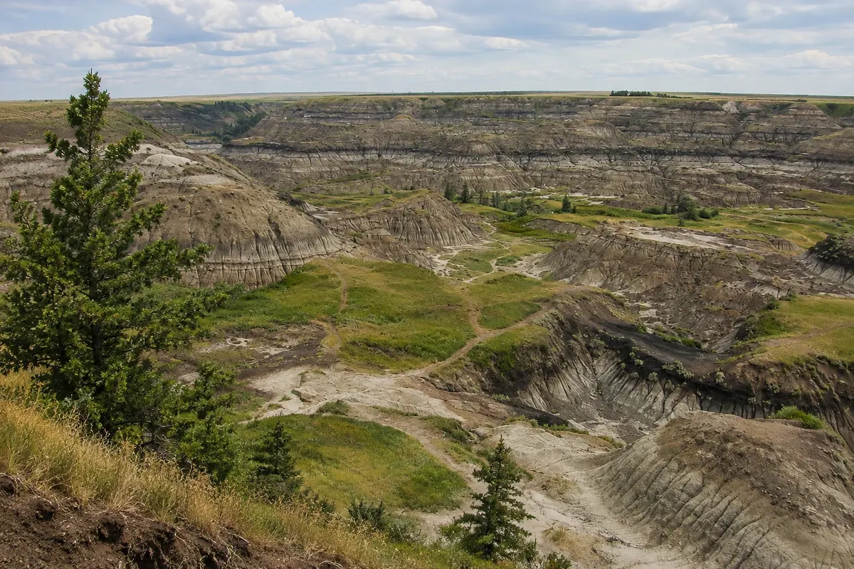
Canyon · Drumheller, Alberta
Horseshoe Canyon (Horseshoe Canyon)
A horseshoe-shaped canyon in the badlands, about 17 km from Drumheller, with a roadside viewpoint and trails that descend between striped slopes.
Illustrative images. The pictures in this guide are illustrations based on the real place, not photographs, and may differ from it.

Discover
About Horseshoe Canyon (Horseshoe Canyon)
Horseshoe Canyon sits beside Highway 9, about 17 km southwest of Drumheller, on the road from Calgary. The flat prairie suddenly opens into a horseshoe-shaped canyon with slopes of gray, ochre and reddish layers.
From the roadside viewpoint next to the parking area you can see the whole canyon. Trails descend to the canyon floor among eroded hills, small stone chimneys and layers of coal and clay. Prairie plants such as sage and low cacti grow on the slopes.
The layers hold fossils from the dinosaur age, which should not be collected: in Alberta fossils belong to the province. There is no entrance fee.
Before you go
Practical information
Cidade Turismo reviews its information regularly, but something may have changed. Check with the place before planning your trip.
How much time to set aside
30 minutes to 2 hours, depending on the trails.
Best time
In the morning or late afternoon, when the light brings out the colors and temperatures are lower. Avoid descending in the rain.
How to get there
On Highway 9, about 17 km southwest of Drumheller, with roadside parking.
Tip
Bring water and a hat in summer: there is no shade on the canyon floor.
Official website
Get your questions answered
Frequently asked questions about Horseshoe Canyon (Horseshoe Canyon)
Where is Horseshoe Canyon located?
On Highway 9, about 17 km from Drumheller, on the road coming from Calgary.
Can you descend to the bottom of Horseshoe Canyon?
Yes, via trails from the viewpoint. The ground is clay and becomes slippery when it rains.
Can you take fossils found in Horseshoe Canyon?
No. In Alberta, fossils belong to the province and must not be collected.