

 Brazil
 Argentina
 Chile
 Colombia
 Ecuador
 Guyana
 French Guiana
 Falkland Islands (Malvinas)
 Paraguay
 Peru
 Suriname
 Uruguay
 Venezuela
 Germany
 Austria
 Belgium
 Croatia
 Denmark
 Spain
 Finland
 France
 Greece
 the Netherlands
 Hungary
 Ireland
 Iceland
 Italy
 Luxembourg
 Norway
 Poland
 Portugal
 the United Kingdom
 the Czech Republic
 Sweden
 Switzerland
 Turkey
 the United States
 Mexico
 the Dominican Republic
 South Africa
 Australia
 Fiji
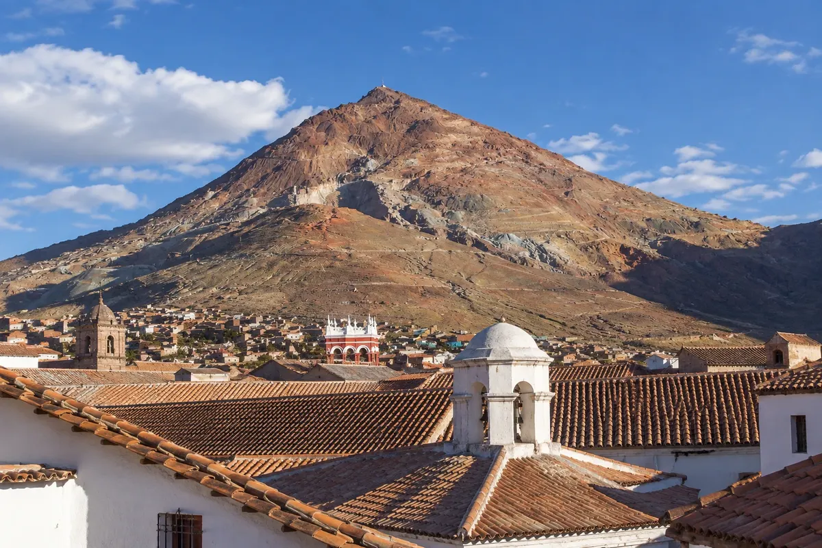
Mountain · Potosí, Potosí
Cerro Rico
The conical, reddish mountain of about 4,780 m to the south of Potosí, from which silver has been extracted since 1545, visible from almost the entire city and from the viewpoints of the downtown towers.
Illustrative images. The pictures in this guide are illustrations based on the real place, not photographs, and may differ from it.

Discover
About Cerro Rico
The Cerro Rico, called in Quechua Sumaq Orcko, 'the beautiful mountain', is the reddish cone that rises to the south of Potosí, at about 4,780 meters altitude. In 1545, the discovery of a large silver vein led to the founding of the city, and in the following decades the mountain became the world's largest source of silver, sustaining the Spanish empire for more than two centuries.
The exploitation was carried out with forced indigenous labor under the mita system, which brought men from across the Altiplano to the mines, and later with enslaved Africans as well. Thousands died in the galleries, and among the inhabitants the mountain earned the nickname 'the mountain that eats men'. That history is at the center of Potosí's identity and appears in the city's museums.
Mining continues to this day, carried out by cooperatives, and the hill is cut by hundreds of galleries. The colors of the cone, from red to ochre, come from the minerals and the spoil heaps. At its foot are the mining neighborhoods and the old network of artificial ponds built in the colonial period to power the mills.
The Cerro Rico can be seen from almost the entire city, but the best viewpoints are the towers of the Compañía de Jesús and the Catedral in the center, and the high streets south of the Convento de Santa Teresa. The mountain's image appears on Bolivia's coat of arms.
Before you go
Practical information
Cidade Turismo reviews its information regularly, but something may have changed. Check with the place before planning your trip.
How much time to set aside
About 20 to 30 minutes at the downtown viewpoints.
Best time
In the late afternoon, when the low light brings out the cone's red, or early in the morning, with the clear skies of the dry season from May to October.
How to get there
It lies south of Potosí's center, about 3 km in a straight line from Plaza 10 de Noviembre. To see it, go up the tower of the Compañía de Jesús, one block from the square, or walk to the high streets near the Convento de Santa Teresa.
Tip
See Cerro Rico from the tower of the Compañía de Jesús in the late afternoon, after visiting the Casa Nacional de Moneda, which tells the story of the silver mined there.
Get your questions answered
Frequently asked questions about Cerro Rico
What is the altitude of Cerro Rico?
About 4,780 meters, roughly 700 meters above Potosí's center.
What was the mita?
It was the system of forced labor that the Spaniards adapted from an Inca practice, obliging indigenous people from across the Altiplano to work in Potosí's mines.
Where to see Cerro Rico in the city?
From the tower of the Compañía de Jesús and the tower of the Catedral in the center, and from the high streets near the Convento de Santa Teresa.