

 Brazil
 Argentina
 Bolivia
 Chile
 Colombia
 Guyana
 French Guiana
 Falkland Islands (Malvinas)
 Paraguay
 Peru
 Suriname
 Uruguay
 Venezuela
 Germany
 Austria
 Belgium
 Croatia
 Denmark
 Spain
 Finland
 France
 Greece
 the Netherlands
 Hungary
 Ireland
 Iceland
 Italy
 Luxembourg
 Norway
 Poland
 Portugal
 the United Kingdom
 the Czech Republic
 Sweden
 Switzerland
 Turkey
 the United States
 Mexico
 the Dominican Republic
 South Africa
 Australia
 Fiji
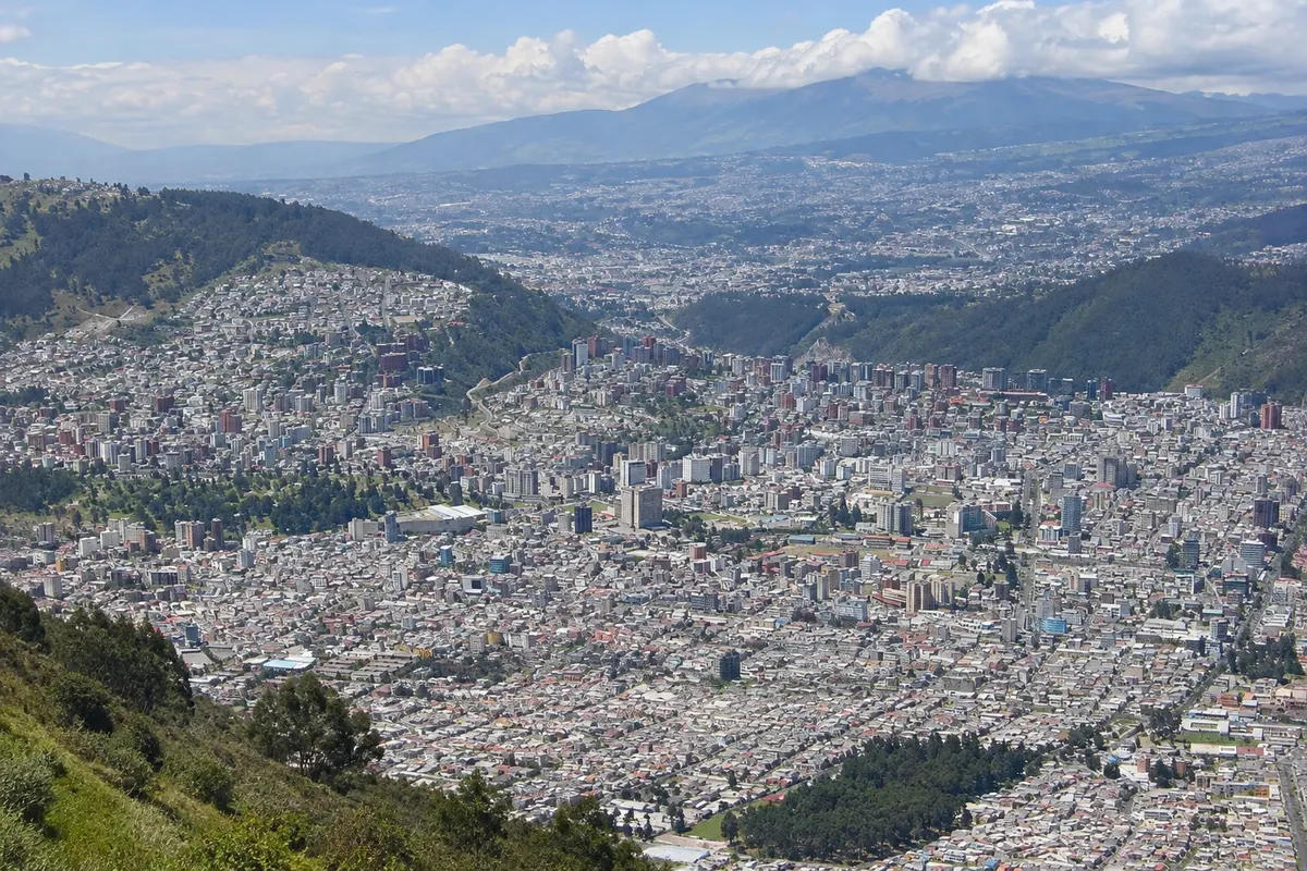
Viewpoint · Quito, Pichincha
TelefériQo
Cable car that climbs the slope of the Pichincha volcano, from about 3,000 to almost 4,000 meters, up to the Cruz Loma viewpoint, with views of all of Quito and trails in the páramo.
Illustrative images. The pictures in this guide are illustrations based on the real place, not photographs, and may differ from it.

Discover
About TelefériQo
The TelefériQo departs from the La Gasca neighborhood on Quito's west slope and climbs in enclosed cabins to Cruz Loma, at about 3,950 meters on the slope of the Rucu Pichincha volcano. The trip takes 10 to 20 minutes and rises almost a thousand meters, with the city opening up below.
From above you can see Quito spread across the narrow valley from north to south, and on clear days the volcanoes of the Avenue of the Volcanoes such as Cotopaxi, Cayambe and Antisana. Around the station there are viewpoints, a café and a small chapel, as well as the páramo, the high-mountain grass and shrub vegetation.
From there the trail to the summit of Rucu Pichincha departs, at about 4,700 meters — a long, demanding hike of several hours for those already acclimatized to the altitude. Short stretches in the páramo near the station are suitable for those who only want a short walk.
It is cold and windy at the top and the weather changes quickly; fog usually arrives by late morning. The cable car may stop operating in strong winds or electrical storms.
Before you go
Practical information
Cidade Turismo reviews its information regularly, but something may have changed. Check with the place before planning your trip.
How much time to set aside
1.5 to 2 hours including ascent and descent; half a day or more for the trail to Rucu Pichincha.
Best time
Early in the morning, when there is a better chance of clear skies. Leave it for your second or third day in Quito, once acclimatized to the altitude. Check that the cable car is operating before you go.
How to get there
The base station is on Avenida Occidental in the La Gasca neighborhood, about 4 km from the Historic Center. Take a taxi to the station.
Tip
Bring a jacket, hat and sunscreen: it's cold at Cruz Loma and the sun is strong. Do not attempt the Rucu Pichincha trail in the first days of your trip or alone.
Official website
Get your questions answered
Frequently asked questions about TelefériQo
Up to what altitude does the TelefériQo go?
Up to Cruz Loma, about 3,950 meters, on the slope of Rucu Pichincha.
Is it cold at the top?
Yes. It is cold, windy, and fog can arrive quickly. Bring a coat and a hat.
Can you climb to the summit of Pichincha?
There is a long, demanding trail to Rucu Pichincha, about 4,700 meters, for those already acclimatized to the altitude, preferably with a guide.