

 Brazil
 Argentina
 Bolivia
 Chile
 Colombia
 Ecuador
 Guyana
 French Guiana
 Falkland Islands (Malvinas)
 Paraguay
 Peru
 Suriname
 Uruguay
 Venezuela
 Germany
 Austria
 Belgium
 Croatia
 Denmark
 Spain
 Finland
 France
 Greece
 the Netherlands
 Hungary
 Ireland
 Italy
 Luxembourg
 Norway
 Poland
 Portugal
 the United Kingdom
 the Czech Republic
 Sweden
 Switzerland
 Turkey
 the United States
 Mexico
 the Dominican Republic
 South Africa
 Australia
 Fiji
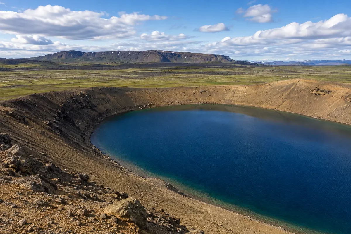
Volcanic landscape · Reykjahlíð, Northeastern Region
Krafla
Volcanic area north of Mývatn with a crater, lava fields and geothermal landscape.
Illustrative images. The pictures in this guide are illustrations based on the real place, not photographs, and may differ from it.

Discover
About Krafla
Krafla is a volcanic area north of Mývatn. The landscape brings together a caldera, eruption forms, and geothermal energy exploitation. The different visiting points are not all at the same viewpoint and require selecting a route.
The Víti crater offers a depression with a lake, while the Leirhnjúkur area shows lava and geothermal activity. Observing both helps distinguish the shape of a crater from the field left by lava flows, rather than reducing the region to a single photograph.
Road access starts from the Mývatn corridor, with paths subject to local conditions. Before proceeding, check which sectors are open and choose the walks that fit your day. Combine the visit with Reykjahlíð, allowing time for the walking sections and the return to base.
Before you go
Practical information
Cidade Turismo reviews its information regularly, but something may have changed. Check with the place before planning your trip.
How much time to set aside
Half a day for the chosen sectors, depending on access conditions.
Best time
During the operating hours of the chosen land sectors; check conditions at Víti and Leirhnjúkur.
How to get there
On a detour from Route 1 north of the Námafjall and Reykjahlíð area.
Tip
Choose between Víti and the Leirhnjúkur trails based on openings and available time.
Official website
Get your questions answered
Frequently asked questions about Krafla
How much time to allow for Krafla?
Half a day for the selected areas, depending on access conditions.
How to organize access to Krafla?
By turning off Route 1 north of the Námafjall and Reykjahlíð area.
What to consider when visiting Krafla?
Choose between Víti and the Leirhnjúkur trails depending on which are open and the time available.